
10 Must-Do Short Hikes in Valley of Fire State Park
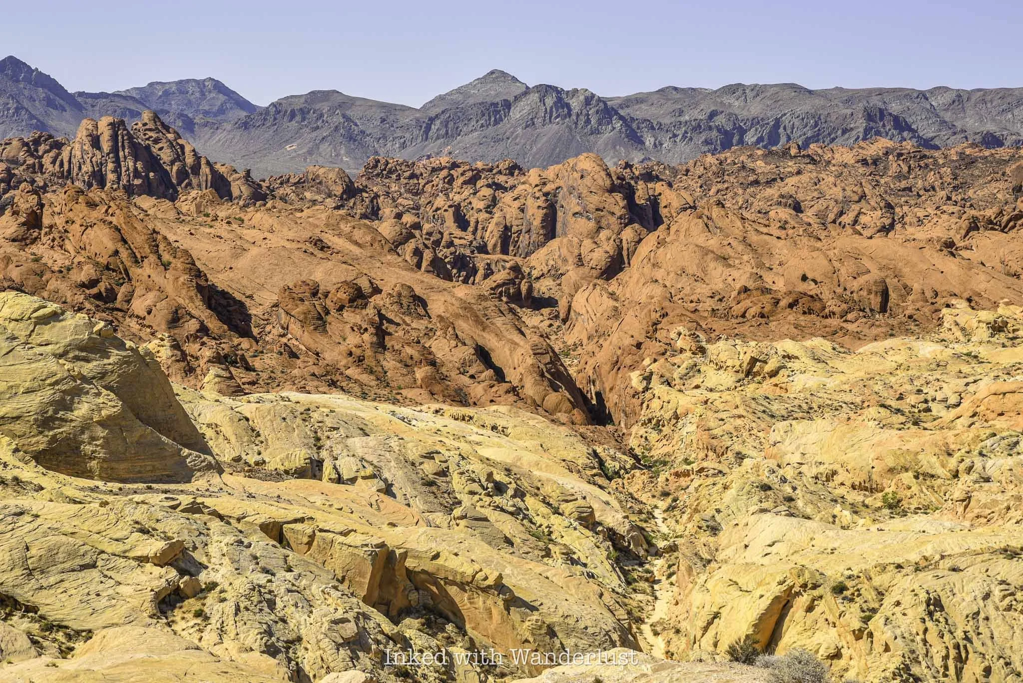
The beautiful rock formations and colors, in addition to being packed with short day hikes, make Valley of Fire State Park a place you could easily spend a whole day (or two) exploring. Best of all, most…
Disclosure: This post contains affiliate links. If you make a purchase through these links, I may earn a small commission at no additional cost to you. I only recommend products or services that I believe will add value to my readers.
Valley of Fire became Nevada's first state park in 1934 and since then, it's developed into one of the state's most sought after destinations and is one of the best things to do when visiting Las Vegas, often rivaling nearby Red Rock Canyon.
The beautiful rock formations and colors, in addition to being packed with short day hikes, makes Valley of Fire State Park a place you could easily spend a whole day (or two) exploring. Best of all, most of the park’s most popular hikes are short and easy, making them family-friendly.
In this post, I'm going to present to you 10 must-do short hikes in Valley of Fire. If you plan correctly and not visit on a day where the heat reaches dangerous levels, it's totally possibly to do all of these in a single day visit, dependent on your conditioning.
That said, there is one caveat to this list, and that's the seasonal trail closures discussed below...
Valley of Fire Seasonal Trail Closures

While the park itself is open daily, between the months of May and September, when temperatures at Valley of Fire State Park often reach dangerous levels, park officials enact trail closures at several popular hiking trails to prevent needless deaths.
There have been quite a few exposure-related deaths over the years, including in 2023 when two hikers were found dead on the Prospect Trail on a day when high temperatures reached a scorching 118-degrees.
Unfortunately, several of the hiking trails listed below are included on the closure list. So if you're going to visit between May and September, please respect these closures and don't risk it. It isn't worth the chance of a hefty fine or even worse...death.
These are the trails affected by seasonal closures:
White Domes Loop
Fire Wave/Seven Wonders/Pastel Canyon/Pink Canyon
Pinnacles Loop
Prospect Trail
Arrowhead Trail
Natural Arch Trail (excludes Arch Rock)
Charlie's Spring

West Entrance vs. East Entrance
There are only two entrances to Valley of Fire State Park. If you’re coming from Utah, Arizona, or any state east of Nevada, you’ll likely be entering through the east entrance. If you're like most people and you're coming from the Las Vegas Strip area, you'll want to head towards the west entrance.
For some reason, Google Maps likes to take people coming from the strip to the east entrance, which is further away. It has tried doing that to me twice now. So make sure that whichever navigation system you use that you specify the west entrance.
Entrance Fees
In 2025, the fees to enter Valley of Fire are:
$15 (non-Nevada vehicles)
$10 (Nevada vehicles)
Fees are payable, at either entrance, with cash via the iron ranger/envelope or with credit cards at the self-pay digital kiosk. Note that the digital kiosk doesn't always work, so it's best to bring exact cash as a back up.
1) Atlatl Rock

SEASONAL CLOSURE: NO
TRAIL LENGTH: 0.1 MILES
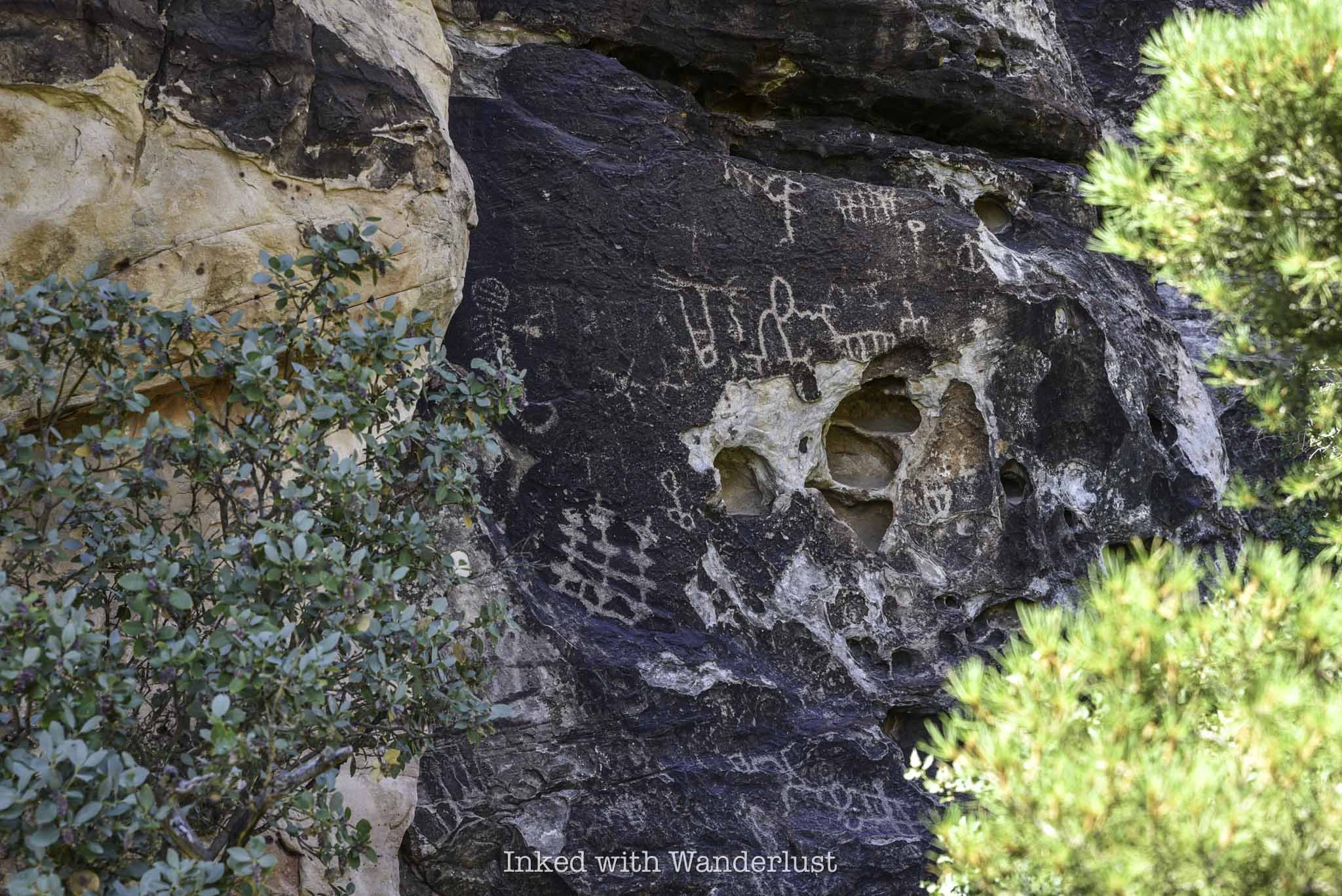
Atlatl Rock is one of the most popular attractions in the entire park. It isn't much of a hiking trail, as the stairwell and rock face are located a very short distance from the parking area. Where Atlatl Rock shines is its historical significance.
At the top of the stairwell, you'll reach a platform in front of a smooth rock face. On that rock face are several old petroglyphs which are believed to be up to 4,000 years old. Atlatl Rock isn't the only spot in Valley of Fire where you can see petroglyphs, but it's the easiest (aside from the stairwell, that is).
You can read more details about Atlatl Rock in this featured post.
2) Fire Wave Trail

SEASONAL CLOSURE: YES
TRAIL LENGTH: 1.3 MILES
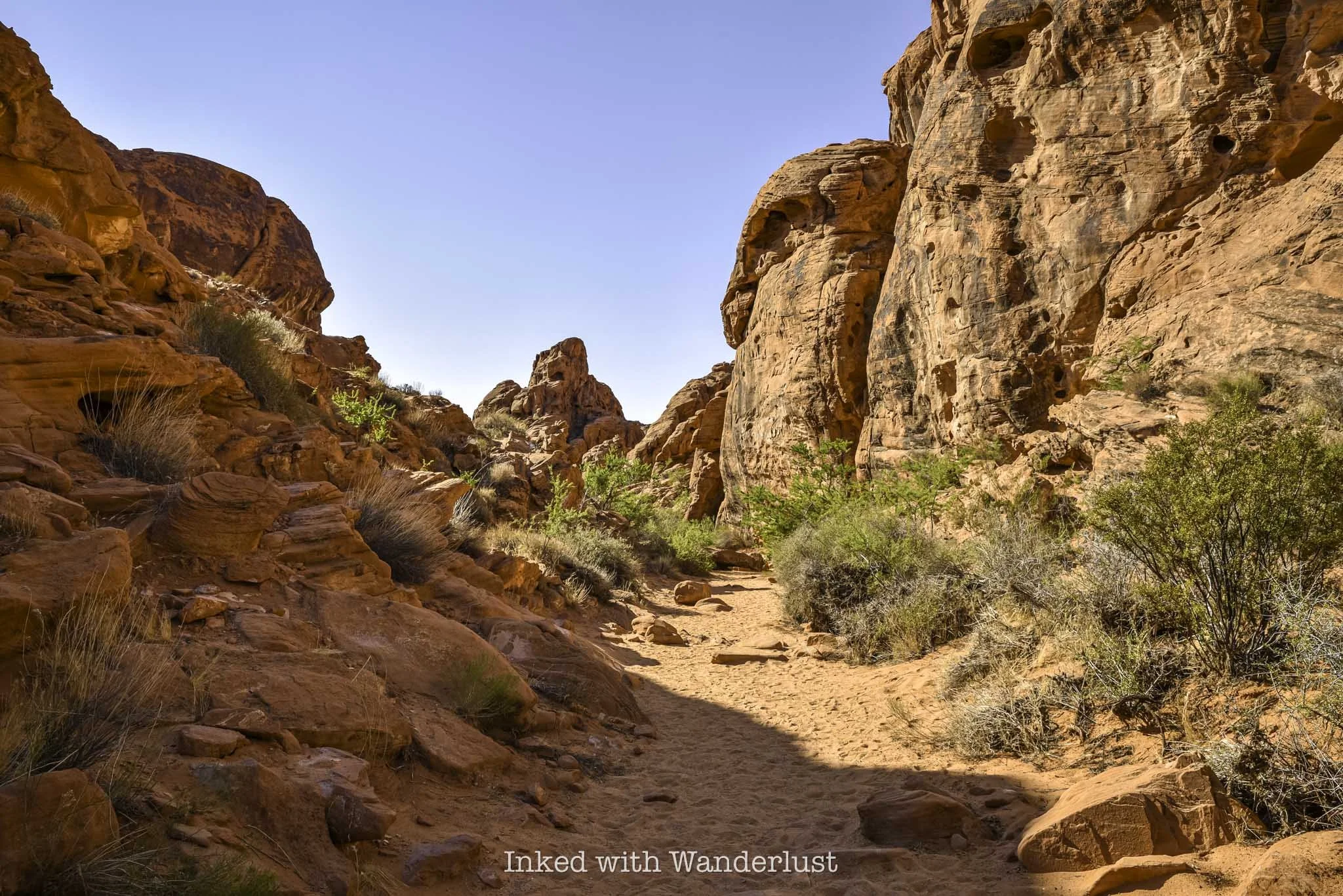
The Fire Wave is a stunning sandstone rock formation located at the backside of the park along White Domes Road. Over millions of years, shifting sand dunes compressed, creating the wavy swirls of red, white and pink stripes we see today.
Fire Wave is easy to get to via a short, well maintained trail that leaves from a fairly large parking area. Shortly after descending for about 6/10's of a mile, the Fire Wave will come into view. Getting there during the early morning light is good, but sunset is when Fire Wave comes to life.
3) Seven Wonders Loop

SEASONAL CLOSURE: YES
TRAIL LENGTH: 1.9 MILES
While not an official hiking trail at Valley of Fire, you can extend your hiking time by continuing past Fire Wave and see many other infamous Valley of Fire attractions. Hiking Seven Wonders will take you past Fire Wave and through pink rock formations at Pink Canyon.
You'll then cross White Domes Road and go through a stunning slot canyon, before heading onto additional sights like Crazy Hill, Fire Cave and Thunderstorm Arch. The loop will eventually take you back to where you parked for Fire Wave.
Since it's not an official trail, I suggest downloading the AllTrails map. While it isn't inherently difficult to follow, there are a few spots where the trail is easy to lose.
4) Mouse’s Tank Trail
SEASONAL CLOSURE: NO
TRAIL LENGTH: 0.7 MILES
Mouse's Tank Trail is one of my favorites in the park because of the story behind it. The canyon you hike through is one of the places where a Southern Paiute Indian, named "Little Mouse", took refuge after being accused of and wanted for the murders of two prospectors (and other crimes) in the late 1800's.
Additionally, the canyon walls are littered with old petroglyphs dating back thousands of years. They're easy to miss if you're not looking for them but once you spot them, they're easy to view. At the end of the canyon, you'll come across "Mouse's Tank", a natural rock basin which collects rain water.
The whole trail is less than a mile but you'll be traversing along loose, fine sand the entire time. Still, it's one of the park's most intriguing hikes with a great backstory, tons of history, and features numerous incredible rock formations. It can be found directly off of Mouse's Tank Road.
5) Petrified Log Loop
SEASONAL CLOSURE: NO
TRAIL LENGTH: 0.3 MILES
The Petrified Log Loop is an easy 0.3-mile loop trail that passes several examples of real petrified wood logs, as well as many informative displays detailing the history of the logs and how they came to be.
If you don't know, petrified logs are fossilized tree trunks that have been replaced by minerals. The process in which this is done - petrification - is essentially the process of turning wood into stone. It's a great trail for kids, as it has educational value in combination with outstanding views.
6) Elephant Rock

SEASONAL CLOSURE: NO
TRAIL LENGTH: 0.3 MILES
The trail to Elephant Rock is also an easy, 0.3-mile walk to and from the car. There's a slight amount of elevation involved, but you'll barely notice it. The trail leads to an amazing, orange-sandstone rock formation that strikingly resembles an elephant.
If you come into the park via the east entrance, the parking lot will be on your right as soon as you drive through. You'll ascend a short walk up a small hill and when you reach the top, Elephant Rock will come into view.
Additionally, Elephant Rock is clearly visible from the Valley of Fire Scenic Drive, but you cannot stop on this road to take pictures. Elephant Rock is a mega-popular attraction in Valley of Fire, so arrive early to beat the crowds.
7) Balancing Rock Trail

SEASONAL CLOSURE: NO
TRAIL LENGTH: 0.3 MILES
There's no way to classify the path to Balancing Rock as a "hike". The pathway is located on the left side of the visitor center parking lot and it's maybe a tenth of a mile to the viewing area. However, that doesn't make Balancing Rock any less impressive and worth checking out.
Balancing Rock is a stunning red rock formation where a large rock appears to precariously balance itself on top of a smaller, thinner rock resembling a pedestal. It's a visually intriguing rock formation, and a favorite amongst photographers.
8) Silica Dome/Fire Canyon

SEASONAL CLOSURE: NO
TRAIL LENGTH: 0.9 MILES
Silica Dome is a visually striking viewpoint in the northern section of Valley of Fire, right about where Mouse's Tank Road turns into White Domes Road. In the summer, it's the final spot in this area of the park where you explore on foot, as everything north of Silica Dome is closed in the summer months.
You can choose to just walk out onto the viewing platform and gaze at the stunning contrasting colors of red, white, and brown rocks seemingly stacked on top of one another, or you can take the trail into the canyon below.
Fans of Star Trek may find Silica Dome familiar, as it's the location of Captain Kirk's gravesite from the movie, Star Trek Generations. Many "trekkies" make the pilgrimage to this sight every year. However, you don't need to be into Star Trek to appreciate the visually striking views and formations.
9) Rainbow Vista Trail
SEASONAL CLOSURE: NO
TRAIL LENGTH: 1.0 MILE
The Rainbow Vista Trail, which is also located along Mouse's Tank Road, clocks in at just over a mile in length and features some of the best views in a short hike. In fact, this area of the park is where you have the best chance of seeing herds of Bighorn Sheep, as they're often found grazing near the parking lot and along the road.
This short and easy trail is known for its colorful red rock formations, as well as stunning views of neighboring Fire Canyon from the viewpoint at which the trail ends. While it doesn't close in the warmer months, it is mostly exposed. So if you're here in the summer, I would avoid this trail mid-day.
10) White Domes Loop

SEASONAL CLOSURE: YES
TRAIL LENGTH: 1.1 MILES
White Domes Loop, located at the northernmost point you can drive in the park, is my personal favorite Valley of Fire hike. To get to it, drive north on Mouse's Tank Road from the Valley of Fire Scenic Byway. After a couple miles, the road will become White Domes Road (just past Rainbow Vista). From there, drive another four miles until you reach the road's terminus at the White Domes day-use area.
Along this 1.1-mile loop, you'll encounter a variety of red, orange, and white sandstone formations, as well as an old movie set, slot canyon, and the white dome rocks for which the trail is known. If you're up for a longer hike, you can extend it another 7-miles or so by combining it with the Prospect Trail.
White Domes Loop is one of the most popular short hikes in Valley of Fire, so arrive early to beat the crowds. Additionally, this trail is on the seasonal closure list, so you'll need to visit between the months of November and April in order to experience it. You can read my comprehensive post on White Domes Loop here.
Do you plan to visit Valley of Fire this year? If so, let me know in the comments below. If you have any questions, you can leave them there or ask me on my Facebook page.


Sorry Not Sorry Creamery in Las Vegas
With temperatures often getting close to and even into the three digits fairly often, Las Vegas is the one of the few places with an ice cream shop could flourish all year…
Disclosure: This post contains affiliate links. If you make a purchase through these links, I may earn a small commission at no additional cost to you. I only recommend products or services that I believe will add value to my readers.

With temperatures often reaching three digits fairly often, Las Vegas is the one of the few places where an ice cream shop could flourish all year long. With several locations in the area, Sorry Not Sorry Creamery had long ago earned a reputation as a shop that serves the best ice cream in Las Vegas.
Using quality ingredients, including dairy from grass-fed and hormone-free cows, Sorry Not Sorry Creamery serves several creative ice cream flavors made up of the highest percentage of butterfat legally allowed (16%).
It may not be the healthiest thing you’ll ever eat (quite the opposite, actually), but this ice cream in Vegas is not to be missed. No matter the weather, a visit to try a scoop (or several) of ice cream at Sorry Not Sorry is a must.
Sorry Not Sorry Creamery on Flamingo

The chain has several locations, but the closest to the Las Vegas Strip is their shop on Flamingo. This is the one I went to and it was about a twenty-five minute drive away. There’s a way to avoid that lengthy Uber ride, though.
Sorry Not Sorry offers delivery through app services like DoorDash and UberEats. The downside to this (aside from the inflated cost), is you can only order pints. If you had your heart set on trying multiple flavors, it could get expensive.
The other way is to go to Fremont Street to a place called We All Scream, which is an ice cream themed nightclub. There’s a Sorry Not Sorry walk up window located on the right of the club’s entrance. Otherwise, the Flamingo location is your best bet if you’d rather visit a proper shop.

The Flamingo location opens daily at noon and closes at 11pm on most days, except on Fridays and Saturdays when they close at midnight. Time your visit strategically to avoid crowds, because it isn’t unheard of for a massive line to form, causing a wait upwards of an hour to order. This is particularly true on weekends.
I came on a weekday and arrived shortly after they opened. I was able to walk right up to the counter with no wait. Fifteen minutes later, though, it started to get packed as a line began forming. So be sure to arrive early to avoid the crowds.
Sorry Not Sorry Creamery Ice Cream Flavors

Sorry Not Sorry Creamery features many unique flavors. Their menu advertises sixteen classic favorites that are always offered, in addition to four additional flavors that rotate based on season (they also vary by location as well).
In addition to the traditional dairy-based ice cream, Sorry Not Sorry also offers a handful of flavors made with an oat milk base and vegan ingredients, making them vegan friendly.
The sixteen classic flavors you can enjoy throughout the year are:
Bumbleberry Cheesecake Crumble
Campfire S’mores
Cinnamon Snikerdoodle Cookie (vegan)
Coffee and Doughnuts 2.0
Cookie Butter Swirl
Double-Stuffed Cookies n’ Cream
Honey Lavender
Milk & Cereal
Mint Chocolate Chunk
O.G Buttercake
Rocky Road (vegan)
Salted Pistachio Brittle
Sea Salt + Caramel
Strawberry Shortcake (vegan)
Triple Chocolate Chunk Brownie
Ube Honeycomb
Blackberry Basque Cake (Downtown Las Vegas location exclusive)

Their wide variety of unique, creative flavors help to maintain their status as the best ice cream in Las Vegas. Just like at other ice cream shops, you can order their flavors in single or double scoops in a freshly made cone or cup, or go with a pint size if you favor a specific flavor.
If you’re new to Sorry Not Sorry and can’t decide on a single flavor, you can order the flight and receive four scoops in any combination of the classic or seasonal flavors. This option is also good for those who came with a group and wish to split their order.


Since it was my first time at Sorry Not Sorry, I decided to go with the four scoop flight ($14). In my flight, I went with the Ube Honeycomb and Bumbleberry Cheesecake Crumble flavors (pictured above in order) and the Cream Cheese Cinnamon Roll (fall seasonal flavor) and Double-Stuffed Cookies and Cream flavors pictured below in order.


Of the four, the cinnamon roll flavor, which was a fall seasonal exclusive, was my least favorite as I found it to be way too sweet. My favorite was the Ube Honeycomb, with the Bumbleberry Cheesecake Crumble coming in at a close second.
You will definitely taste the difference. I found their ice cream to be rich, creamy, and thicker than any other ice cream I’ve ever tried. This is due to the high amount of butterfat content, which Sorry Not Sorry touts as the, “highest legally allowed”, at 16%.
If you’re looking for the best ice cream in Las Vegas, look no further than Sorry Not Sorry Creamery. It may be a lengthy Uber ride away from the strip, but you could always head to the Fremont Street pick-up window for quicker access to it. You won’t regret trying it.

My Honest Review of TownPlace Suites Hotel Near Allegiant Stadium
When searching for hotels near Allegiant Stadium, many look to the resorts located on the southern end of the strip. A few of which include…
Disclosure: This post contains affiliate links. If you make a purchase through these links, I may earn a small commission at no additional cost to you. I only recommend products or services that I believe will add value to my readers.

When searching for hotels near Allegiant Stadium, many look to the resorts located on the southern end of the strip. A few of which include the Excalibur, Mandalay Bay and Luxor. However, just as many prefer Las Vegas hotels off the strip for a variety of reasons.
Since opening in 2020, Allegiant Stadium has been the new home of the Las Vegas Raiders and has played host to a variety of events. Due to this, Allegiant Stadium attracts millions of visitors on a yearly basis.
If you’re coming to Las Vegas, primarily for an event at the stadium, and you want to avoid the chaos of the strip, there’s an off-strip hotel near Allegiant Stadium that I’ve recently stayed at and recommend. It’s within walking distance of Allegiant Stadium and the strip, and offers solid amenities. Best of all, it’s reasonably priced.
In this review, I’m going to share photos of the property and room, and discuss their various amenities. Additionally, I’ll tell you about my experience and whether or not I would book here again. For transparency purposes, I was not given anything by the property in exchange for this review.
TownePlace Suites Location, Parking, and Rates

TownPlace Suites Stadium District (mouthful, I know), is located on the corner of Dean Martin Drive and Tropicana Ave., roughly half a mile from Allegiant Stadium. Its exact address is 4920 Dean Martin Drive, Las Vegas, NV, 89118.
During my stay, there was a ton of construction happening on Dean Martin Drive and the neighboring overpass, which made it an absolute nightmare driving in and out. However, the hotel is located directly off of Interstate 15, which is the jumping off point to Valley of Fire. Once construction is complete, it’ll be a conveniently located hotel.
Across the street from the property is an In & Out Burger, Chevron gas station, and a variety of other fast food restaurants and marts. TownPlace shares the property with a neighboring Hilton, and both of these hotels share the parking structure as well.

The parking garage is four-levels, with additional parking in the small lot behind it. At TownPlace Suites, guests are charged a daily parking fee of $15. This is becoming more and more commonplace in Las Vegas, with free parking just about non-existent at this point.
Upon check-in, you’ll be given a code to get in and out of the parking garage. Additionally, there are EV charging stations on property. You’ll inquire about those with the clerk at check-in.
If you’re part of the Marriott Bonvoy program, it’s possible to obtain free parking. Not sure which tier my Dad is at but for what it’s worth, he was never charged for parking. It’s worth looking into if you’re a member.
The nightly rate varies greatly according to time of year, current events, and more. On average, you can expect to pay between $250-$350 per night. I believe we paid near the high point of that range. However, there are NO resort fees, which are commonplace for hotels on the strip.
TownPlace Suites Stadium District Amenities (Common Areas)

TownPlace Suites offers many amenities for guests, both in-room and throughout the common areas. In the exterior area just outside of the lobby are many lounge-style seating options with a propane-powered fire pit. Parts of this area are shaded, both by trees and an awning.
Inside, near the check-in desk, are additional seating areas. Some of it is for lounging or socializing, while other areas are reserved for dining during their complimentary, buffet-style breakfast. Breakfast is served:
Monday - Friday: 6:30am - 9:30am
Saturday & Sunday: 7:00am - 10:00am
The food offered at breakfast included a variety of yogurts (none of which were greek), waffles, pancakes, breakfast cereals, fruit, eggs, sausage (turkey and beef), and bacon. To be honest, it was just ok. The eggs tasted like the powdered, mix-n-go, type. But hey, it was free.


The pool is considerably small, especially given the locale they’re in. I can’t give it a proper review as it was closed during my stay for an unknown reason. The neighboring Hilton was allowing guests of TownPlace Suites to use theirs, though.
Inside the hotel, a few steps past the elevators on the right is where you’ll find the fitness center. Honestly, I was impressed with its size and amount of equipment, as many hotels of this type tend not to put a whole lot of effort into their gyms.

When you first walk in, the cardio equipment and smith-style weight machine come into view. To the right are a few benches and a dumbbell rack with weights up to 65-pounds. Additionally, there’s water bottle refill station and a plethora of towels at your disposal.
Lastly, to the left of the check-in desk, you’ll find a grab and go market where you can purchase a variety of snack foods, candy, and drinks. To be honest, there’s nothing in there you couldn’t find across the street at Chevron at much better prices.
Most of the hotels near Allegiant Stadium have similar amenities, so there isn’t much here to truly make it stand out, in my opinion. Still, considering the size of the property and price point, they make good use of the space. However, the rooms are where this property shines most.
TownPlace Suites Stadium District One Bedroom Suite

My Dad and I were in town for the Billy Joel concert at Allegiant Stadium, so we decided to book a one bedroom suite since it has a queen bed and a pull out-style couch in the living space. The room was impeccably clean, organized, and well appointed.
The main room comes with a queen-sized bed, a plethora of drawers for organization, flat screen TV, and a closet. While semi-small, it does the job just fine. My Dad reports the mattress and pillows as comfortable. However, there’s a severe lack of plugs and USB ports.

The room came with just about every kitchen amenity you could ask for, including a full-size refrigerator with top freezer, oven with stovetop, dishwasher, and microwave. In addition, you’re provided with a variety of cook and dish ware.
To be honest, we didn’t utilize any of it, with the exception of the refrigerator. That said, the set-up is fantastic. If you’re looking to save money in your food budget, you’ll have everything you’d need to make all of your meals right in your room.
Also in the kitchen is decently-sized coat closet. Inside is a stand-up ironing board, complete with iron, as well as bedding for the pull-out couch. One thing I really liked about this closet was the additional storage space.


The living space, along with the bedroom, is carpeted and comes with a couch that coverts into a bed (more on that later), plenty of drawer space, a flat screen TV, lap desk, rolling food tray and a work desk complete with lamp and a good amount of USB ports.
The couch, when utilized as such, is fine. When converted to a bed, though, it was far and away the most uncomfortable thing I’ve ever slept on. The “mattress” was so thin that I may as well have just slept straight on the metal bars underneath.


Despite this being the sole negative I experienced, it was a big one considering this was what I had to sleep on. If you decide to book this room, do yourself a favor and bring an inflatable sleeping pad, like this one, to give yourself more comfort.
Finally, the bathroom featured a walk in-style shower. These are my preference, but those with kids may prefer a tub. Going through Yelp photos, it appears as though this property doesn’t have any rooms with tubs. If that’s a deal breaker for you, you may want to call the property to verify.
Mounted on the shower wall are full-size containers of shampoo, conditioner, and body wash by Alice & Co. Botanicals. Additionally, on the sink counter are hand wash bars and tissues, as well as a blow dryer on the shelf underneath.
How Close to Allegiant Stadium is TownPlace Suites?

TownPlace Suites is one of the many hotels within walking distance of Allegiant Stadium. If you’ve ever been to an event here, you’d know how much of a hassle it is to park or worse yet, the complication of summoning an Uber when the event is over.
When my wife and I came here for a Beyonce concert, we were hit with a three figure Uber ride back to our hotel, all thanks to surge pricing. Additionally, it took close to two hours for our Uber to reach us.
This time around, I was able to save myself a lot of money and hassle by simply walking a short distance back to my hotel. From the hotel’s lobby to security check at Allegiant, TownPlace Suites was just over a half-mile (or about thirteen minute), straight-shot walk down Dean Martin Drive.
As far as safety is concerned, my Dad and I walked this street numerous times, both during the day and at night. Not once did anyone bother us. Additionally, on the night of the concert, there was a heavy police and security presence along the street.
If you’re looking for hotels near Allegiant Stadium, TownPlace Suites Stadium District is a solid option. Additionally, while it’s a hotel off the strip, it’s still close enough to the action. Nearby is the Titanic Artifact Exhibition museum in the Luxor, which is a great family-friendly activity on the strip.

Titanic: The Artifact Exhibition in Las Vegas
Located on the second level promenade of the Luxor Hotel, the Titanic museum features dozens of real artifacts recovered from the Titanic’s wreckage…
Disclosure: This post contains affiliate links. If you make a purchase through these links, I may earn a small commission at no additional cost to you. I only recommend products or services that I believe will add value to my readers.
If you’re a fan of the Titanic and you’re planning a vacation to Las Vegas, you’ll want to make your way to the southern end of the strip and tour Titanic: The Artifact Exhibition.
Located on the second level promenade of the Luxor Hotel, this Las Vegas museum features dozens of real artifacts recovered from the Titanic’s wreckage site, 2.5 miles below the surface of the Atlantic Ocean.
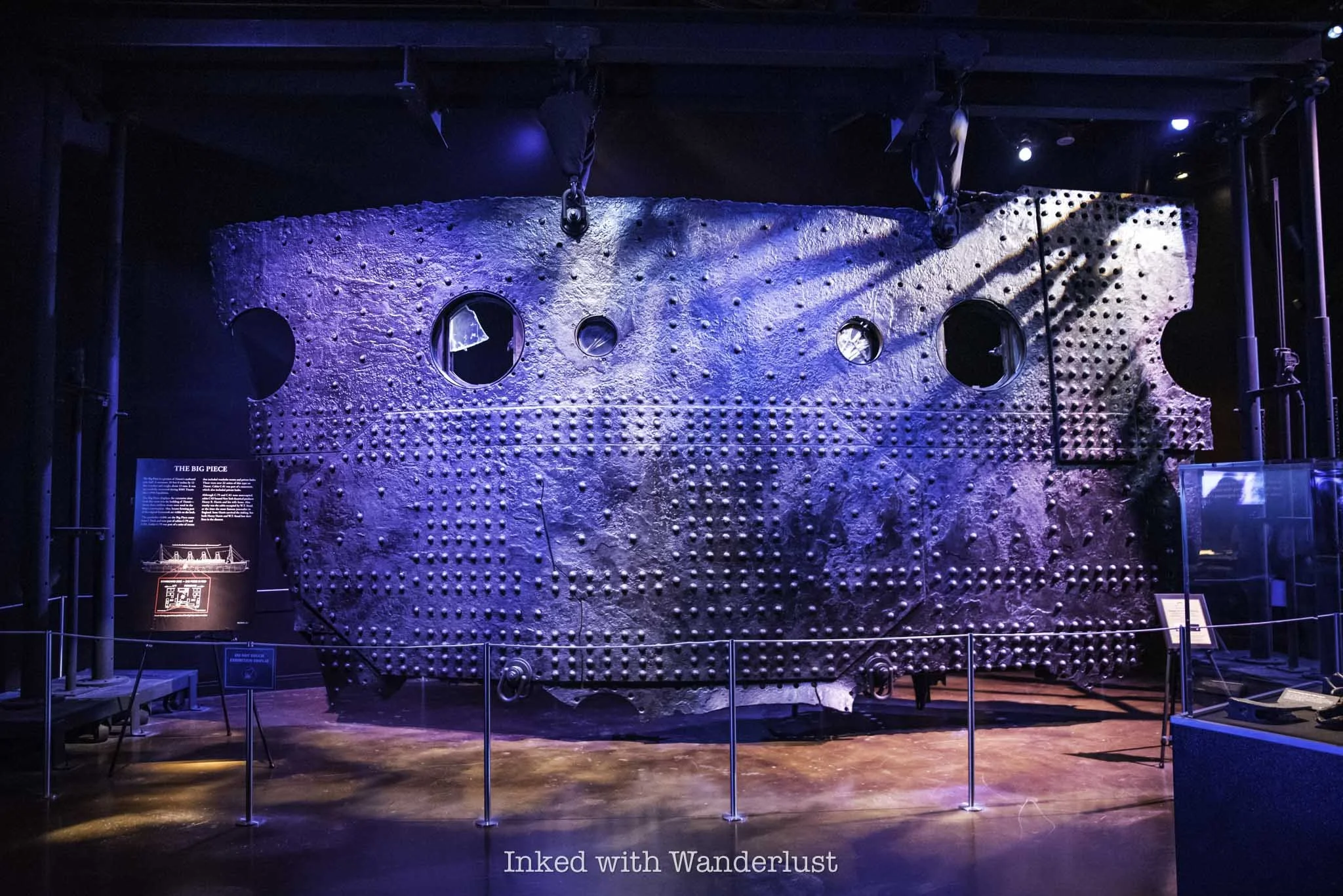
The museum’s most famous artifact, the “Big Piece”, is an actual section of the Titanic’s hull, formally located near the center of the ocean liner. It hangs in one of the final rooms of the museum, along with several other displayed pieces.

If you’re not aware, Titanic, formally referred to as the, “Unsinkable Ship”, indeed sunk during its maiden voyage across the Atlantic after striking a rouge iceberg. More than 1500 people lost their lives either during the sinking or by freezing to death in the bitterly cold water.
As a long-time Titanic aficionado, I’ve always wanted to tour this museum and see the artifacts for myself. I did so recently, along with my Dad, and it was a somber, yet epic experience. In this post, I’ll discuss what it costs, where to find it, what to expect during the tour, the museum rules, and more.
Quick Stats
Location: Inside the Luxor Hotel in Las Vegas
Fee: $27 - $34 per person
Open: Seven days a week, even on holidays
Family Friendly: Yes
Cell Service: Yes
Restroom: Outside the museum
Parking: Paid parking at the Luxor
EV Stations: Yes
Popularity: Moderate
Features: Numerous artifacts recovered from the wreckage site
Pets: Not allowed
Cameras: Allowed, but a few off-limit areas (explanation below) and no video or live feeds
My Visit(s): November 2024
Titanic Exhibit Las Vegas Price, Location & Hours

To find the Titanic museum, you’ll need to make your way to the Luxor Hotel, which is the big black pyramid-shaped hotel on the southern end of the strip. Trust me, you can’t miss it. There’s plenty of parking available, though you’ll likely have to pay.
Current parking rates are $18 to $40, dependent on where and when you park. If you’re a Nevada resident, you can get free parking for three hours by showing the attendant your Nevada drivers license. If you’re an MGM Rewards member with a ranking of Pearl or higher, you’ll receive free self-parking. Otherwise, you’ll have to pay.
Once inside the Luxor, take the escalators to the second level promenade. This is where you’ll find the Titanic museum, Bodies exhibition, restaurants, and more. The escalators are located to the right of the giant Egyptian statues and across from the check-in desk.

When you get to the second level, you should have no problem spotting the museum’s entrance. Look to your right and you’ll spot a giant, billboard-like sign with a huge mural of the Titanic indicating the correct spot.
To the right of this sign is where the ticket booth is. If you’ve purchased your tickets online, simply get in the queue and they’ll scan your phone. If not, head to the ticket booth first. Ticket prices to the Titanic Artifact Exhibition are currently:
$34 - General Admission
$32 - Seniors (65+)
$27 - Military (w/ ID)
$27 - Nevada Residents (w/ ID)
$26 - Child (4 - 12)
$0 - Child (0 - 3)
Additionally, you can purchase combo tickets, which include access to the Titanic Artifact Exhibition and Bodies..The Exhibition. The combo tickets are only available at the booth. My Dad and I passed on “Bodies”, but if you’re interested, combo ticket prices are $44 for adults and $38 for children.
Also, you can opt for the recording device for an additional $5. It includes headphones and a narrator who guides you through the museum, explaining things along the way. It’s not a requirement, though, as there’s plenty of signage you can read in the museum.
Titanic Artifact Exhibition Photography Rules

Photo copyright - Titanic Artifact Exhibition, Las Vegas, Nevada
To answer the question on if cameras are allowed in the museum, the answer is “yes”, but with a few caveats. For starters, you are allowed to bring your cell phone and/or DSLR to capture photos of the exhibits. However, there’s no video and/or live streaming allowed.
The only area inside the museum “off-limits” to photos is the replica of the Grand Staircase. I put “off-limits” in quotations because it’s only “off-limits” to your camera. The only way to get a photo of or with the staircase is through their photographer, and you’ll have to pay for it. No, the photographer won’t take your picture with your camera.
Turning to commentary, I never participate in these, as I view them as cash grabs for something that should be included with the money you’ve already spent. Conveniently, they don’t advise you of this until after you’ve purchased your ticket. I declined the employee’s request to take my photo and continued on. If you want your photo here, though, they’ll happily oblige.
Titanic: The Artifact Exhibition in Las Vegas

After they’ve scanned your ticket, they’ll have you go through the obligatory photo opp, where one of their employees takes your photo in front of a giant green screen. At the conclusion of your tour, these photographs will be available to purchase.
Normally, when I do things like this on my own, I decline the photo and move on. However, my Dad was me and he actually had a great idea for photo of the two of us, so we opted to do it. If you don’t want to, simply advise the employee of such.

Additionally, you’ll be given a card that resembles a boarding pass. On the flip side of the pass will be the name and details of a real-life Titanic passenger. Hang on to this because at the end, you’ll discover the fate of that passenger.
The first room you’ll enter is lined with burnt-orange walls and features numerous artifacts from Titanic’s boiler room, as well as information about the doomed ship’s construction and the people who worked on it. You’ll then walk down a short hallway before turning into a re-creation of the third-class level of the ship.
Third-Class Level

Along the hallway, you’ll see signs with details on individual passengers. This will be a common theme throughout the museum that I thought was a great way to honor their memories. Learning how they ended up on the Titanic, some by pure chance, stirred up emotions at times.
At the end of the hallway, there’s a re-creation of a third-class passenger stateroom. It’s small, no bigger than a walk-in closet, and contains four bunk-style beds. It wasn’t uncommon for ships in this era to place complete strangers together in the same room.
Second-Class Level

In the next room, you’ll see recovered artifacts from the second-class level of the Titanic. The stark differences between third-class and second-class quickly becomes apparent just by looking at the dish ware. You won’t see a re-creation of any staterooms here, as they were starkly similar to first-class, which you’ll see up ahead.
One of the featured passengers you’ll learn about is the Laroche family. The Laroche’s initially booked a passage on the steamship France, however, due to that ships’ policy of not allowing children in the dining room, they were transferred to second-class accommodations on the Titanic. While his wife and children survived the sinking, unfortunately, Joseph Laroche did not.

After the second-class room, you’ll enter a white-walled hallway with a quote from the shipbuilder on the wall. At the end of this hallway through the exit on the right, you’ll come up on the museum’s replica of the grand staircase.
As mentioned above, there are no photos or video allowed here, unless their employee does it. There are also two or three artifacts on display in this room but unless you’re wanting to take the photo, bypass the queue and head straight into the first-class room.
First-Class Level

In the first-class room, opulence is the name of the game. In the re-created first-class stateroom, you’ll immediately notice the size difference from its third-class counterpart. I didn’t measure, but it appears as though you could fit three or four third-class staterooms in just one first-class room.

One of the featured artifacts in this room is a gold-plated chandelier that once hung from the ceiling of the first-class men’s Smoking Room. Additionally, there’s a wall-sized display case showcasing many of the first-class dish ware and eating utensils recovered.
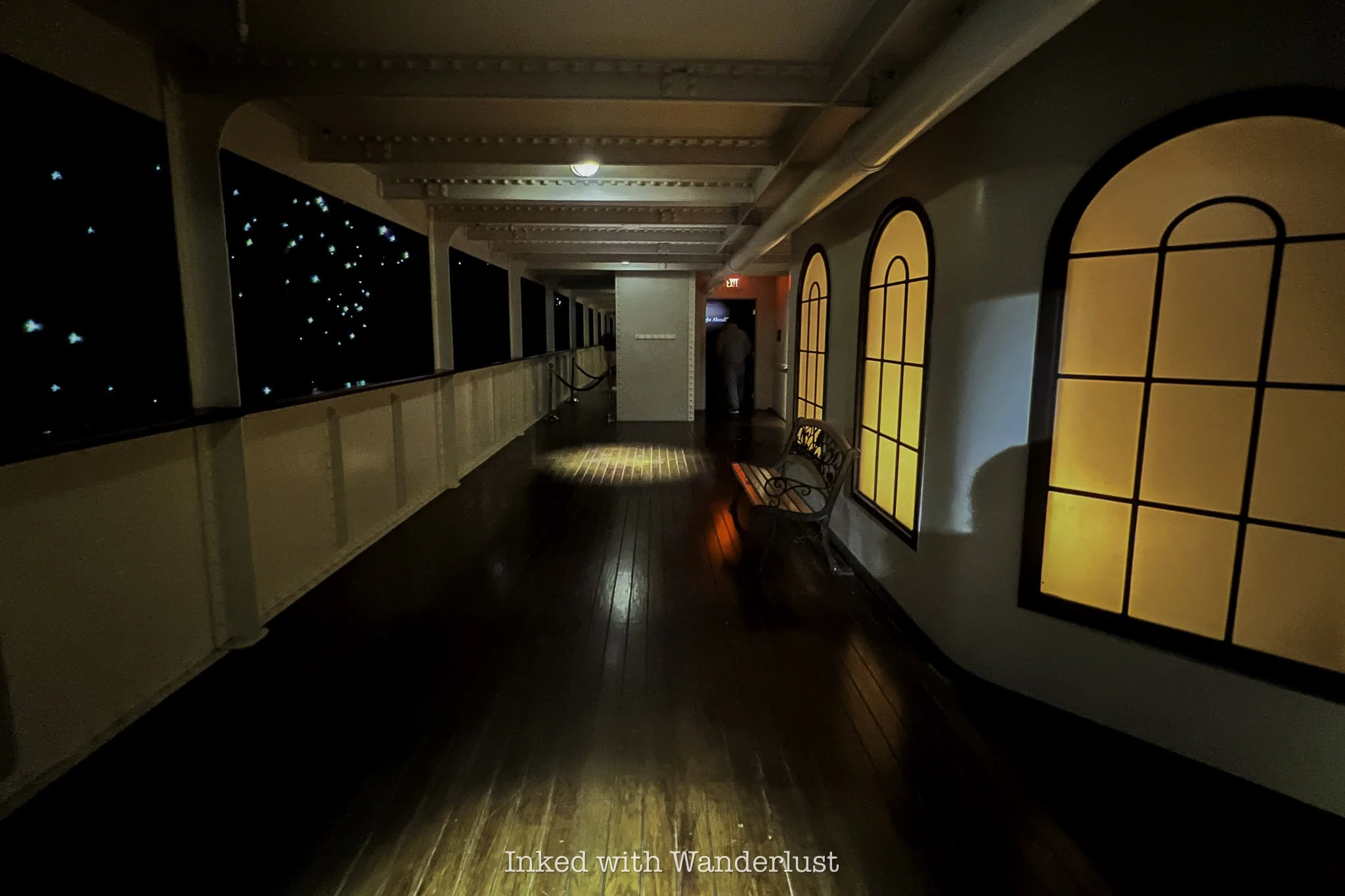
Beyond the first-class room, you’ll step out onto a re-creation of the outdoor promenade, complete with a view similar to what passengers would’ve seen that fateful night. Looking out beyond the guardrail, all passengers would’ve seen is pure darkness in the middle of the Atlantic.
After the promenade, you’ll enter a darkened, chilly room, meant to mimic the sound and feel of a windy evening on the ocean. On the wall to your immediate right are a few signs with the timestamped words of several iceberg warnings sent to the Titanic the day it sunk.
April 14, 1912 - The Fateful Day

Up to this point, you’ve been shown examples of the various levels of Titanic’s accommodations and amenities. No matter the class, the first four days of the ship’s maiden voyage had been nothing short of spectacular for her passengers. Marking what should’ve been a happy memory for all.
However, the evening of that fourth (and final) day would warp feelings of happiness and excitement into those of horror and panic. Shortly before midnight on April 14, 1912, Titanic struck an iceberg, forever changing the course of its brief history.
The next series of rooms are dedicated to the events between the collision and the ship’s eventual sinking. Despite Titanic’s false reputation as unsinkable, it took less than three hours from the time it struck the iceberg to smash into the ocean floor.
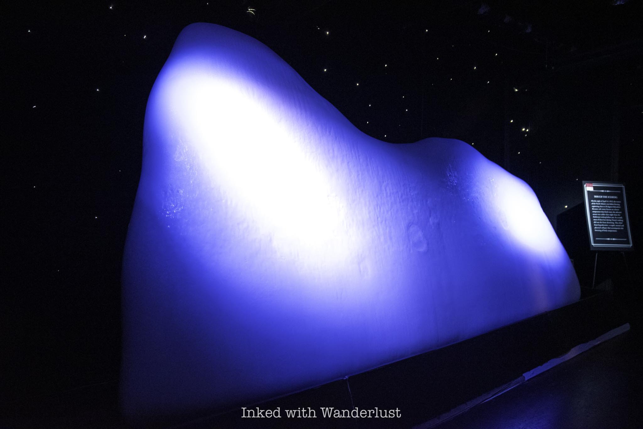
In one of the rooms, the main attraction is an example of an iceberg made of actual ice, maintained at a temperature similar to the stinging cold of the water passengers experienced when they jumped in to escape, or worse yet, unexpectedly fell into.
Unlike the other exhibits, you’re allowed to touch it. In fact, they encourage you to do so in order to get an idea of what passengers went through. It was so cold, I could only keep my hand pressed against it momentarily. Knowing the water that night was even colder than that really put things into perspective.

You’ll then walk down a dark hallway, illuminated by several display cases, each showcasing a single artifact. At the end of that hallway, you’ll enter another room. This one features several more artifacts, such as a few dozen au gratin dishes.
These dishes were discovered stacked neatly together in the sand, much like they appeared in the case. This happened when the cabinet they were stored in remained intact after hitting the ocean floor, but rotted away over the years, leaving the dishes almost perfectly in place.

Another featured display in the same room is a scale-sized model of the bow (front) half of Titanic as it appears on the ocean floor. During the sinking, Titanic was going down by the bow but before going near vertical, the stern (back) split, leaving the two halves only loosely connected.
After the split, the stern crashed back into the water, before being lifted again by the still sinking bow. This time, the ship went completely vertical. The bow, now completely submerged, broke free of the stern and began its descent. The stern would bob around momentarily before it too sunk.
This left the Titanic with two wreck sites 2,000 feet (600 meters) apart, roughly 12,500 feet (or nearly 2.5 miles) beneath the surface. At some point, a sizable chunk of the ship’s hull would break off and eventually, would go on to become the largest piece of the Titanic ever recovered.
The Big Piece
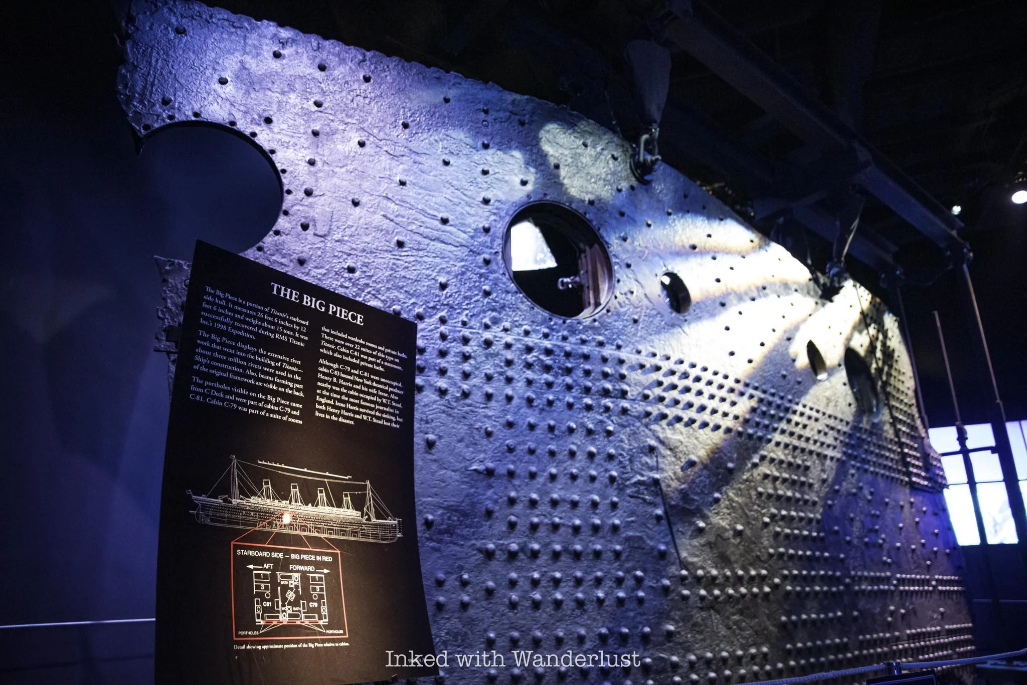
First discovered in 1994, nine years after Titanic’s wreck site was first discovered, the Big Piece was brought to the surface in 1998 after several failed attempts, with the intention of making it the centerpiece for a planned exhibition.
The piece, formally located around the mid-point of Titanic’s starboard side hull, weighs fifteen tons and is twenty-six feet, six inches across and twelve feet, six inches high. The extensiveness of the rivet work is on full display, showing a mere fraction of the three million rivets used to build the Titanic.

The portholes on the Big Piece came from C deck and were part of cabins C-79 and C-81, both of which were suites (presumably second class). Both of these suites were unoccupied but the neighboring suite, C-83, was occupied by Henry B. Harris, a famous New York theatre producer. He did not survive the sinking.
To date, the Big Piece is the largest artifact ever recovered from Titanic’s wreck site. Given the quickly deteriorating state of the ship, it’ll likely remain as such. Due to strong currents and rust-eating bacteria, it is estimated that the Titanic will completely collapse by 2030.
Titanic’s Death Toll

In the final exhibit room will be a giant wall-sized display. On this display will be the names of every Titanic passenger and crew member, separated by class and whether or not they survived. As you can see in the photo above, Titanic’s crew suffered the greatest loss with 701 perishing. Interestingly, they also had the most survivors at 209.
Of the passengers, third-class suffered the greatest loss at 529, with only 181 surviving. In stark contrast, the overwhelming majority of the Titanic’s first-class passengers survived, with about 200 surviving and 125 perishing, most of those being men. This was largely due to the “women and children first” rule of the time.
Remember the “boarding pass” you’re given at the start of your tour with a passenger’s name on it? Here is where you’ll scan the back of it to discover the fate of your passenger. Mine was a man named Johannes Joseph Van de Velde, a native of Belgium.

Not much is known about him, but we do know he did not survive. We only know this because a survivor named Theodor De Mulder visited Johannes’ family and relayed to them the final days he spent with him.
While the exact number varies, it is believed that over 1,500 passengers and crew lost their lives in the early morning hours of April 15, 1912. Many, including the ship’s captain, went down with the ship, but the vast majority was due to drowning or freezing to death in the icy Atlantic waters.
Perhaps the largest contribution to the high death toll was an insufficient amount of life boats. Titanic had only twenty, capable of holding only 1,178 of the 2,240 passengers and crew, if filled to capacity (and none of them were).

Of the 1500 victims, most were third-class passengers and/or men, as well as crew. As mentioned above, Captain Smith was thought to have given the order of “women and children” first.
It is now believed that first officers mistook this as, “no men until all women and children are off the ship”. Consequently, the lifeboats were lowered with plenty of room available, some at just half capacity.
Additionally, many third-class passengers were largely prevented access to top deck, where the lifeboats were located, to allow the wealthier passengers to board them first. This delay meant that many in third-class were doomed from the start. May they all rest in peace.
PSALM 23:3-4
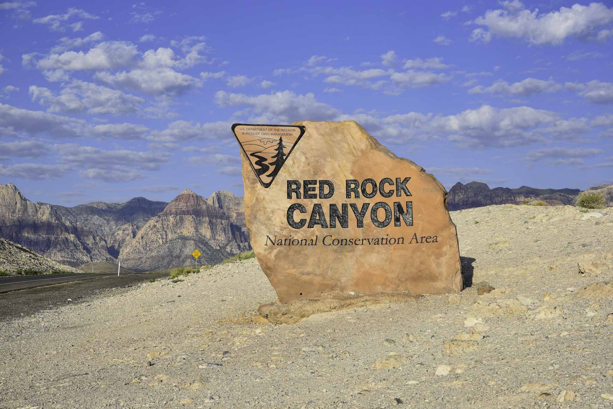
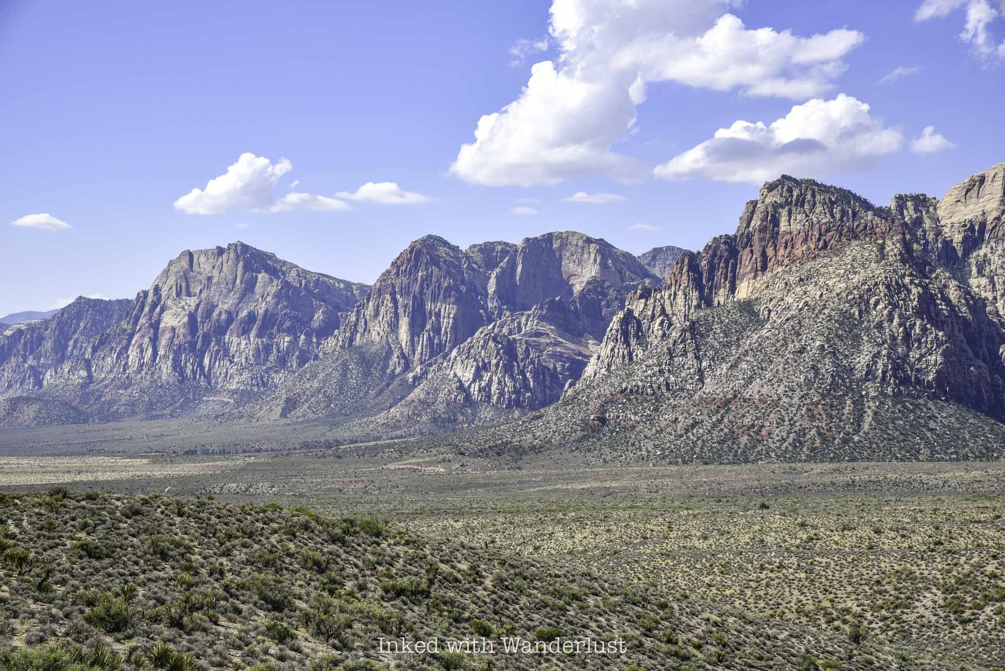
Red Rock Canyon: The Ultimate Travel Guide
Red Rock Canyon is a stunning desert oasis in Southern Nevada, just 15-miles or so from the Las Vegas strip. The park’s landscape includes…
Disclosure: This post contains affiliate links. If you make a purchase through these links, I may earn a small commission at no additional cost to you. I only recommend products or services that I believe will add value to my readers.

Red Rock Canyon is a stunning desert oasis in Southern Nevada, just 15-miles or so from the Las Vegas strip. The park’s landscape includes stunning mountain peaks, maze-like canyons, sandstone ridges, an abundance of wildlife and endless recreational opportunities.
If you are traveling with small children who cannot partake in the adult-only activities on the strip, Red Rock Canyon is an excellent alternative that the entire family can enjoy together. Likewise, it’s a great way to take a break from casino hopping. Some common activities in the park include:
Hiking
Rock Climbing
Photography
Wildlife Viewing
Bike Riding
Scenic Drive
and more…
Due to this, Red Rock Canyon has become a mega-popular destination, attracting upwards of three million people annually. Before visiting, there are several things you need to know. For example, dependent upon when you’re visiting, you may need a reservation.
Additionally, there are other aspects to Red Rock you need to know, such as entry fees, parking, the unfortunate vehicle breaks-ins that occur with regularity, which hiking trails to hit and more. Don’t visit Red Rock without consulting this guide first. Let’s get into it!
Red Rock Canyon Timed Reservations

Timed reservations for Red Rock Canyon are required during the park’s peak visitation season, which for the 2023/2024 season is October 1, 2023 through May 31, 2024. Normally, peak travel season would mean the summer months, but because of the triple digit temperatures the area sees in the summer, less people visit during this time.
If you plan to visit during this timeframe, you will need a reservation. Even if it’s a fee-free day. Timed reservations can be made and purchased online through Recreation.gov in one of two booking windows. Those windows are:
Primary Booking Window: Thirty days prior to your intended visit beginning at 7am.
Secondary Booking Window: Additional reservations are made available two days in advance. For example, reservations for November 3 will be available beginning November 1 at 7am.
During the process of making your reservation, you can also pay your entry fees, including an annual pass. If you already have one, including the America the Beautiful pass, simply state so while making your reservation.

When making your reservation, you’ll need to select what time you want to enter the park from the list of available times. Be sure of your choice because they’ll only give you thirty minutes for early or late entry. Meaning, if you chose 9:00am, the earliest you could enter is 8:30am and the latest would be 9:30am.
Additionally, keep in mind that there is no re-entry during the reservation period. You can stay in the park as long as you want but if you leave, you’ll need another reservation in order to re-enter the park.
Remember, if your visit falls outside of that timeframe, you don’t need to worry about making a reservation. You’ll still need to pay entry fees, but that’s it.
Red Rock Canyon Fees and Parking

How easy or difficult parking is to come by at Red Rock Canyon depends on several aspects, such as season, day of visit, time of day, how crowded it is, etc. Visiting on the off-season, arriving to the park early and coming on a weekday nearly ensures a hassle-free experience.
I visited in August, way outside of the park’s peak season. Though I had to deal with triple digit heat, the park was a literal ghost town and I had no issue with parking at any of the trailheads or any traffic jams on the scenic drive.
The first and largest parking lot is at the visitor center just inside the entry gate. From there, there are several parking lots dotted along the scenic drive at various trailheads and viewpoints. The largest of which are at the Calico Hills and Calico Tanks trailheads.

Much like most parks in the national park system, there are entry fees associated with visiting Red Rock Canyon. The fees for 2024 are:
$20 per vehicle
$10 per motorcycle
$8 per bicyclist
$5 per pedestrian (walk-in)
$50 for the Red Rock Canyon annual pass
$80 for the ‘America the Beautiful’ annual pass (good for all national park sites)
The first four fee categories listed are for a single day. Meaning if you plan to visit on multiple days, you would need to pay the entry fee on each day. If you’re planning to visit for three or more days in a calendar year or are visiting multiple national park sites, it may make sense to purchase one of the two annual passes.
How Much Time You Need at Red Rock Canyon

The scenic drive in Red Rock Canyon is only 13-miles from beginning to end but with so much to do and see, that 13-miles could take a while to get through. If all you want to do is drive through the park and take in the sights, 45-minutes to one hour is all you would need.
My recommendation, though, is to commit to more time than that. There are so many hiking trails, viewpoints and sights to see that you could easily spend an entire day (or three) in the park.
If you’re on a time crunch, I recommend choosing one hiking trail to hike (such as Calico Tanks) and driving the scenic drive. If you choose an easy to moderate trail at a few miles or less, it shouldn’t take you longer than a few hours to do that, plus the scenic drive.
How to Get to Red Rock Canyon

If you’re like most people, you’ll be visiting Red Rock Canyon from somewhere in Las Vegas, proper. From the Las Vegas Strip, Red Rock Canyon is only about 20-30 minutes away (by car), depending on where you’re staying.
You’re in an even better position if you’re staying in Summerlin, as hotels such as JW Marriott are only 10-15 minutes away. The closest conceivable hotel to the park, Red Rock Casino Resort and Spa, is less than a two-mile drive from the gate.
While you are allowed to walk to bike into the park, I highly recommend visiting in a car. There is no public transportation going to or within the park and since cell phone signals are spotty (at best), ride sharing options aren’t reliable.
Before driving to Red Rock Canyon, make sure your gas tank is full as there are no fuel services in the park. Also, bring with you an insulated cooler and stuff it with as much water as you can fit. Dehydration is a very real threat during a visit to Red Rock Canyon. So bring more than you think you’ll need.
You’ll also want to bring food with you as there aren’t any concessionaires in the park. There are a number of restaurants within a few miles of the park and the closest grocery store, Albertsons, is less than a mile away on W Charleston blvd.
The Best Time to Visit Red Rock Canyon

With an average of 295 days of sunshine and only four inches of rain per year, there are very few bad times to visit Red Rock Canyon. Still, each season has its own positives and negatives, so it’s a good idea to know ahead of time to avoid being caught off-guard.
Red Rock Canyon in Spring
Spring time, early spring specifically, can be a great time to visit Red Rock. Daytime temperatures rarely exceed 77 degrees, but nighttime temperatures hover around 50 degrees. This makes hiking during the day quite comfortable, but it’ll be chilly at night if you’re planning to camp.
One of the downfalls to visiting in spring, though, is how windy it can get. Wind can happen anytime of year at Red Rock but in March and April, gusts have been recorded at 60+ mph. Aside from that and the chilly evenings, spring is a great time for hiking and climbing.
Red Rock Canyon in Summer
If all you’re looking to do is take a lap around the Red Rock Scenic Drive and pop out here and there to take in the views, then summer is fine. If you’re looking to hike or rock climb, however, the hot weather can make a summer visit a potentially dangerous one.
With an average daytime temperature of 93-degrees and not much shade on the park’s hiking trails, dehydration is a real concern. A concern that I, unfortunately, know all too well. I, stupidly, hiked the Calico Tanks trail on a triple digit day and despite drinking lots of water, I started feeling the effects of dehydration on my way back to the car.
If you’re key on hitting the trails, my recommendation would be to visit in the spring or fall. If you must hike in the summer, go on a day with the lowest possible temperature and get an early start so you’ll be off the trail before the mid-day heat sets in.

Red Rock Canyon in the Fall
The benefits of visiting Red Rock Canyon in the fall are:
The daytime temperatures are significantly better than they are in the summer.
The fall foliage colors in contrast to the red rock makes for a stunning sight.
One significant drawback to fall, though, is it’s when monsoon season hits. So it’s imperative to check the weather forecast before heading to Red Rock (be sure to look up the weather for Red Rock, specifically, as it can differ greatly from nearby Las Vegas, proper).
Also, ready yourself for potential seriously high winds as much like in the spring, gusts can reach 60 mph or more. However, amidst all that wind, you’ll bare witness to the leaves and other foliage changing colors, creating a beautiful contrast to the red rocks.
Winter in Red Rock Canyon
If you’re planning to visit Red Rock in the winter, prepare yourself for chilly conditions as daytime temperatures average around 57 degrees and dip down to an average of 32 degrees at night. Needless to say, bring a warm jacket and dress in layers.
The upside to this time of year are the epic sunsets you can catch from various points in the park, including and especially from the various mountain peaks. If you do decide to hike up to the peaks, keep an eye out for patches of snow and ice.
While it doesn’t snow too often, it isn’t unheard of to see accumulated snow around the scenic drive and visitor center. Additionally, it tends to rain in the winter more-so than any other time of year, so be sure to bring an umbrella and a waterproof layer of clothing.
Things to Do in Red Rock Canyon

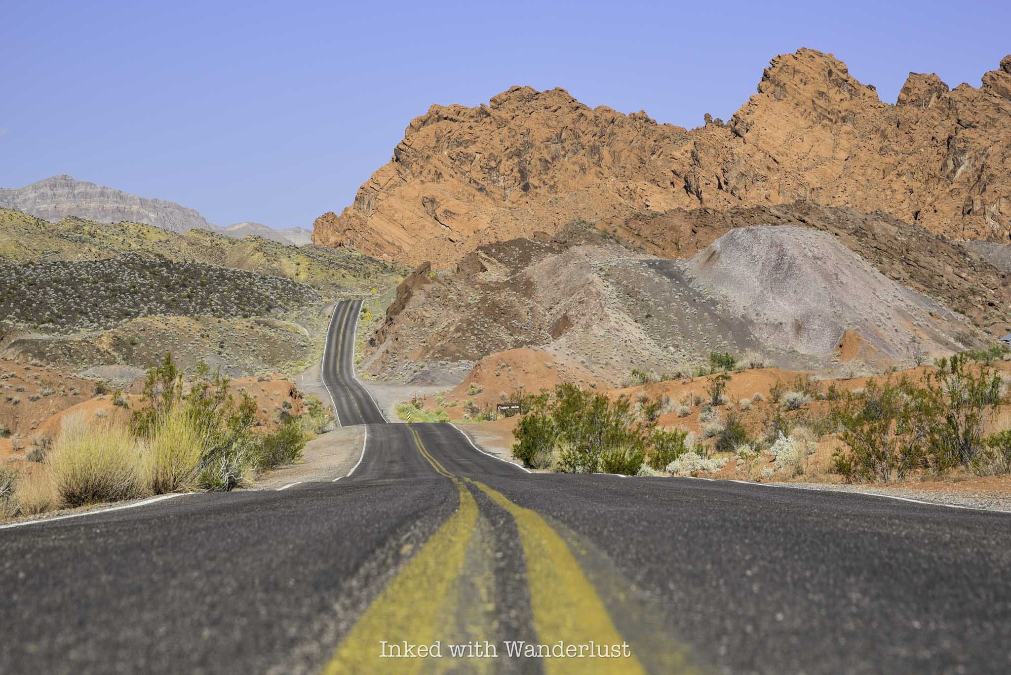
1) Drive the Red Rock Canyon Scenic Drive
One of the most popular things to do in Red Rock Canyon is to drive the 13-mile, one-way scenic drive that winds through the park. There are pull-outs and parking lots dotted along the road at several of the park’s most popular trailheads and lookouts.
2) Hit the Hiking Trails
There are many hiking trails in Red Rock with varying levels of difficulty. A couple of the easier trails include Pine Creek Canyon and the historic Petroglyph Wall. Two of the park’s most popular trails, Calico Tanks and Icebox Canyon, fall into the moderate category. If you’re looking for more of a challenge, Turtlehead Peak and Kraft Mountain Loop offer just that.
3) Book a Horseback Riding Tour
Access areas of the park only possible on horseback by booking a horseback riding tour through Viator. This two hour tour doesn’t require any experience and allows you to experience the rugged side of the park. Pay later options are available.
4) Try Your Hand at Rock Climbing
Red Rock Canyon is a rock climber’s paradise. If you’re still learning how to climb and aren’t comfortable going out on your own, there are many tour options available. If you are experienced, though, you’ll love the free range of options and solitude Red Rock provides.
5) Stop by the Visitor Center
A visit to the park wouldn’t be complete without stopping by the visitor center. Inside, there are many artifacts found in the park and exhibits detailing the history of Red Rock.
6) Take a Shaka Tour of Red Rock Canyon
Download a Red Rock Canyon Shaka Guide. It’s like having a personal tour guide in the car with you. Packed with useful information and stories of Red Rock, you’ll follow your Shaka Guide around the park, hitting up numerous stops such as the historic Petroglyph Wall, hike the Sandstone Quarry, enjoy lunch at Willow Springs and more!
Be Sure to Hide Your Valuables

Unfortunately, Red Rock Canyon has been fraught with vehicle break-ins in recent years in areas both outside and inside of the park. What happens is the criminals wait for people to make their way down a hiking trail and then inspect their vehicle. If they see something, they’ll smash out the window and grab the item(s).
To combat this issue, the Friends of Red Rock Canyon have been raising funds to increase the amount of cameras in the park’s parking lots. Furthermore, increased patrols from park rangers have been implemented.
However, to help ensure your windows don’t get smashed out, it’s best to keep all valuables hidden in the trunk. This includes backpacks, coolers (especially Yeti branded ones), cameras, wallets, cell phones, branded clothing such as The North Face and anything else that could be perceived as valuable.
Red Rock Canyon Frequently Asked Questions
Are dogs allowed at Red Rock Canyon?
As long as they’re leashed and never left unattended, you are allowed to bring your dog(s) to Red Rock Canyon and its hiking trails.
How much time should I spend at Red Rock Canyon?
You should, at minimum, allocate two to three hours if all you want to do is the scenic drive and see the main highlights. If you want to hike multiple trails, though, I recommend setting aside two full days, at least.
Can I enter Red Rock Canyon without a reservation?
Yes and no. If you’re visiting between October and May, then yes, you’ll need a timed reservation. June through September, however, you can come and go as you please as reservations are not required during these months.
How far is Red Rock Canyon from Las Vegas?
From the Las Vegas Strip, Red Rock Canyon is around 20-miles (give or take) or a 30-minute drive away.
Which is better, Red Rock Canyon or Valley of Fire?
Both! Honestly, there’s no way to compare the two. They’re each amazing in their own right and I highly recommend visiting both. You can read my one-day at Valley of Fire itinerary here for inspiration.
Is there cell service at Red Rock Canyon?
Cell service is nearly non-existent at Red Rock Canyon.
Are there bathrooms at Red Rock Canyon?
Bathrooms are readily available at Red Rock Canyon. The visitor center has one and additionally, most of the trailhead parking lots and pull-outs have (rather clean) vaulted toilets.
Is there public transportation to Red Rock Canyon?
No. Additionally, due to limited cell service, ride sharing isn’t a viable option.
Is flying a drone allowed at Red Rock Canyon?
Yes! Flying a drone in the park for recreational purposes is allowed.
PROVERBS 3:23

See The Historic Petroglyph Wall at Red Rock Canyon
Located within Red Rock Canyon Recreation Area, not too far from the Las Vegas strip, you can find an amazing…
Disclosure: This post contains affiliate links. If you make a purchase through these links, I may earn a small commission at no additional cost to you. I only recommend products or services that I believe will add value to my readers.
Located within Red Rock Canyon Recreation Area, not too far from the Las Vegas strip, you can find an amazing example of Native America history - the Petroglyph Wall.
It’s easy to find as the road leading to it runs just off of Scenic Drive, the main road that runs through the park. Additionally, it’s easy to get to as it’s less than a quarter mile to the wall and back.
So what’s the parking situation like? How do you get to the trailhead? Are there any fees involved? I answer all of these questions, and more, in the post below. Let’s get into it.

Click ad to view offer
Trail Stats
Location: Red Rock Canyon Recreation Site, Las Vegas, NV
Fee: None for the trail, but Red Rock charges an entry fee
Open: All year
For: Everyone
Cell Service: Spotty, at best
Restroom: In the trailhead parking lot
Parking: Semi-large, unpaved lot
EV Stations: None
Difficulty: Easy
Accessibility: Not wheelchair or stroller friendly
Popularity: Medium
Mileage: Less than a quarter mile, there and back
Time: 20-30 minutes
Condition: Semi-maintained (follow trail markers)
Features: Historic petroglyphs and mountain views
Best Viewed: Any time of year
Pets: Allowed, as long as they’re leashed
Drones: Allowed for recreational purposes
Hazards: None other than usual outdoor hazards
Our Visit(s): August 2023
Petroglyph Wall Parking, Trailhead and Getting There

While there are no fees associated with Petroglyph Wall directly, there are fees you’ll need to pay to enter Red Rock Canyon and depending on the time of year you visit, reservations may be needed as well. Fees for Red Rock Canyon are as follows:
$20 per vehicle
$10 per motorcycle
$8 per bicyclist
$5 per pedestrian
$50 for a Red Rock annual pass
$80 for the ‘America the Beautiful’ pass
Additionally, between October 1 and May 31, advanced reservations are required to enter the park between the hours of 8am and 5pm. Reservations are available 30-days in advance and no re-entry is allowed. Scenic Drive is only one-way, so arrive early and have a plan in place.


To get to the parking lot and trailhead for Petroglyph Wall, simply drive for about eight miles from the Red Rock Canyon entrance. You’ll see the road ahead turning into a tight horseshoe. As the road begins to horseshoe, you’ll see Rocky Gap Road on your right. Turn there.
You’ll first come upon another parking lot for a different trail on your left, bypass this and continue until you reach the second parking lot, where the Willow Springs Picnic Area is. This is where you’ll park for Petroglyph Wall.
The trailhead is located at the north end of the lot, on the far left corner, across from Willow Springs. There’s a sign indicating you’re in the right spot (pictured above).
Trail to Petroglyph Wall

The trail from the parking lot to Petroglyph Wall, one-way, is just a tenth of a mile across a wash. The trail isn’t maintained all that well, but it’s still easy to follow as it’s dotted with the same trail markers you’ll find on most Red Rock Canyon trails.
After a short time, you’ll arrive to at Petroglyph Wall. The area surrounding the wall is small, with a couple trees providing a smidgen of shade. Near the wall, you’ll find informational signage detailing the facts of the petroglyphs.

The rock art on Petroglyph Wall is estimated to be at least 800 years old. Most of the art is found on one section of the wall (the dark part), but there are a few others scattered about.
This is far from the only examples of petroglyphs in Red Rock Canyon, but it is the easiest to access. While the trail isn’t stroller or wheelchair friendly, it’s accessible to children, the elderly and everyone in between.
Unless you’re a huge fan of petroglyphs, I don’t recommend visiting Red Rock purely to visit Petroglyph Wall considering the fees to enter the park. This is more of a bonus if you’re already planning to be here.
Where Do You Go From Here?

As stated above, Petroglyph Wall serves as an excellent bonus to your already planned visit to Red Rock. Considering that Scenic Drive and there is no re-entry during the reservation period, I recommend checking out the Calico Tanks hiking trail first, as it’s before Petroglyph Wall.
Beyond Petroglyph Wall, there’s another amazing hiking trail by the name of Icebox Canyon you should check out, as well as Pine Creek Canyon.
If you want further examples of petroglyphs, I recommend driving east to famed Valley of Fire State Park. There’s an equally easy example of rock art on Atlatl Rock, among other areas of the park. While you’re there, there are many other highlights in the park you can see in a relatively short amount of time.

Hike the Calico Tanks Trail at Red Rock Canyon
While there aren’t any fees associated with the trail itself, the trail is located inside Red Rock Canyon, which does…
Disclosure: This post contains affiliate links. If you make a purchase through these links, I may earn a small commission at no additional cost to you. I only recommend products or services that I believe will add value to my readers.
If you live in the Las Vegas area or you’re planning to visit soon and you’re in search of local hiking trails, you can’t go wrong with one of the most popular in the area - the Calico Tanks Trail.
Located in Red Rock Canyon National Conservation Area, right off the Scenic Drive, this trail takes hikers on a thrilling experience through red and white sandstone formations across rolling hills and inside the walls of a canyon, before ending at the famed Calico Tank and a jaw dropping view of the valley below.
While the trail length is moderate, coming in at only 2.4-miles, out and back, it’s far from your normal, everyday trail as there’s some mild scrambling required, increasing the time it’ll take to complete the hike.
Curious to see what the trail looks like? Want to know where the parking lot is and what, if any, fees are associated with this hike? I discuss all of that and more in the post below.

Click or tap on the ad to view offer
Trail Stats
Location: Red Rock Canyon National Recreation Area, Las Vegas, NV
Fee: Up to $20 per vehicle
Open: All year
For: Hikers
Cell Service: Spotty, at best
Restroom: At the trailhead
Parking: Large paved lot at the trailhead
EV Stations: None
Difficulty: Moderate
Popularity: High
Mileage: 2.4 miles, out and back
Elevation Gain: 440 feet
Condition: Trail is dotted with trail markers, but there isn’t much of a designated path for most of it. Bringing a map would be wise
Features: Beautiful sandstone formations, the Calico Tank and a great view of Las Vegas at the end
Accessible: Any time of year, but with the limited shade and the extreme heat, summer isn’t ideal
Pets: Not allowed
Drones: Not allowed
Hazards: Little to no shade, sandy boulders and rattlesnakes
My Visit(s): August 2023
Take a look at these products that I recommend for this hike…
Red Rock Canyon Fees and Parking

While there aren’t any fees associated with the trail itself, the trail is located inside Red Rock Canyon, which does charge a fee to enter. Fees for 2024 are as follows:
$20 per vehicle
$10 per motorcycle
$8 per bicyclist
$5 per pedestrian
Furthermore, if you’re visiting between the months of November and May, a timed reservation will be required to access the park between the hours of 8am and 5pm. An additional $2 fee will be charged by Recreation.gov for these.
If you have any variation of the America the Beautiful pass, you can use it for entry here. You will still need a reservation during the months mentioned above, though. Conversely, you can purchase a Red Rock Canyon annual pass for $50.
The parking lot for the Calico Tanks Trail is easy to find, as it’s located just off Scenic Drive on the right. It’s fairly large, capable of holding several dozen vehicles or so, and is paved.

It’s the second parking lot you’ll encounter along Scenic Drive. The first one is for the Calico Hills and Basin, so don’t confuse the two (though this area is also worthy of exploring if you have the time).
Unfortunately, Red Rock Canyon experiences vehicle break ins and thefts at the most popular parking lots, Calico Tanks being amongst them. So don’t leave valuables in plain view.
Near the entrance, I pulled over to take a photo of the welcome sign and while doing so, I witnessed a black SUV pull over. A young man jumped out, looked into my car and the car parked in front of me, looked up and saw me, jumped back in his car and took off. So definitely heed the warnings.
The Trail

The trailhead is located at the northern end of the parking lot, next to the restrooms. There’s trail signage here advising visitors of potential hazards and/or trail conditions, so be sure to give them a quick read.
The trail begins in the shade of the large canyon wall and runs straight for about 30 yards, before pivoting right towards an area of gravel wash.
This area can be easy to lose at times as the trail appears to have been washed away by reoccurring flooding events. You’ll know you’ve went the right direction when you see two giant boulders on your left (pictured below).

Past these boulders, you’ll travel along a clear pathway for a short spell before coming across an even larger gravel wash field. Throughout this stretch, it would be advisable to have a map on hand as the trail is non-existent.
If you don’t have one, just keep an eye out for the trail markers and make your way to the next one the best you can, simply repeating the process until you’re back on the path.

After a short while, the trail will become obvious again and will narrow as it aligns with the canyon walls. It is here where your adventure truly begins.
If there’s been rainfall recently, you’ll likely encounter several large puddles of water and work your way through the canyon. None of them are deep or treacherous, though.
You can easily bypass many of them by utilizing the spur trails, but there is one in particular that forces you to either scramble over the sandstone or just accept the fact that your feet are going to get wet.

You’ll soon come upon the first of many large boulders you’ll need to negotiate in order to complete the trail. None of which are difficult.
There are no ropes or chains to hoist yourself up on, nor will you need any special equipment. Be sure to bring shoes or boots with good tread, though, as the sandstone is slick and sandy in some spots.

Much like at the beginning of the trail, there are several trail markers placed along this stretch indicating the best possible path, as there is no proper trail from this point forward.
You’re never out of eye-shot of one of these markers, so as soon as you make your way to one, simply look around to find the next and make your way there, watching your steps.

Depending on the time of day, you’ll have some shade on this section of the trail, but it’s mostly in the morning. As the sun gets higher, the amount of shade dissipates, leaving you more exposed to the Las Vegas heat.
It goes without saying, but you should bring as much water your shoulders can handle on this hike. It’s always better to bring too much than not enough.

You’ll know you’re nearing the end of the trail when you reach a series of sandstone steps, coupled with a dirt path leading you upward.
At the top of those sandstone steps, you’ll notice a notch in the distance. Just beyond that notch is where the Calico Tank lies.

The water level in the tank varies throughout the year. It can be anywhere from bone dry in the summer to full and frozen over in the winter.
Either way, it makes for a great spot to sit and enjoy a snack. There are numerous rocks to sit on along the trail on the south side of the tank. Additionally, if the water level is low enough, there’s a small area on the shore where you can sit.
Just beyond the tank is an outstanding view of Las Vegas and the valley. I did not go any further as I was feeling the effects of the day’s 108 degree heat and had to turn back.
From what I was told by others on the trail that day, you’ll need to do a little more boulder hopping past the tank to reach the overlook, but it’s only a few more minutes beyond the tank.
READ NEXT: “How to Spend a Few Hours at Valley of Fire in the Summer”

My Experience at Jade Asian Kitchen & Noodles in Las Vegas
During my recent visit of Valley of Fire State Park and Red Rock Canyon, I stayed at the JW Marriott in the community of…
Disclaimer: I am not a professional restaurant critic, nor has this restaurant offered me any incentive to write this post. My opinions are my own and are based on my personal experience only.
In Las Vegas, there is no shortage of amazing places to eat. People from all over the world and all walks of life come to Vegas so thus, there are many restaurants serving a wide variety of delicacies.
While many websites focus on places to eat on or near the Las Vegas strip, I feel there isn’t enough representation of great places to our outside of the stip.
During my recent visit of Valley of Fire State Park and Red Rock Canyon, I stayed at the JW Marriott in the community of Summerlin. If you’ve ever stayed at a JW, you’ll know they’re known for being large properties with many restaurants and other offerings.
One such restaurant at the JW Las Vegas is Jade Asian Kitchen & Noodles, located behind the hotel’s palms tower, down a beautiful marble floored hallway, right across from Starbucks.
I was famished after spending half the day exploring Valley of Fire and was looking to replenish those lost calories. After a quick Yelp review search, I decided to book a table at Jade.
Click or tap on the ad to view offer
Disclaimer: I am not a professional restaurant critic, nor has this restaurant offered me any incentive to write this post. My opinions are my own and are based on my personal experience only.
Restaurant Info
Location: JW Marriott Las Vegas Resort & Spa
Address: 221 North Rampart Blvd.
Cost: $$$$
Food: Fresh sushi, Teppanyaki and other Asian dishes
Open: 5pm - 10pm (Wed, Thurs, Fri) & 4pm - 11pm (Sat & Sun). Closed Mon & Tues
Seating: Mostly indoor. Some outdoor seating on the patio
Alcohol: Full bar - extensive beer and cocktail menu
My Visit: August 2023
Rating (out of three): 👍🏼👍🏼

As stated above, Jade Asian Kitchen is located inside the JW Marriott in the Las Vegas community of Summerlin, behind the hotel’s Palms Tower.
If you’re not staying at the hotel, your best bet is to park in the self parking area of the hotel, just outside Rampart Casino. You’ll find the restaurant outside of the berm of the casino area, adjacent to Starbucks.
You can make a reservation for the regular menu at Jade through the OpenTable app, or by calling them directly. Though it isn’t required.
If you’re wanting to enjoy Teppanyaki, though (like I did), then reservations are required. When arriving, be sure to specify to the host/hostess about your Teppanyaki reservation.

The dining room is beautifully lit in a contemporary setting. There are touches of Asian culture decor mixed in as well. Jade does a great job of honoring Asian culture without coming across as cliche.
The Teppanyaki counters are located in the rear of the dining room, near the entry doors to the outdoor patio. If I remember correctly, there were four grills set up.
For those who’re unaware of what Teppanyaki is, it’s a post-World War II style of Japanese cuisine in which an iron griddle is used to cook food. The word is derived from teppan (the metal plate) and yaki, which means pan-fried, grilled or broiled.

Once everyone at your table has been seated, your chef will come out to make their introduction and explain the process to you. It’s around this time when your waiter or waitress will take your food and drink orders.
The protein options on the Teppanyaki menu include the usual that you’d find at most restaurants. These include; chicken, shrimp, salmon, filet mignon, ribeye, sea scallops, lobster, wagyu and vegetarian.
Prices range from $29 (chicken) to $136 (wagyu ribeye) and includes a soup starter and a side of fried rice. They also offer combo options where you can get two proteins if you’re having a difficult time deciding.
Your chef will leave again to obtain the necessary ingredients. When they return, they will begin cooking your food right in front of you, all while telling jokes, making quips and lighting up an enormous flame of fire (or two).


As you can see in the photo above, I went with the New York strip/chicken combo ($59), as I wanted to try both. While both were good and had great flavor, I personally enjoyed the chicken more so than the steak.
I also received a side of grilled vegetables and three difference dipping sauces. I don’t recall what the sauces were, but I do remember the only one I liked was the dark brown one in the middle.
Additionally, I ordered one of their specialty cocktails with my meal. I’m a whiskey guy, so I went with their “Jade Old Fashioned” ($25). It’s made with barrel aged Toki whiskey and angostura bitters. While it was a fine old fashioned, I felt it wasn’t special enough to warrant a $25 price tag.

All in, including tax and tip, my final bill was $108. It officially became the most expensive meal I’ve ever paid for, for just myself. Was it worth it? That all depends on perspective.
I came here because I’ve always enjoyed Teppanyaki, I was starving, it was conveniently located in my hotel and I was gathering content for this website. Would I, under normal circumstances, spend that much money for dinner on just myself? Probably not.
Looking at the regular menu, they have many entree options that I feel are reasonably priced. So if you can live without doing the Teppanyaki option, a family can dine at Jade and not spend much more than they would at most Las Vegas restaurants.

How to Spend a Few Hours at Valley of Fire in the Summer
Valley of Fire offers a variety of hiking trails, a visitor center with informative exhibits and many historical sites. There’s…
Disclosure: This post contains affiliate links. If you make a purchase through these links, I may earn a small commission at no additional cost to you. I only recommend products or services that I believe will add value to my readers.
Established in 1935 as Nevada’s first state park, Valley of Fire attracts thousands of hikers, photographers and overall nature enthusiasts annually.
It’s located in southern Nevada, just an hour so from the bright lights of the strip and is one of the most popular things to do near Las Vegas.
Valley of Fire offers a variety of hiking trails, a visitor center with informative exhibits and many historical sites. There’s literally something for everybody in this geological wonderland.
While I always recommend spending at least a full day at the park, the reality is, the extreme heat that Valley of Fire sees in the summer is simply too much for many people. It’s quite common to see high triple digits consistently.
Thankfully, Valley of Fire offers many attractions that are easy to see, with most only requiring a small commitment of thirty minutes or less, allowing you to see many of the highlights in a short amount of time.
So if you’re thinking about visiting Valley of Fire in the summer, but you can’t stand the heat and only have a few hours to spend, you’ve come to the right blog. Let’s get into it!
Click/tap on the ad to view offer
Valley of Fire Entrances, Fees & Reservations
Before we get into the fun stuff, there are a few things you need to know before traveling to Valley of Fire. For starters, no, day-use reservations are NOT required at Valley of Fire at this time. However, with the recent launch of the Reserve Nevada website, I wouldn’t be surprised to see it happen eventually as it’s the most popular state park in the state.
On the flip side, yes, you will have to pay an entrance fee. Thankfully, the fees aren’t all that high and if you’re driving a car with a Nevada license plate, you’ll get a discount! As of 2024, day-use entry fees are as follows:
$15 - Non-Nevada vehicles
$10 - Nevada vehicles
You can pay with a credit/debit card or cash. If the ranger booths aren’t staffed when you arrive, simply pull into the parking lots to the right to pay. If paying with cash, insert cash into the provided envelope and slip that into the iron ranger.
Conversely, you can still pay with a credit or debit card at the digital self-pay stations. Keep in mind that there’s always a chance that those pay stations will be offline, so it’s best to bring cash with you just in case (it happens more than you think).
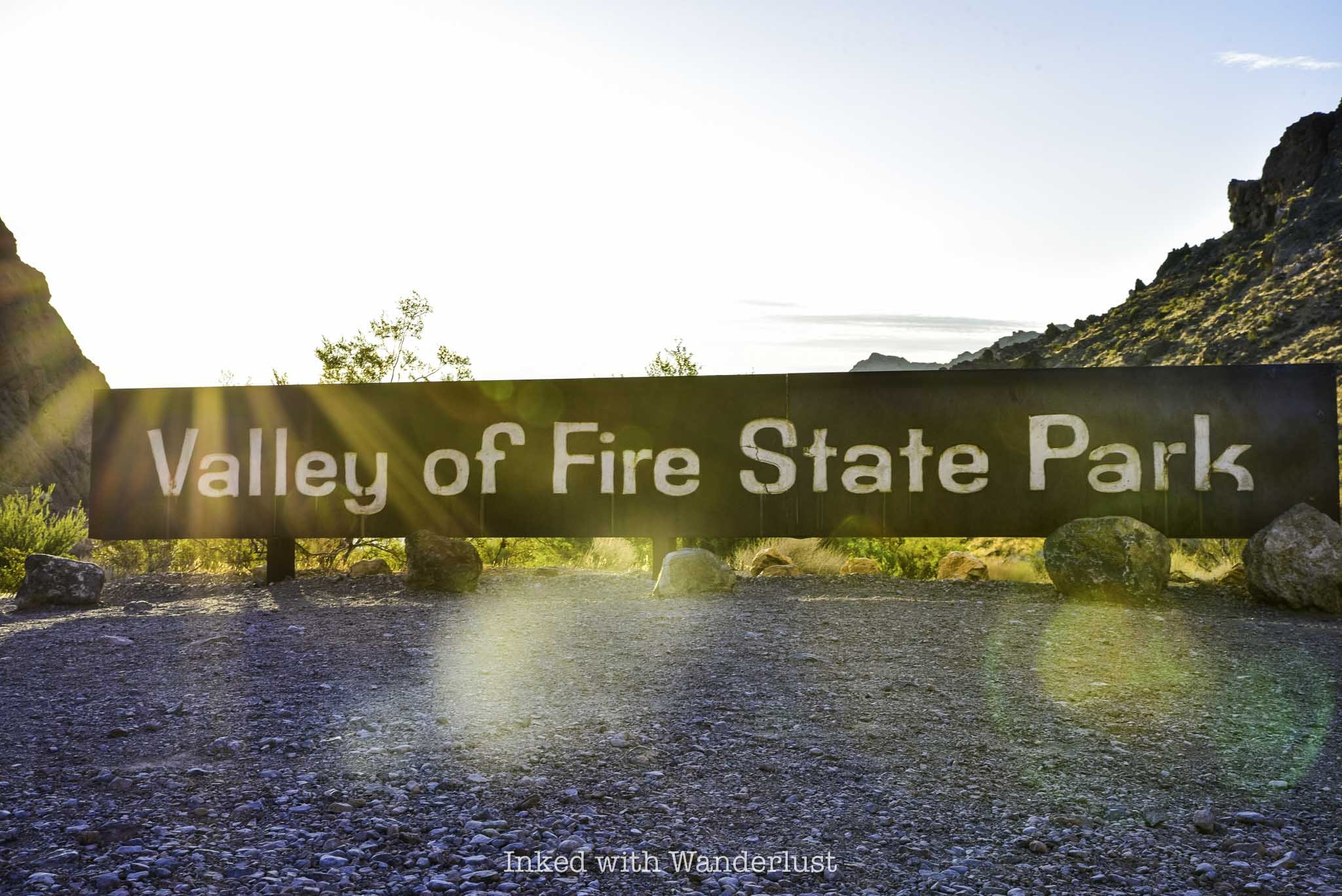
There are two entrances at Valley of Fire; the east entrance and the west entrance. If you’re coming from Las Vegas, you’ll likely drive through the west entrance. Conversely, if you’re driving from Lake Mead/Hoover Dam, Arizona or Utah, you’ll likely go through the east entrance.
Additionally, there are only two main roads in the park; the Valley of Fire Highway (or, Valley of Fire Scenic Byway) which runs east to west, and Mouse’s Tank Road (or, White Domes Road) which takes you to the northern section of the park.
Navigating the park is easy, so you don’t need to rely on GPS too much. Keep in mind that cell service in the park is spotty to non-existent in most areas of the park. There are roadside signs all along the road announcing which attractions you’re approaching, though.

Lastly, be sure to heed the ominous signs at the park’s trailheads. They may seem dramatic, but many heat-related deaths have occurred in the park over the years. There isn’t much shade on any of the trails. I had my own scary experience while hiking in Red Rock Canyon, making me a believer.
For pleasant, somewhat cooler weather, early October to April are the best times to visit Valley of Fire. Though fall and spring sees the biggest crowds for that very reason.
If your aim is to visit with the least amount of people around as possible, then the summer months are your best bet. You will be contending with peak temperatures, though, so an early arrival is paramount to an enjoyable experience in the summer.
Here are some products that I recommend bringing to the park with you to help combat the heat:
Things to See at Valley of Fire in a Few Hours
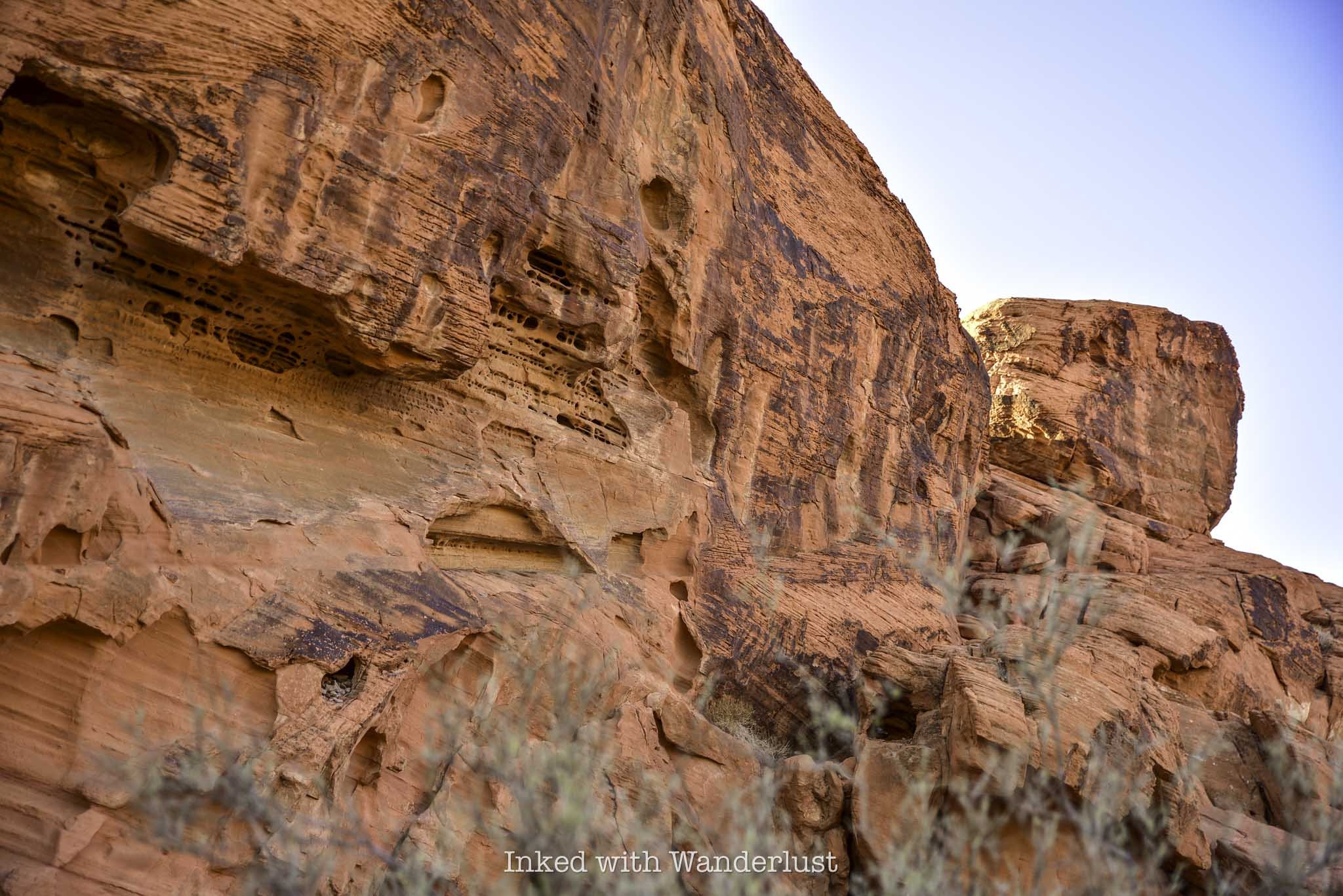
While it would be easy to spend two or three days at this beautiful park, you can just as easily spend a few hours due to the park’s many easily accessible attractions.
Below, I’m going to provide a list of things to see and do in Valley of Fire that will allow you to see many of the highlights in a relatively short amount of time.
This itinerary will list the attractions in the order that they appear in the park and will assume you’ll be driving in from Las Vegas, through the west entrance (if you’ll be driving in through the east entrance, just complete this itinerary in reverse order).
Remember, the goal is to arrive at the park as close to sunrise as possible. This will allow you to see everything listed below and be out of the park by 11am or so, when the heat and crowds are at their worst.
Keep in mind that certain trails are closed in the summer months due to extreme heat, so in respect to responsible travel, I will be omitting those from the list. For informational purposes only, the following trails are closed from May to September:
White Domes Loop
Fire Wave/Seven Wonders Loop/Pastel Canyon/Pink Canyon
Pinnacles Loop
Prospect Trail
Arrowhead Trail
Natural Arch Trail (excluding Natural Arch itself)
Charlie’s Spring
The Beehives
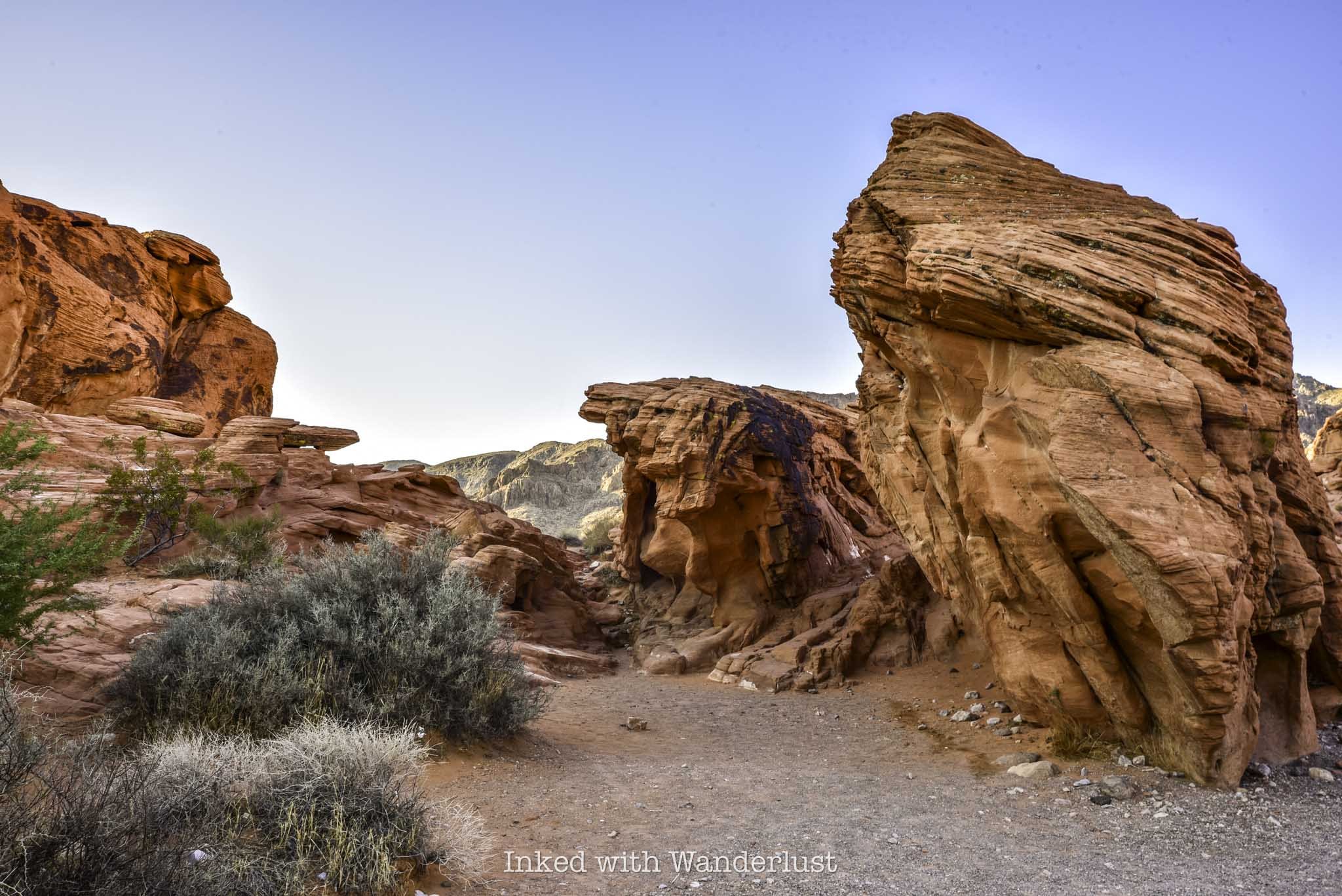
After driving in through the west entrance, the Beehives will be the first major attraction you’ll see and the large parking lot will be on your right.
The Beehives themselves are located right off the parking lot. There’s no designated path to follow, so feel free to explore them at your leisure.
You’ll quickly realize why they were named, “Beehives”, as you’ll see many honeycomb-like formations in the sandstone rocks. I feel that they’re the perfect introduction to Valley of Fire and a great place to watch the sunrise.
Atlatl Rock
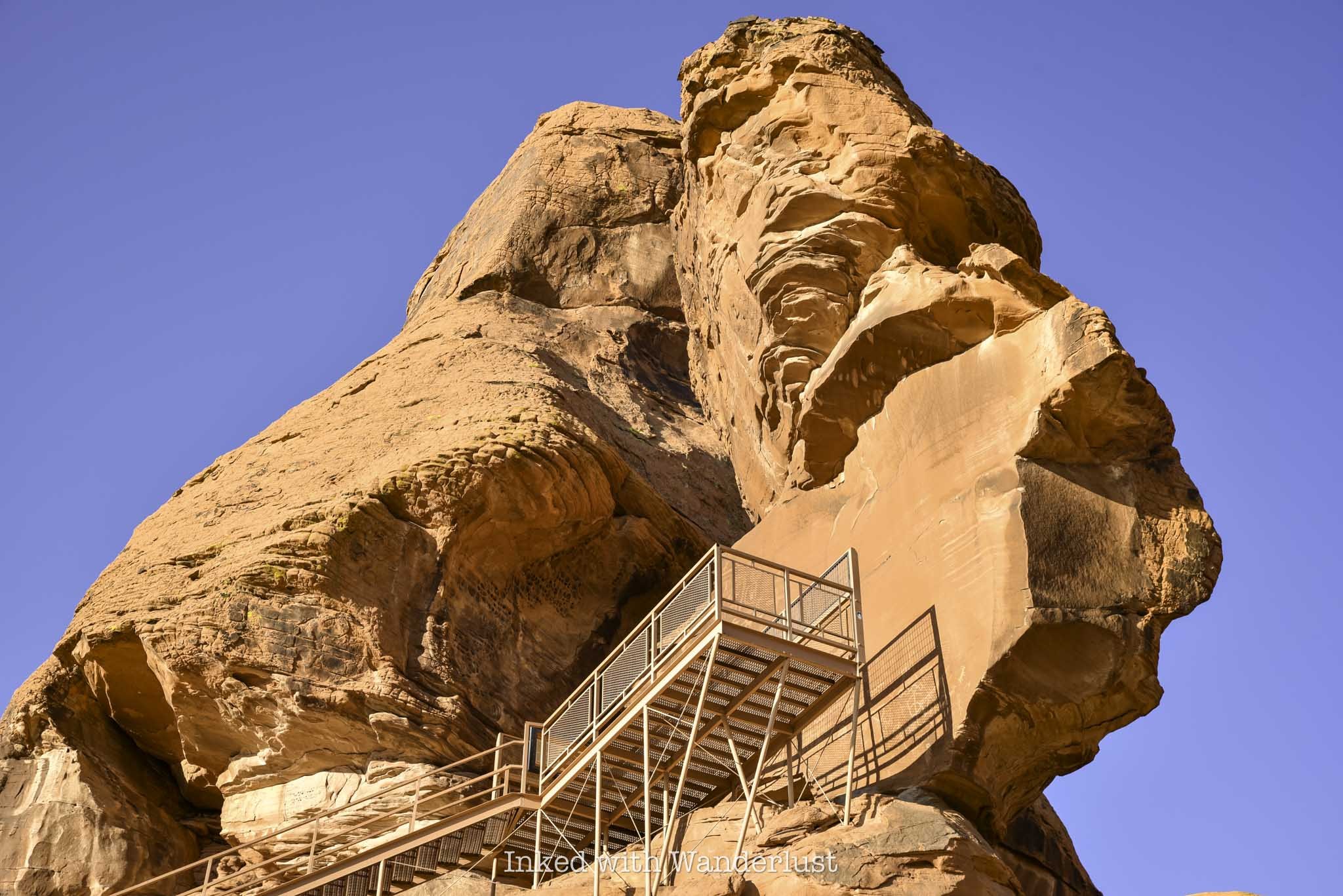
From the Beehives parking lot, drive east for a couple of miles until you see the turn-off for Campground road on your left. You can see Atlatl Rock from the highway but as you get closer, its commanding presence becomes more and more clear.
Aside from the large rock itself, the main draw to Atlatl Rock are the petroglyphs on the smooth rock face near the top. Simply take the steel staircase to the viewing deck above to see them.
The parking lot is fairly large, located just off the road, and features a restroom as well as a half a dozen or so shaded picnic tables. This makes Atlatl Rock an ideal spot for a quick break.
Atlatl Rock doesn’t take long to explore, as most of the petroglyphs are located in one central location. Though there are others scattered through the neighboring campground as well.
For more information, read my comprehensive guide on Atlatl Rock here.
Natural Arch
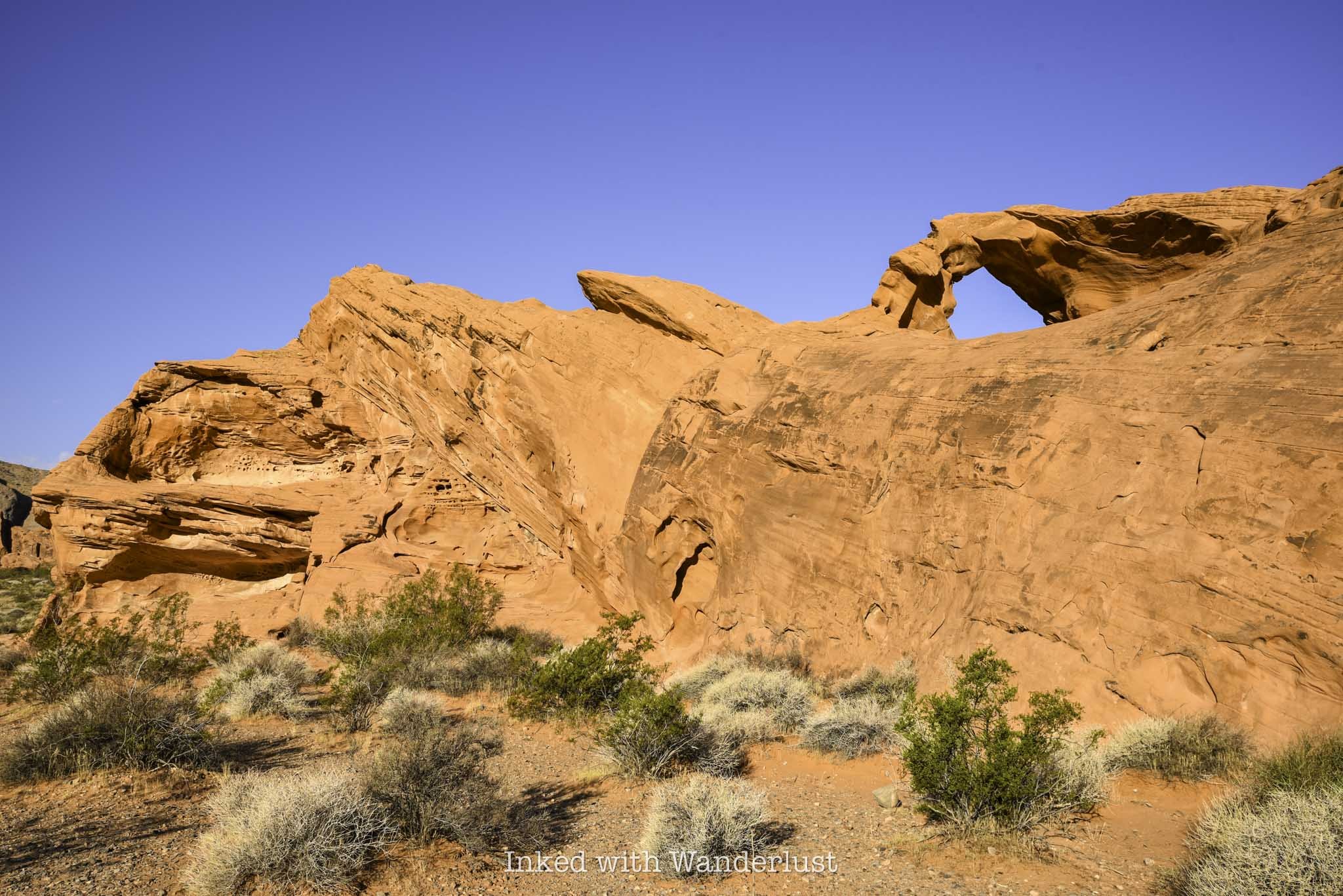
To see Natural Arch, turn left onto Campground road going out of the Atlatl Rock parking lot and follow it for about a mile. It’ll be on the left side of the road.
There’s no real parking lot, just a small pull-out style, dirt and gravel lot. In the morning, the view from the roadside will be dulled by the shade but if you walk behind it, you’ll discover a brilliantly lit Natural Arch in front of you.
Natural Arch isn’t the most impressive sight you’ll see at the park, but there aren’t many of them here and this one is the easiest to access. It’s small, but a sight to behold nonetheless.
To continue on your journey, simply turn back towards Atlatl Rock and the Valley of Fire Highway. If you continue down the road in the opposite direction, the road will become harder to pass as it isn’t well maintained (or even paved).
There are other formations down that road, such as Piano Rock, that are worth seeing but as stated above, the road becomes difficult (though not impossible) for those without high clearance. If you do go that way, the road will eventually loop you back to the highway, just before the Beehives. Turn left to continue.
Historic Cabins
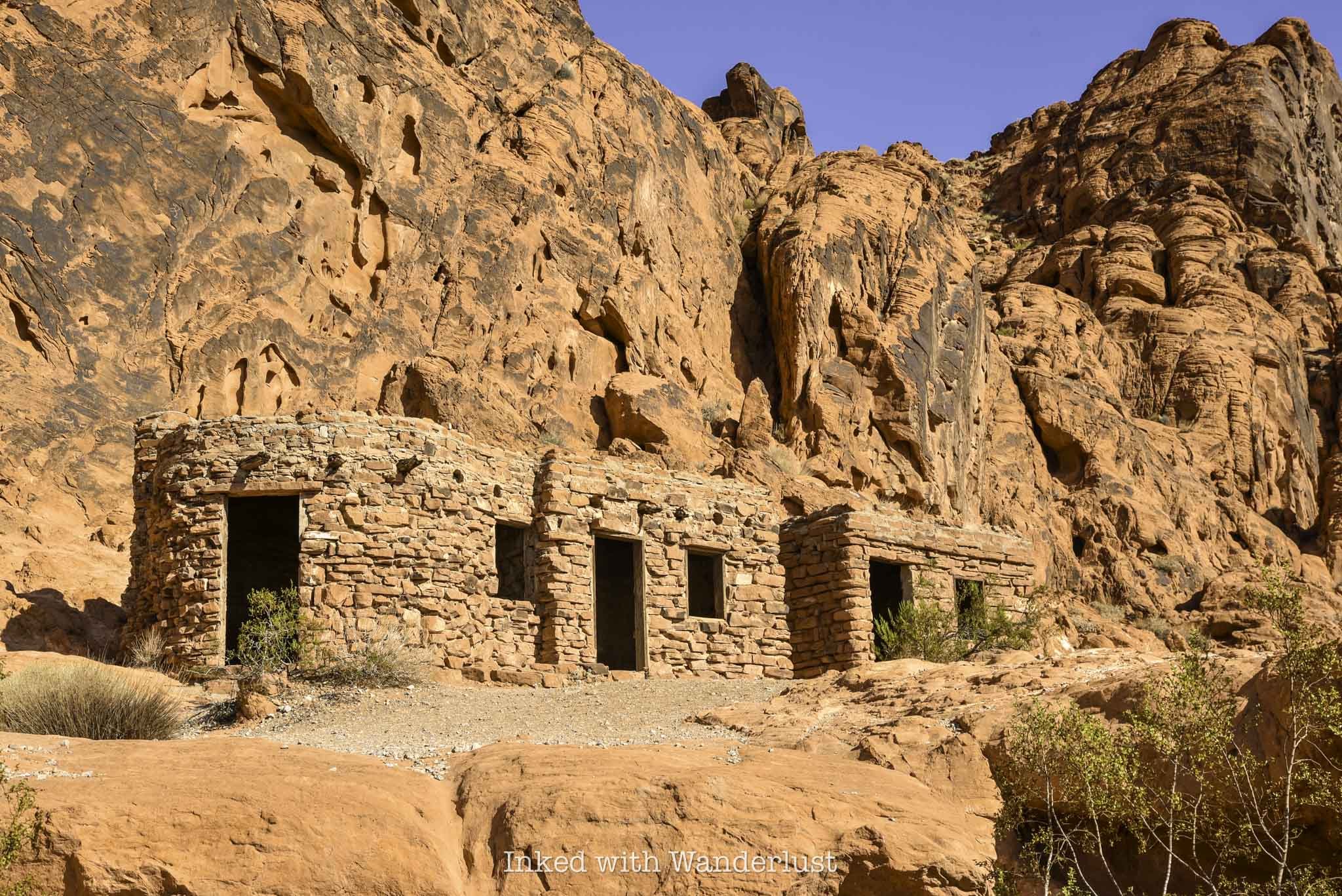
After leaving Natural Arch, turn left to get back onto Valley of Fire Highway to continue onto next attraction; the Historic Cabins. You’ll travel another five miles or so until you reach an un-named road on your left that leads to the cabins (there will be sign indicating the cabins are down that road).
The well maintained road will terminate at an eventual dead end lot, with the cabins out in front of you. There will also be another restroom and picnic area.
The cabins were built by the Civilian Conversation Corps (C.C.C) shortly after Valley of Fire became a state park in 1935 and were made with native sandstone. Their intended use was to provide shelter to travelers.
You can explore the exterior and interior of the preserved cabins. You’ll take notice of the built-in fireplaces and windows overlooking the valley in the distance.
Elephant Rock
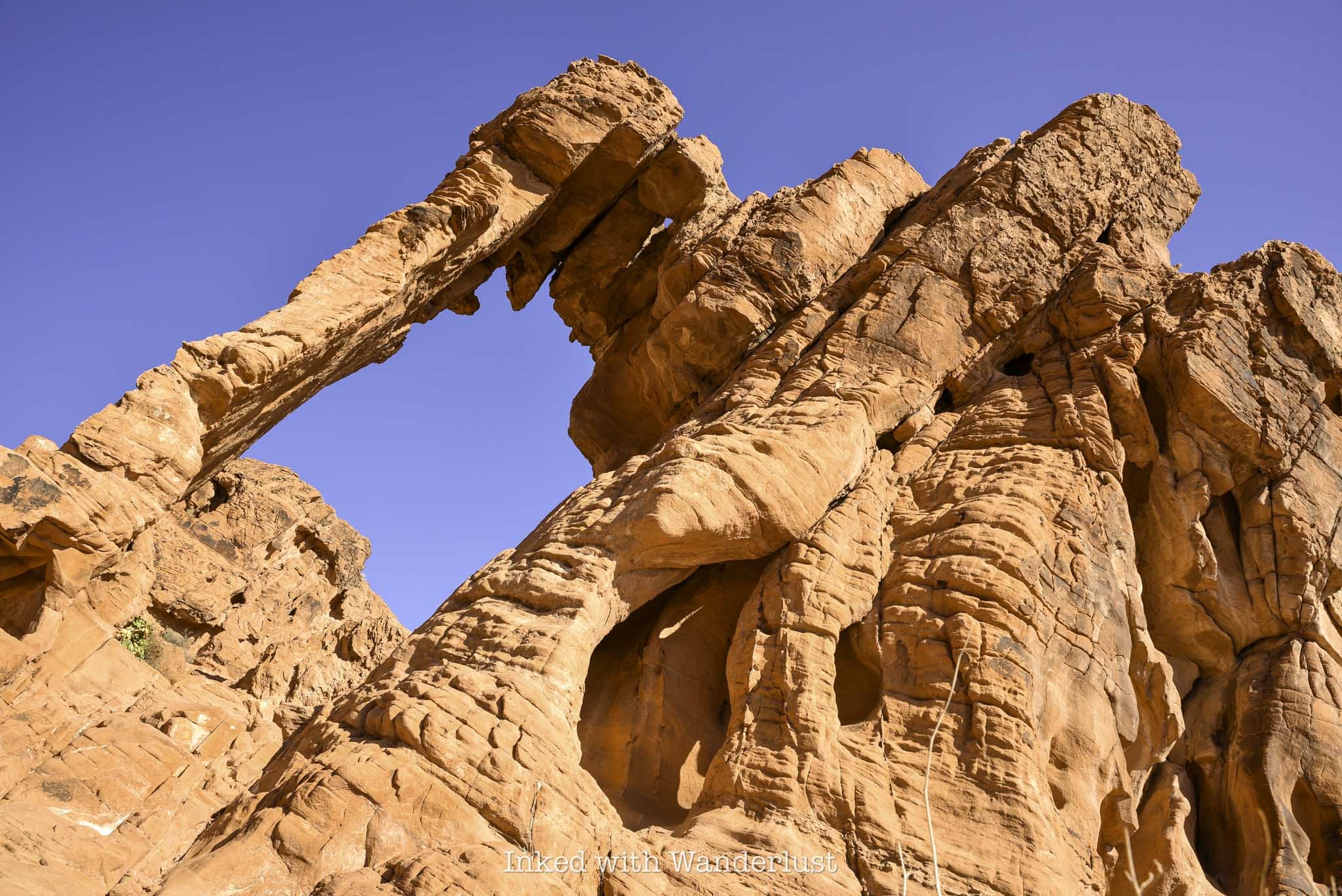
Elephant Rock is one of the most infamous, Instagram worthy rock formations in Valley of Fire. Seeing it in person, it won’t take you long to make out the shape of the trunk, head, body and legs.
From the cabins, turn left onto the highway and follow it for a few more miles until you see the east entrance ahead of you. The parking lot for Elephant Rock is to your left, just before the exit.
The trail to Elephant Rock is a short, 0.3-mile jaunt that leads you right up to it. From there, you can scramble your way up for a closer look (but don’t climb on it).
To read more about Elephant Rock, read my comprehensive guide here.
Visitor Center and Balanced Rock
By now, you’ve undoubtedly worked up a sweat. It’s time to get out of the sun and head to the Visitor Center. To get there, travel west from Elephant Rock (the way you came) for three and a half miles.
You’ll eventually come up upon Mouse’s Tank road on your right. Turn here and keep straight at the fork to get to the parking lot.
The Visitor Center is a great way to escape the heat for a bit. While the A/C is great, the best part about it are the exhibits that detail the extensive history of Valley of Fire. From Native American artifacts and geological education, to examples of native flora and fauna, there’s much to learn here.
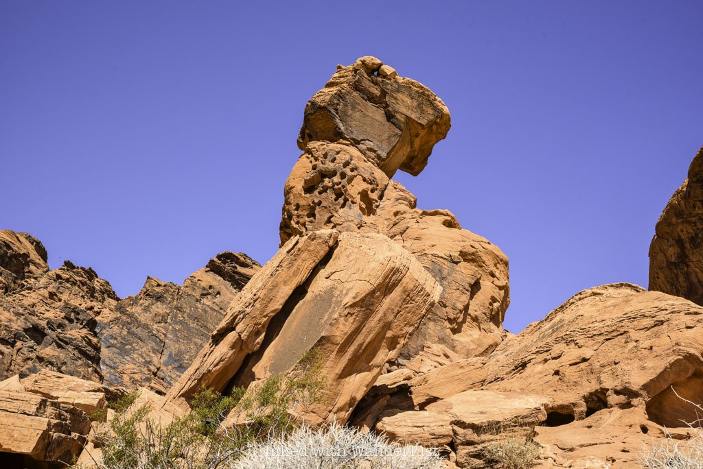
Once you’ve cooled off, head back outside to the short but sweet trail to Balancing Rock. Facing the Visitor Center, you’ll find the trailhead on the left side of the parking lot.
As stated above, the trail is short, even more so than Elephant Rock’s trail. It’ll terminate at a small viewing area that puts you front and center to Balancing Rock.
Much like Natural Arch, Balancing Rock isn’t the most impressive thing you’ll see at Valley of Fire, but it’s so easy to see that it would be a crime not to check it out.
When you’re done, head back to your car and drive north on Mouse’s Tank road.
Mouse’s Tank Trail
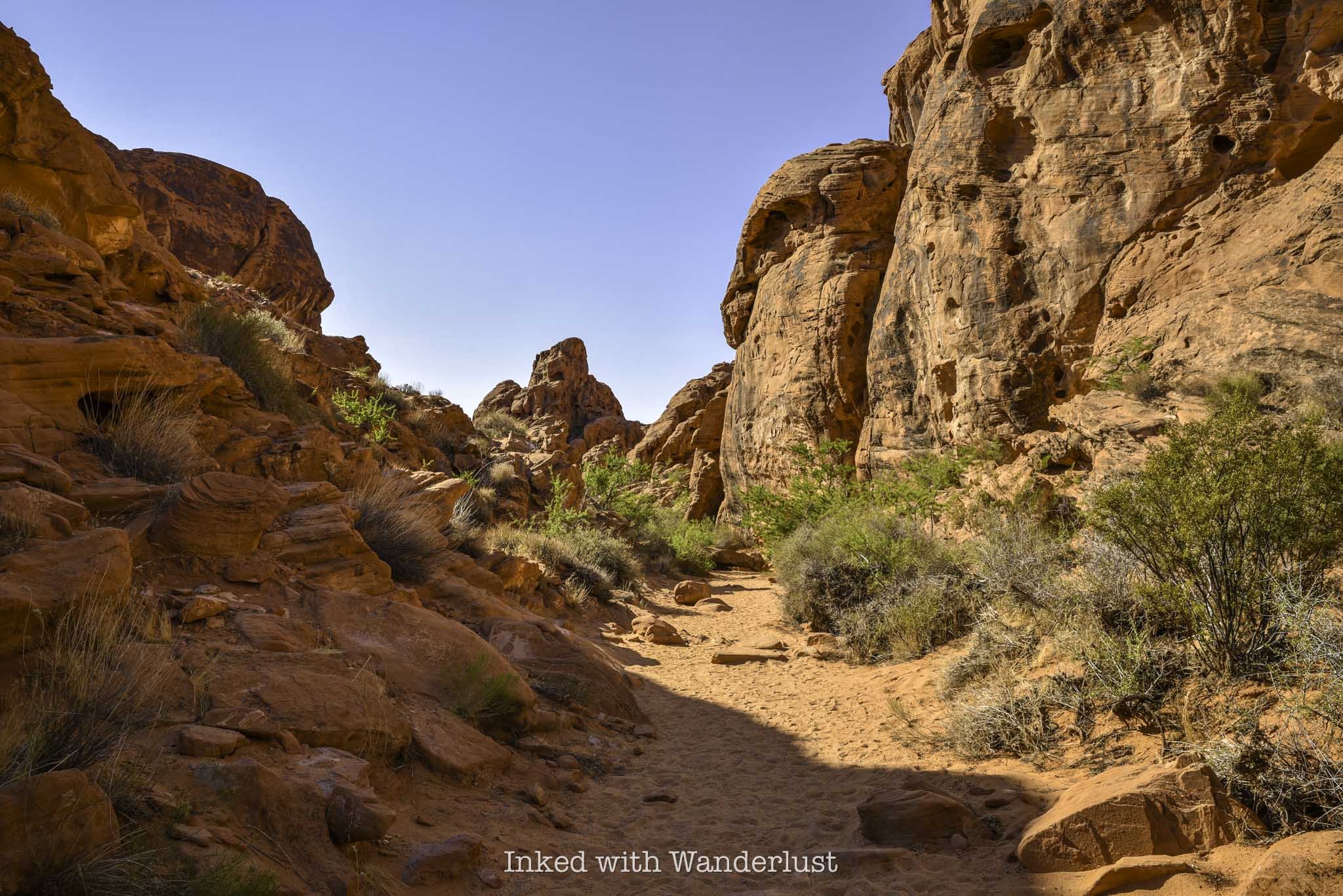
The trailhead for Mouse’s Tank Trail (or, Petroglyph Canyon) is located just off of Mouse’s Tank road on your right. I found more shade on this trail than any other I went on during my visit.
Mouse’s Tank Trail (along with the road) is named after, “Little Mouse”, a Southern Paiute Indian renegade who hid in areas of Valley of Fire after being accused of the murders of two prospectors (among other crimes).
The trail takes you through a canyon, with walls loaded with prehistoric petroglyphs. It terminates at Mouse’s Tank, which is a natural basin inside the rock that collects water after each rainfall.
Mouse’s Tank Trail is only half a mile, roundtrip, and if you get on the trail prior to 11am like I did, you’ll have plenty of shade throughout much of it.
The ‘Instagram View’ of Mouse’s Tank Road
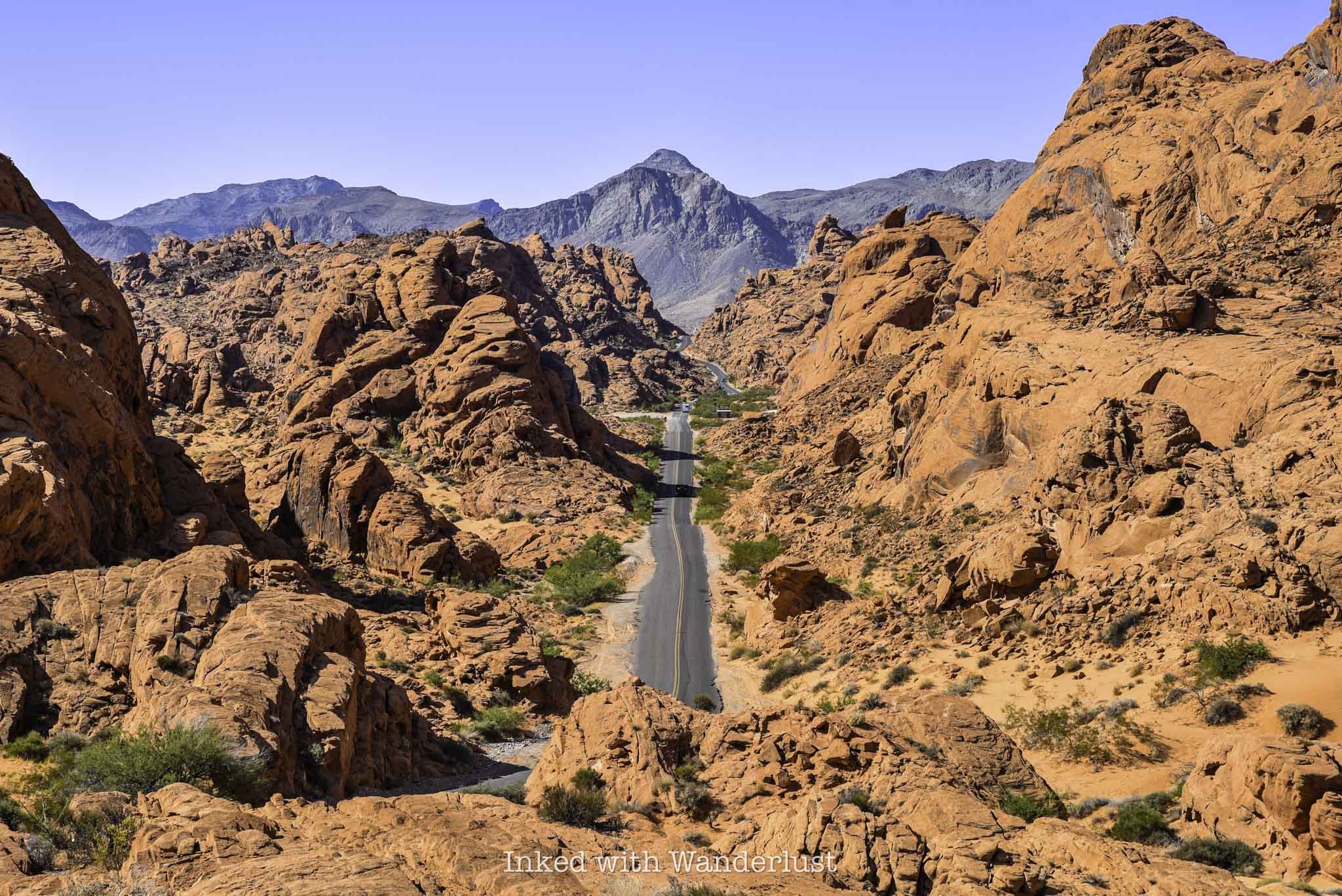
Mouse’s Tank road is undoubtedly one of the most scenic roads in all of Nevada. You’ve seen it all over social media, Instagram specifically, and it’s been plastered all over ads on TV, casino wall posters, etc.
If you’re wanting to get your own photo of this magnificent sight, there’s a much simpler way to do it than what other websites specify. You won’t need coordinates or have to pull over into one of the narrow slots on the side of the road.
Simply drive along Mouse’s Tank road until you see the parking lot for the Rainbow Vista Trail on your right (you can’t miss it). Park your car here, cross the road and walk along the rock until you reach the overlook perch at the end. Voila, you’re there.
Other sites I’ve seen overcomplicate it way too much. Doing it this way is way easier and it’s mostly the exact same view, albeit a bit higher. I feel it’s superior to other angles I’ve seen,
Fire Canyon/Silica Dome Viewpoint

To get to the next stop, head north from the Rainbow Vista parking lot (turn right). Shortly thereafter, you’ll make a right turn onto Fire Canyon road and follow it to its terminus at the parking lot.
There are a number of trails that begin here but for my money, the main attraction is the view. In front of you are examples of sandstone and silica rock.
The multi-layer, contrasting reds of the sandstone on top of the yellow/tan tint of silica with the browns of the mountain range in the distance make a stunning sight.
You can walk out onto the dirt path that leads to a viewing area or simply take a gander from the parking lot. Either way, it doesn’t take much time to enjoy the sights at this lookout.
Drive the Remainder of Mouse’s Tank Road and Take in the Views
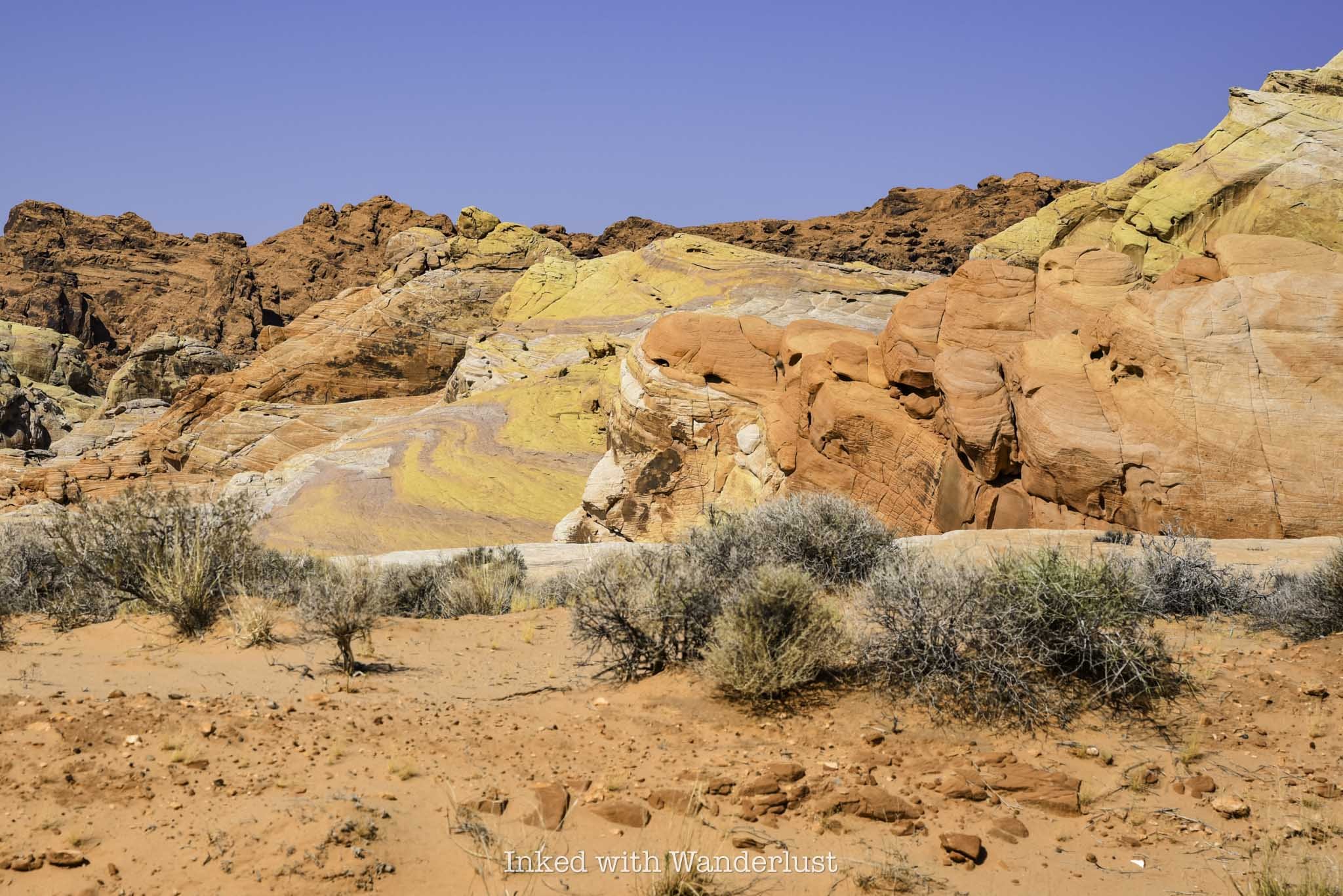
To complete your visit, turn right onto Mouse’s Tank road and drive it for 4.5-miles to its terminus at the White Domes parking lot. The trails in this area of the park are closed in the summer, mind you, but you can still drive the highly scenic road.
From the road, you’ll see teasing glimpses of Pastel Canyon, White Domes and Fire Wave. You cannot park alongside of the road on this stretch, but there are multiple parking lots dotted along the road where you can stop to take pictures.
From here, simply head back towards whichever exit you need to leave from. Remember, this itinerary is assuming you’re driving in through the west. If coming in through the east, simply begin at Elephant Rock and end at The Beehives, before making your way up Mouse’s Tank road.
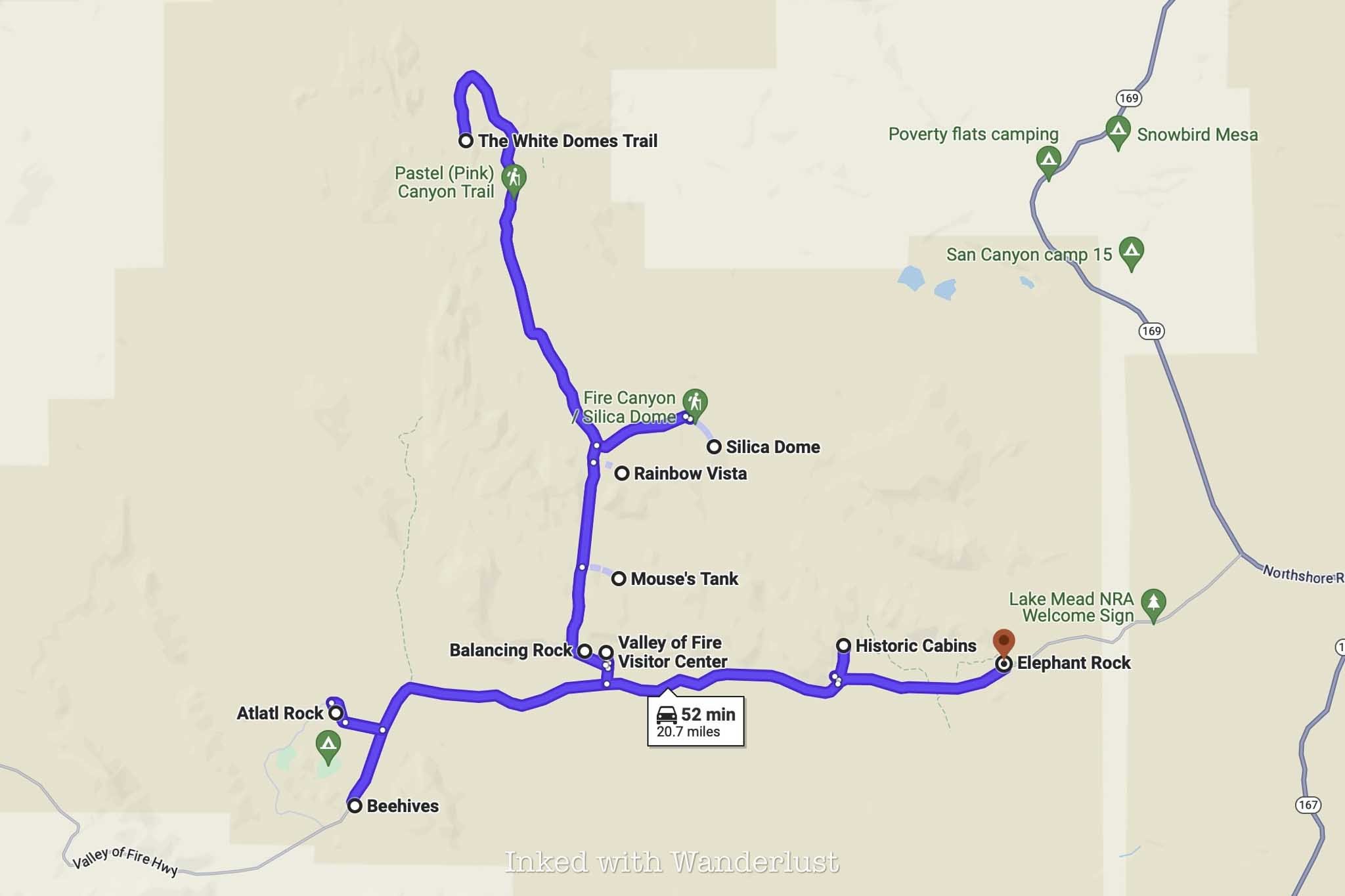
Conversely, if you’re driving in through the west entrance but exiting the east, simply knock out the sights along Mouse’s Tank road after visiting Natural Arch and then work your way east to the cabins and Elephant Rock.
The route above is the one I followed during my first visit. I was able to see and do everything listed above, while being out of the park by noon. Good thing, because it got up to 113 degrees that day (I went in August).
Your milage will vary depending upon how much time you spend at each site. In general, though, you shouldn’t have much of an issue. If you need to shave even more time, I recommend skipping Natural Arch, Balancing Rock and perhaps even the Visitor Center.

How to See Elephant Rock at Valley of Fire
Located on the east side of Valley of Fire State Park, just inside the entrance, sits a sandstone formation so unique…
Disclosure: This post contains affiliate links. If you make a purchase through these links, I may earn a small commission at no additional cost to you. I only recommend products or services that I believe will add value to my readers.
Located on the east side of Valley of Fire State Park, just inside the entrance, sits a sandstone formation so unique that it has become one of the most popular in the park - Elephant Rock.
From nearly any angle, you can make out the shape of the trunk, head and body of an elephant. When using your imagination, you’ll start to notice the outline of legs in the rock. It’ll make you question if you’re actually looking at a formation, or an actual mammoth encased in rock.
Elephant Rock is a must-see when visiting Valley of Fire for the first time. It’s easily accessible and something the whole family can participate in.
So how do you get to Elephant Rock? What is the trail like? What’s the parking situation? I answer all of these questions and more below. Let’s get into it.
Click/tap the ad to see offer details.
Trail Stats
Location: Valley of Fire State Park, Southern Nevada
Fee: $15 per vehicle day use fee ($10 for Nevada plates)
Permit: None
Open: All year
Cell Service: Spotty
Restroom: At the trailhead
Parking: Small, paved lot at the trailhead
EV Stations: None
Difficulty: Easy
Popularity: High
Mileage: 0.3 miles, RT
Time: 30 minutes to 1 hour
Elevation Gain: About 50 feet
Condition: Maintained
Features: Sandstone formation in the shape of an Elephanet
Best Viewed: Early morning for low crowds, late afternoon for best light
Pets: Not allowed
Drones: Not allowed
Hazards: Heat can be extreme and little-to-no shade
Our Visit(s): August 2023
Parking at Elephant Rock & Getting There
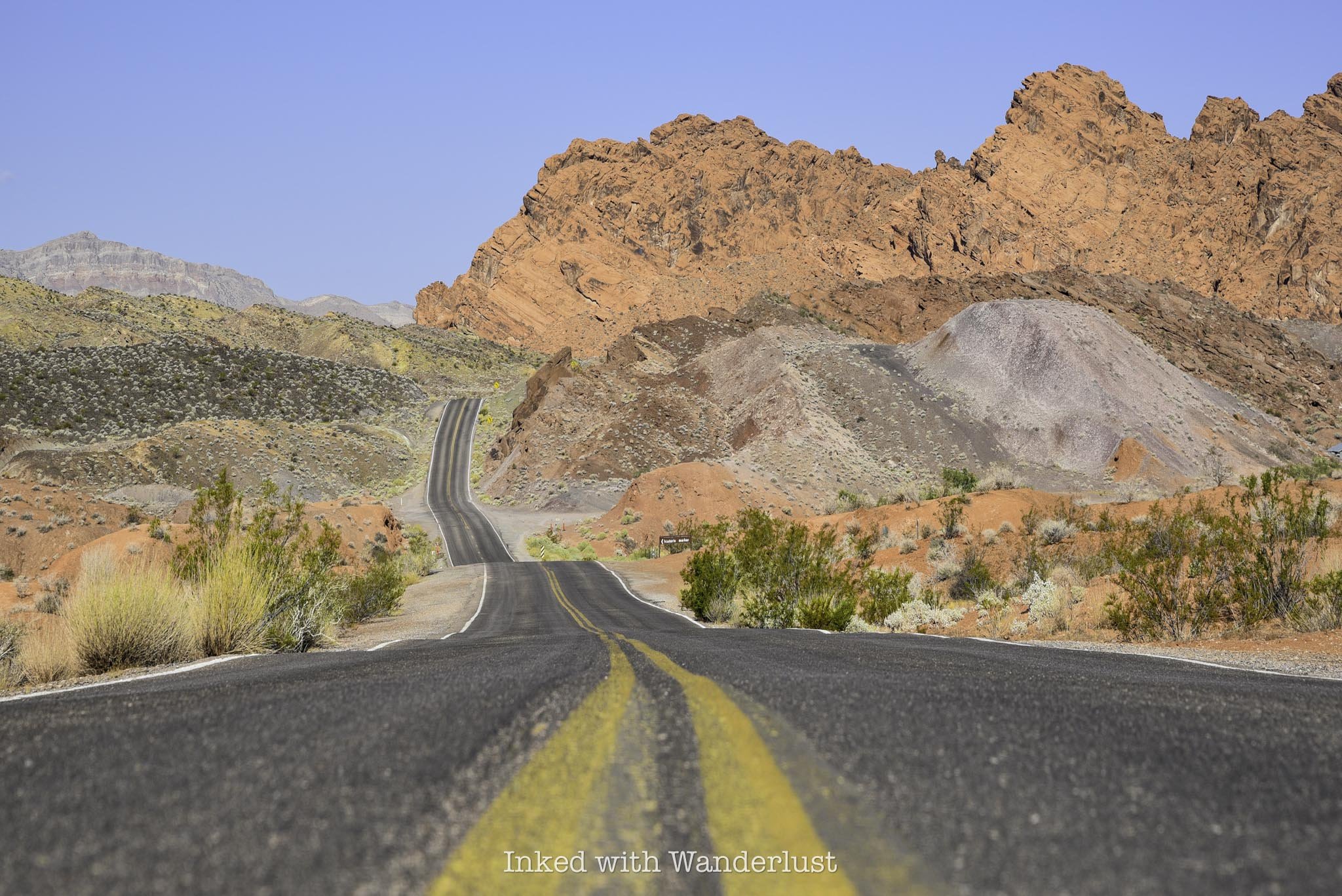
The ease of getting to Elephant Rock highly depends on which entrance you’re entering the park through. Elephant Rock is just past the east gate, on the right. So if you’re driving in on this side, you’re already there.
If you’re entering through the west gate, though, you’ll need to drive for eleven miles on the Valley of Fire Scenic Byway to the east gate, passing other attractions along the way, such as; The Beehives, Atlatl Rock and Mouse’s Tank Road.
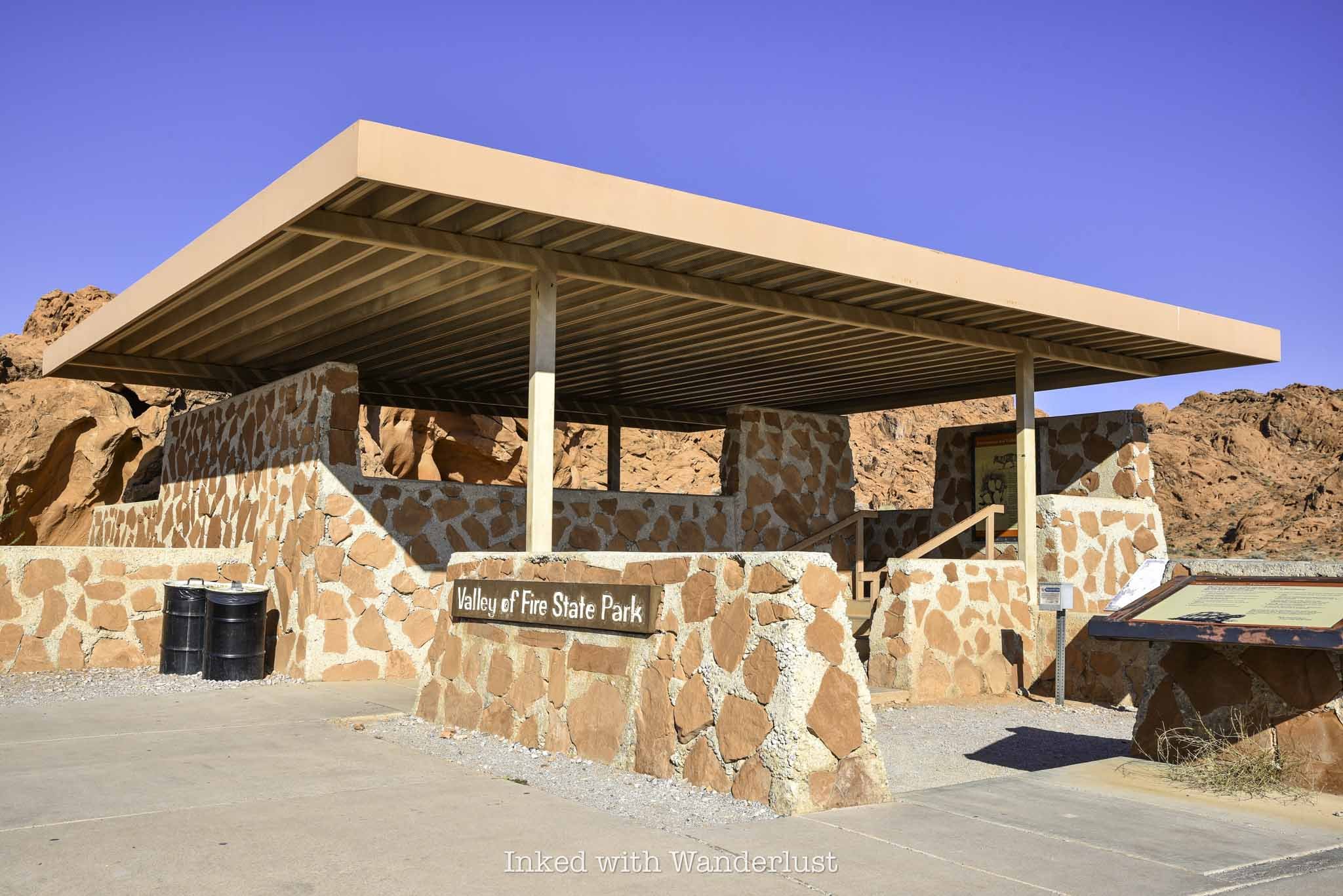
The parking lot for Elephant Rock is fairly small and paved, capable of holding a fair amount of vehicles. When the gate is unstaffed, this lot doubles as a place to park for visitors to pay their entry fees.
When I was here in August, my vehicle was the one of only two in the lot. Due to extreme heat, summer isn’t an ideal time to visit Valley of Fire, so visitation was low on this day.
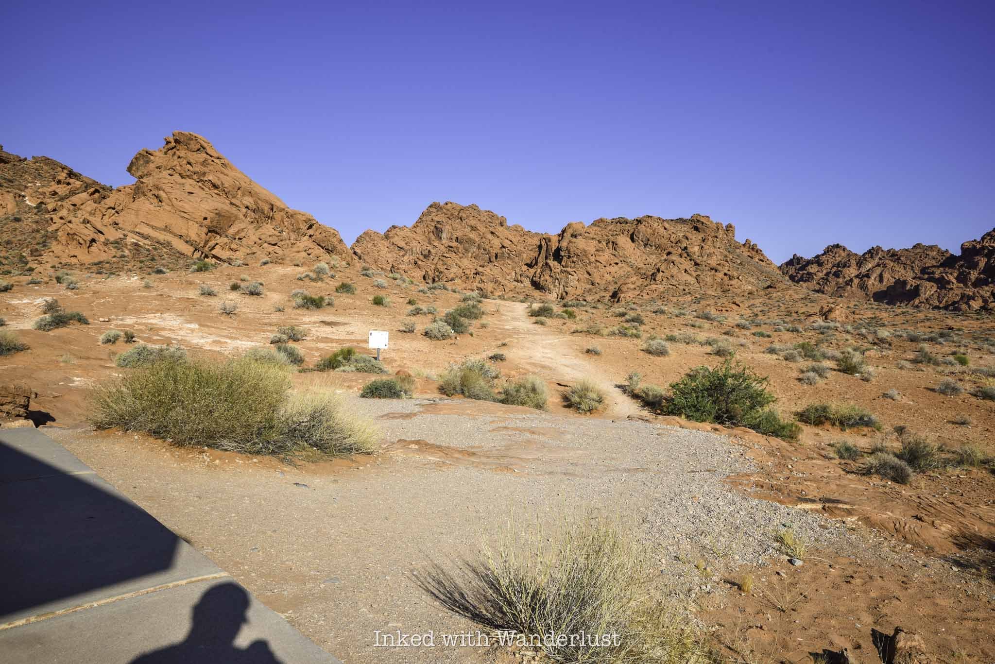
If you come during the peak season, which is October through April, that’ll likely be different. On a particularly busy day, I can see this lot filling up early and quickly. So arrive as early as possible.
To find the trailhead, simply walk between the brick structure and the Valley of Fire photo opp sign on the right. You’ll find the trail behind the structure leading towards the sandstone ridge in the distance.
The Trail to Elephant Rock
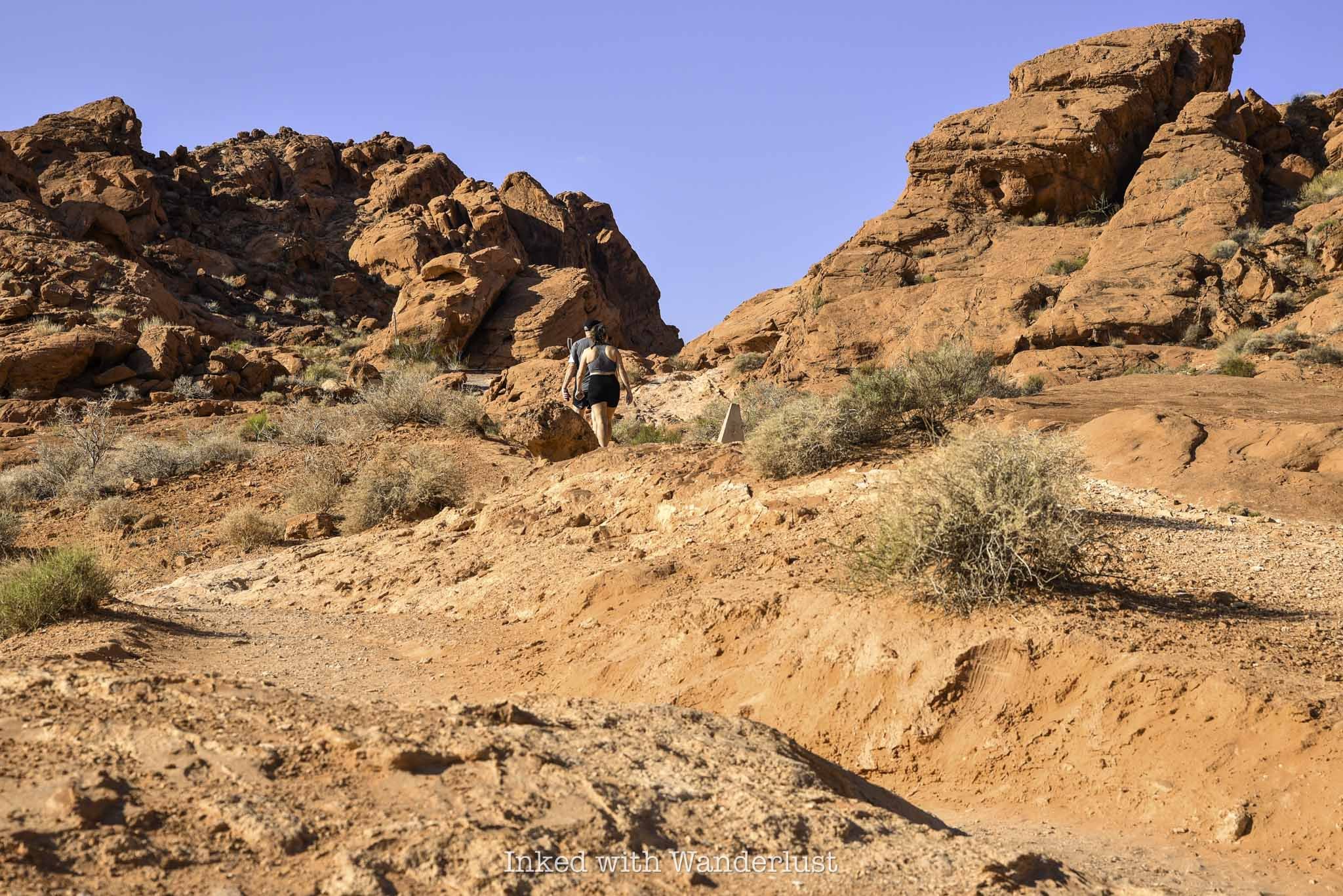
The trail is short and sweet with very little elevation gain. You’ll be walking uphill nearly the entire way but it’s nothing difficult. In fact, until you get close to Elephant Rock, it’s barely noticeable.
There’s only one trail junction. You will find it at around the halfway mark. Going right will place you on the 1.2-mile Arrowhead Trail. To keep to Elephant Rock, continue left.
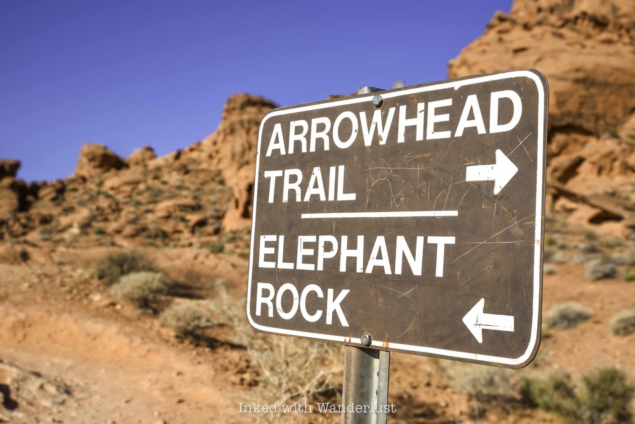
Shortly after the trail junction, you’ll notice the trail is leading you back towards the road. Once you are aligned with the road, you’ve reached the end of the trail. Elephant Rock will be to the right of the road, looking up.
Do keep in mind to stay off the road. Visibility of this area from the vehicle perspective isn’t very good, as they’ll be coming up a hill towards you.
Elephant Rock

Elephant Rock is easily viewed from below, with no real reason to force yourself to climb up to it. There are a number of paths leading the way if you choose to do so, though.
There is a sign stating there’s no climbing allowed. I asked a park ranger for clarification and she advised that it is ok to go up to Elephant Rock, but NOT to actually climb on it, as it could cause irreversible damage.
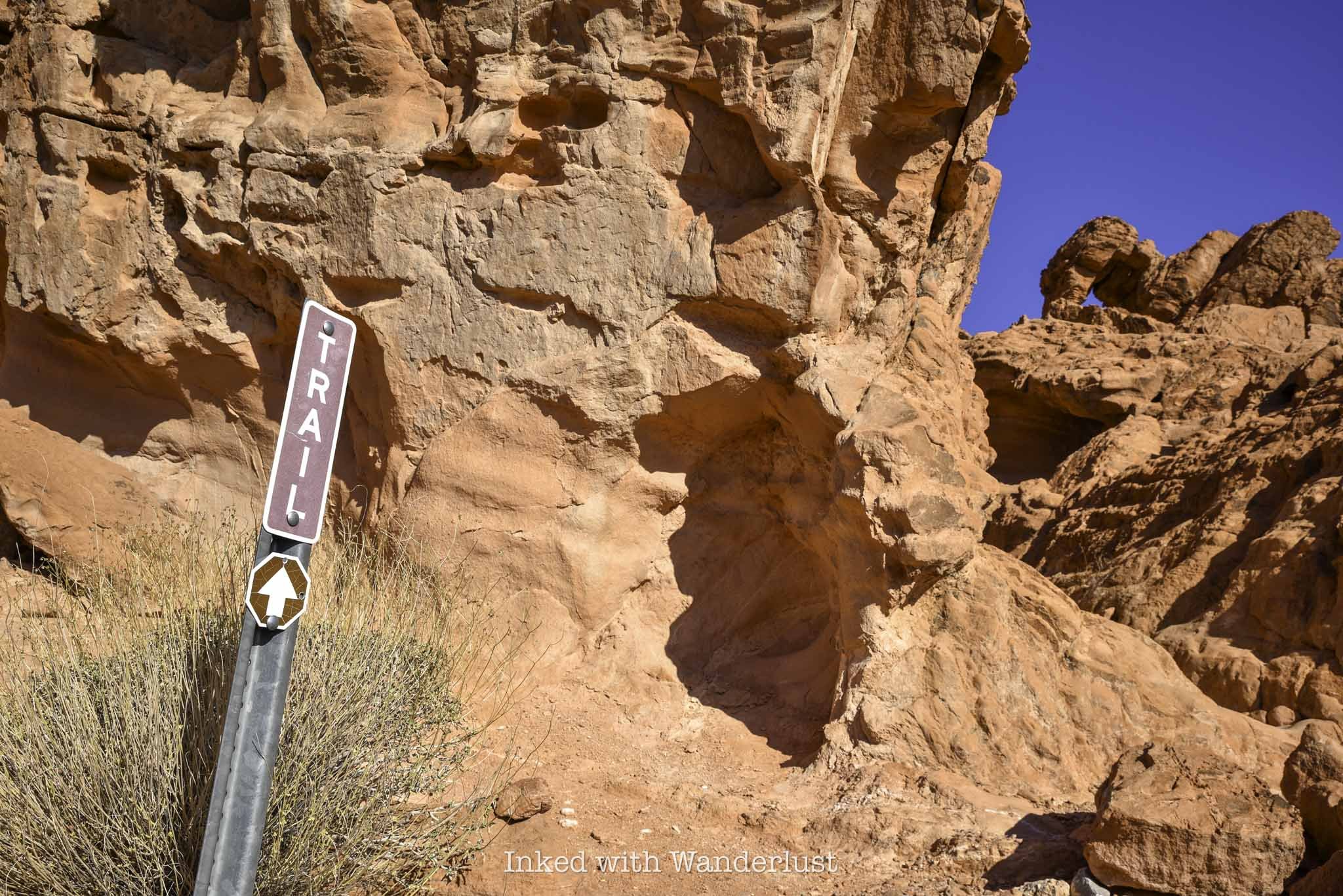
As stated above, there are several paths leading towards the formation, but the one I took (and appeared to be the easiest) was the one located just to the right of the sign pictured above.
It’s a quick jaunt to the top of Elephant Rock. Once you’re up there, you will have views of the mountains and valley in the distance.

Seeing Elephant Rock from this angle made the “Elephant” formation appear more clearly to me. So if you’re having a difficult time picturing it from below, try it from up here.
When you’re done, simply head back the same way you came in on the trail. Please do not walk along the road as park rangers will cite you if you’re caught.
From here, I recommend making your way to one of the most historic locations in the park, Atlatl Rock. You can read my post about it here.

How To See Atlatl Rock in Valley of Fire
Valley of Fire is one of the most popular parks in the entire Nevada state park system, and for good reason. This beautiful…
2 minute read | may contain affiliate links
Valley of Fire is one of the most popular parks in the Nevada state park system, and for good reason. This beautiful park is littered with fire-red sandstone rocks that, with the help of erosion, have formed mind-boggling shapes and formations.
There are many attractions within Valley of Fire, but the one that stands out from the pack due to its historical value is Atlatl Rock. It’s one of the first things you’ll see if you’re driving in from the west entrance and is easily seen from the main road.
Aside from its unique formation, the big draw to Atlatl Rock are the petroglyphs located on the smooth rock face at the top of the stairwell and others scattered around the base of the rock. These petroglyphs are believed to over 4,000 years old!
So how do you get to Atlatl Rock? What’s the parking situation like? Are there any fees involved? I cover all of this and more below.
Trail Stats
Location: Valley of Fire State Park in Southern Nevada
Fee: $15 per vehicle ($10 for Nevada residents). This is to enter Valley of Fire
Permit: None
Open: All year
For: Anyone
Cell Service: Spotty
Restroom: In the parking lot
Parking: Medium sized paved lot
EV Stations: None
Difficulty: Easy
Popularity: High
Mileage: Walk-up
Time: At least 30 minutes
Condition: Well maintained and easy to follow
Features: Petroglyphs and unique rock formations
Best Viewed: In the morning (less crowded)
Pets: Not allowed
Drones: Prohibited
Hazards: No shade on the stairwell or platform.
Our Visit(s): August 2023
What is an Atlatl?
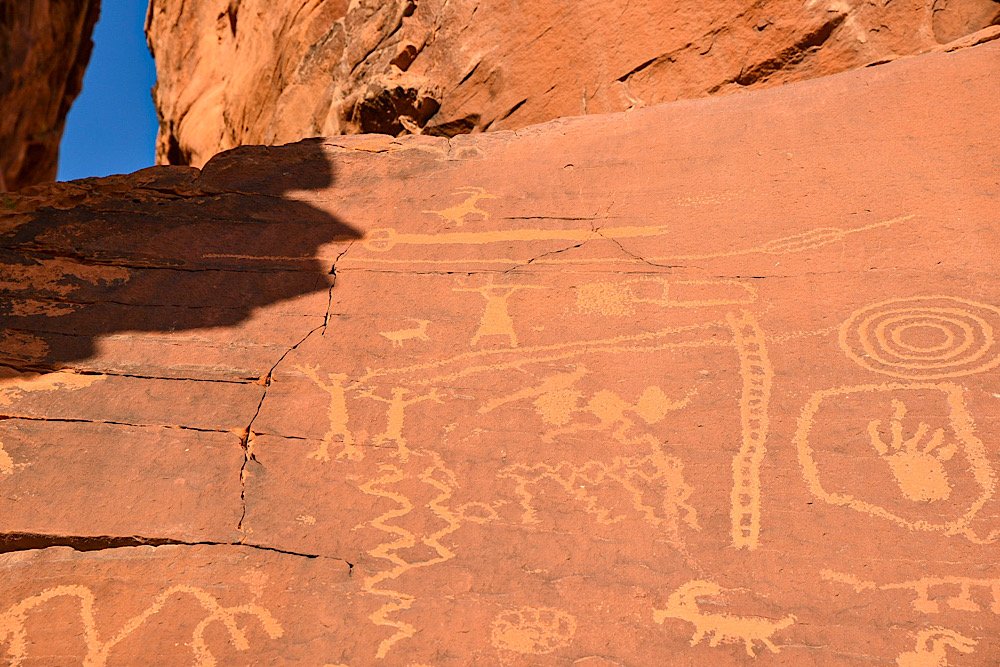
An atlatl, the namesake of this location, was an tool used by ancient tribes as a throwing stick or dart thrower. It allowed the user to employ more force to their spears or darts.
An atlatl was usually made of wood, about two feet long and had a handhold on one end with a hook on the other. A slot cut into the tail end of the dart was set against the nook enabling the dart to lie along the atlatl so that both could be grasped midway.
There was no signage explaining why this rock was named after this ancient tool, but one reason could be that there are multiple petroglyph illustrations of the tool on the rock.
Getting There & Parking
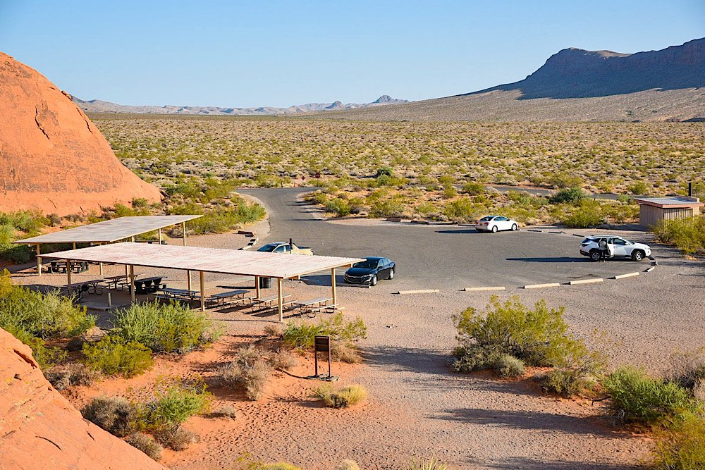
Getting to Atlatl Rock is easy, as it’s located just off the main road in the park. It’s closest to the west entrance of the park, but getting there from the east entrance is just as easy.
From the west entrance, drive for about 4 miles before turning left onto Campground road. You’ll keep straight for about a half mile before turning left into the parking lot. The directions are virtually the same coming from the east entrance. Though you’ll drive a few more miles.
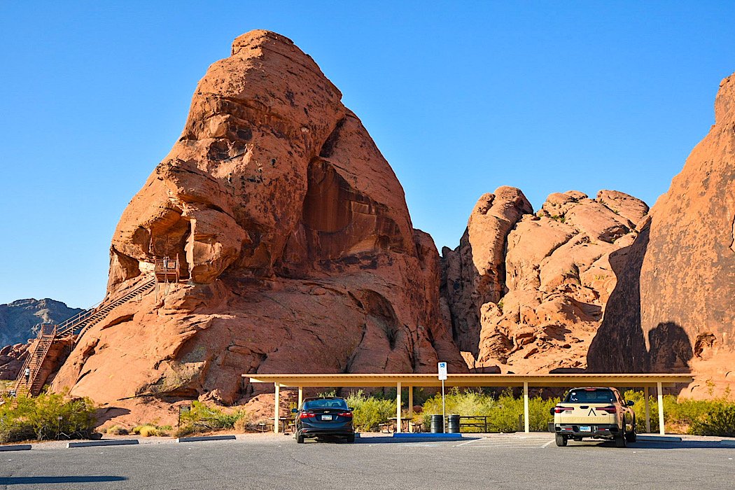
The parking lot is decently sized, but it will fill quickly as the day progresses. Your best bet is to arrive early in the morning. I was here about an hour after sunset and there were just a few others at the rock.
There are covered picnic tables near Atlatl Rock you can use, as well as a restroom at the far end of the lot. From what I could see, there was only one spot designated for disabled parking.
Atlatl Rock Petroglyphs
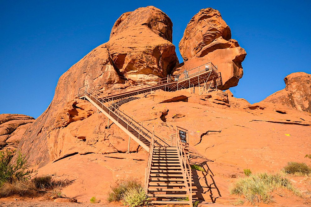
To reach the main petroglyphs on the smooth rock face at the top, you’ll need to go up the stairwell. There are three sets of stairs, totaling about 100 steps or so.
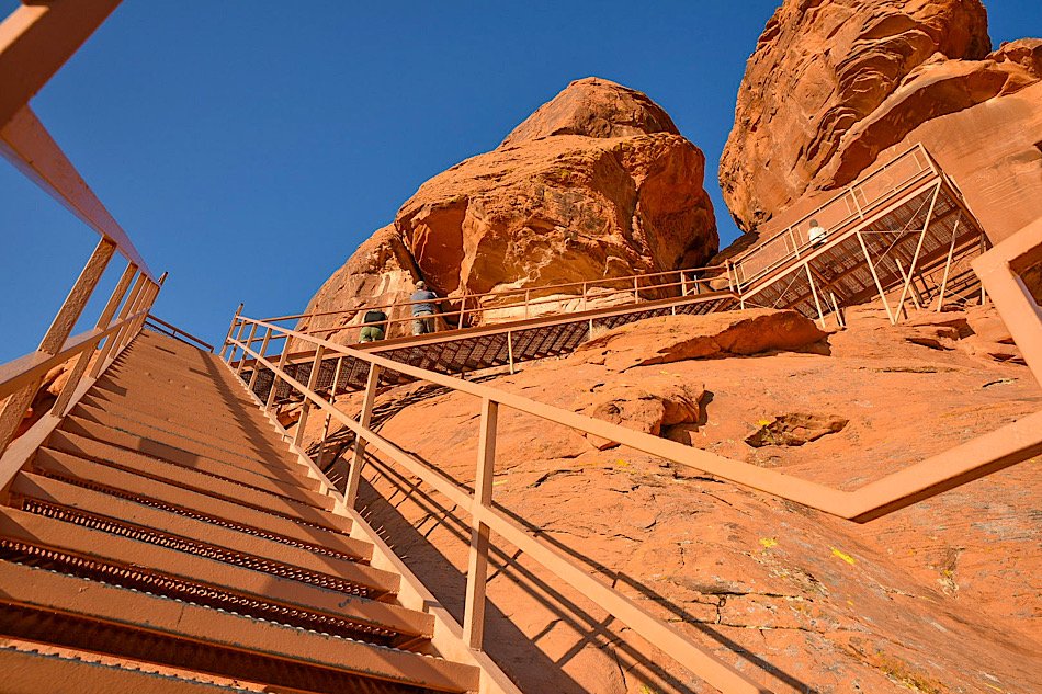
The downfall to being here early in the morning is you’ll be hit by the sun full-blast as it’s rising. There’s no real cover from the sun on the stairwell or on the viewing platform up top.
The upside is as the sun hits the rock, you get the full color show those fire-red sandstone rocks put on. It’s an amazing sight to behold.
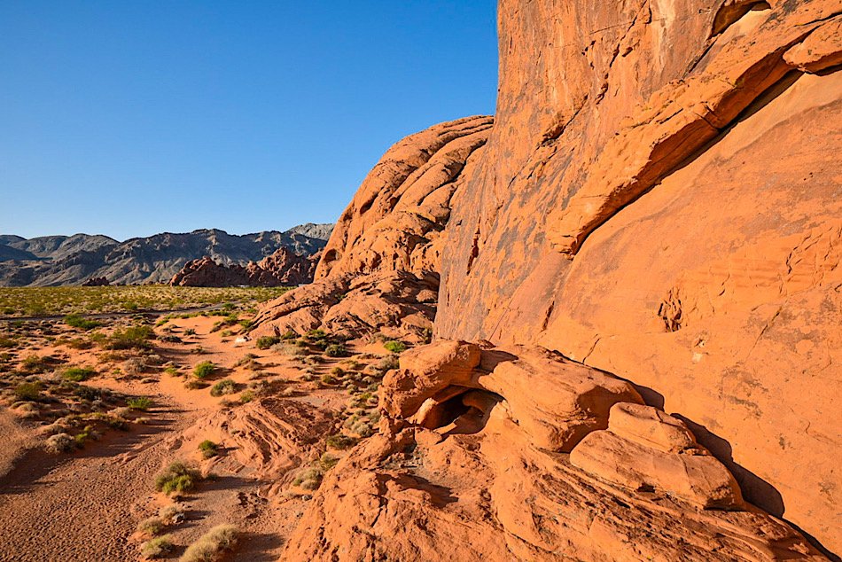
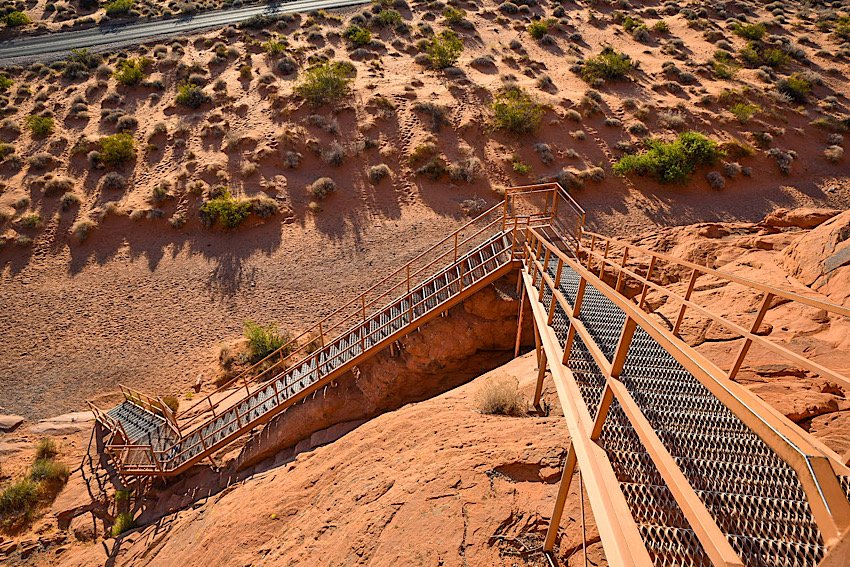
Before long, the petroglyphs come into view. From what I could see, the smooth rock face is the only location (at the top) where petroglyphs can be found.
Just above the smooth rock face on the bottom side of a rocky lip are dinosaur tracks. Unfortunately, the close up shot I got of them was lost, but you can see them in the photo below from further out.


As stated in the beginning of this post, these petroglyphs are over 4,000 years old. As such, there’s no way for us to know exactly what the ancient tribes were trying to convey, but you can see a mixture of illustrations of presumed animals, possible portraits of tribal members and other symbols.
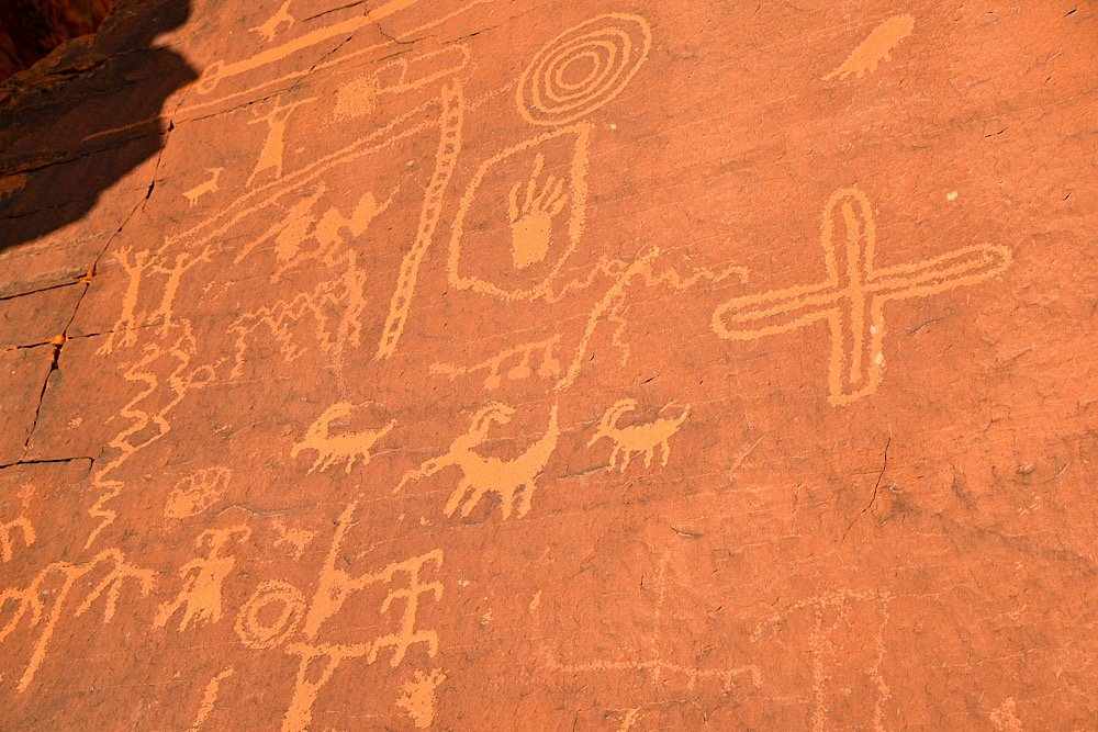
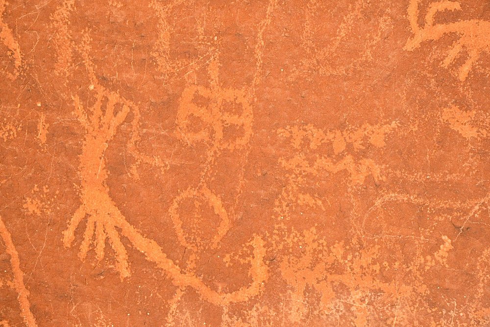
I stood and stared at these petroglyphs for a while, trying to come up with possible meanings or subjects behind them. There was one that looked like a goat. The squiggly lines, to me, indicate flowing water and another appeared to be the sun.
There was another near the top of the rock face that looked like a tribal member, possibly a warrior, holding what looks like an atlatl or some kind of weapon above their head in celebration.

Before leaving, be sure to explore the base of the rock to see more petroglyphs. Most people just go up the stairwell, come back down and leave. Don’t be one of those.
While it’s definitely one of the touristy areas of the park, these’s so much history on display in this single location that it would be a crime to skip it. Be sure to put Atlatl Rock on your ‘things to do’ list for your visit to Valley of Fire.
Please support this website by subscribing to the newsletter below.
Thank you for reading.