Hike To Monkey Rock For Incredible Views Of Lake Tahoe
Disclosure: This post contains affiliate links. If you make a purchase through these links, I may earn a small commission at no additional cost to you. I only recommend products or services that I believe will add value to my readers.
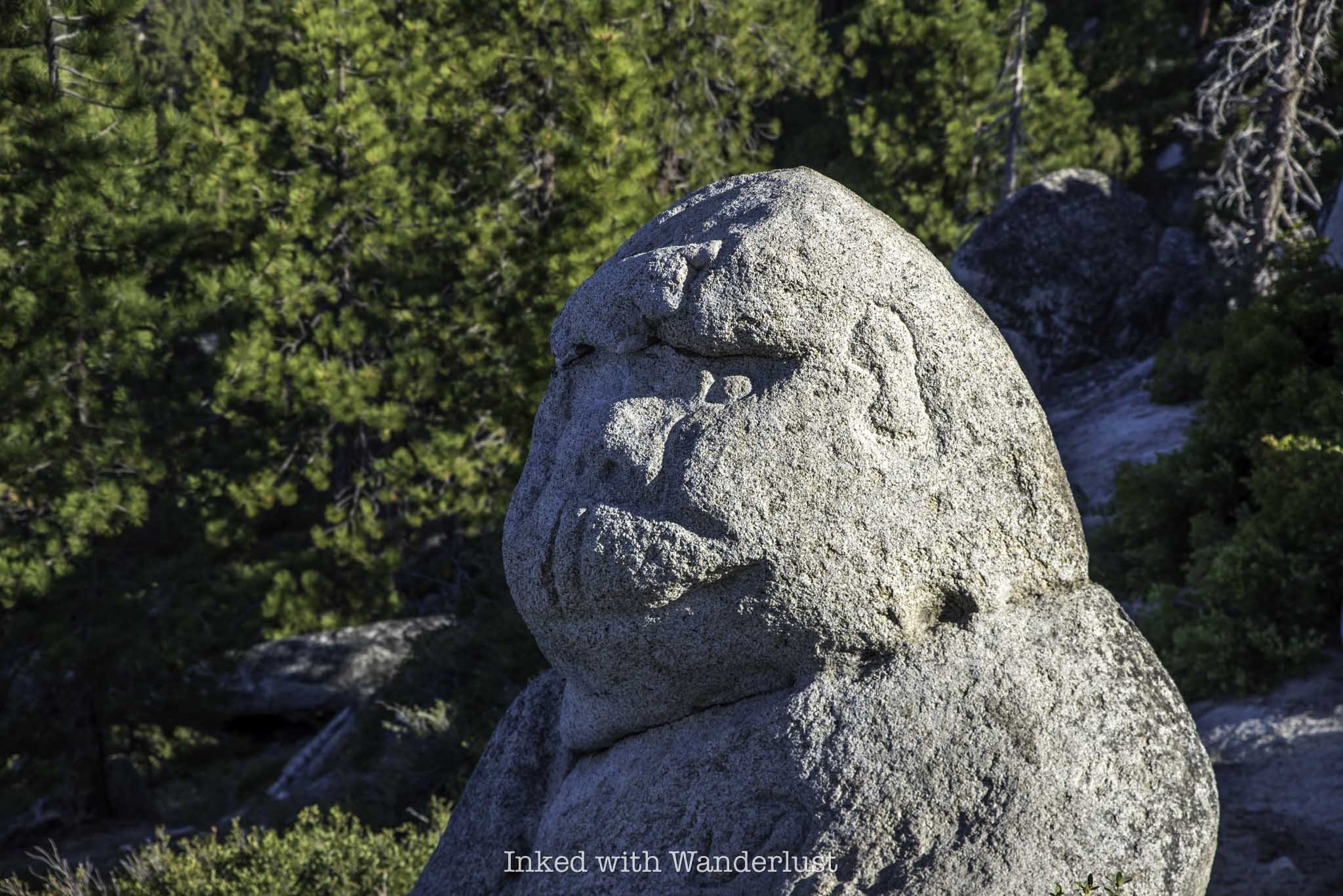
In an area with many landmarks, Monkey Rock stands as one of Lake Tahoe’s most iconic and sought after. Its popularity has exploded over the last few years due to its status on social media sites such as TikTok and Instagram.
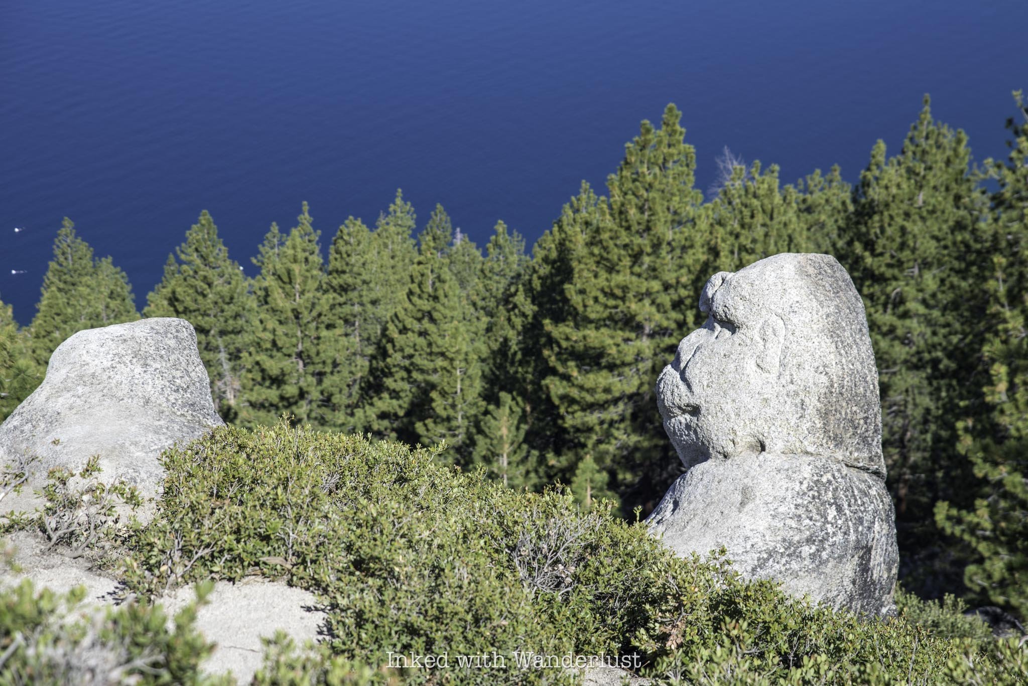
This short and sweet Lake Tahoe hiking trail takes hikers above Incline Village, the Nevada side of Lake Tahoe, to a rock formation that, when observed at the right angle, looks an awful lot like a monkey sitting on the hillside taking in the views.
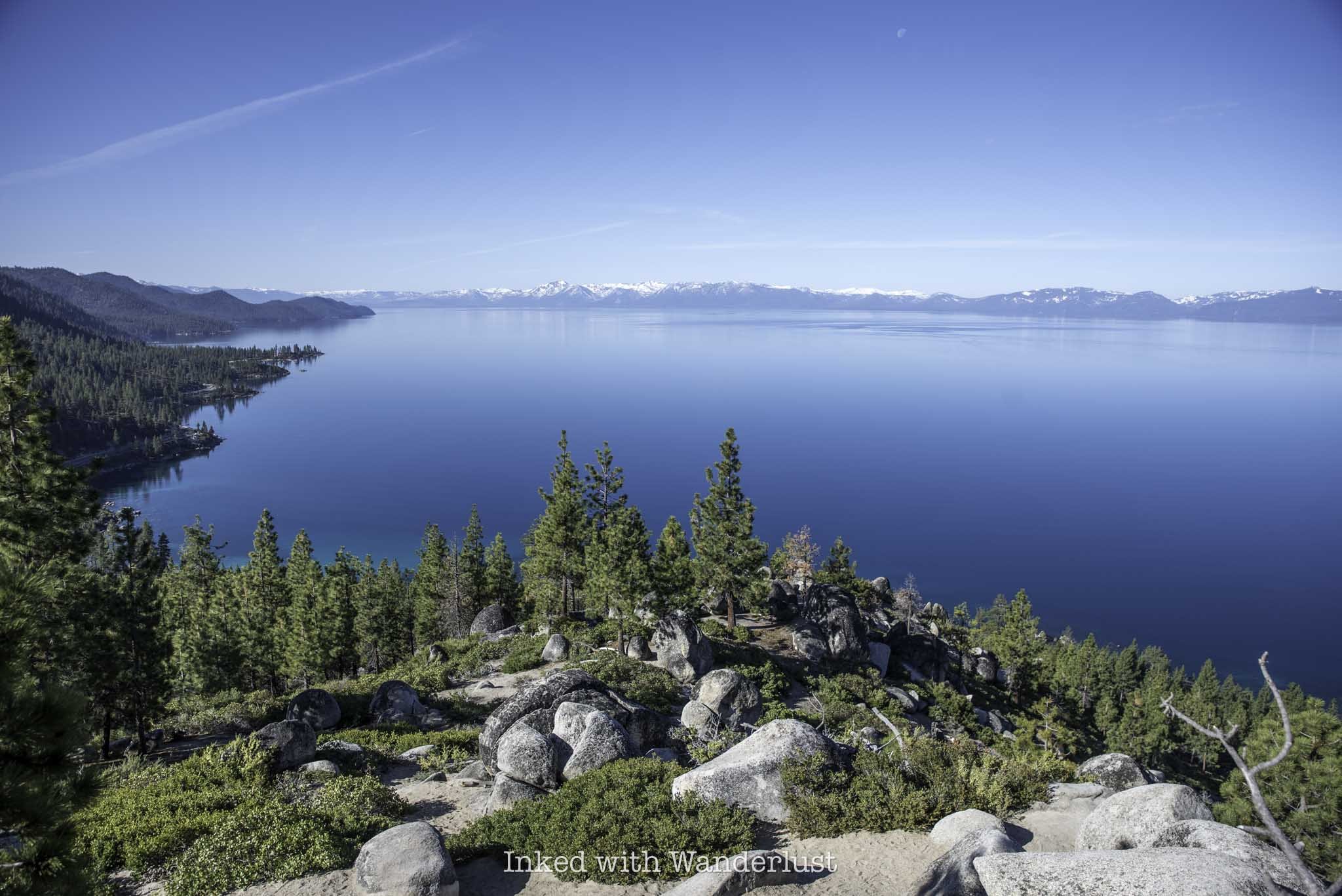
Many, however, would argue that Monkey Rock is only a bonus to this hike, as the real payoff is in the views of the lake you’ll get once you reach it. As much as I love odd and interesting rock formations, I’d be hard-pressed to disagree with that statement.
If you’re looking for a family-friendly hiking trail in Lake Tahoe, or you’re traveling to the lake and want to see as many of the highlights as possible, Monkey Rock is one trail you definitely do not want to pass up. There’s a few things you’ll need to know, though. Let’s get into it.
Trail Stats
Location: Incline Village, NV (Lake Tahoe)
Fee: Parking fees apply
Permit: None
Open: All year, but difficult to access in winter
For: Hikers
Cell Service: Good throughout most of the trail
Restroom: In the parking lot
Parking: Two large lots near Tunnel Creek Cafe
EV Stations: None
Difficulty: Moderate
Popularity: High
Mileage: 2.6 miles, out and back
Time: Two hours or less
Elevation Gain: 479 feet
Condition: Well maintained and easy to follow
Features: Rock formation in the shape of a monkey/epic views of the lake
Pets: Allowed on leash
Drones: No signage stating you can’t
Hazards: None, other than usual wilderness hazards
My Visit(s): May 2024
Monkey Rock Lake Tahoe Parking
The trailhead for Monkey Rock can be found in Incline Village, which is in the Nevada side of Lake Tahoe. Parking for Monkey Rock is located at the Tunnel Creek and Deer Creek parking lots, which are both adjacent to the Tunnel Creek Cafe. They’re located just a few miles from the Sand Harbor turn off.
These parking lots are the only available parking for Monkey Rock and the adjoining Tahoe East Shore Trail. There is no legal parking at the trailhead proper. There’s a private residence up there and they make their disdain for those trying to illegally park perfectly clear.
You can refer to the above photo for current parking fees. They’re based on several elements, such as time of year, time of day, day of week, etc. For reference, I arrived on a Tuesday at 7:30am and paid for three hours. My total was $6.00. You’ll need to know your license plate number and it only accepts plastic for payment.
Due to this area’s popularity, you’ll want to arrive as early as possible. When I got there at 7:30am it was just me and a couple other vehicles. By the time I finished with the hike (about (9:30am) both lots were nearly full.
To make your way to the actual trailhead to Monkey Rock, make sure you’re walking in the direction away from Tunnel Creek Cafe if you parked in the Tunnel Creek lot. There’s a road that runs adjacent and above the cafe (Tunnel Creek road). Take this road up to the trailhead.
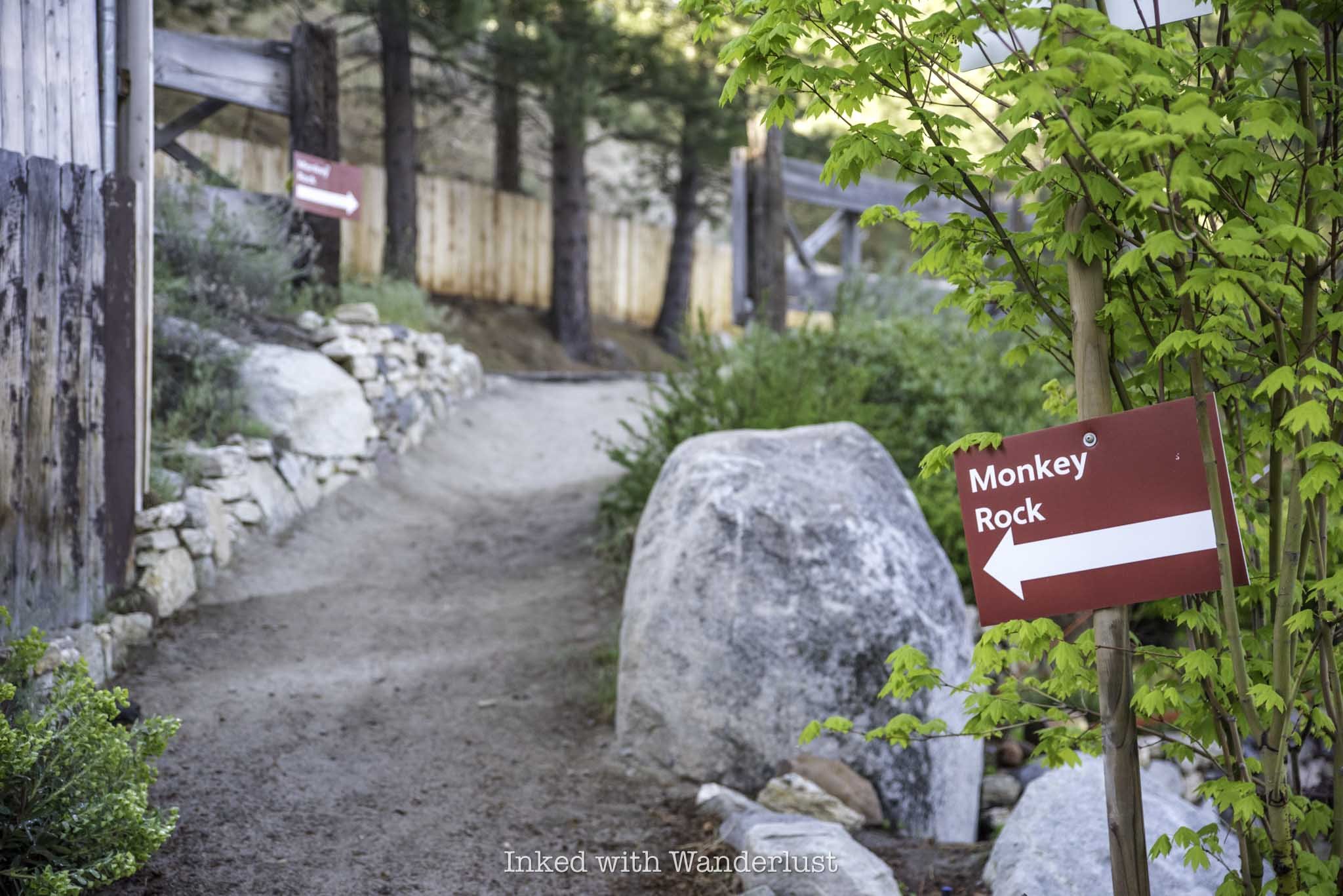
If you get turned around, there are many red signs in the area to point you in the correct direction. Just remember, if the road is going above Tunnel Creek Cafe, then you’re going in the correct direction. You’ll also pass a blue sign warning you of wildlife being present in the area.
When you get to the top of the road, you’ll see a private residence on your right and trail signage on your left. Up ahead will be the official trailhead for Monkey Rock. During my visit, there was construction happening shortly into the trail on the right.
The Monkey Rock (Tunnel Creek) Trail
Once you’re past Tunnel Creek road, the trail becomes sandy and remains that way throughout the entirety of the hike. If you’ve done any hiking in Tahoe, you would know how infamously rocky many of its hiking trails are. I’m happy to report that the Monkey Rock trail is probably the least rocky trail in Tahoe I have been on.
Initially, the trail is mostly flat with only a slight, barely noticeable incline. If you have started early, you’ll enjoy a lot of shade on this stretch of the trail from all the tall trees. Down below you, you’ll notice you are hiking parallel with and above the Tahoe East Shore Trail, which I define as more of an urban hike in a forrest setting.
About a third of a mile into the hike you will come to a green gate with a spur trail heading off to the right. Keep straight past the gate. The spur trail eventually connects you to the Tahoe East Shore Trail, which would be an excellent extension to your hike on the way out. This is also where you’ll start getting those epic Lake Tahoe views.
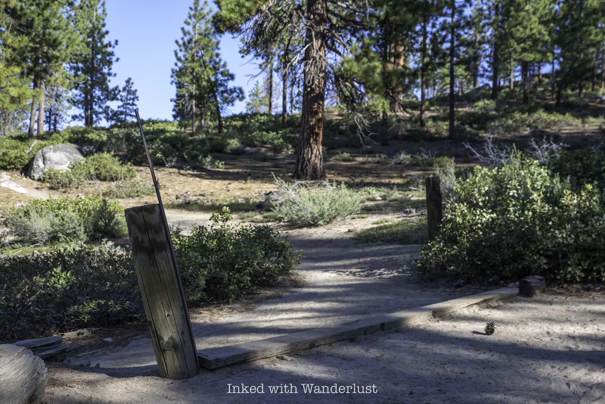
You’ll see other spur trails on both sides of the trail. Just continue straight on the wide sandy path. Shortly after the green gate you’ll come to two wooden pillars on each side of the trail with, you guessed it, another spur heading off to Hidden Beach.
After these wooden pillars is when the trail begins to climb and it will remain that way until just before you reach Monkey Rock. The incline is a slog, but it isn’t difficult. If needed, there are plenty of rocks to sit on and compose yourself. From here, you’re only a quarter mile or so away.
One thing to note is the side trail that spurs off to the left from the main trail (pictured above). You won’t be able to miss it. Shortly after those wooden pillars and across from a community water bowl for dogs is where it’s located.
This trail will take you to Monkey Rock, but it is much steeper than what lies ahead of you. Additionally, based on other reports I’ve read, it isn’t much shorter than the actual trail and thus, not worth the extra effort.
At right about the 1.3-mile mark of the hike, you’ll come across two more wooden pillars with a wooden board running across the ground between them on your left (pictured above). There’s an easily missed sign with an arrow on it. Take this trail to the left to continue to Monkey Rock.
Shortly after turning onto this section of trail and heading up a short and sweet incline, you’ll see a boulder pile in front of you (pictured above). To get to Monkey Rock, stay to the right of the boulder pile. Eventually, Monkey Rock will come into view just off the sandy path.
If you’re like me and you’re fascinated with interesting rock formations, Monkey Rock will surely leave you in awe, as it does resemble a monkey relatively closely. Do know, though, that while the rock has always looked like a monkey, it did receive a little help in attaining its current form.
Monkey Rock is easily viewed and photographed from the path. If you feel inclined, there’s another path that’ll take you down to it. Though if you have any kind of zoom on your camera, it’ll likely be unnecessary to do so.
On the other side of the boulder pile, there’s an excellent view of the lake awaiting you. From there, you can faintly see Sand Harbor State Park, sections of the Tahoe East Shore Trail, and parts of the east and north side of the lake.
When you’re done taking in the views and getting your photos of Monkey Rock, simply head back the same way you came in. Since it’s all downhill from here, you should be able to get back to your vehicle in about twenty minutes or so.
Keep in mind the spur trails you saw coming in that led to the Tahoe East Shore Trail. If you have time on your parking slip, it would be an excellent extension of your hike. Or simply head to Hidden Beach and cool off with a dip in the lake. You can read about the TEST here and Hidden Beach here.
Common Questions About Monkey Rock
Where does the Monkey Rock trail start?
Unofficially, it begins on Tunnel Creek road, just behind Tunnel Creek Cafe on the east side of Lake Tahoe. Officially, the actual trail begins at the end of Tunnel Creek road.
Is Monkey Rock a hard hike?
That’s totally subjective, but I wouldn’t classify it as hard. Distance wise, it’s on the easy side, but the final push near the end could make it difficult to some. Overall, I’d rate it as easy for some and moderate for most.
Is Monkey Rock natural?
Yes and no. Yes in the sense that it’s an actual granite rock that highly resembles a monkey, but no in the sense that it did receive some help to give it more definition.
How long is the hike to Monkey Rock?
Based on the GPS on my apple watch, it’s 2.6-miles, all in.
How can I see Monkey Rock?
The only way to see Monkey Rock is by either hiking or biking up to it. It is not visible from the road.
What elevation is Monkey Rock?
Monkey Rock is roughly 500 feet above the Tunnel Creek parking lot.
Planning a trip to Lake Tahoe? To get information on camping and recreational activities, read my 2024 Emerald Bay State Park guide. Also, to read more about the Tahoe East Shore Trail, go here. If you’re into kayaking, read my Kayaking to Fannette Island post. Lastly, chase waterfalls in my 5 Best Lake Tahoe Waterfalls post.
PROVERBS 3:23
