
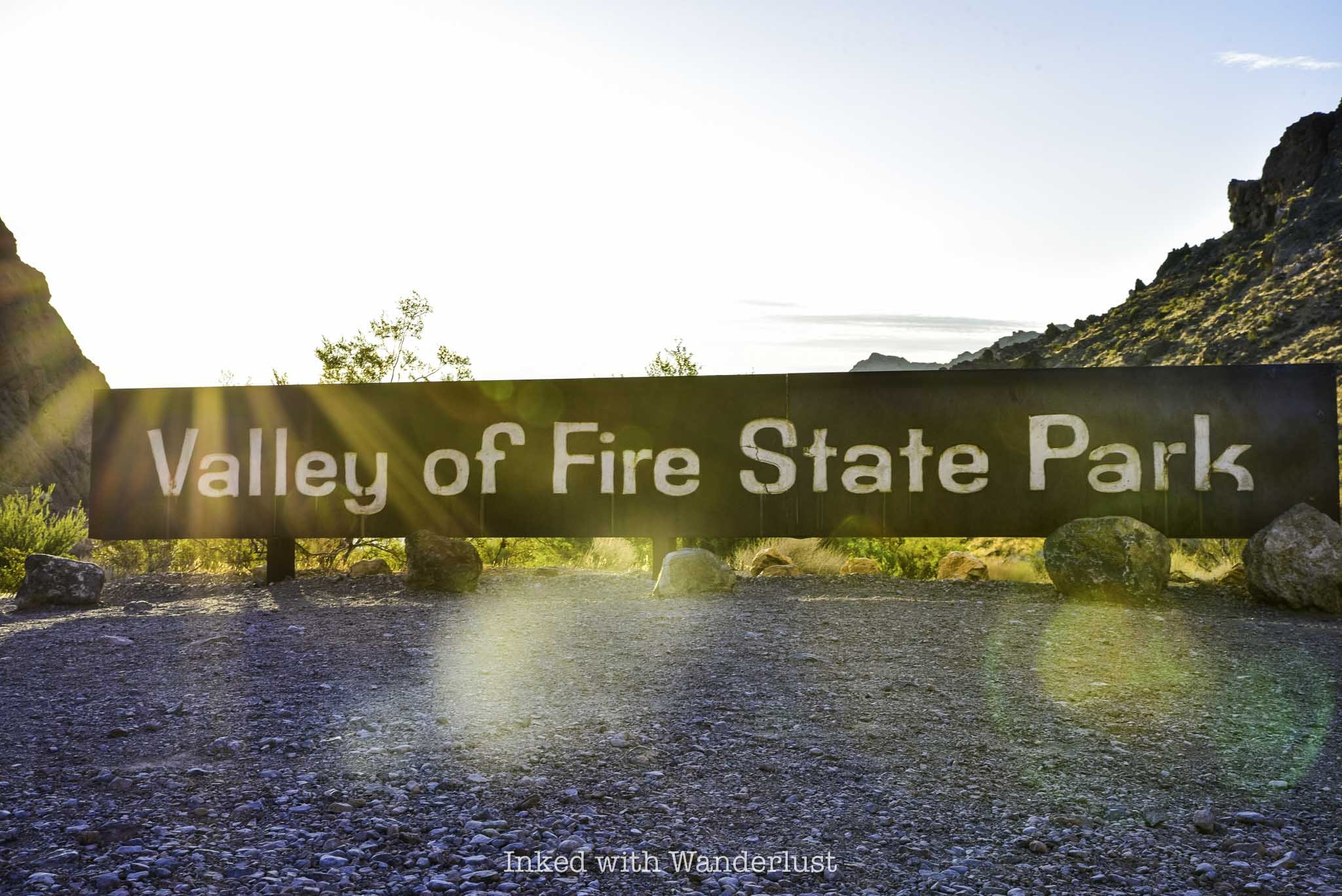
Hike the Fire Wave Trail at Valley of Fire State Park
Located in the northern section of Valley of Fire State Park along White Domes Road lies one of the park’s most fascinating and photographed formations - Fire Wave…
Disclosure: This post contains affiliate links. If you make a purchase through these links, I may earn a small commission at no additional cost to you. I only recommend products or services that I believe will add value to my readers.
Located in the northern section of Valley of Fire State Park along White Domes Road lies one of the park’s most fascinating and photographed formations - Fire Wave. Best of all, it doesn’t require a whole lot of effort to see!
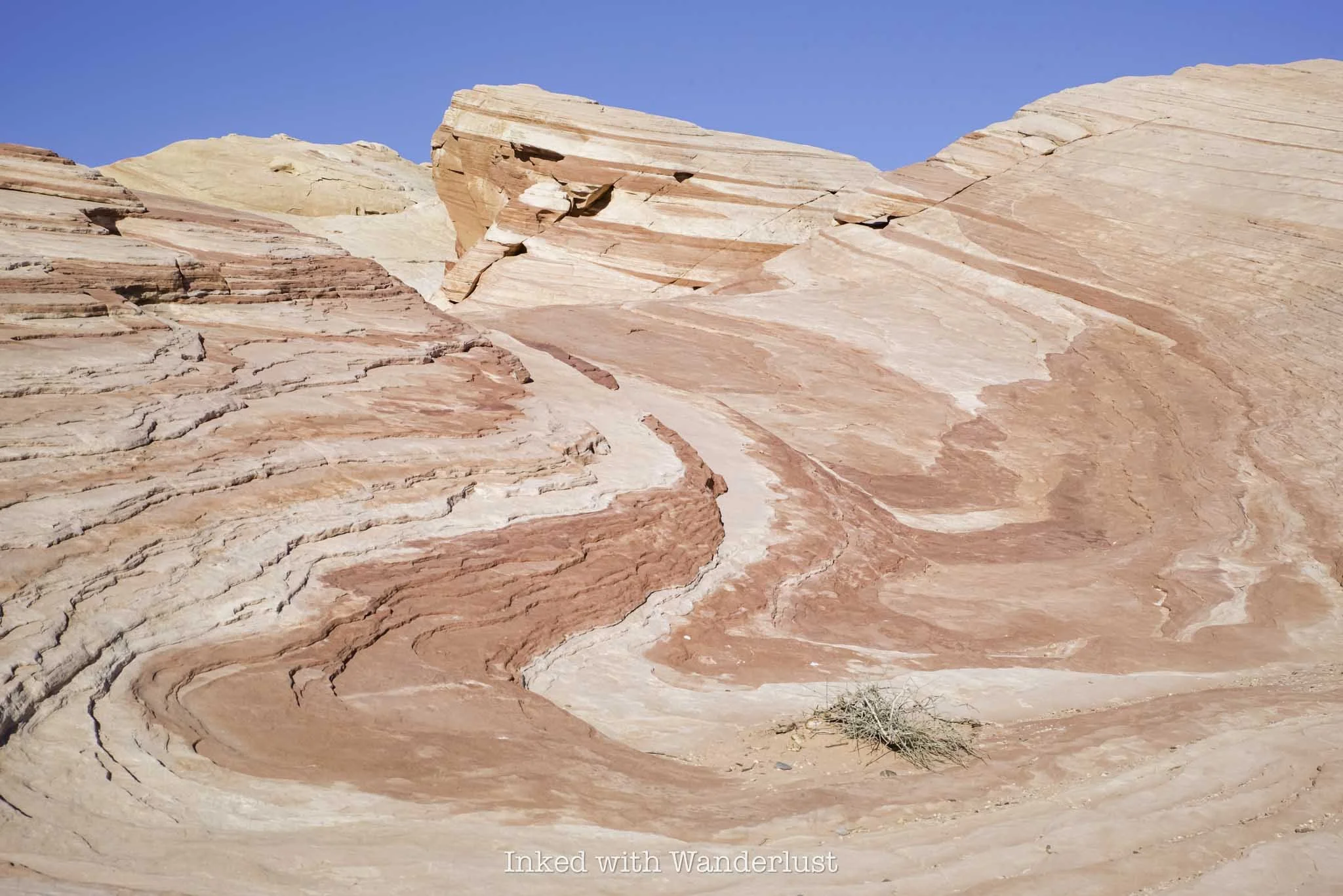
Known for its ultra-colorful swirls of red, white, and orange Aztec sandstone out-crops, Fire Wave offers park goers a picturesque, wavy formation resembling a fiery sunset. Due to this, it’s become one of the most popular attractions in the park.
If you’re heading out to Valley of Fire, Fire Wave should most definitely be on your list. There are a few things you’ll need to know before going, however. In this post, I’ll cover topics such as trail closures, parking, what to expect and more. Let’s get into it!
Trail Stats
Location: Valley of Fire State Park (north section)
Fee: None for the trail, but standard park entry fees apply
Open: Between October and mid-May
Family Friendly: Yes
Cell Service: Spotty (based on Verizon service)
Restroom: None (nearest is at White Domes Day Use Area to the north or Rainbow Vista to the south)
Parking: Two lots at the trailhead
EV Stations: None
Difficulty: Easy to moderate (depending on temperature)
Popularity: High
Mileage: 1.3 miles, out and back
Time: 30 minutes to one hour
Condition: Maintained and easy to follow
Features: Colorful sandstone formations
Best Viewed: Either sunrise or sunset
Pets: Not allowed
Drones: Not allowed
Hazards: Heat exposure, potential wildlife encounters, and rolled ankles
My Visit(s): November 2024
Is Fire Wave Trail Open?
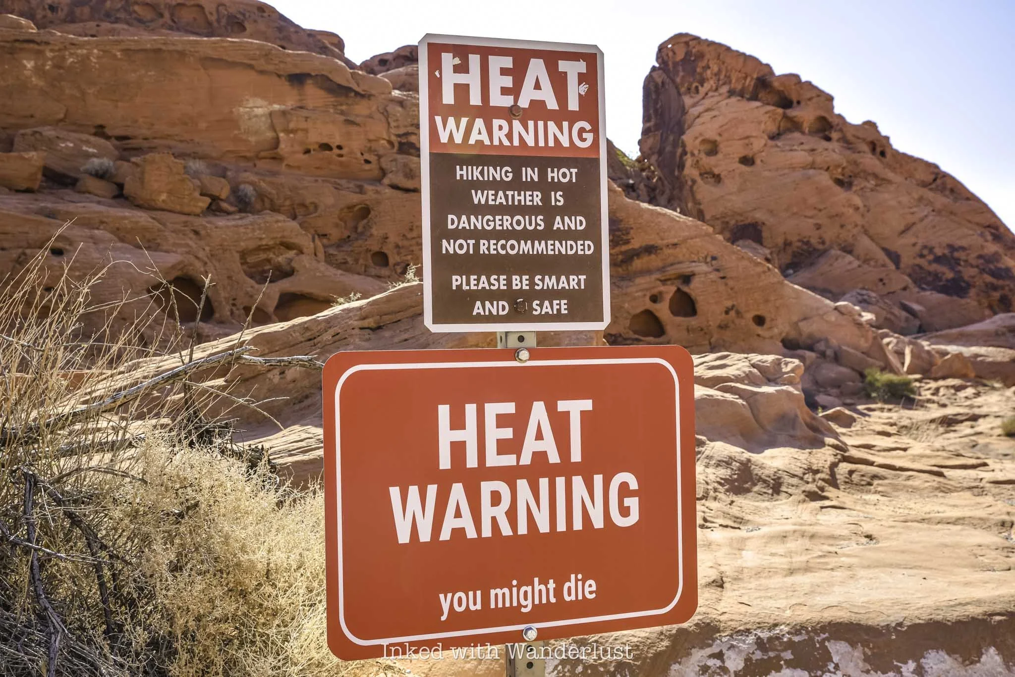
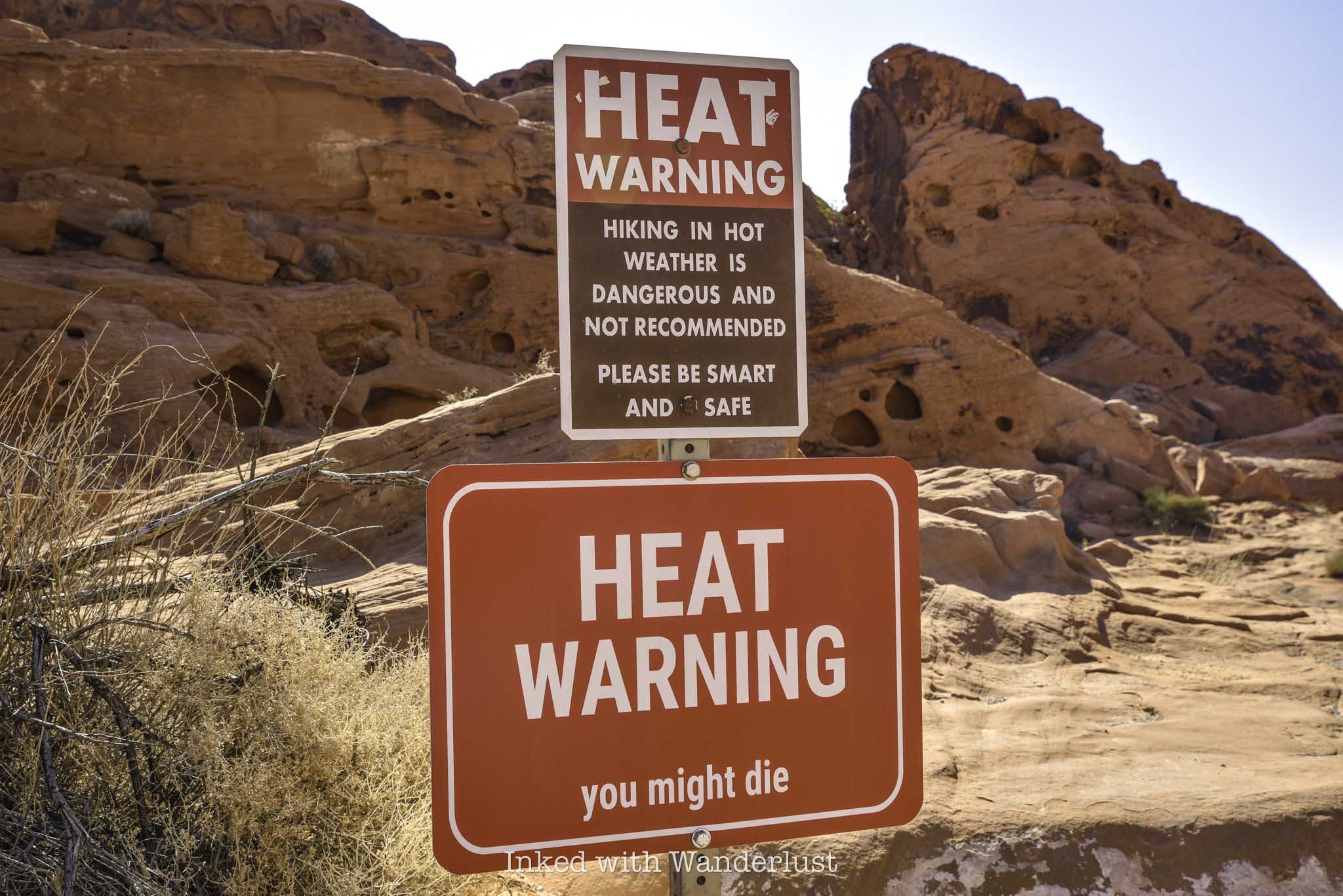
The temperature at Valley of Fire State Park often exceeds tripe digits, necessitating the need to close select trails during parts of the year. This is done to protect visitors from heat-related illness and/or death, as the affected trails are exposed and pose significant danger to hikers. Fire Wave is one of them.
Even though it’s one of the shorter hiking trails in Valley of Fire, it’s mostly all rock and radiates heat like you wouldn’t believe. Thus, Fire Wave is on the annual list of closures, which take place between mid-May and the beginning of October.
If your visit coincides within that timeframe, you won’t be able to see Fire Wave, unfortunately. There is still plenty more to see and do, though. You can read my posts about how to spend a few hours at the park during summer and my pick of ten Valley of Fire short hikes, many of which are open year-round.
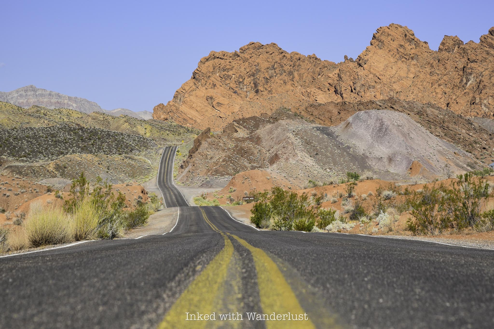
Fire Wave Parking and Getting There
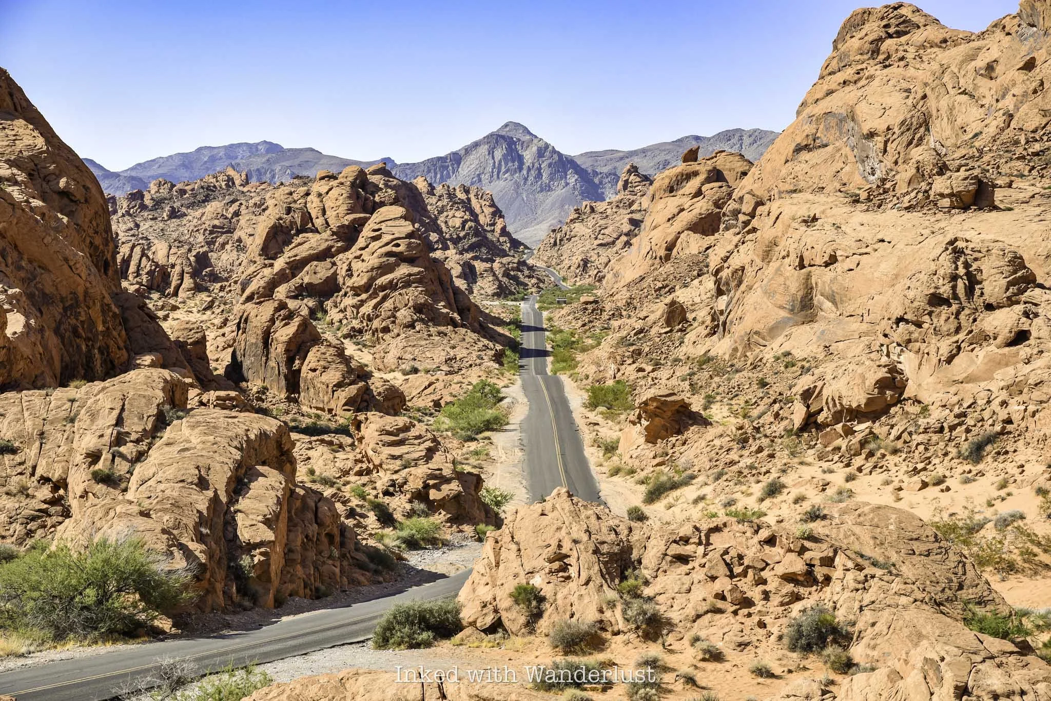
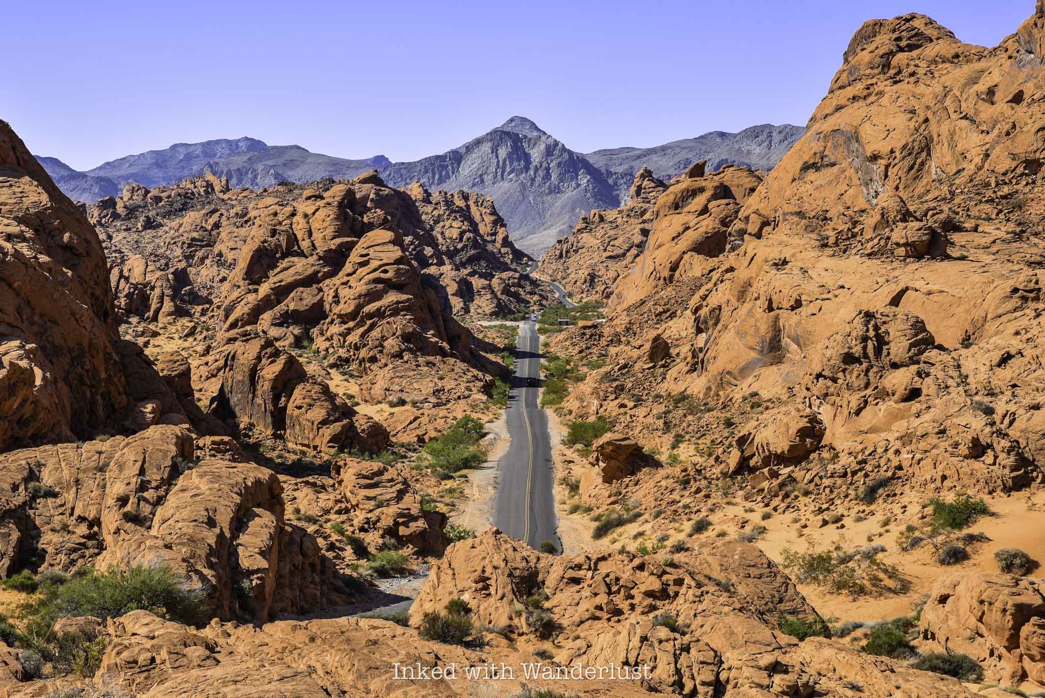
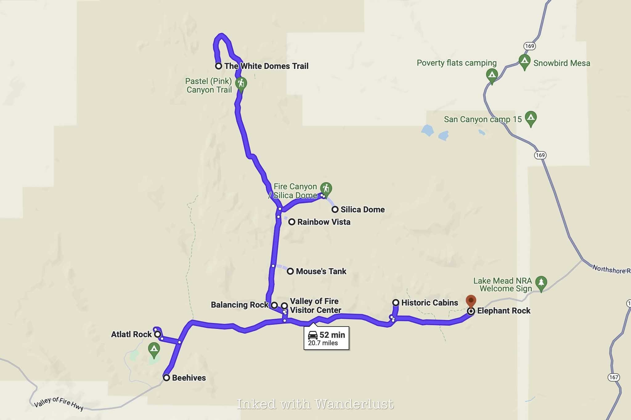
Getting to Fire Wave trailhead (and around the park in general) is easy. There are only two entrances (west and east) and two main roads in the park. Valley of Fire Scenic Byway, the park’s main artery, runs between the two entrances.
To the north is Mouse Tank Road, which itself becomes White Domes Road just beyond Rainbow Vista Trailhead. This road dead ends at White Domes Day Use Area, which is also the trailhead for White Domes Loop, another hugely popular trail.

No matter which entrance you use, simply keep driving until you reach the turnoff for Mouse Tank Road and continue straight. A couple miles after it becomes White Domes Road, you’ll arrive to the parking lot on the left side of the road.
There are two gravel lots where you can park for Fire Wave, one on either side of the road. They’re both gravel and dirt, and are large enough to accommodate many vehicles. Sunrise and (especially) sunset are times when parking can be most competitive, as those are Fire Wave’s most popular times.
Even though the lots are large, it’s best to arrive early, especially during the trail’s peak visitation timeframe of October through mid-May. As the day progresses and the park gets busier, Fire Wave and nearby White Domes are usually the first lots to fill.
Fire Wave Trail
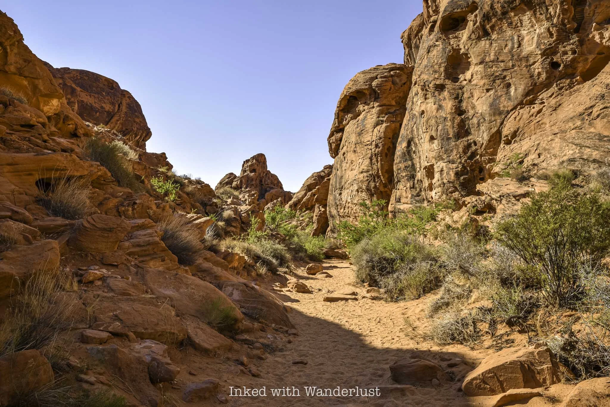
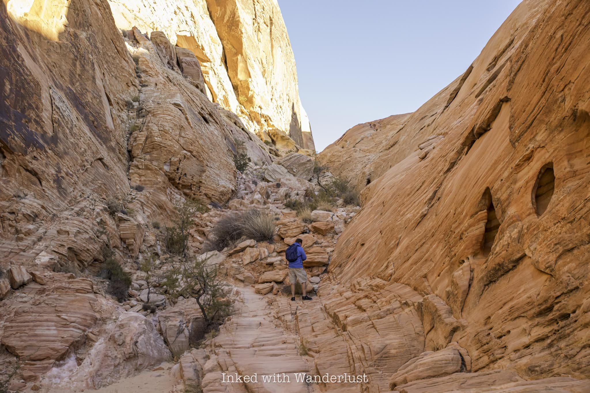
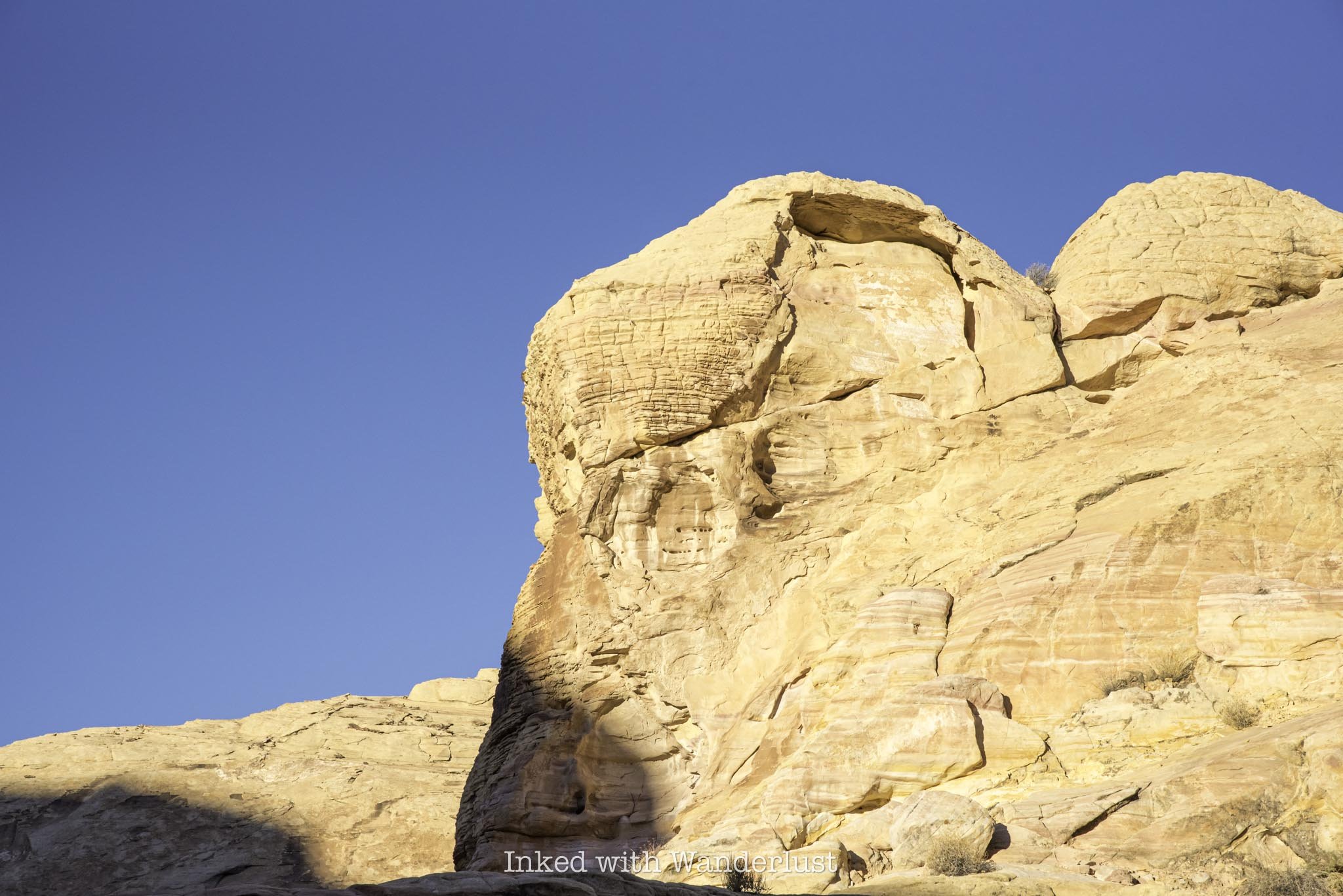
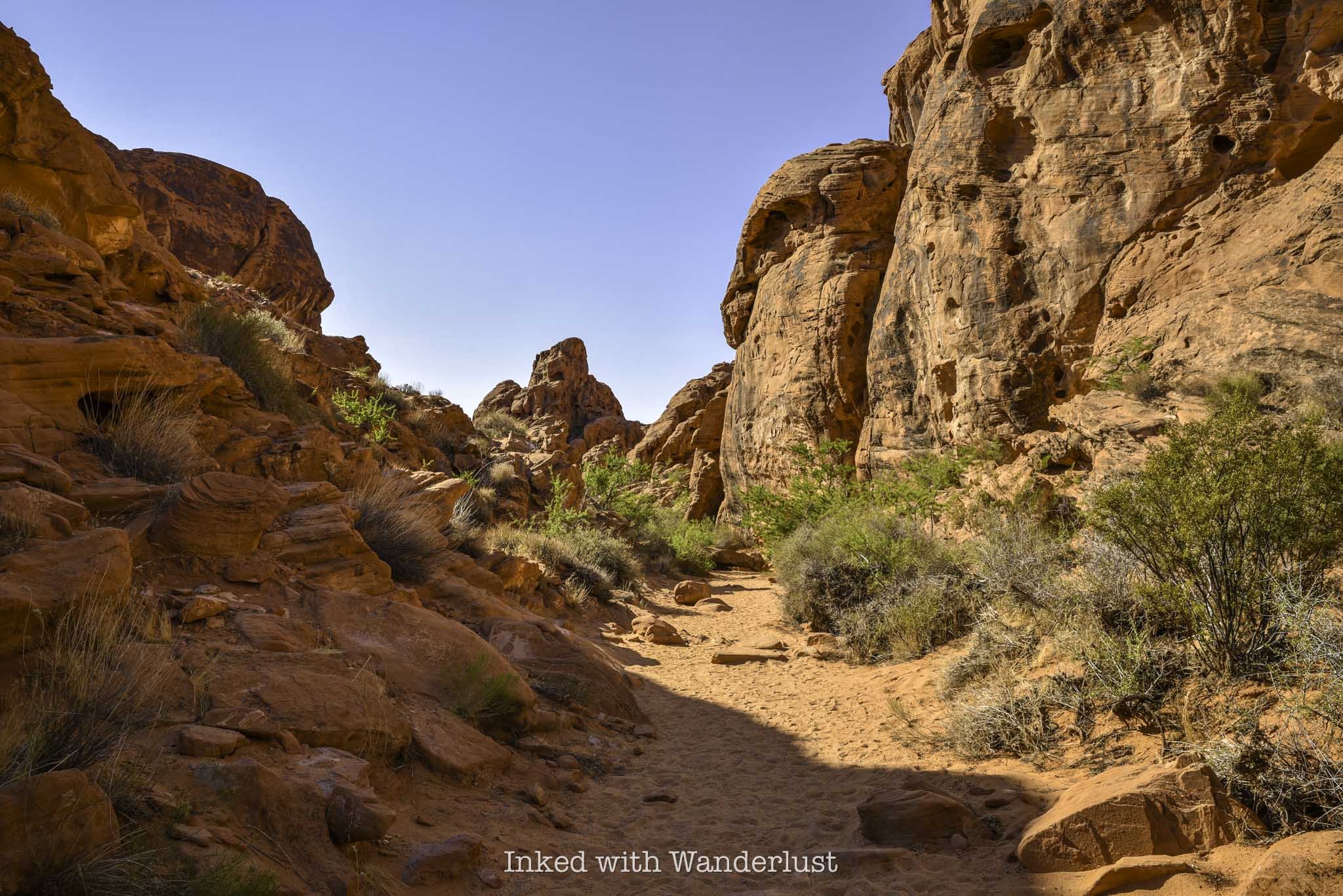
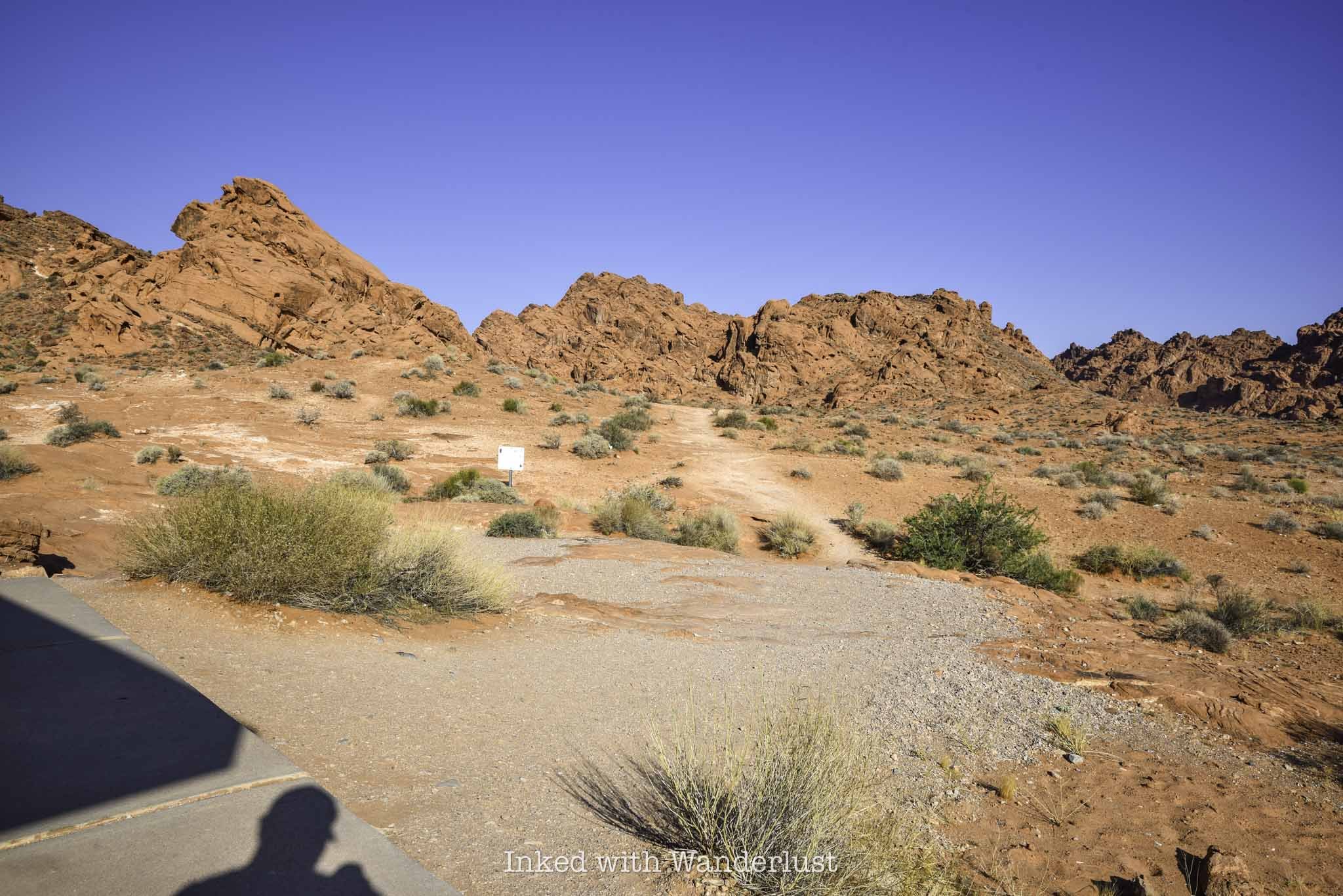
To find the start of the Fire Wave Trail, look for the huge sandstone rock in the picture above and head towards it. You’ll start out in a field condensed in sagebrush, with a sandy trail cutting through it.
The trail is mostly maintained, but does have spots where it seemingly vanishes. Don’t fret, though, as there are also trail markers indicating the correct path. So even in the spots where there doesn’t appear to be a trail, it’s still easy to follow.
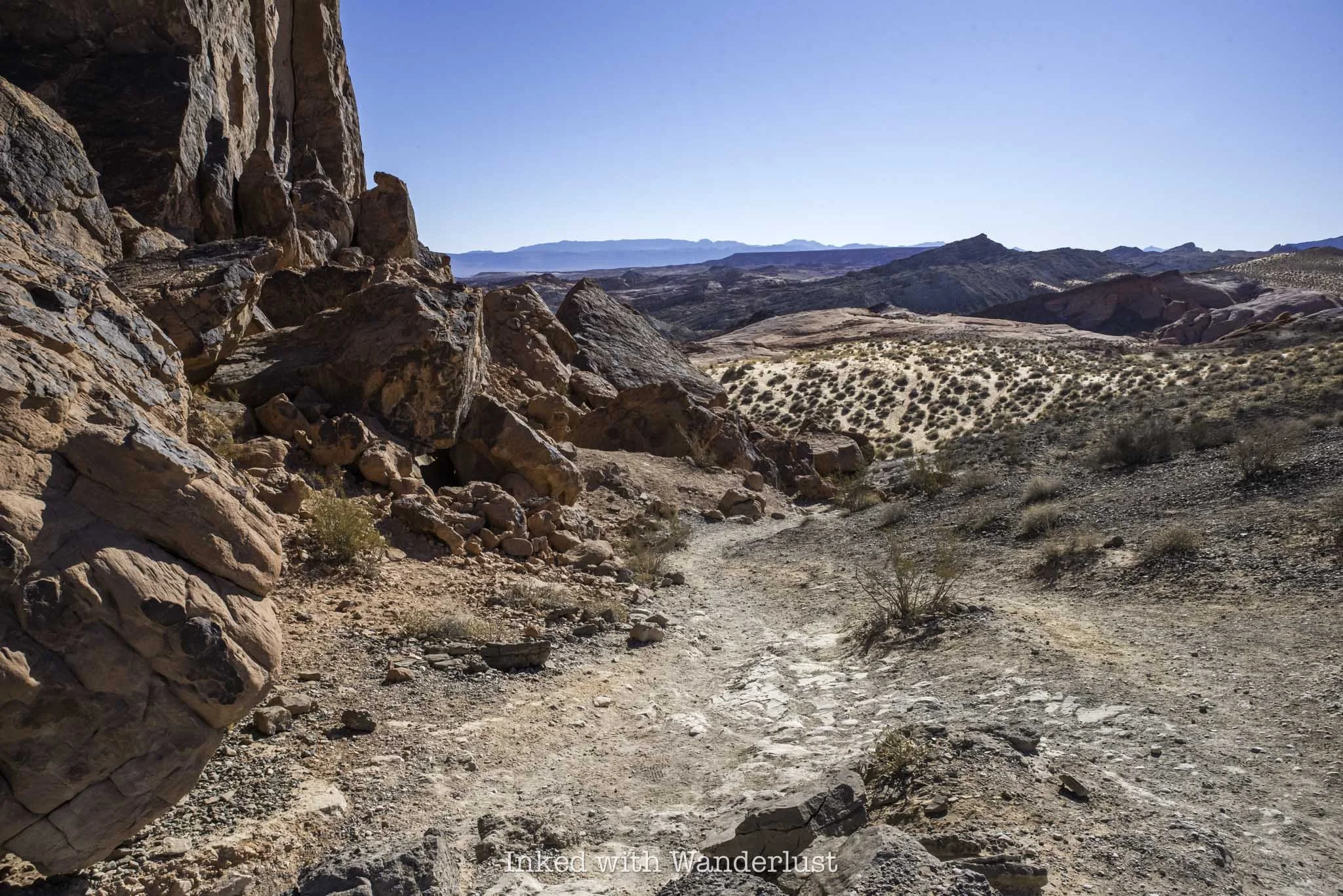
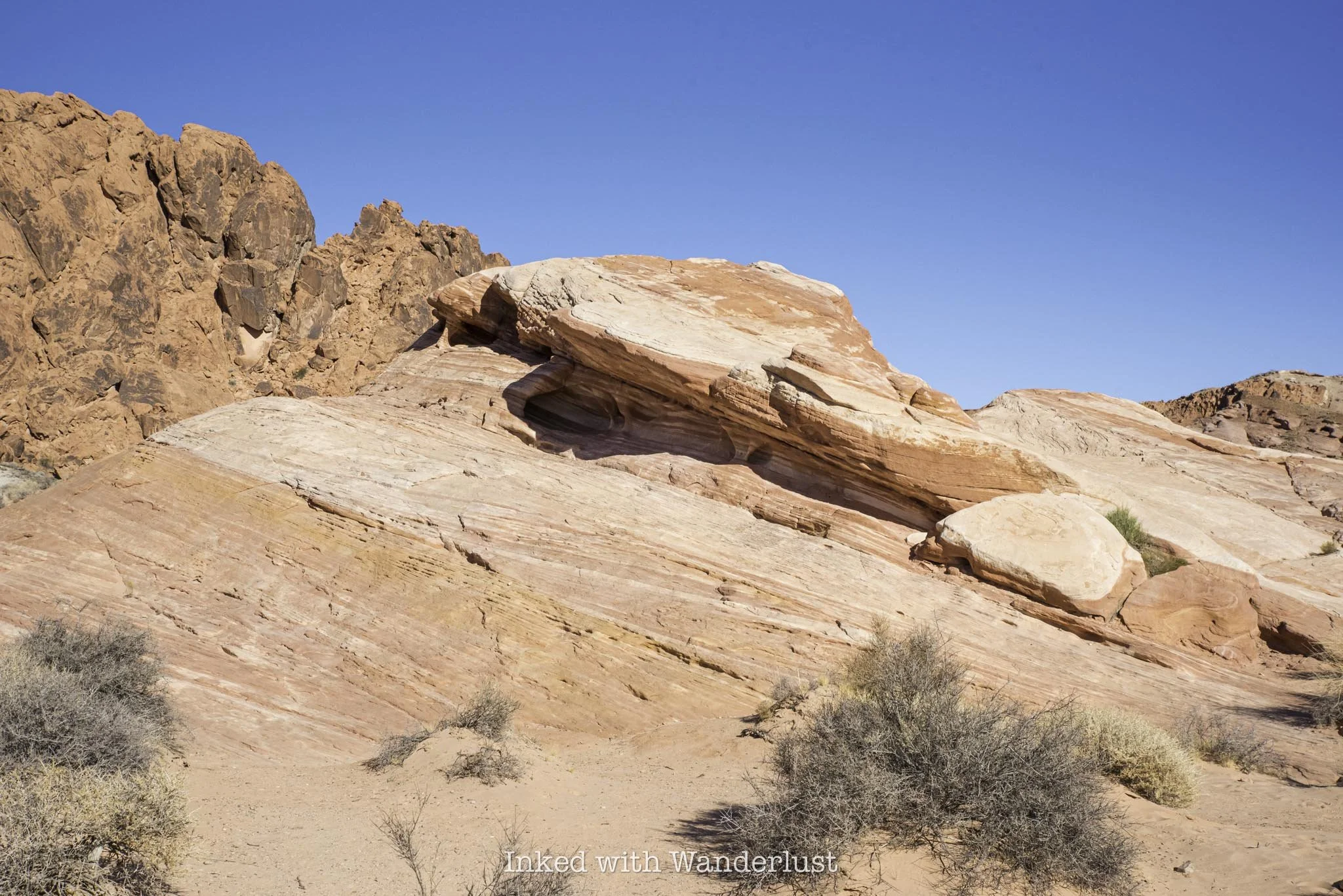
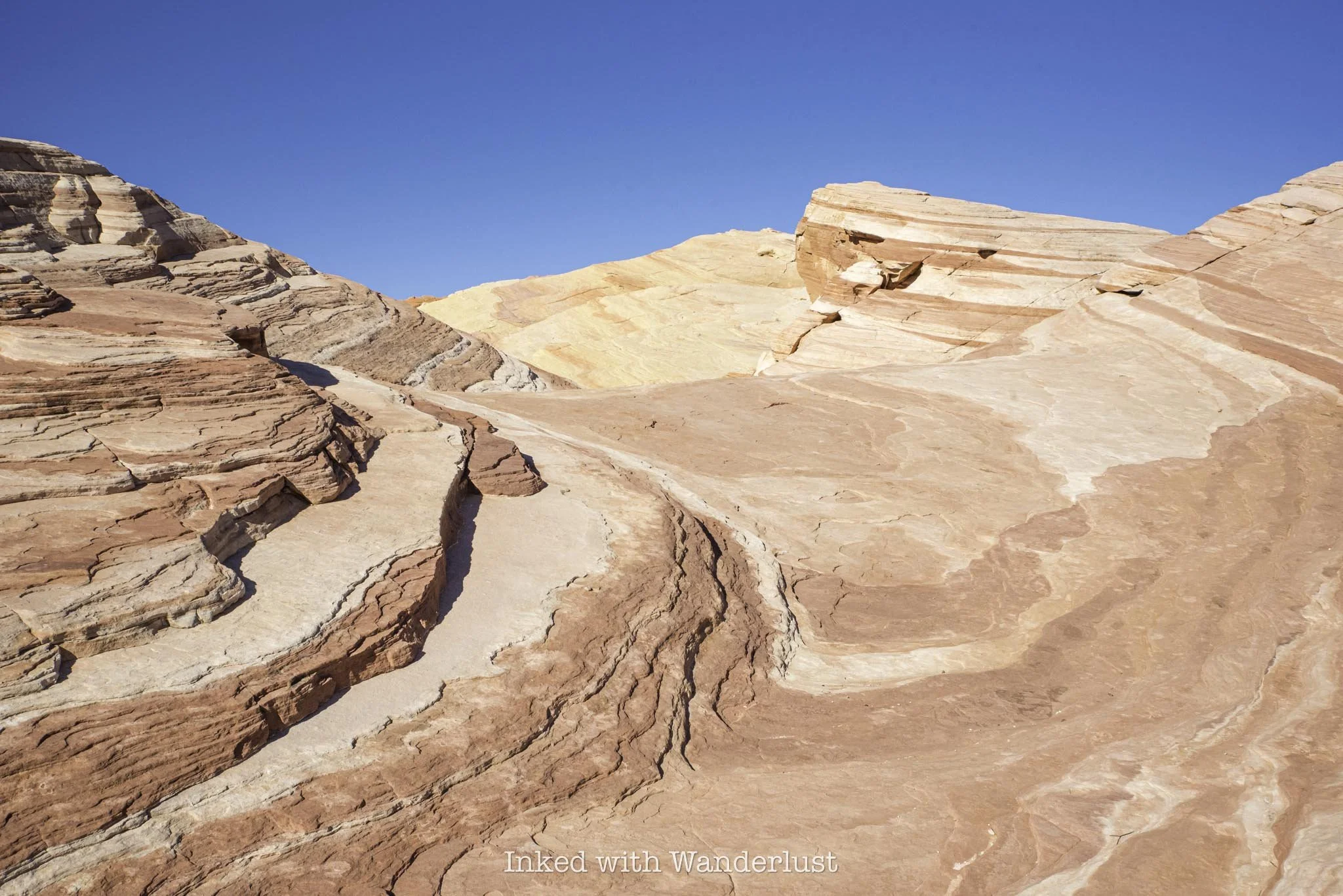
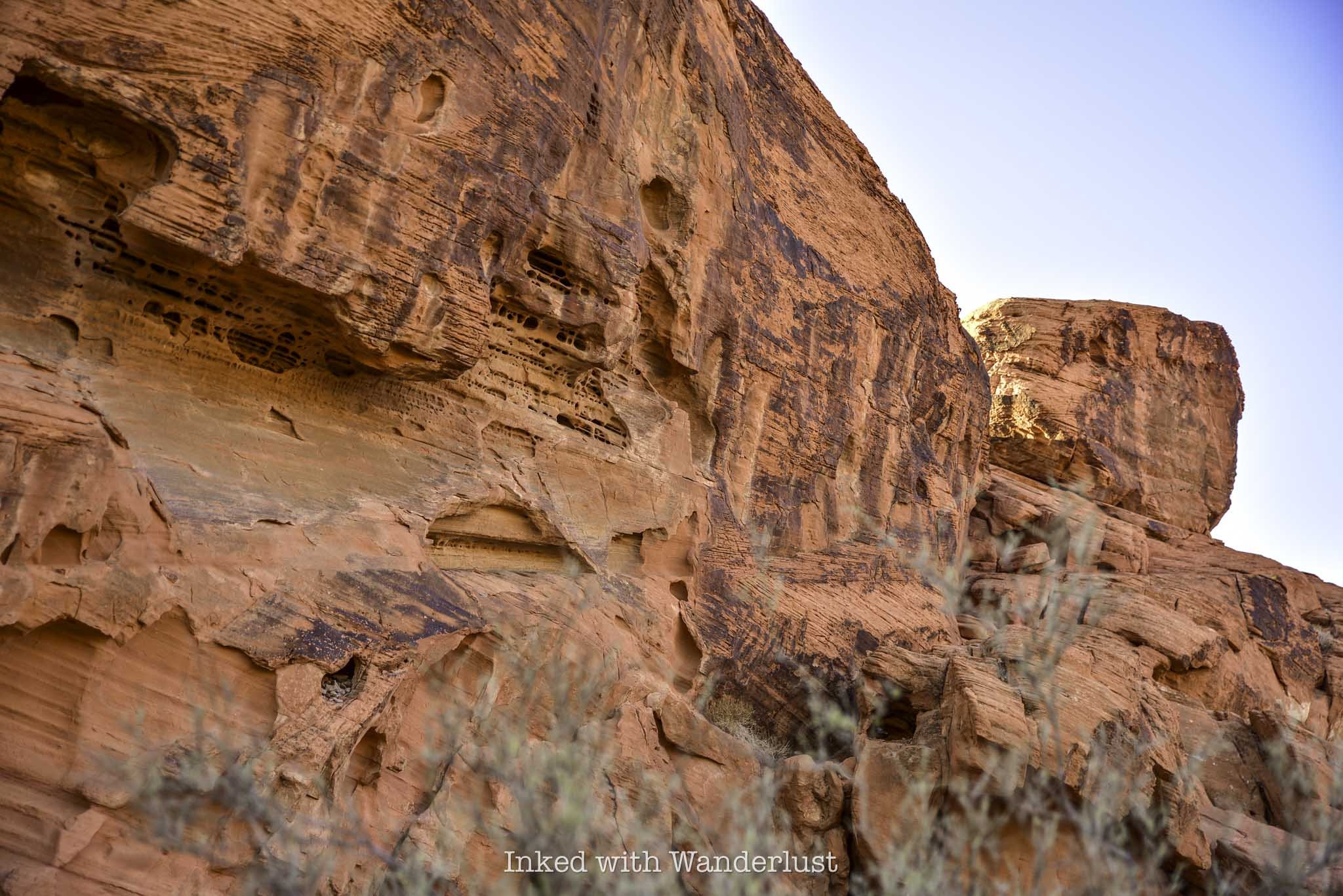
As you get up against the huge sandstone rock, the trail turns to dirt and begins a slight descent to the right. You’re still cutting through heavy sagebrush fields, but you’ll also start to see more of the unique sandstone rock formations Valley of Fire is famous for.
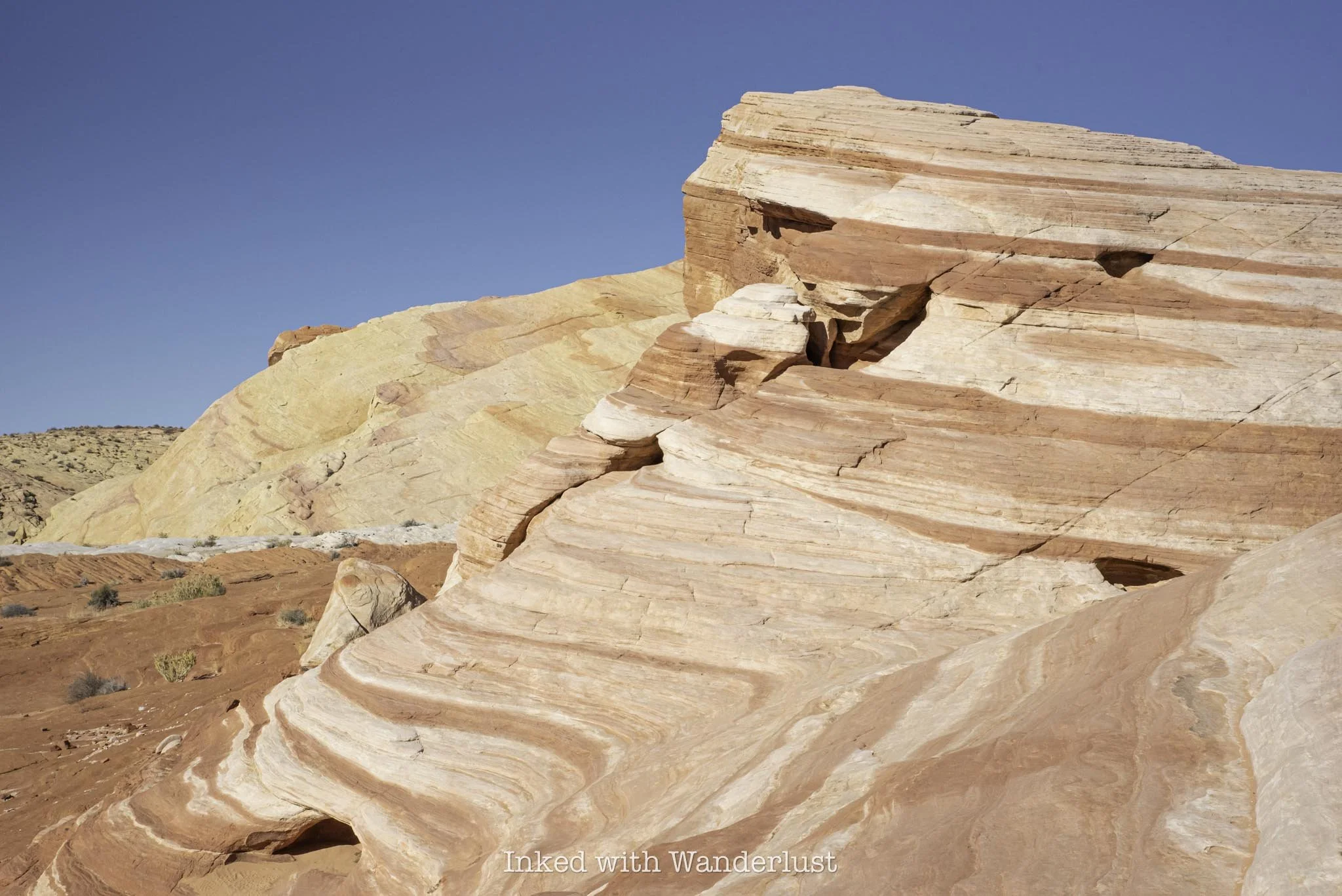
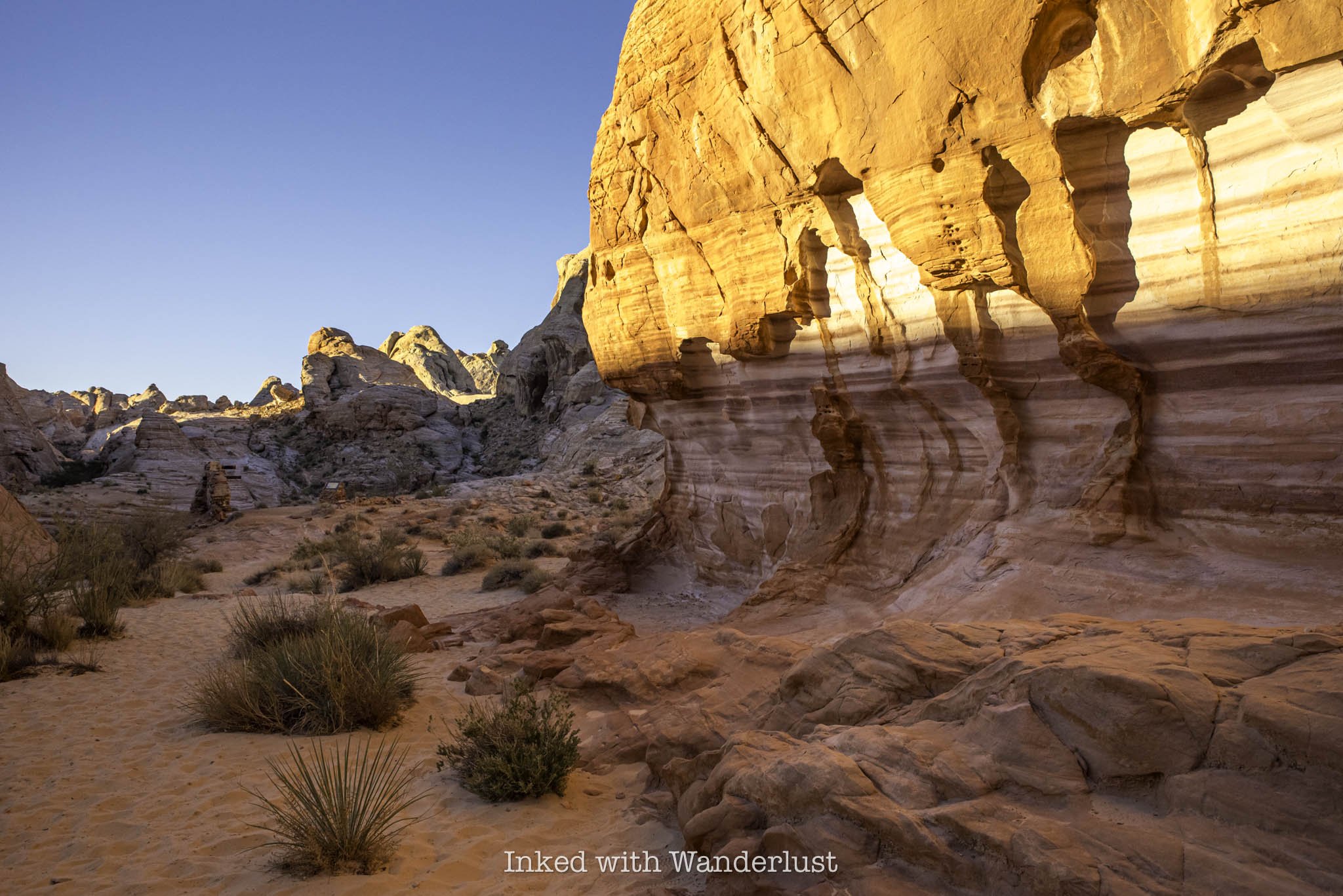
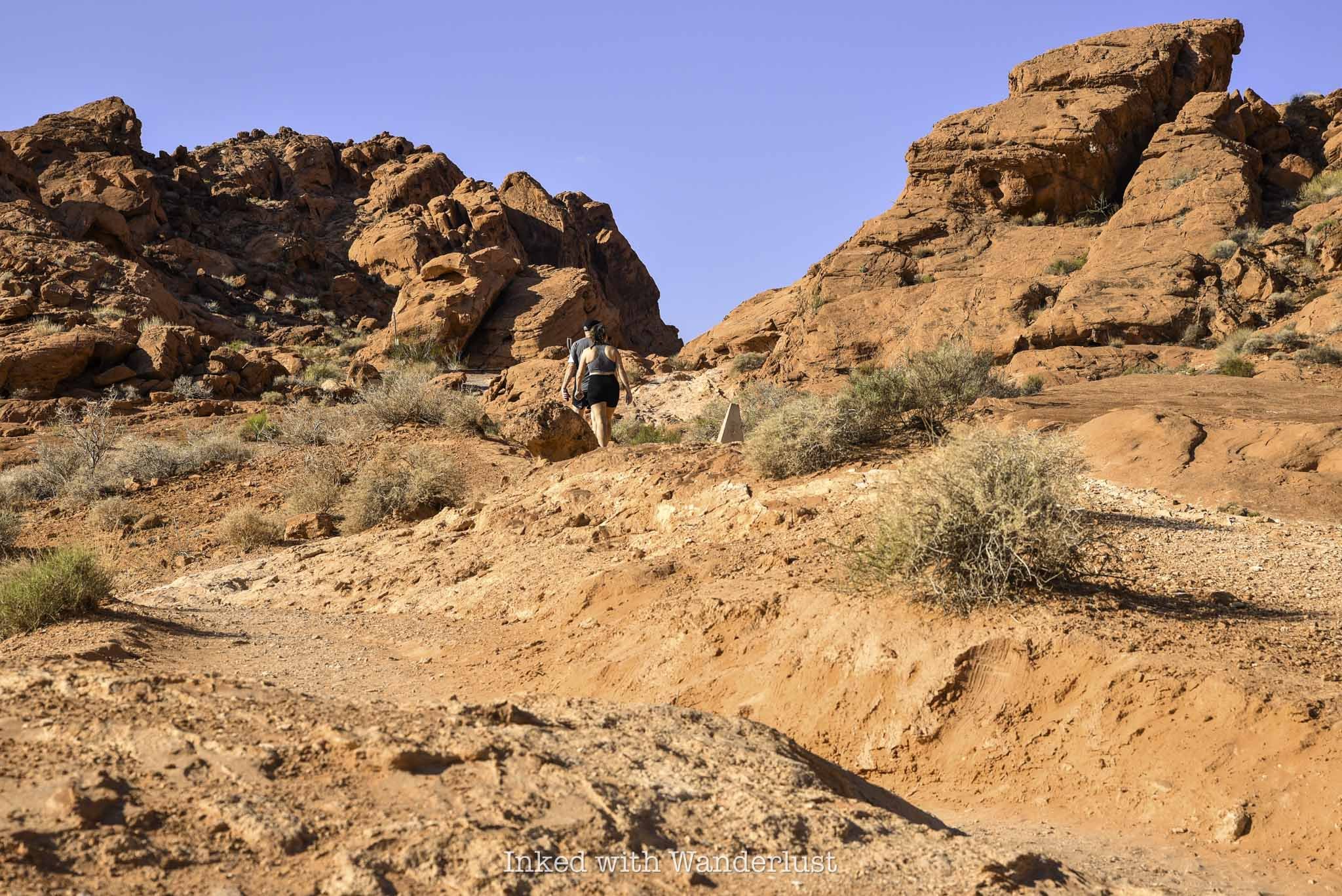
When the trail flattens out again, it’ll become sandy once more and will be lined with rocks, making it incredibly difficult to get lost. You’ll now see far more sandstone rock than sagebrush and the first teasers of Fire Wave and its color patten will become visible.
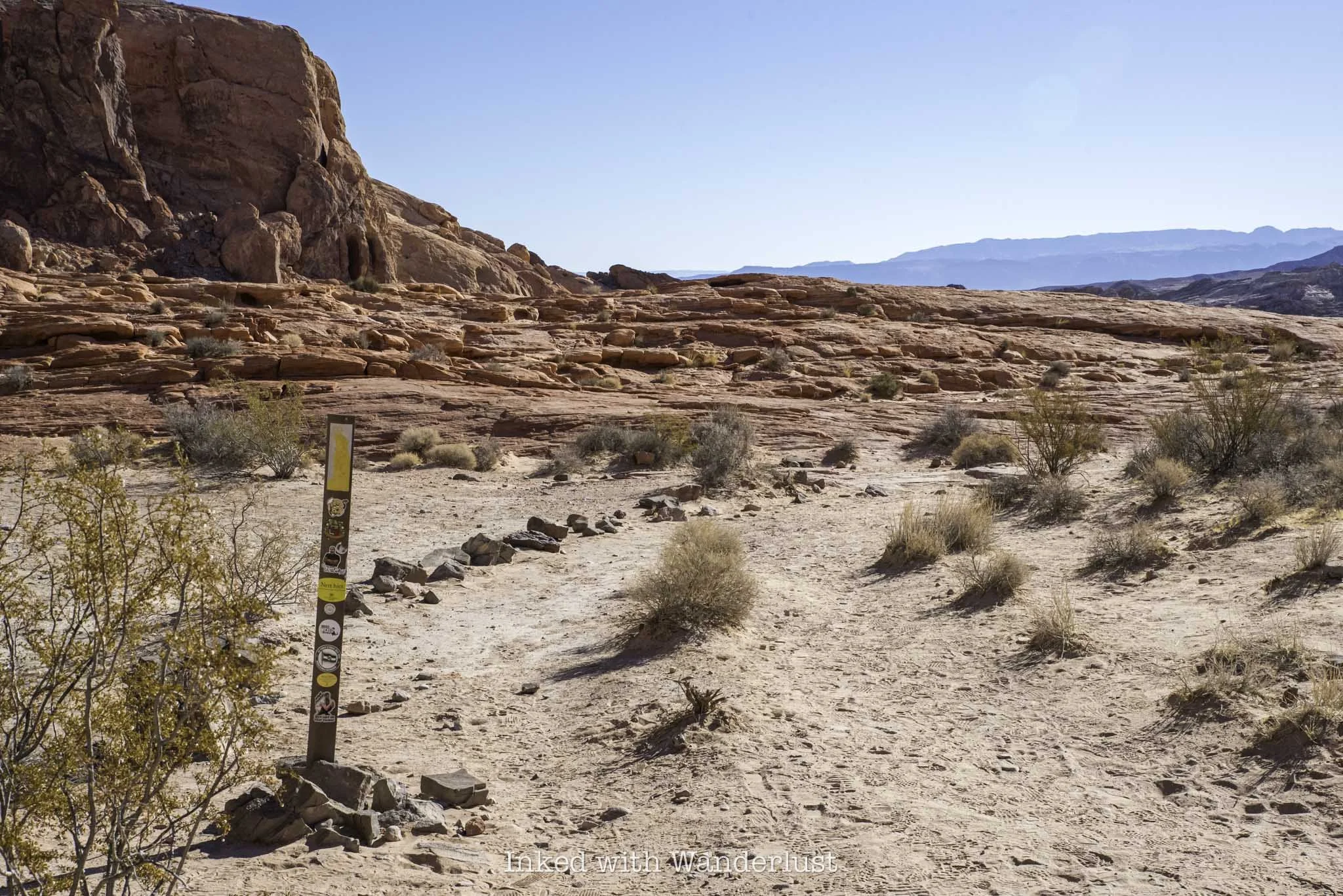
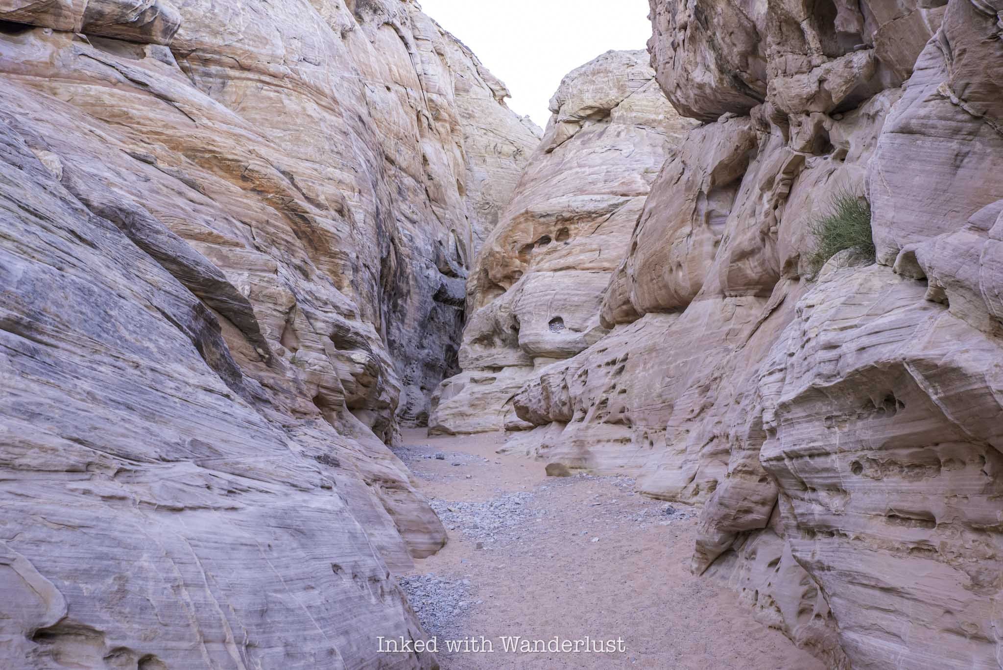
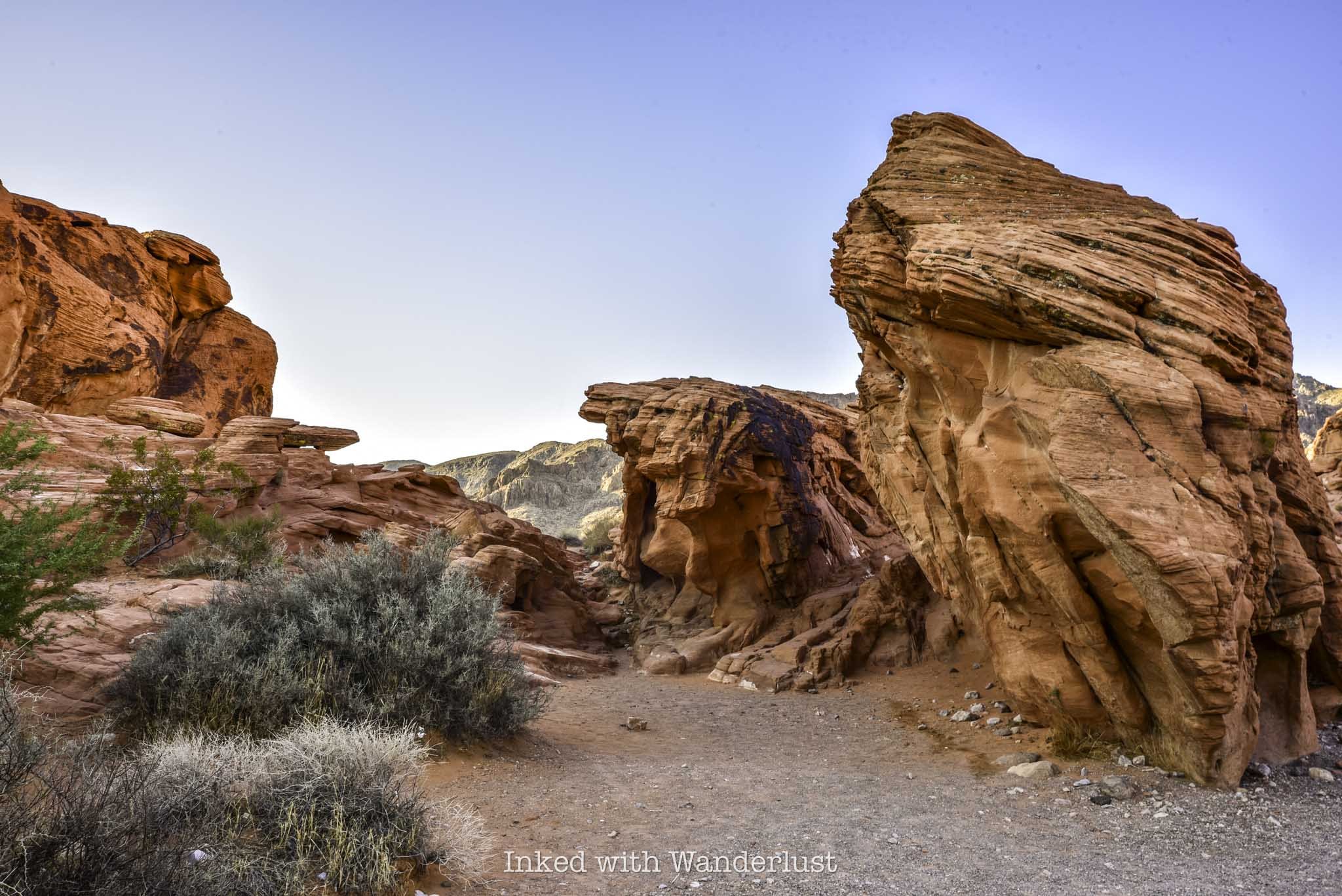
As you start seeing those wavy colors on the rocks, the trail will go from sand/dirt to pure sandstone. From here, there’s no proper trail and you’ll simply keep an eye out for the trail markers and follow them. Don’t worry, each one is easy to spot from the first.
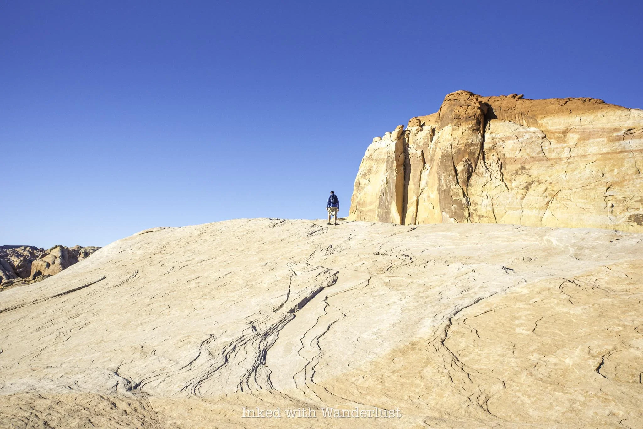
From the last trail marker is where you’ll get your first glimpse of Fire Wave. Simply keep descending on the sandstone rock until it comes into full view. Once you’re there, you’re free to explore at your leisure.
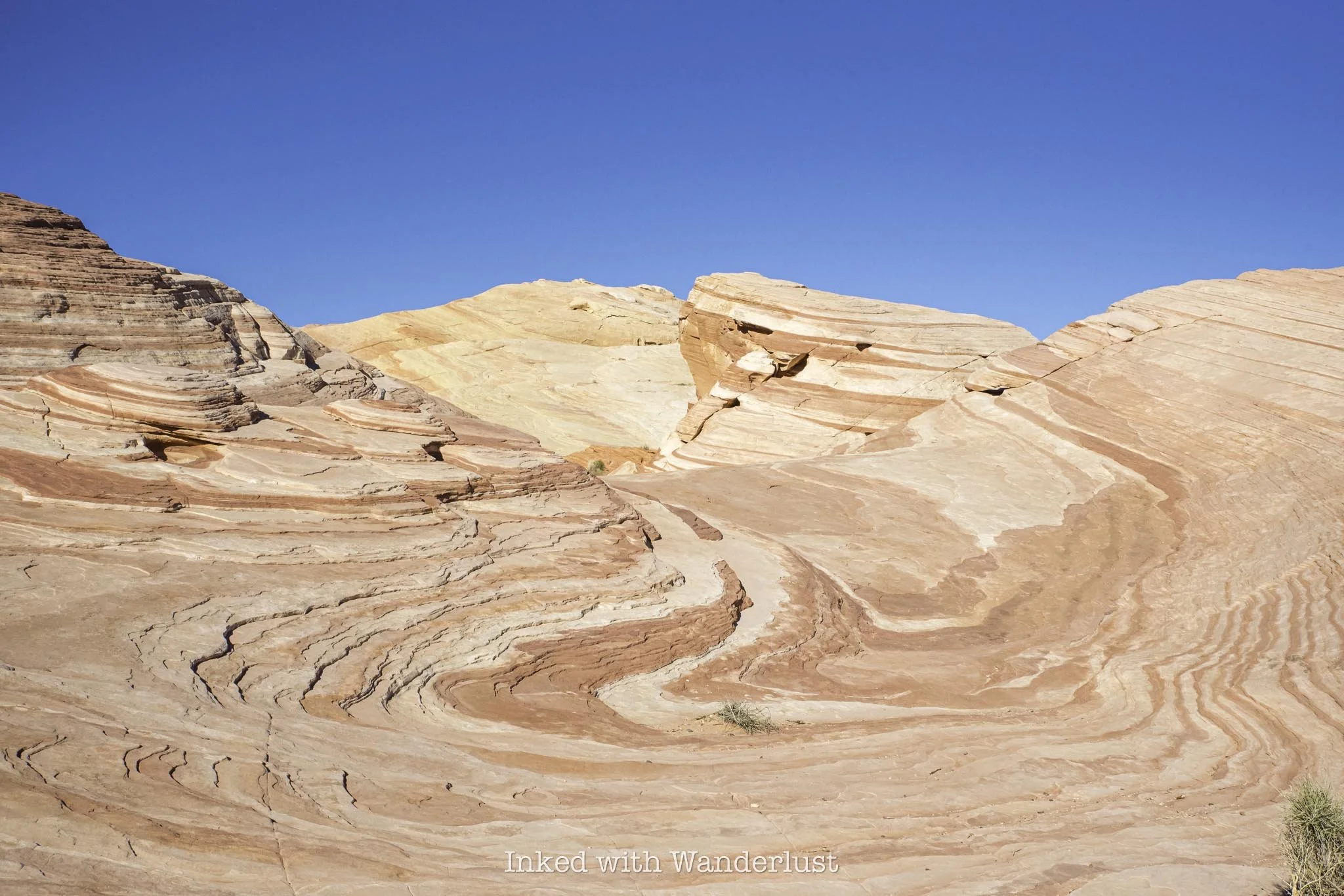
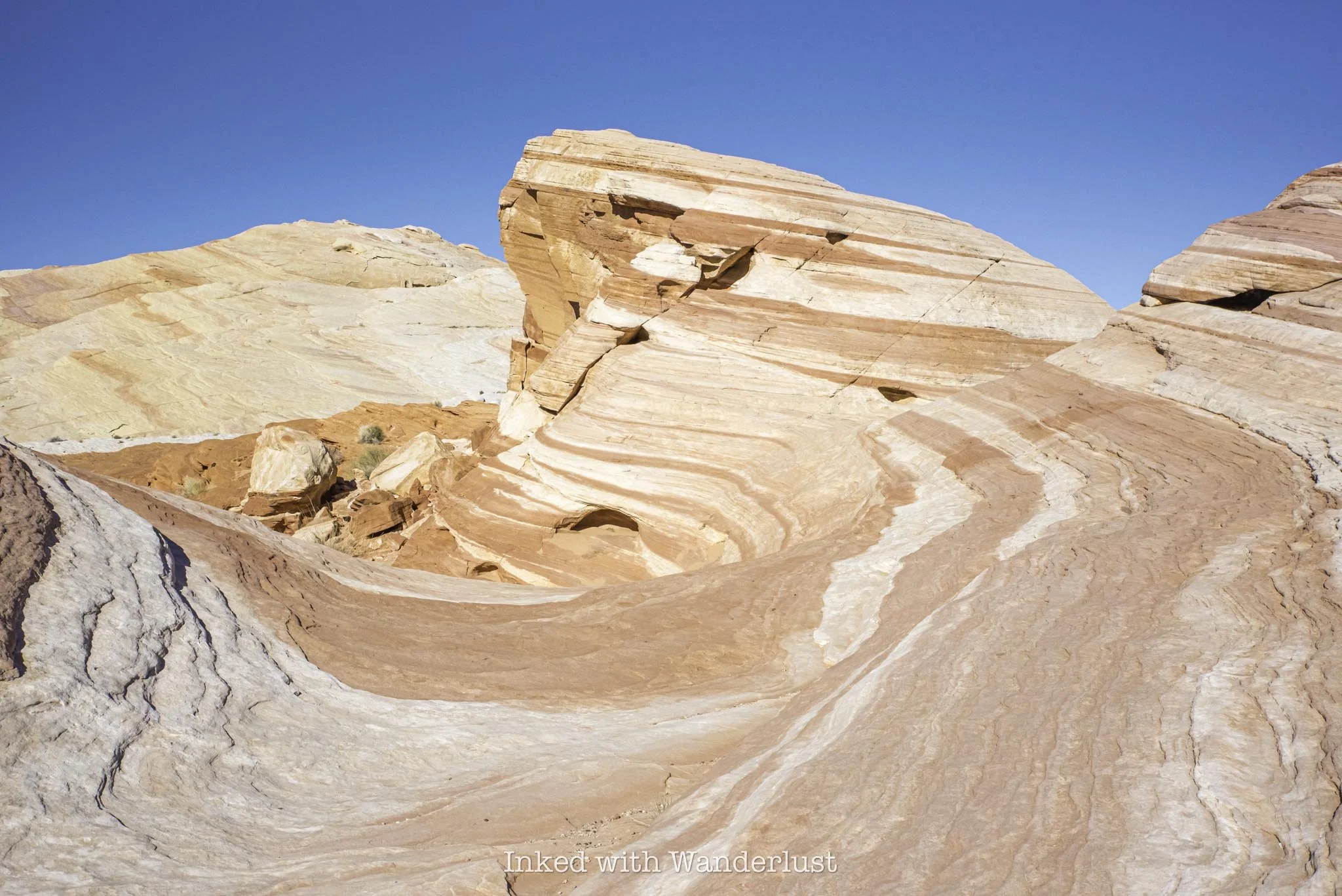
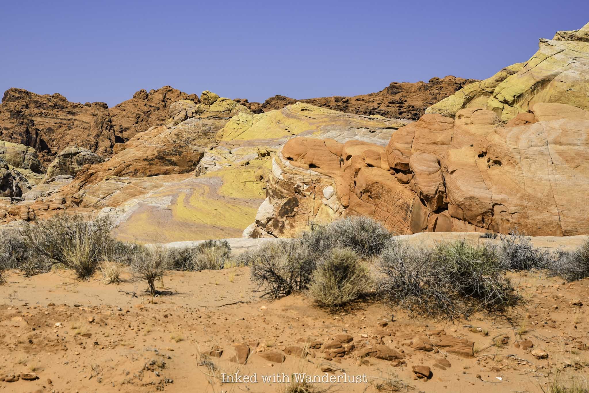
Pictures do no justice to how beautiful Fire Wave is. As stated above, sunrise and sunset are the best times to view it, as that’s when its colors really pop. Even during mid-day, though, like when I went, it’s still a sight to behold.
The swirling reds, oranges, and whites blend so perfectly with one another. The leading lines make it a wonderful photography subject, or to simply stare at in admiration. Either way, you need to see Fire Wave in person.
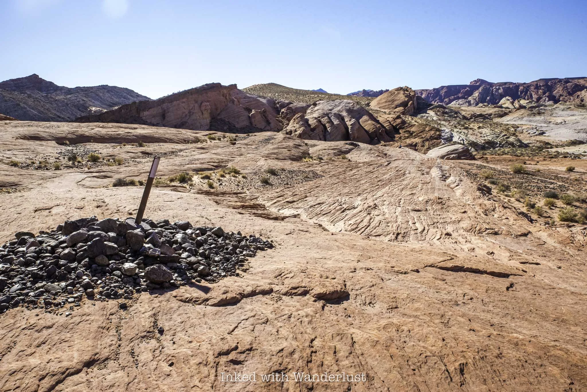
At Fire Wave is where the official trail ends. Simply turn back around and head in the same direction you came to your car. From there, continue driving north to hike White Domes Loop, an equally beautiful trail, or drive south to Mouse’s Tank Trail through Petroglyph Canyon. Or…
Seven Wonders Loop Extension
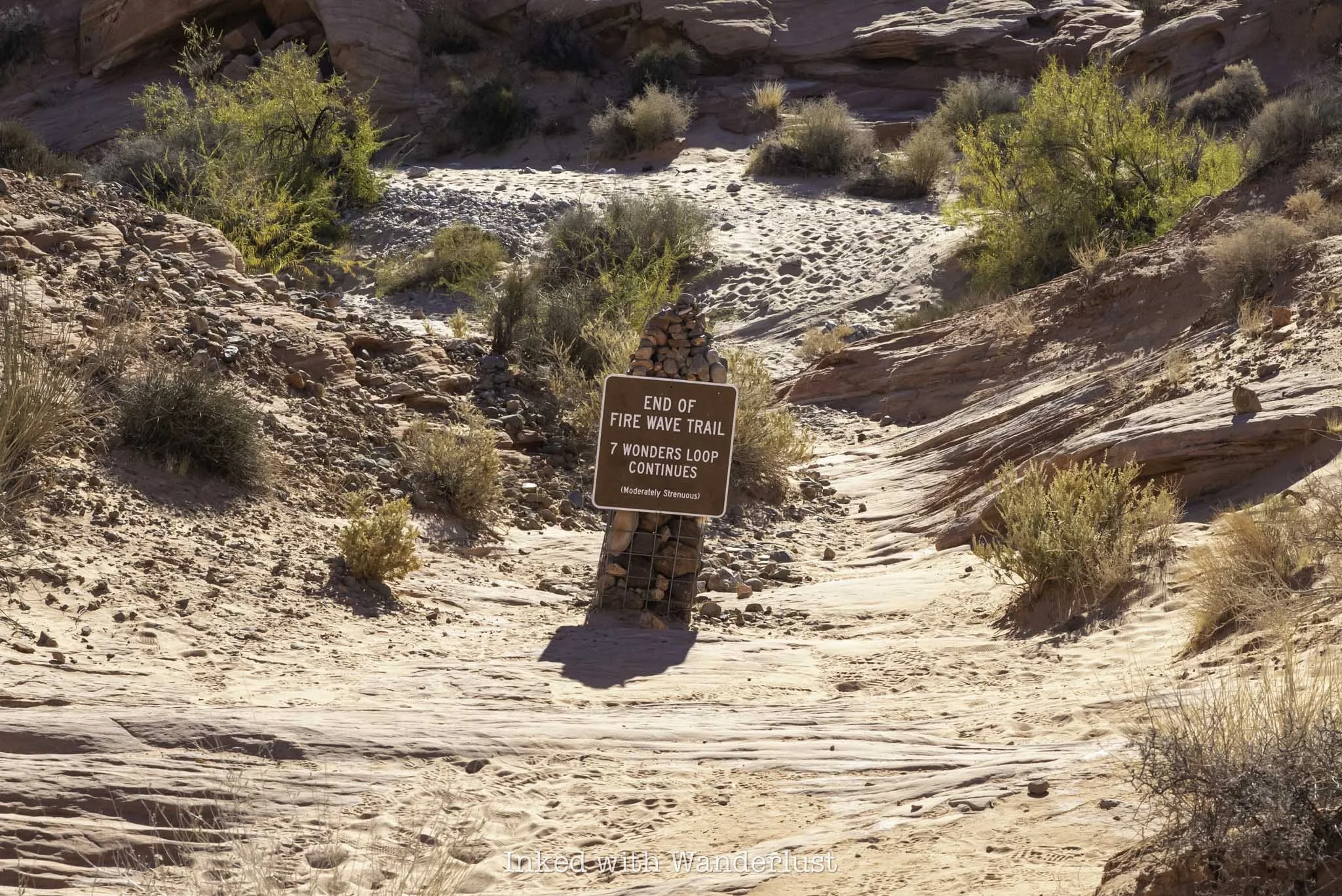
Just beyond Fire Wave, you’ll notice a pile of rocks with a sign atop indicating the end of the Fire Wave Trail. That same sign also marks the extension of the Seven Wonders Loop, if you have energy left over, that is.
Continuing will add another mile or so to your hike and will take you on a complete loop that’ll eventually spit you out to where you’ve parked. It’s definitely worth doing, provided it isn’t scorching that day and you’ve come prepared.
It’s a moderate-level trail and can be easy to lose at times. Due to that, I recommend coming prepared with a downloadable GPS map, like what AllTrails provides. Along the way, you’ll see several Valley of Fire attractions, such as Pastel Canyon, Crazy Hill, Thunderstorm Arch, and more.
Whether you do the full loop or just stick with Fire Wave, you’re sure to have a great time either way. Just remember to steer clear of this trail during the summer months and adhere to the trail closures. It isn’t worth the risk.
If you do find yourself here during the closure period, check out the following trails and attractions listed below, as they’re open all year:

Hike Petroglyph Canyon via Mouse’s Tank Trail in Valley of Fire
One such hike is Petroglyph Canyon via Mouse’s Tank Trail. It’s less than a mile (0.7 mile, to be exact) roundtrip along relatively flat…
Disclosure: This post contains affiliate links. If you make a purchase through these links, I may earn a small commission at no additional cost to you. I only recommend products or services that I believe will add value to my readers.

Valley of Fire State Park in Southern Nevada is a recreational paradise and escape from the noise and chaos of the Las Vegas Strip. In fact, it’s only a one hour drive (or less) from Vegas!
The park is chock-full of shorter hikes, giving families with small children and those who’re less experienced a chance to witness epic landscapes, mind-boggling geology, and a serene environment.
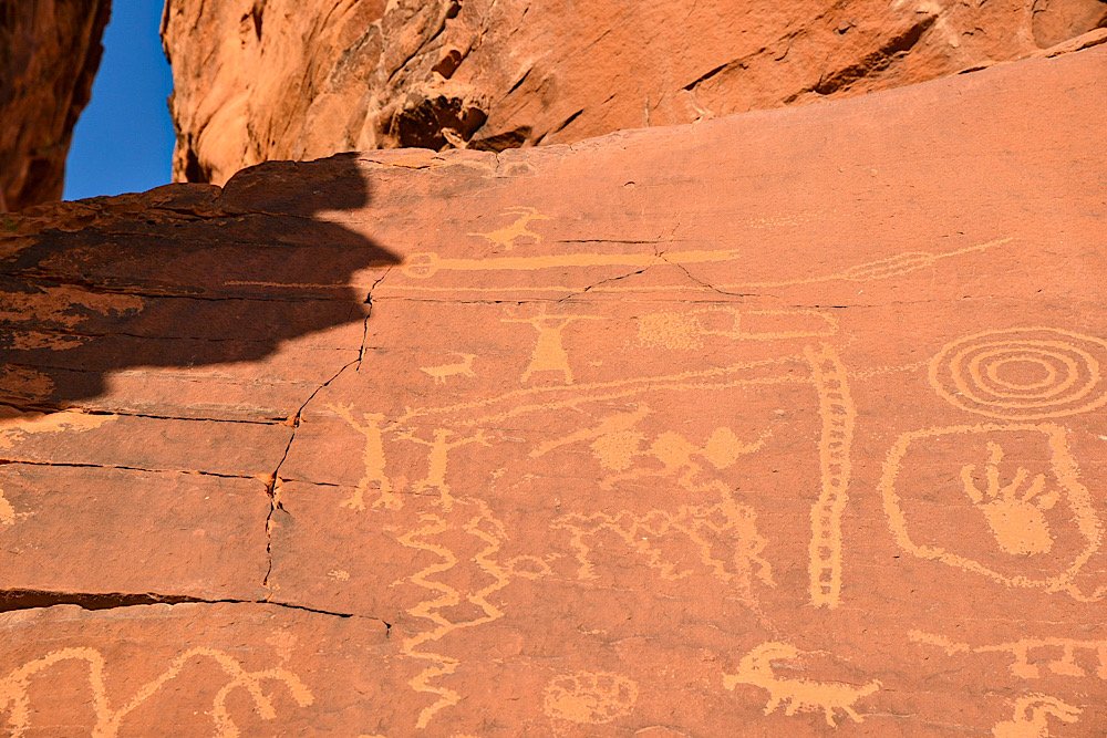
One such hike is Petroglyph Canyon via Mouse’s Tank Trail. It’s less than a mile (0.7 mile, to be exact) roundtrip along relatively flat and sandy ground through a canyon dotted with hundreds of ancient petroglyphs.
What are petroglyphs, you ask? Petroglyphs are images created by carving, etching, or scraping designs into rock surfaces. This form of rock art is often associated with Native American tribes. Which is the case here.
The petroglyphs in this canyon, much like at nearby Atlatl Rock, are believed to be between 2,000 and 4,000 years old and are associated with the Basketmaker and Early Pueblo cultures.
So what can you expect on this hike? Where in the park is it located? Is it worth it? I answer all of these questions and more in the post below. Let’s get into it!
At A Glance…
Location: Valley of Fire State Park
Fee: Standard park day-use fee
Open: Year-round
For: Hikers and families
Cell Service: None
Restroom: At the trailhead
Parking: Large gravel/dirt lot
EV Stations: None
Difficulty: Easy
Popularity: Moderate
Trail Condition: Easy to follow / soft sand
Elevation: 2,024 feet
Stoller Friendly: No
Kid Friendly: Yes
Mileage: 0.7 mile, out and back
Features: Ancient petroglyphs, visually striking rock formations, and natural water basin
Best Viewed: Spring and fall months
Pets: Allowed on leash
Drones: Prohibited
Hazards: Sun exposure and extreme heat (especially in the summer months), potential wildlife encounters
My Visit(s): August 2023 and November 2024
Petroglyph Canyon Trailhead and Parking

The parking lot and trailhead for Mouse’s Tank Trail is located just off of the park’s infamous Mouse’s Tank Road. To get there, you’ll need to drive through either the west or east entrance on the Valley of Fire Scenic Byway and make your way to the visitor center.
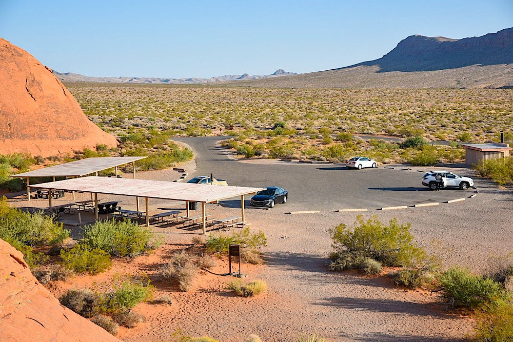
Once there, continue up Mouse’s Tank Road for just over a mile, at which point the parking lot for Mouse’s Tank Trail will be on your right. The parking lot is of the dirt/gravel variety and is rather large. There are restrooms here.


The official trailhead is just to the left of the restroom. Keep in mind that while this trail is open year-round, the extreme heat of the summer at Valley of Fire can make this otherwise easy hike a potentially dangerous one.
If you are here in the summer, it might be a good idea to do this one in the morning or later in the evening, as the canyon walls provide a decent amount of shade from the sun at these times.
Petroglyph Canyon

The trail begins via a short descent into the mouth of the canyon on a paved ramp. At the end said ramp, you’ll be hiking on soft sand, which will continue throughout the remainder of your hike.
After a short distance, you’ll soon be surrounded by those reddish/orange rock canyon walls Valley of Fire is famous for. There isn’t much in the way of trees or greenery, just the usual desert brush.

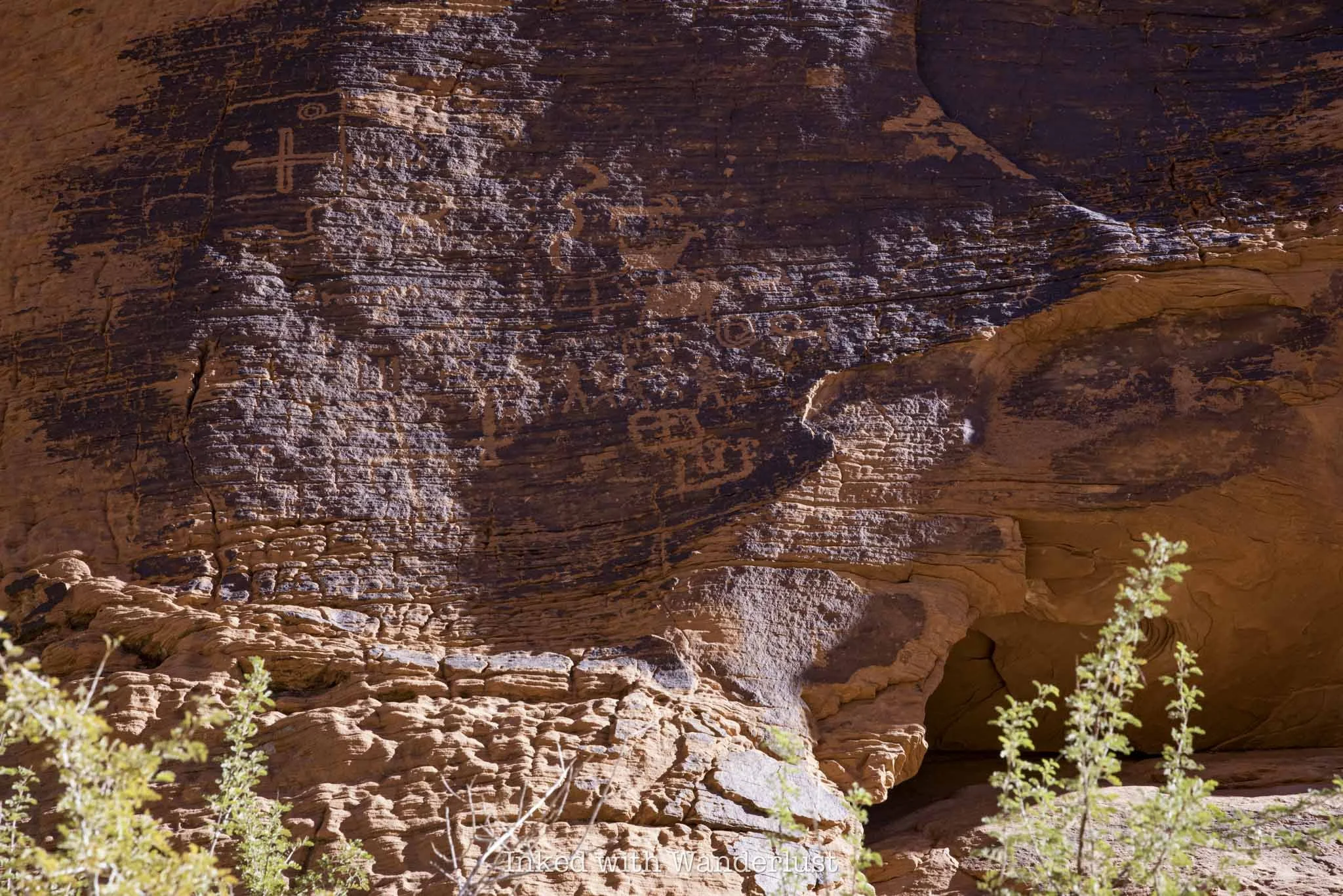
The petroglyphs start popping up almost immediately. There are no signs pointing the way and they’re fairly easy to miss if you’re not paying attention. That said, they’re literally all over the canyon walls.
The first set of petroglyphs I spotted were just a few minutes into the hike. When you come to the sign in the photo above, look for an unmarked path on your left (right about where my Dad is standing in the photo).

Facing that unmarked path, you’ll notice a large rock in front of you and on the left side of that rock you’ll notice what looks like a large burn mark. That’s actually patina and in that patina is where you’ll find petroglyphs.


This is the largest concentration of petroglyphs on one rock that I’ve seen on this trail. The patina-heavy area of the rock is literally covered in them. I wasn’t able to spot any more in the area, but that doesn’t mean they’re not there.
Continue down the trail and keep your eyes peeled for patina on the canyon walls. Whenever you see patina, there will likely be petroglyphs there. However, there are some on non-patina’d rocks as well, so look out for those.


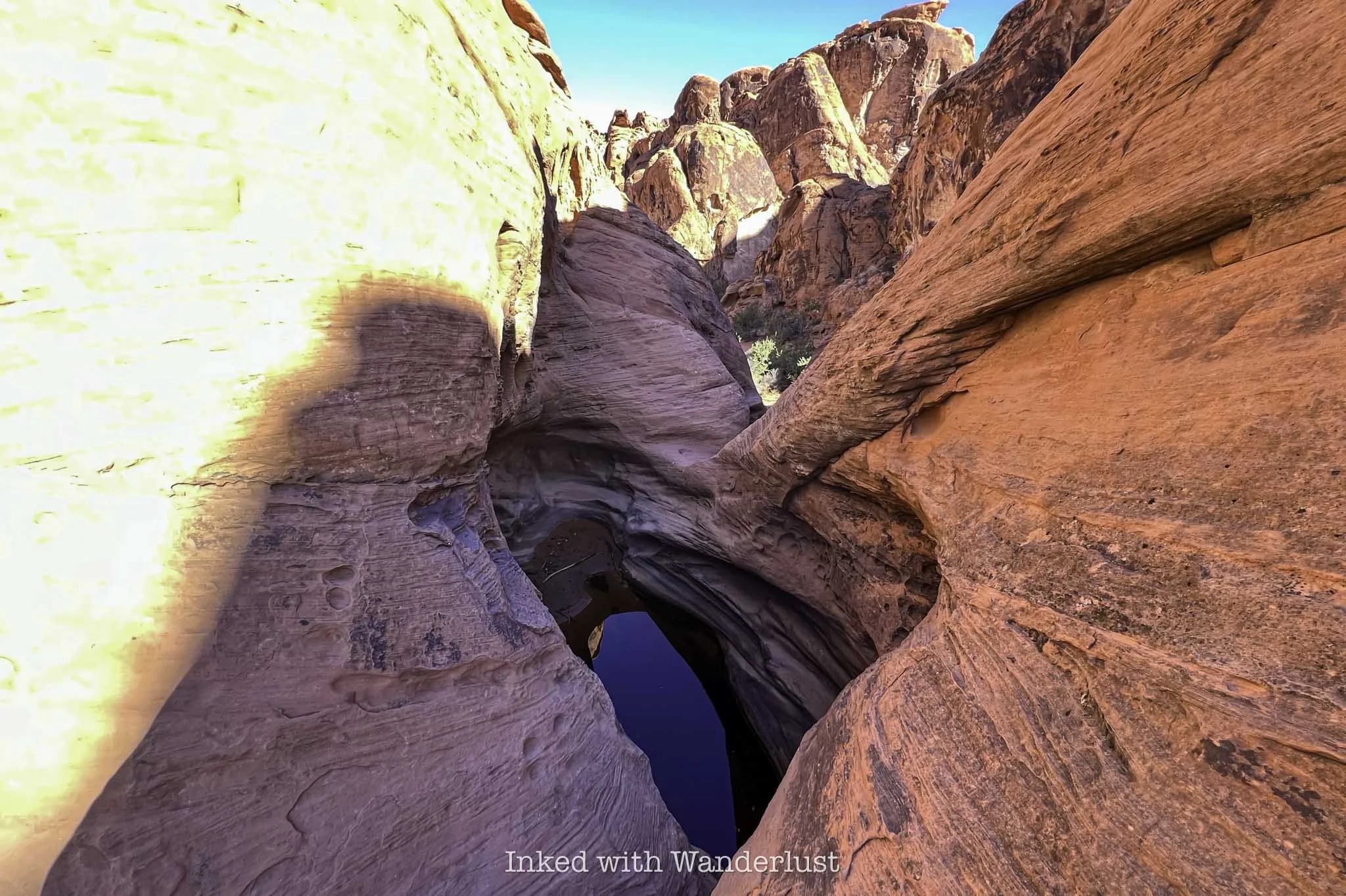
Before long, you’ll come upon a sign stacked onto a pile of stones pointing left, indicating the end of the trail. Turn left here and walk for about 100 feet to a natural basin of water, otherwise known as the “Mouse Tank”.

The “Mouse Tank” is a natural feature in the rocks that collects water after rainfall. It forms a natural basin where water collects. There are a few of these in the park, but this one is named for an Indian outlaw who hid out in this area named, Little Mouse (more on him momentarily).
Walk down to the end of the trail to view the tank. There isn’t always water in it, and sometimes you’ll need to lean over a fair amount to see it. Watch your footing, as it wouldn’t be fun to fall into that…water or not.

In addition to the water tank, there are more petroglyphs in this area. Some are high up on the rocks, so they’ll be a bit difficult to see. There are plenty others at eye level as well, though.
Throughout this post, you may have been wondering why they named this trail “Mouse’s Tank”. It’s named for a Southern Paiute Indian outlaw by the name of “Little Mouse” who hid in this area after being accused of and wanted for a number of crimes.
The Story of Little Mouse - A Southern Indian Paiute Outlaw

It’s said that Little Mouse - or simply, Mouse - hid in this area of the park after being implicated in the murders of two white prospectors (among other crimes). A posse gathered to find him, but they weren’t as familiar with the area as he was.
Walking through Petroglyph Canyon reveals many potential hiding spots in the walls. Whether or not Little Mouse used any of these spots is up for debate, but the sheer possibility is fascinating.


Little Mouse managed to successfully evade capture by hiding in this canyon for several years, utilizing the tank at the end of the canyon as a water source. How exactly he did that without falling is beyond me.
The posse did end up catching up to Little Mouse, though several miles away from this location near the Muddy River. He was surrounded and killed by the posse. Little Mouse’s guilt of the murder of those prospectors was never fully proven.

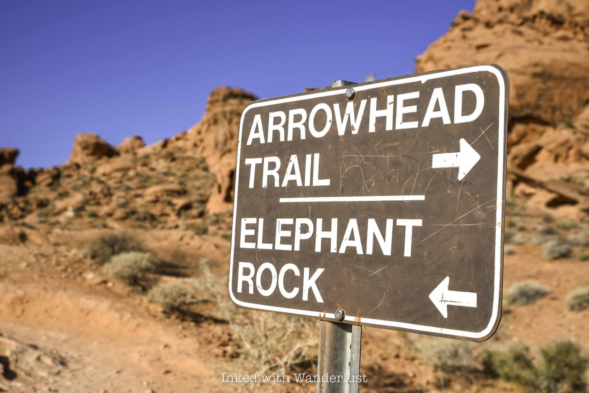
I hope this post inspired you to hike Mouse’s Tank Trail and explore all of the petroglyphs. When you’re done here, there are many other hiking trails nearby I recommend. White Domes Loop, Fire Wave and Elephant Rock, just to name a few.
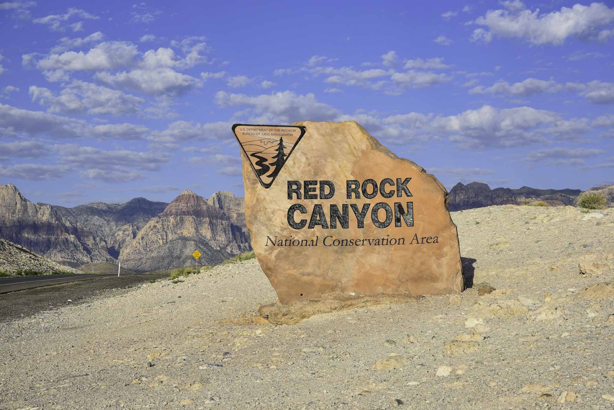
Additionally, you can read this post to see a full list of 10 short hikes in Valley of Fire that I recommend. Additionally, if you have extra days and want to see more petroglyphs, check out nearby Atlatl Rock and the historic Petroglyph Wall in Red Rock Canyon.


10 Must-Do Short Hikes in Valley of Fire State Park
The beautiful rock formations and colors, in addition to being packed with short day hikes, make Valley of Fire State Park a place you could easily spend a whole day (or two) exploring. Best of all, most…
Disclosure: This post contains affiliate links. If you make a purchase through these links, I may earn a small commission at no additional cost to you. I only recommend products or services that I believe will add value to my readers.
Valley of Fire became Nevada's first state park in 1934 and since then, it's developed into one of the state's most sought after destinations and is one of the best things to do when visiting Las Vegas, often rivaling nearby Red Rock Canyon.
The beautiful rock formations and colors, in addition to being packed with short day hikes, makes Valley of Fire State Park a place you could easily spend a whole day (or two) exploring. Best of all, most of the park’s most popular hikes are short and easy, making them family-friendly.
In this post, I'm going to present to you 10 must-do short hikes in Valley of Fire. If you plan correctly and not visit on a day where the heat reaches dangerous levels, it's totally possibly to do all of these in a single day visit, dependent on your conditioning.
That said, there is one caveat to this list, and that's the seasonal trail closures discussed below...
Valley of Fire Seasonal Trail Closures

While the park itself is open daily, between the months of May and September, when temperatures at Valley of Fire State Park often reach dangerous levels, park officials enact trail closures at several popular hiking trails to prevent needless deaths.
There have been quite a few exposure-related deaths over the years, including in 2023 when two hikers were found dead on the Prospect Trail on a day when high temperatures reached a scorching 118-degrees.
Unfortunately, several of the hiking trails listed below are included on the closure list. So if you're going to visit between May and September, please respect these closures and don't risk it. It isn't worth the chance of a hefty fine or even worse...death.
These are the trails affected by seasonal closures:
White Domes Loop
Fire Wave/Seven Wonders/Pastel Canyon/Pink Canyon
Pinnacles Loop
Prospect Trail
Arrowhead Trail
Natural Arch Trail (excludes Arch Rock)
Charlie's Spring

West Entrance vs. East Entrance
There are only two entrances to Valley of Fire State Park. If you’re coming from Utah, Arizona, or any state east of Nevada, you’ll likely be entering through the east entrance. If you're like most people and you're coming from the Las Vegas Strip area, you'll want to head towards the west entrance.
For some reason, Google Maps likes to take people coming from the strip to the east entrance, which is further away. It has tried doing that to me twice now. So make sure that whichever navigation system you use that you specify the west entrance.
Entrance Fees
In 2025, the fees to enter Valley of Fire are:
$15 (non-Nevada vehicles)
$10 (Nevada vehicles)
Fees are payable, at either entrance, with cash via the iron ranger/envelope or with credit cards at the self-pay digital kiosk. Note that the digital kiosk doesn't always work, so it's best to bring exact cash as a back up.
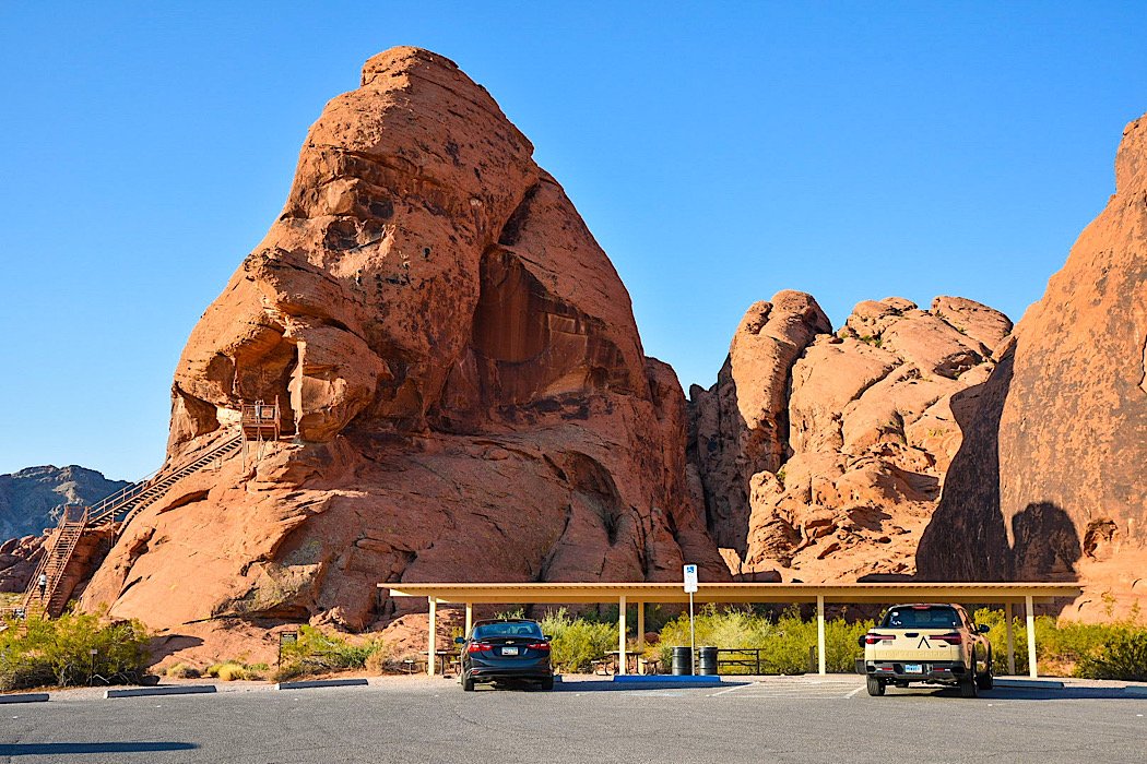
1) Atlatl Rock

SEASONAL CLOSURE: NO
TRAIL LENGTH: 0.1 MILES
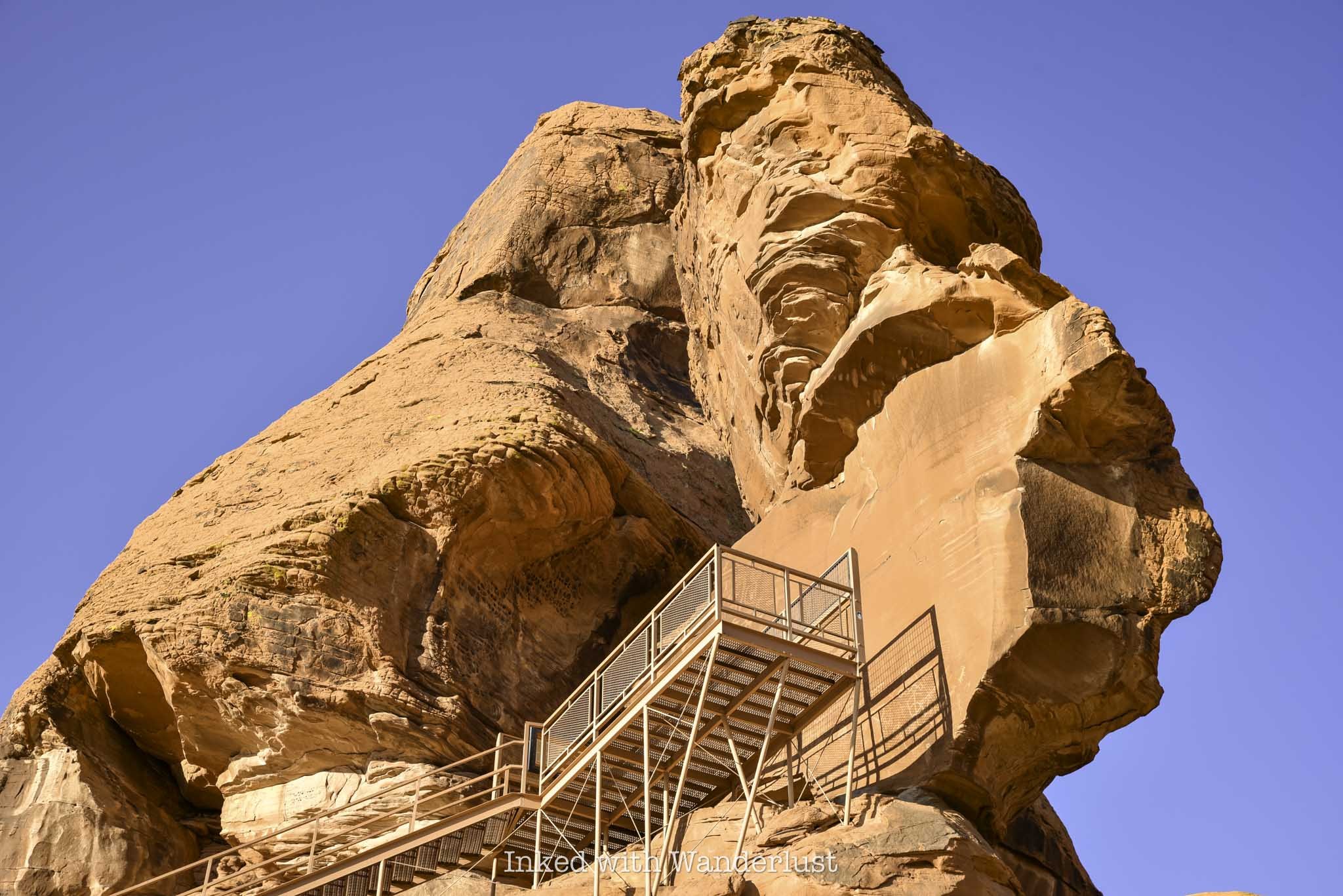
Atlatl Rock is one of the most popular attractions in the entire park. It isn't much of a hiking trail, as the stairwell and rock face are located a very short distance from the parking area. Where Atlatl Rock shines is its historical significance.
At the top of the stairwell, you'll reach a platform in front of a smooth rock face. On that rock face are several old petroglyphs which are believed to be up to 4,000 years old. Atlatl Rock isn't the only spot in Valley of Fire where you can see petroglyphs, but it's the easiest (aside from the stairwell, that is).
You can read more details about Atlatl Rock in this featured post.
2) Fire Wave Trail

SEASONAL CLOSURE: YES
TRAIL LENGTH: 1.3 MILES
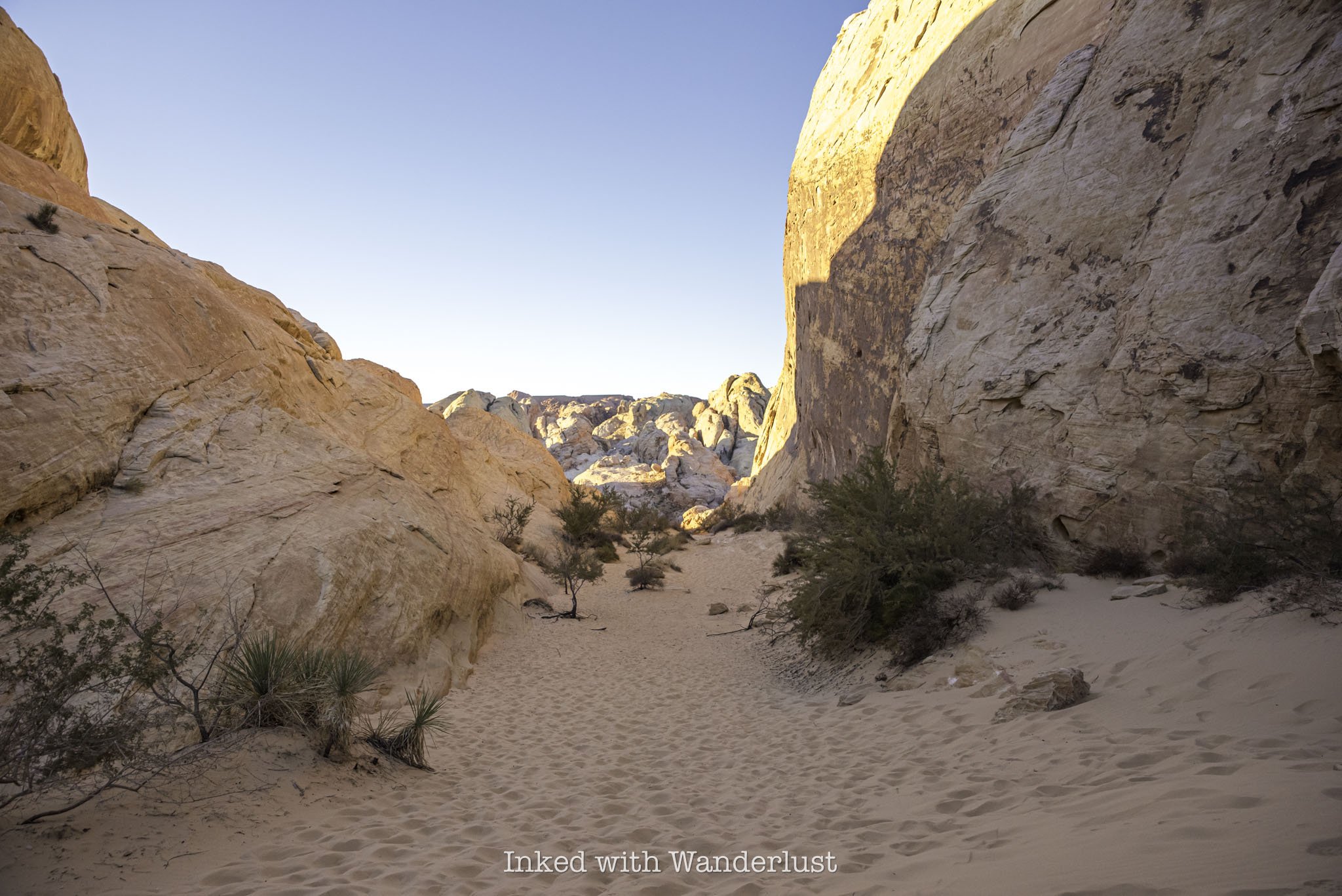
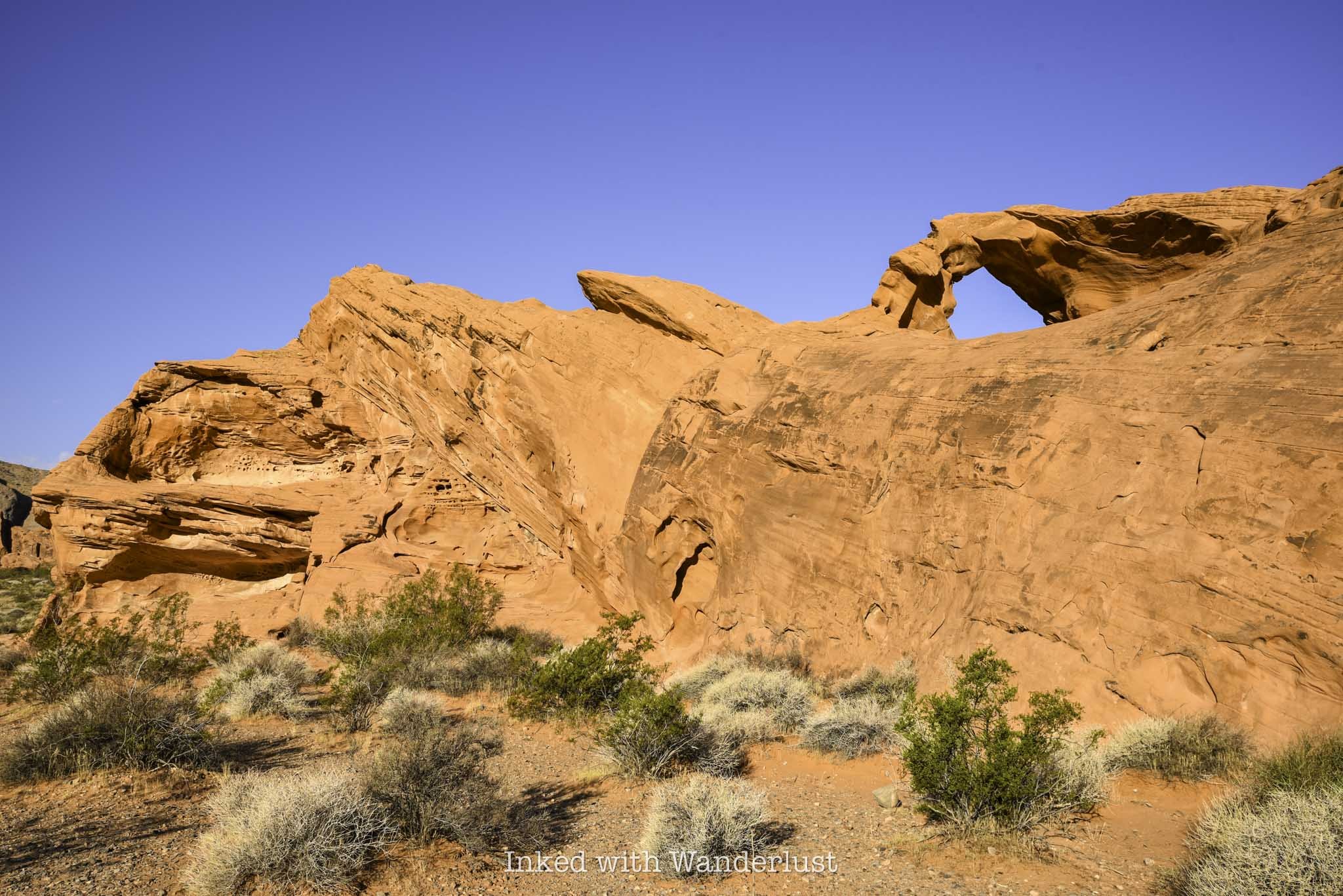
The Fire Wave is a stunning sandstone rock formation located at the backside of the park along White Domes Road. Over millions of years, shifting sand dunes compressed, creating the wavy swirls of red, white and pink stripes we see today.
Fire Wave is easy to get to via a short, well maintained trail that leaves from a fairly large parking area. Shortly after descending for about 6/10's of a mile, the Fire Wave will come into view. Getting there during the early morning light is good, but sunset is when Fire Wave comes to life.
3) Seven Wonders Loop

SEASONAL CLOSURE: YES
TRAIL LENGTH: 1.9 MILES
While not an official hiking trail at Valley of Fire, you can extend your hiking time by continuing past Fire Wave and see many other infamous Valley of Fire attractions. Hiking Seven Wonders will take you past Fire Wave and through pink rock formations at Pink Canyon.
You'll then cross White Domes Road and go through a stunning slot canyon, before heading onto additional sights like Crazy Hill, Fire Cave and Thunderstorm Arch. The loop will eventually take you back to where you parked for Fire Wave.
Since it's not an official trail, I suggest downloading the AllTrails map. While it isn't inherently difficult to follow, there are a few spots where the trail is easy to lose.
4) Mouse’s Tank Trail
SEASONAL CLOSURE: NO
TRAIL LENGTH: 0.7 MILES
Mouse's Tank Trail is one of my favorites in the park because of the story behind it. The canyon you hike through is one of the places where a Southern Paiute Indian, named "Little Mouse", took refuge after being accused of and wanted for the murders of two prospectors (and other crimes) in the late 1800's.
Additionally, the canyon walls are littered with old petroglyphs dating back thousands of years. They're easy to miss if you're not looking for them but once you spot them, they're easy to view. At the end of the canyon, you'll come across "Mouse's Tank", a natural rock basin which collects rain water.
The whole trail is less than a mile but you'll be traversing along loose, fine sand the entire time. Still, it's one of the park's most intriguing hikes with a great backstory, tons of history, and features numerous incredible rock formations. It can be found directly off of Mouse's Tank Road.
5) Petrified Log Loop
SEASONAL CLOSURE: NO
TRAIL LENGTH: 0.3 MILES
The Petrified Log Loop is an easy 0.3-mile loop trail that passes several examples of real petrified wood logs, as well as many informative displays detailing the history of the logs and how they came to be.
If you don't know, petrified logs are fossilized tree trunks that have been replaced by minerals. The process in which this is done - petrification - is essentially the process of turning wood into stone. It's a great trail for kids, as it has educational value in combination with outstanding views.
6) Elephant Rock

SEASONAL CLOSURE: NO
TRAIL LENGTH: 0.3 MILES
The trail to Elephant Rock is also an easy, 0.3-mile walk to and from the car. There's a slight amount of elevation involved, but you'll barely notice it. The trail leads to an amazing, orange-sandstone rock formation that strikingly resembles an elephant.
If you come into the park via the east entrance, the parking lot will be on your right as soon as you drive through. You'll ascend a short walk up a small hill and when you reach the top, Elephant Rock will come into view.
Additionally, Elephant Rock is clearly visible from the Valley of Fire Scenic Drive, but you cannot stop on this road to take pictures. Elephant Rock is a mega-popular attraction in Valley of Fire, so arrive early to beat the crowds.
7) Balancing Rock Trail

SEASONAL CLOSURE: NO
TRAIL LENGTH: 0.3 MILES
There's no way to classify the path to Balancing Rock as a "hike". The pathway is located on the left side of the visitor center parking lot and it's maybe a tenth of a mile to the viewing area. However, that doesn't make Balancing Rock any less impressive and worth checking out.
Balancing Rock is a stunning red rock formation where a large rock appears to precariously balance itself on top of a smaller, thinner rock resembling a pedestal. It's a visually intriguing rock formation, and a favorite amongst photographers.
8) Silica Dome/Fire Canyon

SEASONAL CLOSURE: NO
TRAIL LENGTH: 0.9 MILES
Silica Dome is a visually striking viewpoint in the northern section of Valley of Fire, right about where Mouse's Tank Road turns into White Domes Road. In the summer, it's the final spot in this area of the park where you explore on foot, as everything north of Silica Dome is closed in the summer months.
You can choose to just walk out onto the viewing platform and gaze at the stunning contrasting colors of red, white, and brown rocks seemingly stacked on top of one another, or you can take the trail into the canyon below.
Fans of Star Trek may find Silica Dome familiar, as it's the location of Captain Kirk's gravesite from the movie, Star Trek Generations. Many "trekkies" make the pilgrimage to this sight every year. However, you don't need to be into Star Trek to appreciate the visually striking views and formations.
9) Rainbow Vista Trail
SEASONAL CLOSURE: NO
TRAIL LENGTH: 1.0 MILE
The Rainbow Vista Trail, which is also located along Mouse's Tank Road, clocks in at just over a mile in length and features some of the best views in a short hike. In fact, this area of the park is where you have the best chance of seeing herds of Bighorn Sheep, as they're often found grazing near the parking lot and along the road.
This short and easy trail is known for its colorful red rock formations, as well as stunning views of neighboring Fire Canyon from the viewpoint at which the trail ends. While it doesn't close in the warmer months, it is mostly exposed. So if you're here in the summer, I would avoid this trail mid-day.
10) White Domes Loop

SEASONAL CLOSURE: YES
TRAIL LENGTH: 1.1 MILES
White Domes Loop, located at the northernmost point you can drive in the park, is my personal favorite Valley of Fire hike. To get to it, drive north on Mouse's Tank Road from the Valley of Fire Scenic Byway. After a couple miles, the road will become White Domes Road (just past Rainbow Vista). From there, drive another four miles until you reach the road's terminus at the White Domes day-use area.
Along this 1.1-mile loop, you'll encounter a variety of red, orange, and white sandstone formations, as well as an old movie set, slot canyon, and the white dome rocks for which the trail is known. If you're up for a longer hike, you can extend it another 7-miles or so by combining it with the Prospect Trail.
White Domes Loop is one of the most popular short hikes in Valley of Fire, so arrive early to beat the crowds. Additionally, this trail is on the seasonal closure list, so you'll need to visit between the months of November and April in order to experience it. You can read my comprehensive post on White Domes Loop here.
Do you plan to visit Valley of Fire this year? If so, let me know in the comments below. If you have any questions, you can leave them there or ask me on my Facebook page.

White Domes Loop Trail: A Valley of Fire Hike
The White Domes Loop Trail, located in Valley of Fire State Park, is one of the most popular trails in the entire park. Its trailhead is located at the terminus of Mouse’s Tank…
Disclosure: This post contains affiliate links. If you make a purchase through these links, I may earn a small commission at no additional cost to you. I only recommend products or services that I believe will add value to my readers.
The White Domes Loop Trail, located in Valley of Fire State Park, is one of the most popular trails in the entire park. Its trailhead is located at the terminus of Mouse’s Tank and White Domes Roads in the park’s north section.
This short, yet stunning Valley of Fire hike takes you through jaw-dropping scenery consisting of white sandstone formations which starkly contrast with the vibrant reds and pastels. Additionally, it’ll also take you through a narrow, but brief slot canyon.
Before heading out on this hike, there are a few things you should know first. In this post, I’ll discuss topics such as the trail’s seasonal closure, what to expect along the trail, some tips that’ll help ensure a smooth experience, and more. Let’s get into it.
Trail Stats
Location: Valley of Fire State Park in southern Nevada
Fee: $10 for Nevada license plates / $15 for non-residents to enter the park
Open: Typically between early October and mid-May.
Family Friendly: Yes
Cell Service: Spotty (based on Verizon service)
Restroom: Multiple in the trailhead parking lot (vault style)
Parking: Large paved lot with multiple parking spots
EV Stations: None
Difficulty: Easy to moderate
Popularity: High
Milage: 1.1 miles
Elevation Gain: 177 foot gain
Condition: Well maintained and easy to follow
Features: White, red, and pastel colored sandstone formations and slot canyon
Best Experienced: When open, in the morning
Pets: Allowed, must be leashed
Drone: Prohibited
Hazards: Rocky/sandy decents, sun exposure, and possible wildlife encounters
My Visit(s): 2023 and 2024
White Domes Trail Seasonal Closure
Valley of Fire is just an hour or so from the bright lights of Las Vegas but here, there are no air conditioned casinos to duck into when it gets too hot. Valley of Fire is pure desert. So when it gets hot, it gets really hot.
So much so that it isn’t unheard of for the heat to go well into triple digits in the summer months, making hiking a potentially dangerous, or downright life-threatening activity. In 2023, two women were found dead on the closed Prospect Trail, on a day where temperatures reached a scorching 118 degrees.
To prevent senseless loss of life, Valley of Fire officials enact seasonal closures of a handful of trails, White Domes being one of them. The exact dates change slightly year over year but generally, White Domes Trail is closed between mid-May and early October. You can monitor exact dates here.
You can still drive the highly scenic White Domes Road (which begins shortly after Rainbow Vista) and can access White Domes’ day-use area, but the trail itself is off limits during that period. Please respect the closure. If not, you risk fines, arrest, and death. No trail is worth that.
White Domes Trail Parking and Trailhead

To reach the parking lot and trailhead for White Domes Trail from either entrance of Valley of Fire, make your way to Mouse’s Tank Road, which is where the current visitor center is located. From the visitor center, it is roughly 15-minutes to the trailhead.
Drive along Mouse’s Tank Road for a few miles. When you pass Rainbow Vista on your right, the road will become White Domes Road. Continue for another couple miles until you reach the literal end of the road at the White Domes Trail parking lot.

The parking lot is large and paved, with spaces for many vehicles, including RVs. It isn’t unheard of to see tour busses parked here as well. At the trailhead are two restroom structures. In my experience, they’re not well maintained, so bringing your own biodegradable toilet seat covers and hand sanitizer would be wise (trust me on this).
Behind the restrooms, you’ll find a series of craggy, white sandstone towers with pastel stripes, a sneak peak into what awaits you on the trail. To the right of the restrooms are multiple covered picnic tables available for use. To the left are information boards. Between them and the restrooms is where the trail begins.
White Domes Loop Trail - What to Expect
Beyond the parking lot, you’ll start going slightly uphill on a trail consisting of fine, reddish-colored desert sand. There will be periods where the sand becomes a bit compact and moments where you’ll be traversing along solid, rocky ground but for the most part, you’ll be hiking through sand.
This is why I rated the trail as easy to moderate. Overall, this is an easy hike, but the fine sand takes the challenge level up a slight notch, particularly for those used to hiking on compact dirt. Soon into the trail, you’ll need to descend a series of rocky steps. Watch your step here.
The sandstone walls around you get higher and higher as you descend into the canyon. This is also where you’ll see a variety of unique sandstone formations that Valley of Fire is famous for, where no two formations are the same.
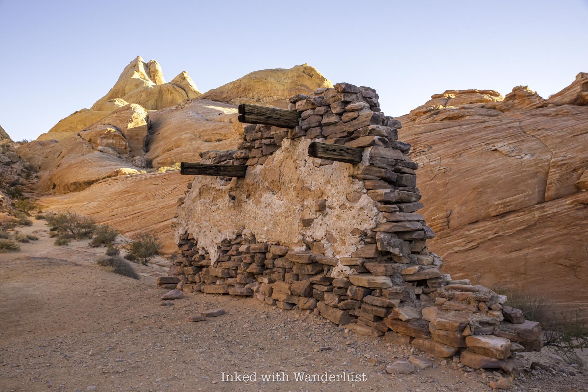
When you reach the bottom, the ground begins to soften again as you rejoin the sand-based trail. Up ahead, you’ll take notice of a man-made structure. This structure was part of a set piece for the 1965 movie, “The Professional”, which was partly filmed here. There’s a monument adjacent to the structure detailing Valley of Fire’s ideal location for filming westerns and the like.
Past the filming location, keep to the left to rejoin the trail. You’ll see a pile of rocks with a black trail marker guiding the way. When you descend further down the rock and back onto sand, you’ll turn right at the junction. Up ahead is another featured aspect of White Domes Trail - the slot canyon.
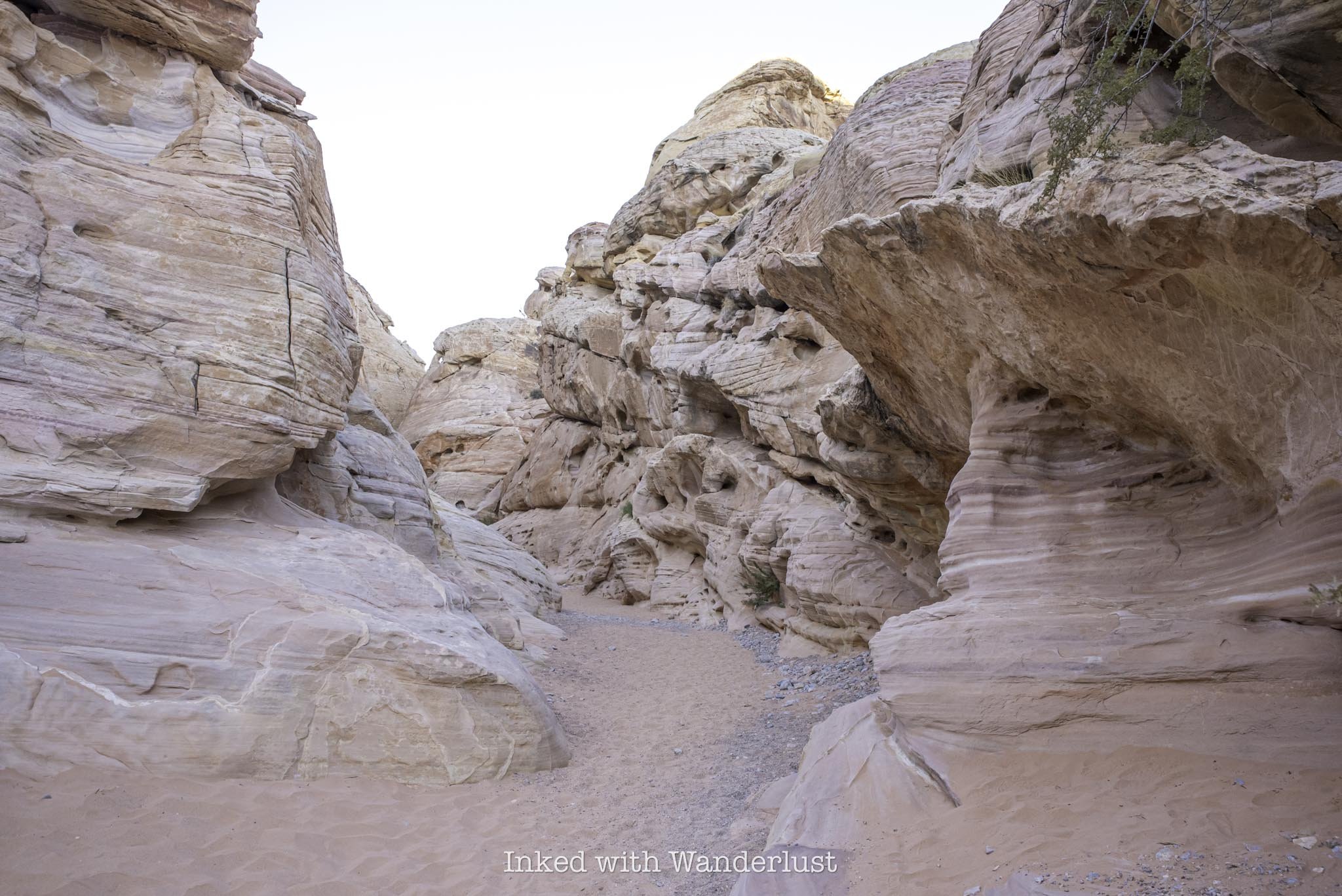
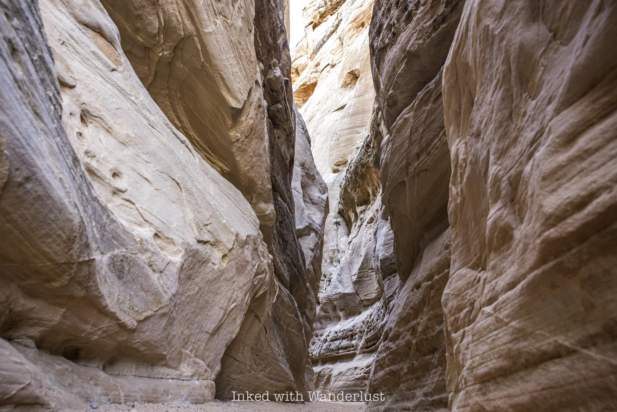
The entrance to the slot canyon is wide at the beginning, but quickly narrows as you progress, though not to the point where you’ll need to squeeze through it. The walls of the slot are a beautiful mixture of white and pastel waves, gliding through the sandstone. You would think it was painted on if you didn’t know any better.
The slot canyon is brief, taking mere minutes to get through. When you get to the other side, the trail continues to the right, up and over more rock. At this point, the ground becomes solid again, making for an easier trek.
This side is where the white domes aspect of the trail becomes more apparent. If you’re here early in the morning, you’ll see the pastel colors shine stunningly as the sun rises on the dome formations. Most of these are on the left side of the trail. On the right side, you’ll see mostly burnt-orange sandstone. The contrasts are truly a sight to behold.


Before long, you’ll reach the point in the trail where it again veers to the right, between two rock formations (pictured above). Past this point, the trail will briefly align with White Domes Road and lead you back to the parking lot, concluding your hike.
Accounting for some picture taking and additional exploring, hiking the White Domes Trail shouldn’t take longer than an hour or two, dependent on your level of fitness and experience, and how often you stop.
When is the Best Time to Hike White Domes Trail?
Obviously, the summer months are out due to the seasonal trail closure discussed above. That leaves early spring, mid-fall, and the entirety of winter. In case you’re wondering, yes, it does snow in Valley of Fire, but it’s rare and even when it does, it isn’t for long and melts away quickly.
My recommendation is to visit the park, and the White Domes Trail, in November. That’s when I came for my second visit and the weather was pleasant. The temperature maintained a comfortable 65 degrees throughout the day. The early morning was cold, though, so dress in layers.
My other recommendation is to start this trail early. White Domes isn’t nearly as sun exposed as nearby Fire Wave and Seven Wonders but in the middle of the day, it’ll definitely beat down on you. By starting your hike early in the morning, the canyon walls will provide shade for much of the hike.
Keep in mind that this will diminish the “pop” of the sandstone colors. If you’re here specifically for photography, that may not work for you. Conversely, if that doesn’t bother you, then you can’t beat morning. My Dad and I started shortly after sunrise and not only did we have plenty of shade, we had the trail all to ourselves until the very end.
PSALM 23:3-4

How to Spend a Few Hours at Valley of Fire in the Summer
Valley of Fire offers a variety of hiking trails, a visitor center with informative exhibits and many historical sites. There’s…
Disclosure: This post contains affiliate links. If you make a purchase through these links, I may earn a small commission at no additional cost to you. I only recommend products or services that I believe will add value to my readers.
Established in 1935 as Nevada’s first state park, Valley of Fire attracts thousands of hikers, photographers and overall nature enthusiasts annually. It’s located in southern Nevada, just an hour so from the bright lights of the strip and is one of the most popular things to do near Las Vegas.
Valley of Fire offers a variety of hiking trails, a visitor center with informative exhibits and many historical sites. There’s literally something for everybody in this geological wonderland.
While I always recommend spending at least a full day at the park, the reality is, the extreme heat that Valley of Fire sees in the summer is simply too much for many people. It’s quite common to see high triple digits consistently.
Thankfully, Valley of Fire offers many attractions that are easy to see, with most only requiring a small commitment of thirty minutes or less, allowing you to see many of the highlights in a short amount of time.
So if you’re thinking about visiting Valley of Fire in the summer, but you can’t stand the heat and only have a few hours to spend, you’ve come to the right blog. Let’s get into it!
Valley of Fire Entrances, Fees & Reservations
Before we get into the fun stuff, there are a few things you need to know before traveling to Valley of Fire. For starters, no, day-use reservations are NOT required at Valley of Fire at this time. However, with the recent launch of the Reserve Nevada website, I wouldn’t be surprised to see it happen eventually as it’s the most popular state park in the state.
On the flip side, yes, you will have to pay an entrance fee. Thankfully, the fees aren’t all that high and if you’re driving a car with a Nevada license plate, you’ll get a discount! As of 2024, day-use entry fees are as follows:
$15 - Non-Nevada vehicles
$10 - Nevada vehicles
You can pay with a credit/debit card or cash. If the ranger booths aren’t staffed when you arrive, simply pull into the parking lots to the right to pay. If paying with cash, insert cash into the provided envelope and slip that into the iron ranger.
Conversely, you can still pay with a credit or debit card at the digital self-pay stations. Keep in mind that there’s always a chance that those pay stations will be offline, so it’s best to bring cash with you just in case (it happens more than you think).
There are two entrances at Valley of Fire; the east entrance and the west entrance. If you’re coming from Las Vegas, you’ll likely drive through the west entrance. Conversely, if you’re driving from Lake Mead/Hoover Dam, Arizona or Utah, you’ll likely go through the east entrance.
Additionally, there are only two main roads in the park; the Valley of Fire Highway (or, Valley of Fire Scenic Byway) which runs east to west, and Mouse’s Tank Road (or, White Domes Road) which takes you to the northern section of the park.
Navigating the park is easy, so you don’t need to rely on GPS too much. Keep in mind that cell service in the park is spotty to non-existent in most areas of the park. There are roadside signs all along the road announcing which attractions you’re approaching, though.
Lastly, be sure to heed the ominous signs at the park’s trailheads. They may seem dramatic, but many heat-related deaths have occurred in the park over the years. There isn’t much shade on any of the trails. I had my own scary experience while hiking in Red Rock Canyon, making me a believer.
For pleasant, somewhat cooler weather, early October to April are the best times to visit Valley of Fire. Though fall and spring sees the biggest crowds for that very reason.
If your aim is to visit with the least amount of people around as possible, then the summer months are your best bet. You will be contending with peak temperatures, though, so an early arrival is paramount to an enjoyable experience in the summer.
Here are some products that I recommend bringing to the park with you to help combat the heat:
Things to See at Valley of Fire in a Few Hours
While it would be easy to spend two or three days at this beautiful park, you can just as easily spend a few hours due to the park’s many easily accessible attractions. Below, I’m going to provide a list of things to see and do in Valley of Fire that will allow you to see many of the highlights in a relatively short amount of time.
This itinerary will list the attractions in the order that they appear in the park and will assume you’ll be driving in from Las Vegas, through the west entrance (if you’ll be driving in through the east entrance, just complete this itinerary in reverse order).
Remember, the goal is to arrive at the park as close to sunrise as possible. This will allow you to see everything listed below and be out of the park by 11am or so, when the heat and crowds are at their worst.
Keep in mind that certain trails are closed in the summer months due to extreme heat, so in respect to responsible travel, I will be omitting those from the list. For informational purposes only, the following trails are closed from mid-May to October:
Seven Wonders Loop
Pinnacles Loop
Prospect Trail
Arrowhead Trail
Natural Arch Trail (excluding Natural Arch itself)
Charlie’s Spring
The Beehives
After driving in through the west entrance, the Beehives will be the first major attraction you’ll see and the large parking lot will be on your right.
The Beehives themselves are located right off the parking lot. There’s no designated path to follow, so feel free to explore them at your leisure.
You’ll quickly realize why they were named, “Beehives”, as you’ll see many honeycomb-like formations in the sandstone rocks. I feel that they’re the perfect introduction to Valley of Fire and a great place to watch the sunrise.
Atlatl Rock
From the Beehives parking lot, drive east for a couple of miles until you see the turn-off for Campground road on your left. You can see Atlatl Rock from the highway but as you get closer, its commanding presence becomes more and more clear.
Aside from the large rock itself, the main draw to Atlatl Rock are the petroglyphs on the smooth rock face near the top. Simply take the steel staircase to the viewing deck above to see them.
The parking lot is fairly large, located just off the road, and features a restroom as well as a half a dozen or so shaded picnic tables. This makes Atlatl Rock an ideal spot for a quick break.
Atlatl Rock doesn’t take long to explore, as most of the petroglyphs are located in one central location. Though there are others scattered through the neighboring campground as well.
For more information, read my comprehensive guide on Atlatl Rock here.
Natural Arch
To see Natural Arch, turn left onto Campground road going out of the Atlatl Rock parking lot and follow it for about a mile. It’ll be on the left side of the road.
There’s no real parking lot, just a small pull-out style, dirt and gravel lot. In the morning, the view from the roadside will be dulled by the shade but if you walk behind it, you’ll discover a brilliantly lit Natural Arch in front of you.
Natural Arch isn’t the most impressive sight you’ll see at the park, but there aren’t many of them here and this one is the easiest to access. It’s small, but a sight to behold nonetheless.
To continue on your journey, simply turn back towards Atlatl Rock and the Valley of Fire Highway. If you continue down the road in the opposite direction, the road will become harder to pass as it isn’t well maintained (or even paved).
There are other formations down that road, such as Piano Rock, that are worth seeing but as stated above, the road becomes difficult (though not impossible) for those without high clearance. If you do go that way, the road will eventually loop you back to the highway, just before the Beehives. Turn left to continue.
Historic Cabins
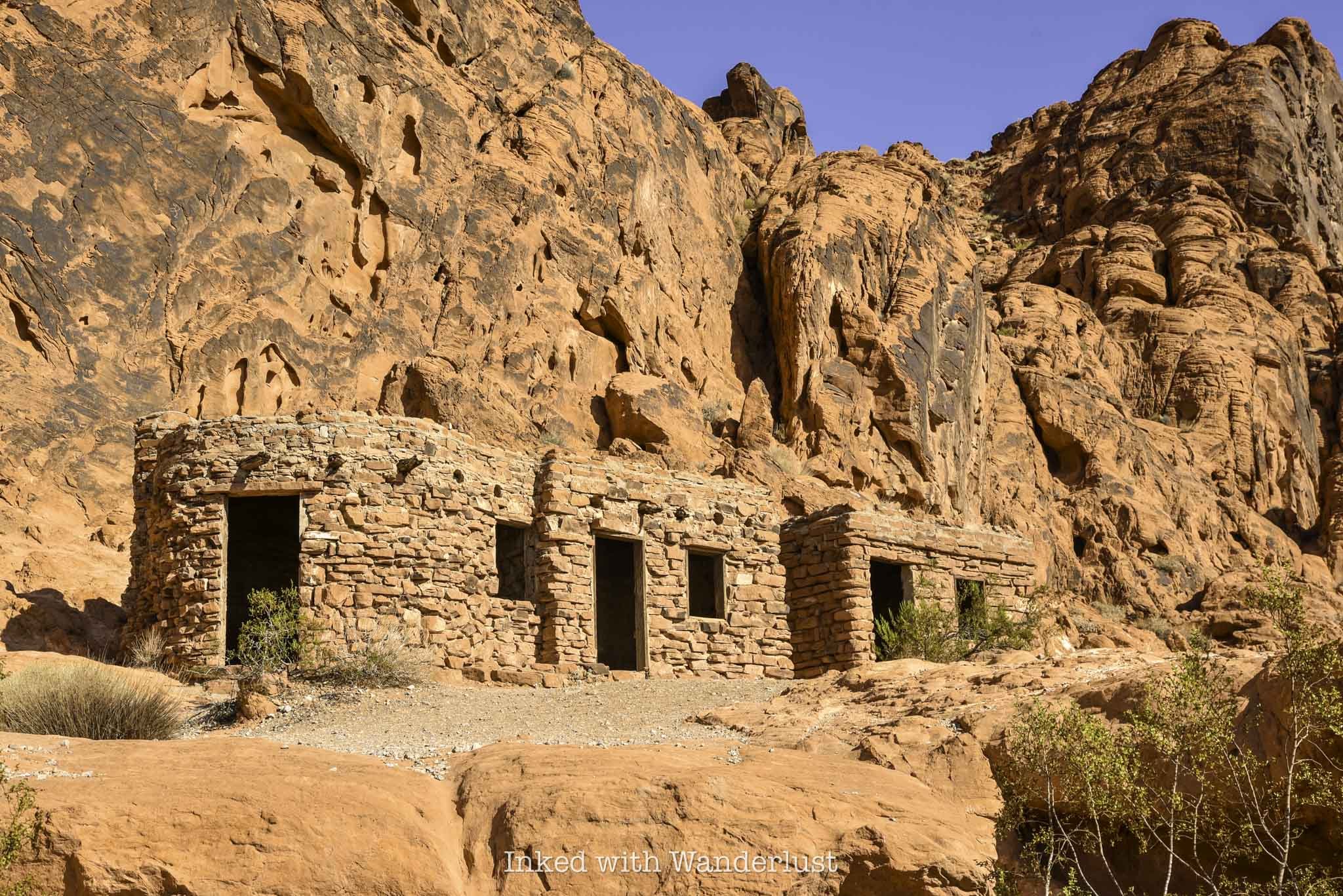
After leaving Natural Arch, turn left to get back onto Valley of Fire Highway to continue onto next attraction; the Historic Cabins. You’ll travel another five miles or so until you reach an un-named road on your left that leads to the cabins (there will be sign indicating the cabins are down that road).
The well maintained road will terminate at an eventual dead end lot, with the cabins out in front of you. There will also be another restroom and picnic area.
The cabins were built by the Civilian Conversation Corps (C.C.C) shortly after Valley of Fire became a state park in 1935 and were made with native sandstone. Their intended use was to provide shelter to travelers.
You can explore the exterior and interior of the preserved cabins. You’ll take notice of the built-in fireplaces and windows overlooking the valley in the distance.
Elephant Rock
Elephant Rock is one of the most infamous, Instagram worthy rock formations in Valley of Fire. Seeing it in person, it won’t take you long to make out the shape of the trunk, head, body and legs.
From the cabins, turn left onto the highway and follow it for a few more miles until you see the east entrance ahead of you. The parking lot for Elephant Rock is to your left, just before the exit.
The trail to Elephant Rock is a short, 0.3-mile jaunt that leads you right up to it. From there, you can scramble your way up for a closer look (but don’t climb on it).
To read more about Elephant Rock, read my comprehensive guide here.
Visitor Center and Balanced Rock

By now, you’ve undoubtedly worked up a sweat. It’s time to get out of the sun and head to the Visitor Center. To get there, travel west from Elephant Rock (the way you came) for three and a half miles. You’ll eventually come up upon Mouse’s Tank road on your right. Turn here and keep straight at the fork to get to the parking lot.
The Visitor Center is a great way to escape the heat for a bit. While the A/C is great, the best part about it are the exhibits that detail the extensive history of Valley of Fire. From Native American artifacts and geological education, to examples of native flora and fauna, there’s much to learn here.
Once you’ve cooled off, head back outside to the short but sweet trail to Balancing Rock. Facing the Visitor Center, you’ll find the trailhead on the left side of the parking lot. As stated above, the trail is short, even more so than Elephant Rock’s trail. It’ll terminate at a small viewing area that puts you front and center to Balancing Rock.
Much like Natural Arch, Balancing Rock isn’t the most impressive thing you’ll see at Valley of Fire, but it’s so easy to see that it would be a crime not to check it out. When you’re done, head back to your car and drive north on Mouse’s Tank road.
Mouse’s Tank Trail
The trailhead for Mouse’s Tank Trail (or, Petroglyph Canyon) is located just off of Mouse’s Tank road on your right. I found more shade on this trail than any other I went on during my visit.
Mouse’s Tank Trail (along with the road) is named after, “Little Mouse”, a Southern Paiute Indian renegade who hid in areas of Valley of Fire after being accused of the murders of two prospectors (among other crimes).
The trail takes you through a canyon, with walls loaded with prehistoric petroglyphs. It terminates at Mouse’s Tank, which is a natural basin inside the rock that collects water after each rainfall.
Mouse’s Tank Trail is only half a mile, roundtrip, and if you get on the trail prior to 11am like I did, you’ll have plenty of shade throughout much of it.
The ‘Instagram View’ of Mouse’s Tank Road
Mouse’s Tank road is undoubtedly one of the most scenic roads in all of Nevada. You’ve seen it all over social media, Instagram specifically, and it’s been plastered all over ads on TV, casino wall posters, etc.
If you’re wanting to get your own photo of this magnificent sight, there’s a much simpler way to do it than what other websites specify. You won’t need coordinates or have to pull over into one of the narrow slots on the side of the road.
Simply drive along Mouse’s Tank road until you see the parking lot for the Rainbow Vista Trail on your right (you can’t miss it). Park your car here, cross the road and walk along the rock until you reach the overlook perch at the end. Voila, you’re there.
Other sites I’ve seen overcomplicate it way too much. Doing it this way is way easier and it’s mostly the exact same view, albeit a bit higher. I feel it’s superior to other angles I’ve seen,
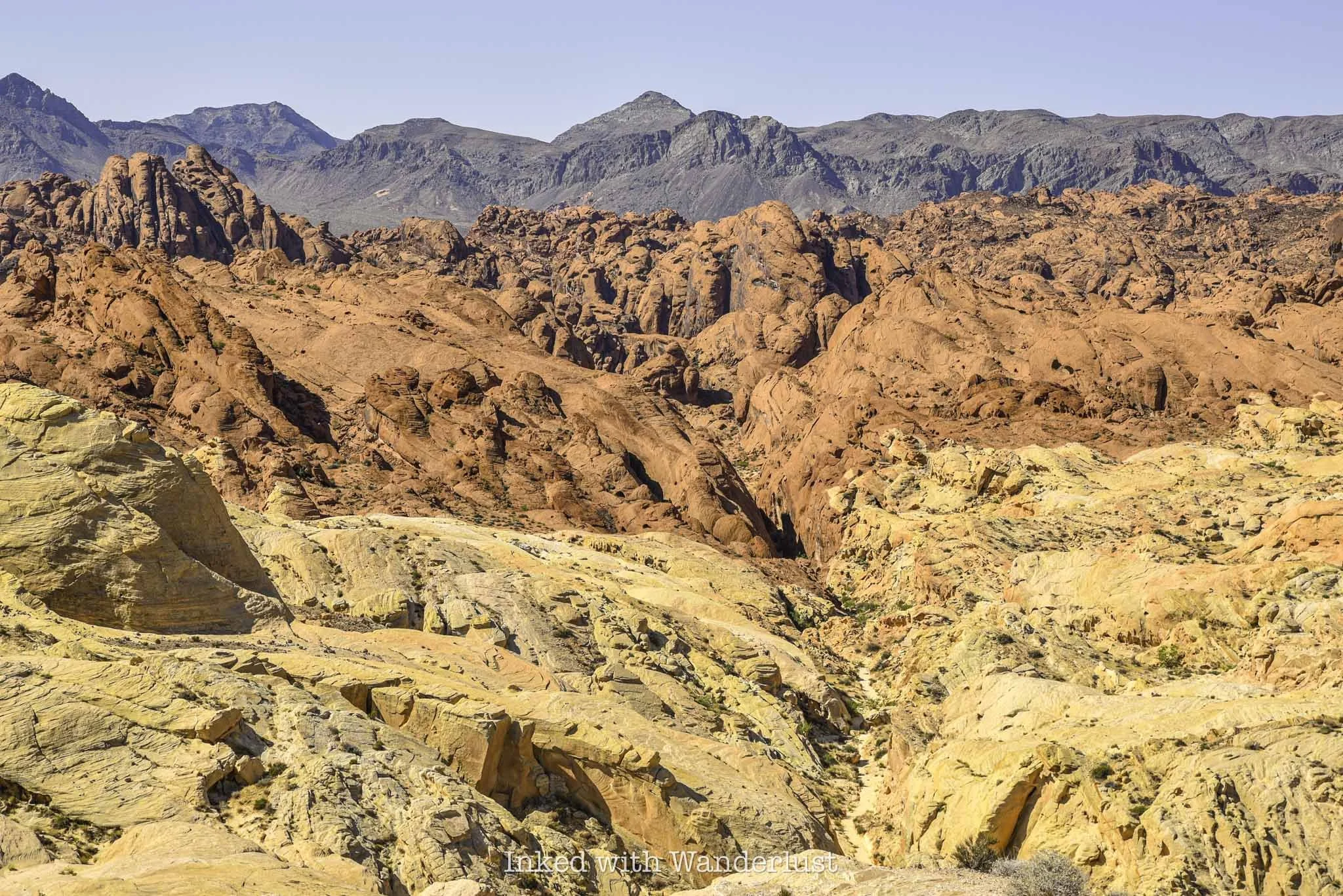
Fire Canyon/Silica Dome Viewpoint

To get to the next stop, head north from the Rainbow Vista parking lot (turn right). Shortly thereafter, you’ll make a right turn onto Fire Canyon road and follow it to its terminus at the parking lot.
There are a number of trails that begin here but for my money, the main attraction is the view. In front of you are examples of sandstone and silica rock. The multi-layer, contrasting reds of the sandstone on top of the yellow/tan tint of silica with the browns of the mountain range in the distance make a stunning sight.
You can walk out onto the dirt path that leads to a viewing area or simply take a gander from the parking lot. Either way, it doesn’t take much time to enjoy the sights at this lookout.
Drive the Remainder of Mouse’s Tank Road and Take in the Views
To complete your visit, turn right onto Mouse’s Tank road and drive it for 4.5-miles to its terminus at the White Domes parking lot. The trails in this area of the park are closed in the summer, mind you, but you can still drive the highly scenic road.
From the road, you’ll see teasing glimpses of Pastel Canyon, White Domes and Fire Wave. You cannot park alongside of the road on this stretch, but there are multiple parking lots dotted along the road where you can stop to take pictures.
From here, simply head back towards whichever exit you need to leave from. Remember, this itinerary is assuming you’re driving in through the west. If coming in through the east, simply begin at Elephant Rock and end at The Beehives, before making your way up Mouse’s Tank road.
Conversely, if you’re driving in through the west entrance but exiting the east, simply knock out the sights along Mouse’s Tank road after visiting Natural Arch and then work your way east to the cabins and Elephant Rock.
The route above is the one I followed during my first visit. I was able to see and do everything listed above, while being out of the park by noon. Good thing, because it got up to 113 degrees that day (I went in August).
Your milage will vary depending upon how much time you spend at each site. In general, though, you shouldn’t have much of an issue. If you need to shave even more time, I recommend skipping Natural Arch, Balancing Rock and perhaps even the Visitor Center.

How to See Elephant Rock at Valley of Fire
Located on the east side of Valley of Fire State Park, just inside the entrance, sits a sandstone formation so unique…
Disclosure: This post contains affiliate links. If you make a purchase through these links, I may earn a small commission at no additional cost to you. I only recommend products or services that I believe will add value to my readers.
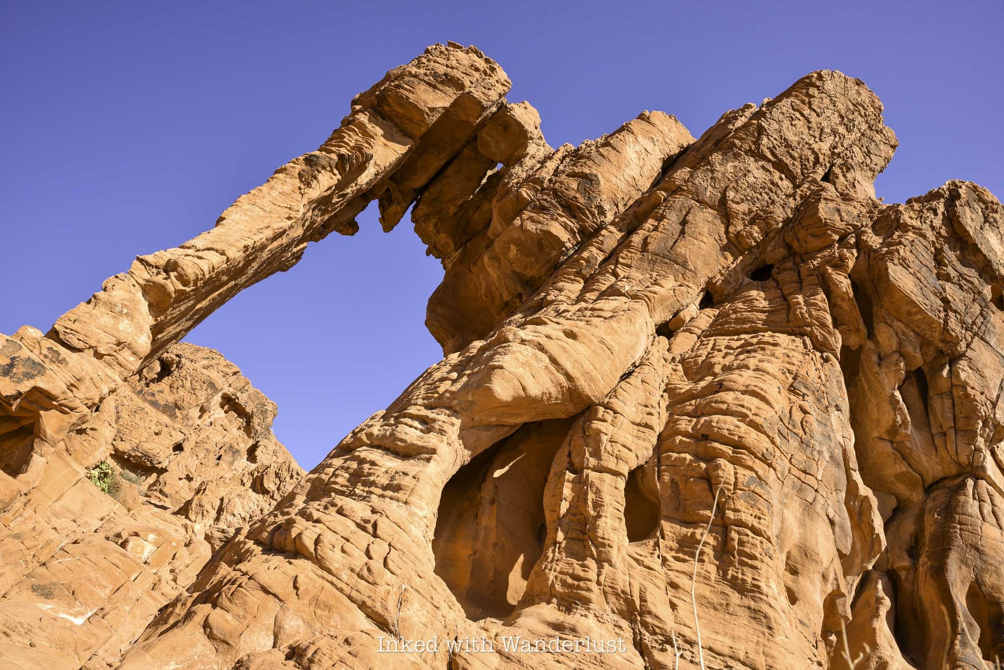
Located on the east side of Valley of Fire State Park, just inside the entrance, sits a sandstone formation so unique that it has become one of the most popular in the park - Elephant Rock.
From nearly any angle, you can make out the shape of the trunk, head and body of an elephant. When using your imagination, you’ll start to notice the outline of legs in the rock. It’ll make you question if you’re actually looking at a formation, or an actual mammoth encased in rock.
Elephant Rock is a must-see when visiting Valley of Fire for the first time. It’s easily accessible and something the whole family can participate in.
So how do you get to Elephant Rock? What is the trail like? What’s the parking situation? I answer all of these questions and more below. Let’s get into it.
Click/tap the ad to see offer details.
Trail Stats
Location: Valley of Fire State Park, Southern Nevada
Fee: $15 per vehicle day use fee ($10 for Nevada plates)
Permit: None
Open: All year
Cell Service: Spotty
Restroom: At the trailhead
Parking: Small, paved lot at the trailhead
EV Stations: None
Difficulty: Easy
Popularity: High
Mileage: 0.3 miles, RT
Time: 30 minutes to 1 hour
Elevation Gain: About 50 feet
Condition: Maintained
Features: Sandstone formation in the shape of an Elephanet
Best Viewed: Early morning for low crowds, late afternoon for best light
Pets: Not allowed
Drones: Not allowed
Hazards: Heat can be extreme and little-to-no shade
Our Visit(s): August 2023
Parking at Elephant Rock & Getting There
The ease of getting to Elephant Rock highly depends on which entrance you’re entering the park through. Elephant Rock is just past the east gate, on the right. So if you’re driving in on this side, you’re already there.
If you’re entering through the west gate, though, you’ll need to drive for eleven miles on the Valley of Fire Scenic Byway to the east gate, passing other attractions along the way, such as; The Beehives, Atlatl Rock and Mouse’s Tank Road.
The parking lot for Elephant Rock is fairly small and paved, capable of holding a fair amount of vehicles. When the gate is unstaffed, this lot doubles as a place to park for visitors to pay their entry fees.
When I was here in August, my vehicle was the one of only two in the lot. Due to extreme heat, summer isn’t an ideal time to visit Valley of Fire, so visitation was low on this day.
If you come during the peak season, which is October through April, that’ll likely be different. On a particularly busy day, I can see this lot filling up early and quickly. So arrive as early as possible.
To find the trailhead, simply walk between the brick structure and the Valley of Fire photo opp sign on the right. You’ll find the trail behind the structure leading towards the sandstone ridge in the distance.
The Trail to Elephant Rock
The trail is short and sweet with very little elevation gain. You’ll be walking uphill nearly the entire way but it’s nothing difficult. In fact, until you get close to Elephant Rock, it’s barely noticeable.
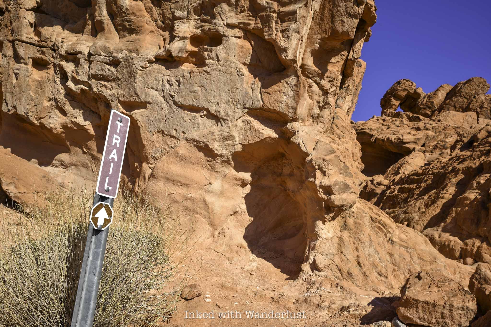
There’s only one trail junction. You will find it at around the halfway mark. Going right will place you on the 1.2-mile Arrowhead Trail. To keep to Elephant Rock, continue left.
Shortly after the trail junction, you’ll notice the trail is leading you back towards the road. Once you are aligned with the road, you’ve reached the end of the trail. Elephant Rock will be to the right of the road, looking up.
Do keep in mind to stay off the road. Visibility of this area from the vehicle perspective isn’t very good, as they’ll be coming up a hill towards you.
Elephant Rock

Elephant Rock is easily viewed from below, with no real reason to force yourself to climb up to it. There are a number of paths leading the way if you choose to do so, though.
There is a sign stating there’s no climbing allowed. I asked a park ranger for clarification and she advised that it is ok to go up to Elephant Rock, but NOT to actually climb on it, as it could cause irreversible damage.
As stated above, there are several paths leading towards the formation, but the one I took (and appeared to be the easiest) was the one located just to the right of the sign pictured above.
It’s a quick jaunt to the top of Elephant Rock. Once you’re up there, you will have views of the mountains and valley in the distance.

Seeing Elephant Rock from this angle made the “Elephant” formation appear more clearly to me. So if you’re having a difficult time picturing it from below, try it from up here.
When you’re done, simply head back the same way you came in on the trail. Please do not walk along the road as park rangers will cite you if you’re caught.
From here, I recommend making your way to one of the most historic locations in the park, Atlatl Rock. You can read my post about it here.

How To See Atlatl Rock in Valley of Fire
Valley of Fire is one of the most popular parks in the entire Nevada state park system, and for good reason. This beautiful…
2 minute read | may contain affiliate links
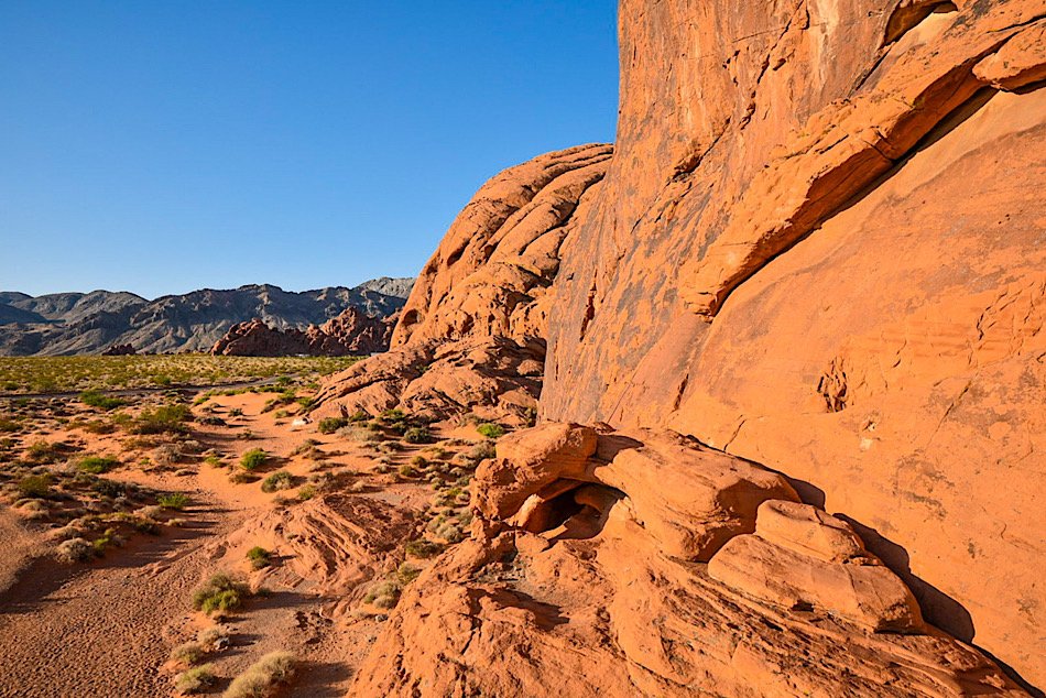
Valley of Fire is one of the most popular parks in the Nevada state park system, and for good reason. This beautiful park is littered with fire-red sandstone rocks that, with the help of erosion, have formed mind-boggling shapes and formations.
There are many attractions within Valley of Fire, but the one that stands out from the pack due to its historical value is Atlatl Rock. It’s one of the first things you’ll see if you’re driving in from the west entrance and is easily seen from the main road.
Aside from its unique formation, the big draw to Atlatl Rock are the petroglyphs located on the smooth rock face at the top of the stairwell and others scattered around the base of the rock. These petroglyphs are believed to over 4,000 years old!
So how do you get to Atlatl Rock? What’s the parking situation like? Are there any fees involved? I cover all of this and more below.
Trail Stats
Location: Valley of Fire State Park in Southern Nevada
Fee: $15 per vehicle ($10 for Nevada residents). This is to enter Valley of Fire
Permit: None
Open: All year
For: Anyone
Cell Service: Spotty
Restroom: In the parking lot
Parking: Medium sized paved lot
EV Stations: None
Difficulty: Easy
Popularity: High
Mileage: Walk-up
Time: At least 30 minutes
Condition: Well maintained and easy to follow
Features: Petroglyphs and unique rock formations
Best Viewed: In the morning (less crowded)
Pets: Not allowed
Drones: Prohibited
Hazards: No shade on the stairwell or platform.
Our Visit(s): August 2023
What is an Atlatl?
An atlatl, the namesake of this location, was an tool used by ancient tribes as a throwing stick or dart thrower. It allowed the user to employ more force to their spears or darts.
An atlatl was usually made of wood, about two feet long and had a handhold on one end with a hook on the other. A slot cut into the tail end of the dart was set against the nook enabling the dart to lie along the atlatl so that both could be grasped midway.
There was no signage explaining why this rock was named after this ancient tool, but one reason could be that there are multiple petroglyph illustrations of the tool on the rock.
Getting There & Parking
Getting to Atlatl Rock is easy, as it’s located just off the main road in the park. It’s closest to the west entrance of the park, but getting there from the east entrance is just as easy.
From the west entrance, drive for about 4 miles before turning left onto Campground road. You’ll keep straight for about a half mile before turning left into the parking lot. The directions are virtually the same coming from the east entrance. Though you’ll drive a few more miles.
The parking lot is decently sized, but it will fill quickly as the day progresses. Your best bet is to arrive early in the morning. I was here about an hour after sunset and there were just a few others at the rock.
There are covered picnic tables near Atlatl Rock you can use, as well as a restroom at the far end of the lot. From what I could see, there was only one spot designated for disabled parking.
Atlatl Rock Petroglyphs
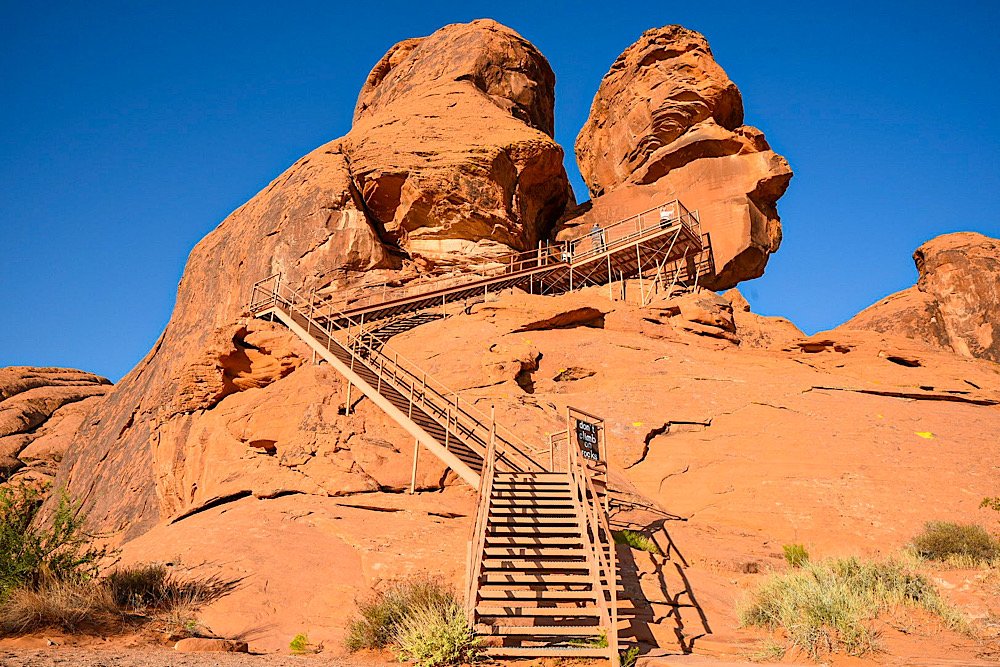
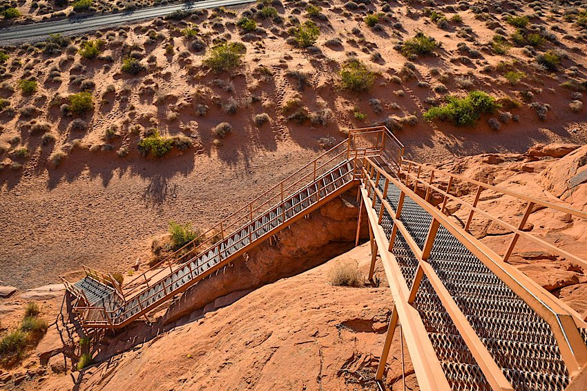
To reach the main petroglyphs on the smooth rock face at the top, you’ll need to go up the stairwell. There are three sets of stairs, totaling about 100 steps or so.
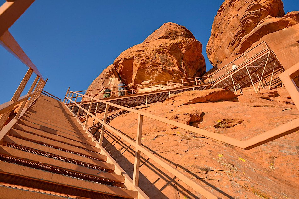
The downfall to being here early in the morning is you’ll be hit by the sun full-blast as it’s rising. There’s no real cover from the sun on the stairwell or on the viewing platform up top.
The upside is as the sun hits the rock, you get the full color show those fire-red sandstone rocks put on. It’s an amazing sight to behold.
Before long, the petroglyphs come into view. From what I could see, the smooth rock face is the only location (at the top) where petroglyphs can be found.
Just above the smooth rock face on the bottom side of a rocky lip are dinosaur tracks. Unfortunately, the close up shot I got of them was lost, but you can see them in the photo below from further out.


As stated in the beginning of this post, these petroglyphs are over 4,000 years old. As such, there’s no way for us to know exactly what the ancient tribes were trying to convey, but you can see a mixture of illustrations of presumed animals, possible portraits of tribal members and other symbols.
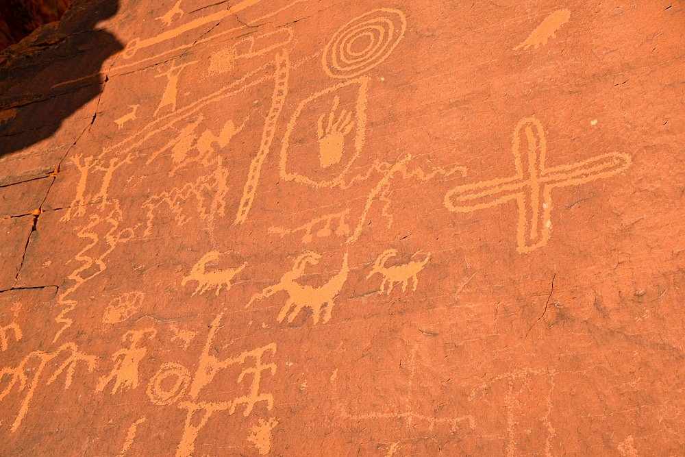
I stood and stared at these petroglyphs for a while, trying to come up with possible meanings or subjects behind them. There was one that looked like a goat. The squiggly lines, to me, indicate flowing water and another appeared to be the sun.
There was another near the top of the rock face that looked like a tribal member, possibly a warrior, holding what looks like an atlatl or some kind of weapon above their head in celebration.

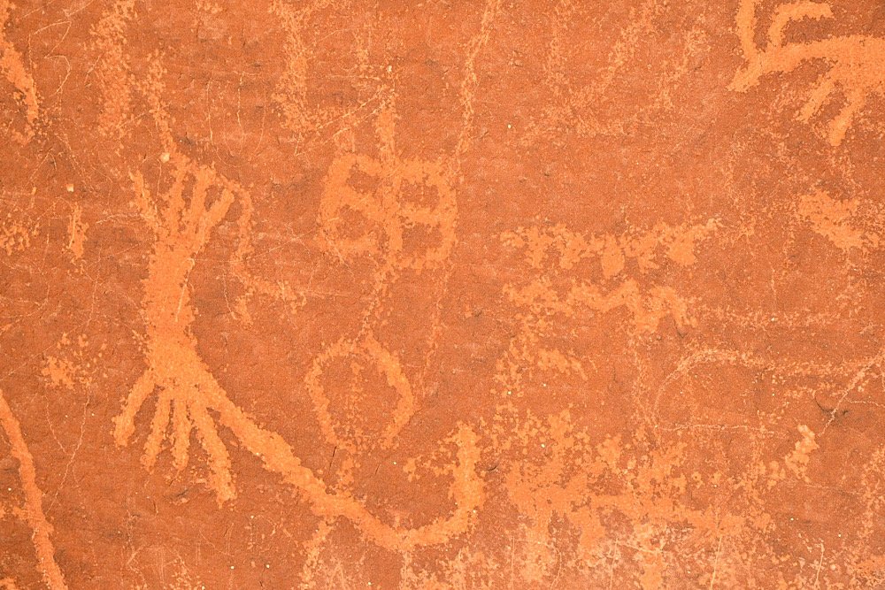
Before leaving, be sure to explore the base of the rock to see more petroglyphs. Most people just go up the stairwell, come back down and leave. Don’t be one of those.
While it’s definitely one of the touristy areas of the park, these’s so much history on display in this single location that it would be a crime to skip it. Be sure to put Atlatl Rock on your ‘things to do’ list for your visit to Valley of Fire.
Please support this website by subscribing to the newsletter below.
Thank you for reading.