Hike To Monkey Rock For Incredible Views Of Lake Tahoe
In an area with many landmarks, Monkey Rock stands as one of Lake Tahoe’s most iconic and sought after. Its popularity has exploded over…
Disclosure: This post contains affiliate links. If you make a purchase through these links, I may earn a small commission at no additional cost to you. I only recommend products or services that I believe will add value to my readers.
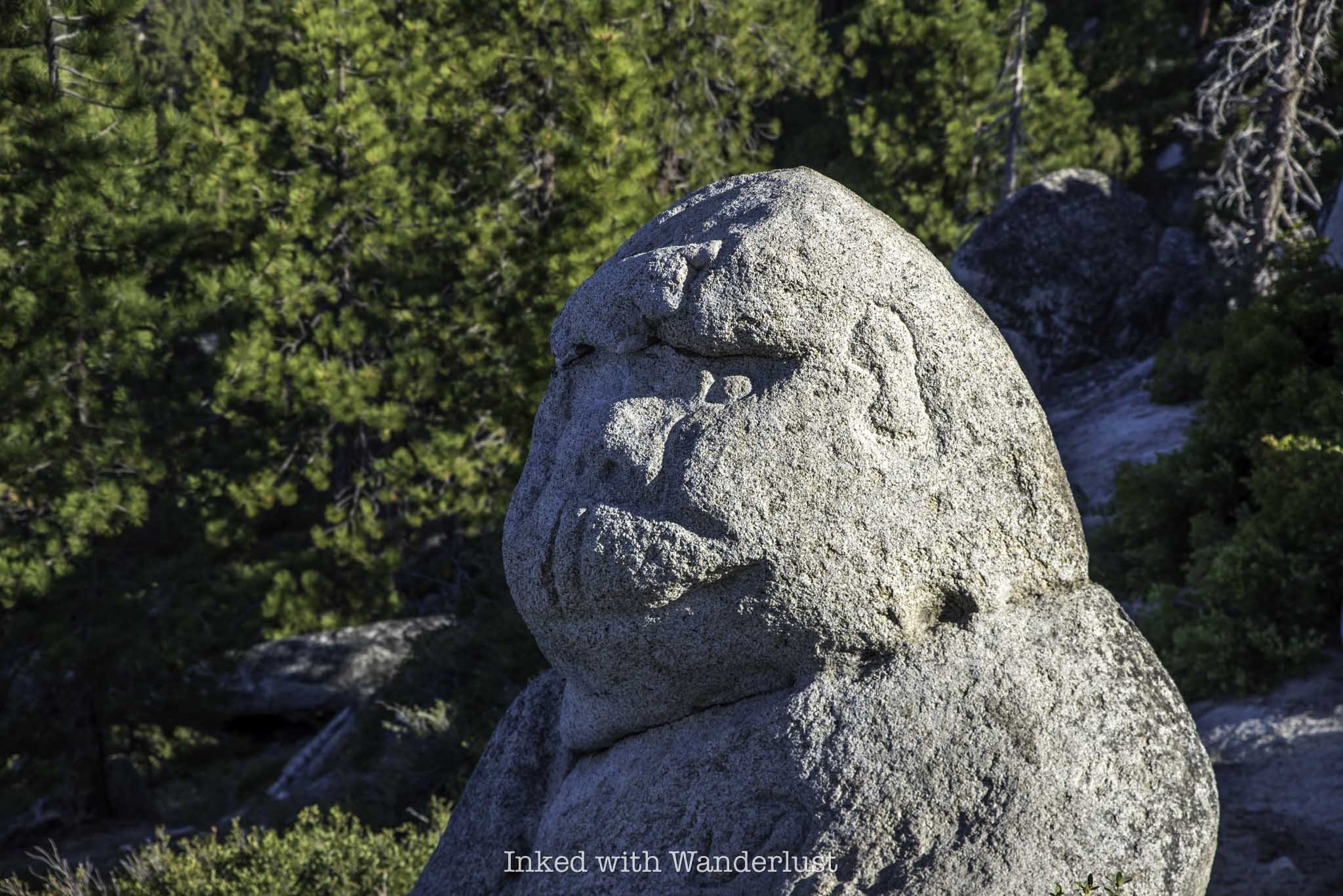
In an area with many landmarks, Monkey Rock stands as one of Lake Tahoe’s most iconic and sought after. Its popularity has exploded over the last few years due to its status on social media sites such as TikTok and Instagram.
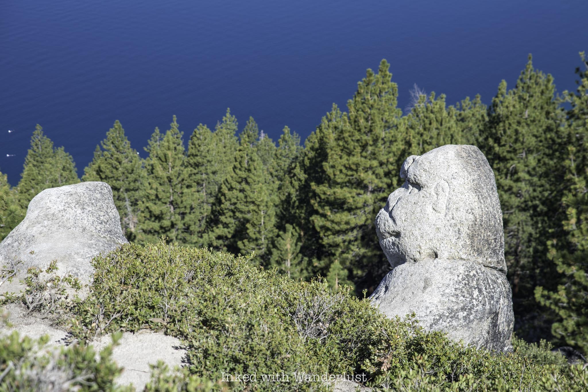
This short and sweet Lake Tahoe hiking trail takes hikers above Incline Village, the Nevada side of Lake Tahoe, to a rock formation that, when observed at the right angle, looks an awful lot like a monkey sitting on the hillside taking in the views.
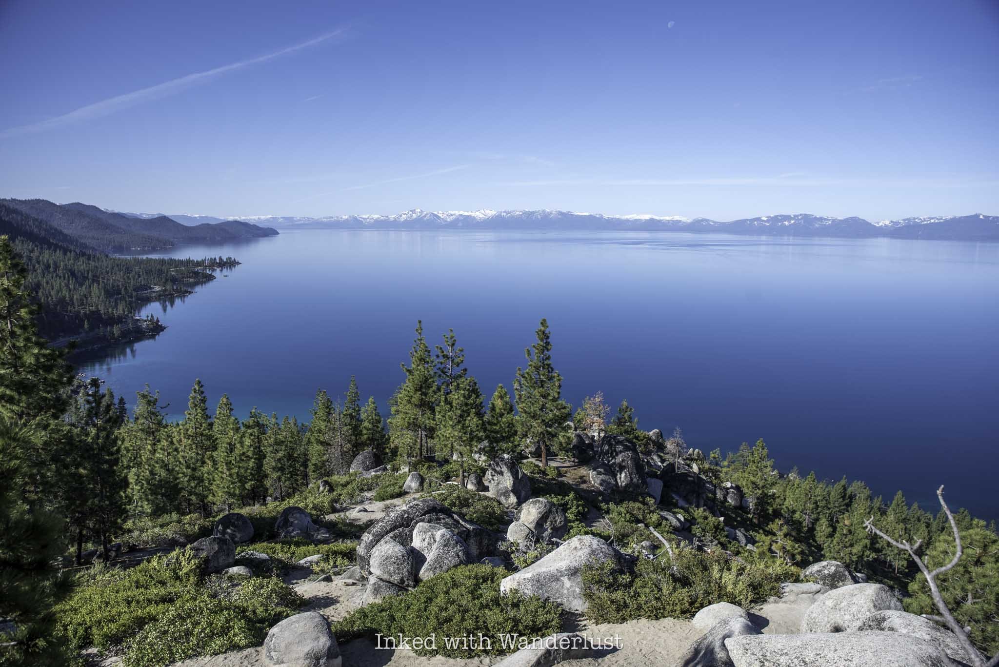
Many, however, would argue that Monkey Rock is only a bonus to this hike, as the real payoff is in the views of the lake you’ll get once you reach it. As much as I love odd and interesting rock formations, I’d be hard-pressed to disagree with that statement.
If you’re looking for a family-friendly hiking trail in Lake Tahoe, or you’re traveling to the lake and want to see as many of the highlights as possible, Monkey Rock is one trail you definitely do not want to pass up. There’s a few things you’ll need to know, though. Let’s get into it.
Trail Stats
Location: Incline Village, NV (Lake Tahoe)
Fee: Parking fees apply
Permit: None
Open: All year, but difficult to access in winter
For: Hikers
Cell Service: Good throughout most of the trail
Restroom: In the parking lot
Parking: Two large lots near Tunnel Creek Cafe
EV Stations: None
Difficulty: Moderate
Popularity: High
Mileage: 2.6 miles, out and back
Time: Two hours or less
Elevation Gain: 479 feet
Condition: Well maintained and easy to follow
Features: Rock formation in the shape of a monkey/epic views of the lake
Pets: Allowed on leash
Drones: No signage stating you can’t
Hazards: None, other than usual wilderness hazards
My Visit(s): May 2024
Monkey Rock Lake Tahoe Parking
The trailhead for Monkey Rock can be found in Incline Village, which is in the Nevada side of Lake Tahoe. Parking for Monkey Rock is located at the Tunnel Creek and Deer Creek parking lots, which are both adjacent to the Tunnel Creek Cafe. They’re located just a few miles from the Sand Harbor turn off.
These parking lots are the only available parking for Monkey Rock and the adjoining Tahoe East Shore Trail. There is no legal parking at the trailhead proper. There’s a private residence up there and they make their disdain for those trying to illegally park perfectly clear.
You can refer to the above photo for current parking fees. They’re based on several elements, such as time of year, time of day, day of week, etc. For reference, I arrived on a Tuesday at 7:30am and paid for three hours. My total was $6.00. You’ll need to know your license plate number and it only accepts plastic for payment.
Due to this area’s popularity, you’ll want to arrive as early as possible. When I got there at 7:30am it was just me and a couple other vehicles. By the time I finished with the hike (about (9:30am) both lots were nearly full.
To make your way to the actual trailhead to Monkey Rock, make sure you’re walking in the direction away from Tunnel Creek Cafe if you parked in the Tunnel Creek lot. There’s a road that runs adjacent and above the cafe (Tunnel Creek road). Take this road up to the trailhead.
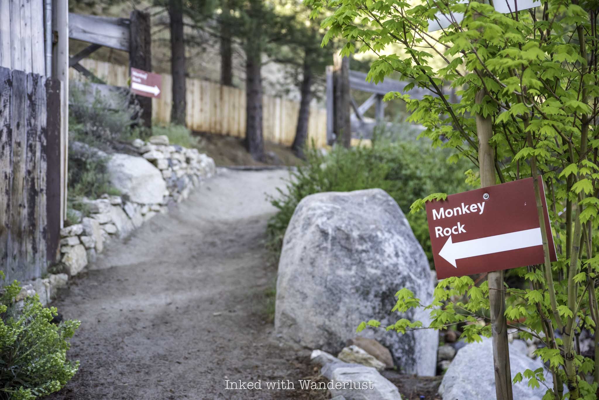
If you get turned around, there are many red signs in the area to point you in the correct direction. Just remember, if the road is going above Tunnel Creek Cafe, then you’re going in the correct direction. You’ll also pass a blue sign warning you of wildlife being present in the area.
When you get to the top of the road, you’ll see a private residence on your right and trail signage on your left. Up ahead will be the official trailhead for Monkey Rock. During my visit, there was construction happening shortly into the trail on the right.
The Monkey Rock (Tunnel Creek) Trail
Once you’re past Tunnel Creek road, the trail becomes sandy and remains that way throughout the entirety of the hike. If you’ve done any hiking in Tahoe, you would know how infamously rocky many of its hiking trails are. I’m happy to report that the Monkey Rock trail is probably the least rocky trail in Tahoe I have been on.
Initially, the trail is mostly flat with only a slight, barely noticeable incline. If you have started early, you’ll enjoy a lot of shade on this stretch of the trail from all the tall trees. Down below you, you’ll notice you are hiking parallel with and above the Tahoe East Shore Trail, which I define as more of an urban hike in a forrest setting.
About a third of a mile into the hike you will come to a green gate with a spur trail heading off to the right. Keep straight past the gate. The spur trail eventually connects you to the Tahoe East Shore Trail, which would be an excellent extension to your hike on the way out. This is also where you’ll start getting those epic Lake Tahoe views.
You’ll see other spur trails on both sides of the trail. Just continue straight on the wide sandy path. Shortly after the green gate you’ll come to two wooden pillars on each side of the trail with, you guessed it, another spur heading off to Hidden Beach.
After these wooden pillars is when the trail begins to climb and it will remain that way until just before you reach Monkey Rock. The incline is a slog, but it isn’t difficult. If needed, there are plenty of rocks to sit on and compose yourself. From here, you’re only a quarter mile or so away.
One thing to note is the side trail that spurs off to the left from the main trail (pictured above). You won’t be able to miss it. Shortly after those wooden pillars and across from a community water bowl for dogs is where it’s located.
This trail will take you to Monkey Rock, but it is much steeper than what lies ahead of you. Additionally, based on other reports I’ve read, it isn’t much shorter than the actual trail and thus, not worth the extra effort.
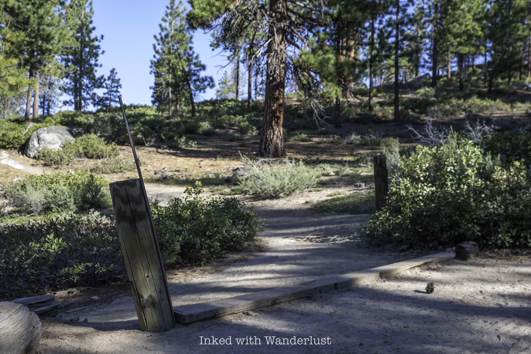
At right about the 1.3-mile mark of the hike, you’ll come across two more wooden pillars with a wooden board running across the ground between them on your left (pictured above). There’s an easily missed sign with an arrow on it. Take this trail to the left to continue to Monkey Rock.
Shortly after turning onto this section of trail and heading up a short and sweet incline, you’ll see a boulder pile in front of you (pictured above). To get to Monkey Rock, stay to the right of the boulder pile. Eventually, Monkey Rock will come into view just off the sandy path.
If you’re like me and you’re fascinated with interesting rock formations, Monkey Rock will surely leave you in awe, as it does resemble a monkey relatively closely. Do know, though, that while the rock has always looked like a monkey, it did receive a little help in attaining its current form.
Monkey Rock is easily viewed and photographed from the path. If you feel inclined, there’s another path that’ll take you down to it. Though if you have any kind of zoom on your camera, it’ll likely be unnecessary to do so.
On the other side of the boulder pile, there’s an excellent view of the lake awaiting you. From there, you can faintly see Sand Harbor State Park, sections of the Tahoe East Shore Trail, and parts of the east and north side of the lake.
When you’re done taking in the views and getting your photos of Monkey Rock, simply head back the same way you came in. Since it’s all downhill from here, you should be able to get back to your vehicle in about twenty minutes or so.
Keep in mind the spur trails you saw coming in that led to the Tahoe East Shore Trail. If you have time on your parking slip, it would be an excellent extension of your hike. Or simply head to Hidden Beach and cool off with a dip in the lake. You can read about the TEST here and Hidden Beach here.
Common Questions About Monkey Rock
Where does the Monkey Rock trail start?
Unofficially, it begins on Tunnel Creek road, just behind Tunnel Creek Cafe on the east side of Lake Tahoe. Officially, the actual trail begins at the end of Tunnel Creek road.
Is Monkey Rock a hard hike?
That’s totally subjective, but I wouldn’t classify it as hard. Distance wise, it’s on the easy side, but the final push near the end could make it difficult to some. Overall, I’d rate it as easy for some and moderate for most.
Is Monkey Rock natural?
Yes and no. Yes in the sense that it’s an actual granite rock that highly resembles a monkey, but no in the sense that it did receive some help to give it more definition.
How long is the hike to Monkey Rock?
Based on the GPS on my apple watch, it’s 2.6-miles, all in.
How can I see Monkey Rock?
The only way to see Monkey Rock is by either hiking or biking up to it. It is not visible from the road.
What elevation is Monkey Rock?
Monkey Rock is roughly 500 feet above the Tunnel Creek parking lot.
Planning a trip to Lake Tahoe? To get information on camping and recreational activities, read my 2024 Emerald Bay State Park guide. Also, to read more about the Tahoe East Shore Trail, go here. If you’re into kayaking, read my Kayaking to Fannette Island post. Lastly, chase waterfalls in my 5 Best Lake Tahoe Waterfalls post.
PROVERBS 3:23
The Ultimate Guide to Visiting Fly Geyser in Gerlach
Located roughly two hours from downtown Reno along the infamous Burner Byway is one of the weirdest, but most fascinating places you…
Disclosure: This post contains affiliate links. If you make a purchase through these links, I may earn a small commission at no additional cost to you. I only recommend products or services that I believe will add value to my readers.
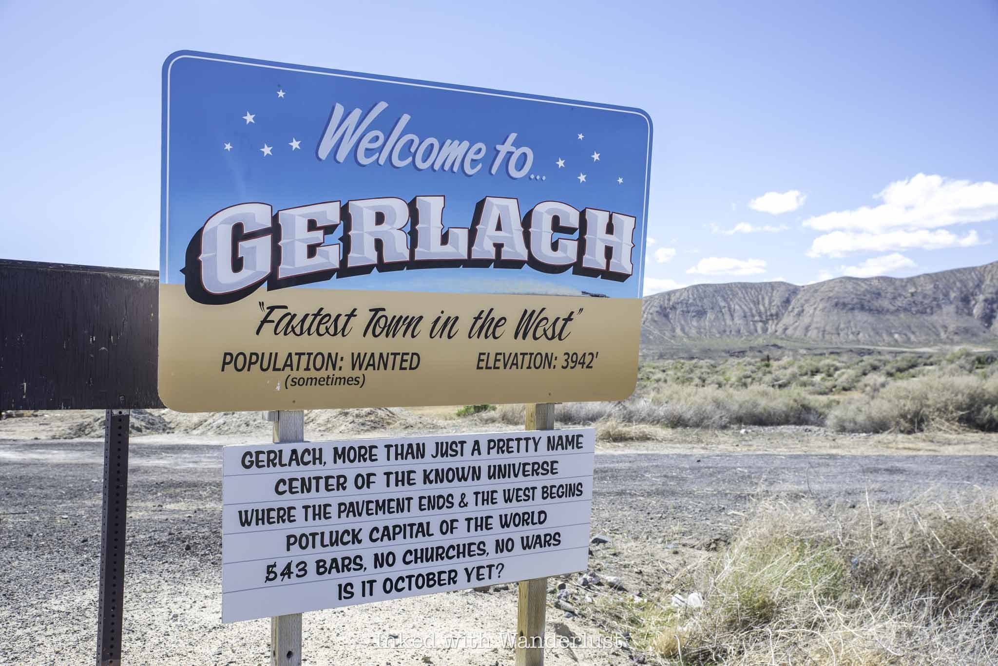
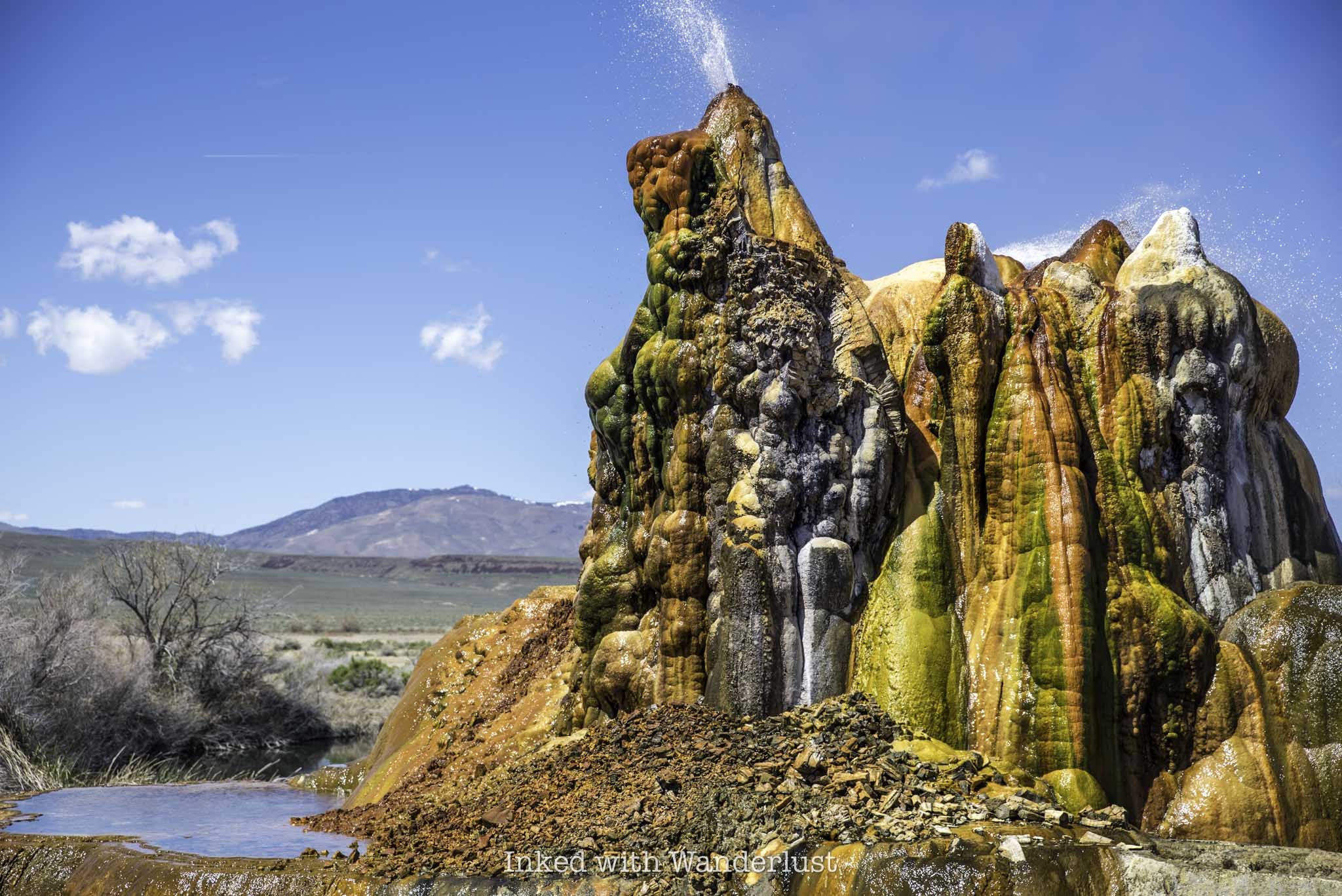
Located roughly two hours from downtown Reno along the infamous Burner Byway is one of the weirdest, but most fascinating places you can see in Nevada; Fly Geyser. The geyser is located on a 3,800-acre parcel of land known as Fly Ranch in the outskirts of the small Nevada town of Gerlach.
Abutted against Nevada’s Black Rock Desert, the location of the annual Burning Man Festival, Fly Geyser has been attracting Nevadans and tourists alike for years due to its bright colors and its reputation as an accidental man-made wonder.
In the early 1960’s, a geothermal power company was drilling in the area when they accidentally penetrated a geothermal source. The workers attempted to plug it but were unsuccessful, which over time led to its development. Calcium carbonate deposits, in conjunction with the scolding hot water, began to form, creating the spectacle you see today.
Since it’s still active, the geyser is constantly changing. From its colors and width to its height and appearance, no two visits are the same. Even the docents, who conduct weekly tours of the geyser, often see changes in the geyser’s appearance.
In this post, I’m going to discuss several aspects of the Fly Geyser tour, such as how much it costs, what to expect and more. Additionally, I’ll cover other things to do in Gerlach, such as where to dine and stay the night. Let’s get into it.
How to Get to Fly Geyser
As stated above, Fly Geyser and Fly Ranch are located in the small town of Gerlach, Nevada, about two hours north of Reno and just over an hour from Fernley. Getting to the geyser requires more driving, as it’s about twenty miles from town.
The geyser is visible from the road, but barely. You can make it out and see the water shooting out from the top, but you won’t be close enough to see its details and truly appreciate it. Since it’s on private property, the only way to see it up close is to take a tour.
Fly Geyser 2025 Tour Price and Details
Access to Fly Geyser (and Fly Ranch in general) is only available through a tour conducted by Friends of Black Rock. In 2025, their tour season is April through October. Tours are conducted on Saturdays and there is only one tour each day. Prices for the tour are as follows:
$50 plus a $3.50 service fee
While tickets can be purchased on the day of the tour, it isn’t advisable to wait as tours often sell out. You can purchase your tickets ahead of time here. You can either print your tickets or simply save them to your device and present them upon arrival.
On the day of your tour, everyone will meet at the Friends of Black Rock visitor center at 320 Main Street to check in and sign waivers. From here, the tour group will caravan over to Fly Ranch and Fly Geyser with a docent at each end to ensure nobody gets lost.
Your tour will last approximately three hours and you’ll leave the visitor center between 10:30am and 11:00am. There is a bathroom at the visitor center you can use, but there will also be portaloos at the ranch and at the geyser.
Tour Stop One - Fly Ranch
The first of two stops you’ll make on your tour is the area of Fly Ranch where the former ranch home is located. From the parking lot, your tour guide will take you on a 45-minute to one hour nature walk through the property to multiple art installations built at and used for Burning Man.
Your tour guide will detail the region’s history and ecology as you walk. Aside from the burner art pieces you’re also likely to see wild horses, dramatic landscapes and migrating birds.
The tour of the ranch portion concludes at the famed Baba Yaga House located near the playa. Aside from the geyser, the Baba Yaga House is sure to the most interesting thing you’ve ever seen (or at least seen in a while).
It was built for Burning Man in 2018 and placed at Fly Ranch in 2019 with a five-year lease (meaning this could be its final year at the ranch). The house is supported by two huge chicken legs and despite its small appearance, has two levels. A bird cage outside the exterior of the second level acts as a deck of sorts.
Amazingly, tour participants are permitted to walk up the wooden stairwell to check out the inside of the house and I highly recommend doing so. It’s cramped and there’s only one way in and out, but there are colorful flowers and other decor draped everywhere.
Once everyone has had a chance to see Baba Yaga House, you’ll head back in the same direction you came. Once you’re back at the car, your tour guide will give the group a chance to use the restroom and then you’ll all drive further up the road to the geyser.
Tour Stop Two - Fly Geyser
A few miles up the road from the ranch is Fly Geyser. The geyser will be within sight from where you park but as part of the tour, the docents will take the scenic route to continue educating you on the history and ecology of the area.
As you approach the geyser, you’ll be walking through tall grass where some people have had issues with ticks in the past. I was wearing shorts and didn’t have an issue with this but if you’re concerned about it, either wear long pants or tick repellant.
At the geyser there’s a wooden boardwalk flanking one side, concluding at an elevated platform. If your tour group is large, the docents will split the group in half so as to not overcrowd the boardwalk and the platform.
You’ll be given about thirty minutes to view the geyser and take all the photos and video of it you want. Afterwards, your tour guide will walk the group back to their vehicles and the tour is then concluded at that point.
Photography Rules at Fly Geyser
There’s much discussion online, including on the Friends of Black Rock website, about photography rules while on the tour. The website states, and I’m paraphrasing, that in order to connect with the land and get the most out of your tour, they request that you refrain from taking photos or video until the end of the tour.
People who have gone on the tour in the past echo this sentiment in their online reviews and fellow bloggers have mentioned it as well. While I don’t doubt what they’re reporting, what I can say is that wasn’t my experience at all during my tour.
For starters, none of the three docents leading our group said anything about taking photos before we left the visitor center. Likewise, they said nothing about it at any point throughout the entire tour. Everybody in the group was taking photos throughout the tour without consequence.
The only instance when the docents mentioned photos was as we approached a hot spring near the geyser that they didn’t want posted online. They’ve been having an issue with trespassers as of late and didn’t want photos of this hot spring geotagged.
I’m not saying your experience will the same, but the docents on my tour took no issue with people having their cameras out. If yours does, please be respectful and honor their request. You’ll be on private property, after-all.
Where to Eat and Stay at Fly Geyser
With a population of only 21, Gerlach doesn’t have a whole lot of businesses. In fact, the ones that are here survive mostly on the crowds that Burning Man and Fly Geyser bring in. So as I usually do on Inked with Wanderlust, I encourage you to support local business during your visit. A few of Gerlach’s restaurants include:
Bruno’s Country Club
Miners Club
Joe’s Gerlach Club
High Rock Pizza
If you want to make a weekend out of it, you can book a room in Gerlach’s only lodging, Bruno’s Motel. Just down the road from the hotel is the town’s only gas stationed name, you guessed it, Bruno’s. I don’t know who Bruno is, but he seems to be the Walt Disney of Gerlach.
The gas station’s market is only open seasonally, but the pumps are open 24/7. They also offer tire service if you find yourself in that predicament. For souvenirs, be sure to stop by Plant X where you can find interesting and unique pottery and other gifts.
Other Things to Do in Gerlach
Aside from Fly Geyser and Fly Ranch, there are quite a few other things to do in the area. All of which are of the outdoor variety. On the way to Fly Geyser, you'll pass a few entrances to the infamous playa where the Burning Man Festival is held. If the playa is dry enough, you can drive on it if you wish. Some other activities include:
Rockhouding (Gerlach is a Rockhounder’s paradise)
Take a day trip to Pyramid Lake
Camping and RV’ing
Explore Doobie Lane (or as it’s officially referred to as, “Guru road”)
Take an ATV or side-by-side in the surrounding public lands
Soak in hot springs
Planning a trip to Northern Nevada? If so, be sure to read 13 Awesome State Parks Near Reno. Furthermore, check out the International Car Forest of the Last Church in Goldfield. Lastly, don’t forget to visit the Nevada side of Lake Tahoe by Hiking the Tahoe East Shore Trail.
PROVERBS 3:23
Thunder Mountain Monument: A Deeply Meaningful Roadside Oddity In Nevada
Imagine you’re on a road trip through the Northern Nevada desert along Interstate 80. You go miles seeing nothing but rolling…
4 minute read | Contains affiliate links
Imagine you’re on a road trip through the Northern Nevada desert along Interstate 80. You go miles seeing nothing but rolling mountains, vast openness and the occasional small town.
You eventually reach one of those small towns; Imlay. A former railroad station 130-miles east of Reno with a population of 178 (as of the 2020 census).
You look around and at first, nothing sticks out. But soon after getting past the main stretch of town, something catches your eye on the side of the freeway. Something strange, but unique. That something is Thunder Mountain Monument.
We recently visited Thunder Mountain, not knowing much about it and thinking it was just another cool (and weird), roadside oddity.
As we explored the property, though, we discovered how meaningful this property was to the original owner, Frank Van Zant, and the current owner, his son, David.
In this post, we’re going to cover some quick details about the property, what you can expect and some other important information.
However, we’re going to encourage you to visit the monument’s website for a more detailed account of its history and background. We will share the link at the end of this post.
Quick Stats
Location: Imlay, NV
Fee/Permit: None, but a $2 donation per group is requested (cash or check)
Open: Year round, from dusk to dawn
For: All visitors
Parking: Semi-large, dirt lot.
Restroom: None
EV Stations: None
Drone Use: Not allowed
Difficulty: Easy
Popularity: Low
Time: An hour or more
Milage: N/A
Elevation Gain: N/A
Trail Condition: Somewhat maintained pathway.
Main Feature(s): The monument and art installations
Pets: Not allowed
Special Notes/Hazards: Broken glass scattered throughout the property. Rattlesnakes have also been spotted here
Our Visit(s): June 2022.
Directions, Parking, & Fees
Thunder Mountain Monument may be located in the middle of nowhere, but it’s easy to reach as it’s located directly off Interstate-80 in Imlay, NV.
There isn’t a whole lot to do, see and eat in Imlay. So if you’re making the trip here from a larger area, you may want to ensure your tank is full and bring plenty of water/food with you.
Additionally, the nearest EV charging stations to Thunder Mountain are in Lovelock (40-miles west) and Winnemucca (35-miles east).
From Reno (133-miles, one way)
From wherever you are in Reno, make your way to I-80 eastbound and continue straight for 133-miles.
Take exit #145 for Frontage road.
At the stop sign, turn right and then make an (almost) immediate left on Frontage road.
You’ll follow this road for slightly less than a mile and it’ll terminate at the monument’s parking lot.
From Winnemucca (36-miles, one way)
Start by jumping on I-80 westbound and continue straight for roughly 36-miles.
Take exit #145 for Frontage road.
At the stop sign, turn left and go under the freeway.
Turn left on Frontage road and continue straight until it terminates at the parking lot.
Shortly after turning onto Frontage road, it’ll turn into dirt. No need to worry if you have a compact vehicle, it’ll make it just fine. Our Chevrolet Cruze made it without issue.
The parking lot is fairly large and entirely dirt. There are no official parking spaces so just find a spot that makes sense and go with it.
There are no parking or hard entry fees. They do request a (totally reasonable) $2 donation per group. There’s nobody on site collecting these donations but they do have an iron ranger adjacent to the picnic table.
It’s cash or check only. So if you don’t have either on hand, you can send a donation to the following address when you get home:
Thunder Mountain Monument, LLC
P.O Box 162 Imlay, Nevada 89418
Any donations left at or mailed to the monument go towards to continued growth, rehabilitation and maintenance of the property.
Exploring Thunder Mountain Monument
To begin exploring the monument, simply look for the official entry to the grounds (pictured above). You can easily spot it from the parking lot.
If your only interest is the monument itself, turn left along the dirt/gravel path as you approach the picnic table. If you have the time though, we recommend heading right and exploring the rest of the grounds in a loop.
At the picnic tables, you’ll find binders containing printed information about the monument’s history and development, as well as information about its founder, Frank Van Zant.
We highly encourage you to stop here and learn about the monument. Its history is fascinating. This is also where you can drop your donation (if you’re able to).
From the picnic table, go right along the path (away from the monument) to check out a cool, but admittedly creepy, art installation on the far side of the property.
Over here, you’ll find rusted vehicles lined up like a barricade of sorts, a swing set made out of wood and mud, a model airplane also made from mud/plaster and a de facto fort in front of all that. It’s weird, but so cool at the same time.
After exploring this area, simply follow the dirt path running parallel to the freeway. After a short distance, you will arrive at the monument itself.
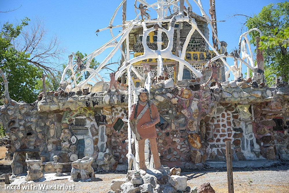
The monument was conceptualized and built by Frank Van Zant (with the help of hippies and passerby’s) after being inspired by a visit to a bottle house in Death Valley.
As you walk up to the monument, the first thing you’ll notice is it’s fenced off with ‘no trespassing’ signs dotted along the fence. This was done to protect the monument from vandalism.
Based on our research, once upon a time the general public was allowed to explore the interior of the monument, but weather damage to the roof has made it too dangerous.
The monument was once lived in by its founder, Frank Van Zant and his family and initially started out as a one-room travel trailer. Over time, it was rocked over and additional features like bedrooms, corridors, stairwells and levels were added.
The roof is adorned with multiple statues and arches, the tallest of which stands fifty-feet. The exterior walls are covered in bas-relief tableaux depicting many historic events, betrayals and massacres of the American Indian.
If you know your history, you’ll no doubt recognize the depictions in some of the statues. Some notable figures include Standing Bear, Quietzalcoati, and Sarah Winnemucca. There’s even one honoring Franks’s late son, Sid.
It’s important to note that the vast majority of the materials used to construct the monument was “trash” Frank found discarded in the desert. This was done to honor the Native Indian tradition of using what you have and not be wasteful.
Many of the windows are windshields from old cars, glass bottles line much of the top end of the monument and a wooden Eagle is perched at the very top.
Some other material used in the monument includes galvanized pipe, scrap iron, chicken wire and concrete. It’s truly amazing what Frank was able to accomplish with what many perceived to be trash.
When you’re done exploring the monument, simply head back up the trail towards the entrance where you came in and back to your vehicle.
There are a few other nooks and features of the property, but we want to leave those things a surprise when you visit for yourself. We highly encourage you to do so.
As promised at the beginning of the post, be sure to visit the monuments official website for more in-depth information of its history and the background of its creator, Frank Van Zant, as well as photos of the interior.
Your Thoughts
Have you visited Thunder Mountain Monument before? We’d really like to know what you thought of it. Or if you’ve never been there, have you been wanting to visit or have you even heard of it?
Either way, let us know in the comments below. We LOVE hearing from our readers!
Please support our website by sharing it with your family and friends.
Thank you for reading.

