June Lake Loop: A Highly Scenic Drive in The Sierras
In the state of California, there’s a large number of scenic drives you could take. Some can be done in a day while others would…
3 minute read | contains affiliate links
In the state of California, there’s a large number of scenic drives you could take. Some can be done in a day while others take multiple days.
There’s one drive in particular that is not only highly scenic, but it can be done in half a day or less. That drive is the June Lake Loop.
The drive begins where State Route 158 breaks away from Highway 395 for 16 miles, then reconnects with it and either end.
You can begin at either the southern tip (closest to June Lake) or at the northern tip (from Lee Vining). This article is going to focus on the north to south route.
In this direction, the lakes you will see are listed below in order of appearance:
First - Grant Lake
Second - Silver Lake
Third - Gull Lake
Fourth - June Lake
If you’re coming from the southern direction, look for the sign indicating you’ve reached the June Lake Junction and turn left here.
At the end of the article, we’ll fill you in on a nearby lake we think you’d be interested in seeing once you’re finished with the drive, proper.
So buckle up, fill your tank (or charge your battery) and head out to this unique, one-of-a-kind drive.
Quick Stats…
The drive is 16 miles in length
You’ll pass a total of four lakes with an option to add a fifth
You can start from either end (north or south)
If you just drive the whole way without stopping, you could complete the loop in less than an hour
However, if you get out at each lake and spend some time on the lakes themselves, you could easily spend a full day here
Bathrooms are available at all four lakes (some are portables)
A variety of restaurants and taverns can be found in the downtown strip between June and Gull Lake
Gas stations are available in the town of Lee Vining (northern end) and at the June Lake Junction (southern end)
Grant Lake
As stated above, this article is going to cover the north to south route. From here, your journey will begin in the small town of Lee Vining:
Head south on Highway 395 for about 5 miles
Turn right on State Route 158
Once you turn onto State Route 158, you have officially began the June Lake Loop. Right around the 3.8 mile mark you’ll run into the largest lake of the four, Grant Lake.
Though it’s the largest, water levels vary greatly as it’s a reservoir for the City of Los Angeles. Early morning fishing and camping are popular here.
While the mountain side of the lake is scenic, the lakeshore and roadside are a bit barren with sagebrush shrub being the closest thing to flora.
Silver Lake
Once you’re done checking out Grant Lake, get back in your car and drive south for another five miles. At that time, you’ll see my personal favorite lake of the four; Silver Lake.
The road runs along the west shore. There’s a small parking lot on your left as you approach the lake with additional parking at the resort.
Much like all the lakes on this list, fishing is the most popular activity here. In fact, The Silver Lake Resort, is one of the oldest operating lake resorts in the Sierras.
If you’re feeling hungry, stop by the cafe inside the resort for lunch. It’s a small space, but they offer meaty sized portions for fair prices.
Gull Lake
Gull Lake is the smallest of the four but it’s no less scenic. Our first time on the loop, we drove right by it without noticing.
The highlight of this lake is the Gull Lake Marina. This small, charming Marina offers a variety of boat rentals such as pontoons, motor barges, kayaks, paddle boats, and boards.
In addition, they have a tackle shop where you pick up bait, licenses and a variety cold sandwiches and drinks. It’s a nice place for a picnic if you’re so inclined.
From Silver Lake, you’ll drive 4.1-miles (roughly 10 minutes) and:
Make a sharp left turn on Gull Lake Road (seriously, it sneaks up on you)
Turn left onto East Granite Ave
Turn left onto West Granite Ave (you’ll see the parking lot/entrance to the marina ahead of you
June Lake
Leaving Gull Lake, you’ll drive through the charming downtown area of June Lake. This strip is dotted with shops, restaurants, motels and a brewery.
There are also two marinas that serve June Lake and much like Silver and Gull Lakes, you can rent boats or launch your own if you’d like.
At the southern end of June Lake you’ll find the popular overlook, “Oh! Ridge”. This is a highly scenic and photogenic spot and has been the subject of many photos.
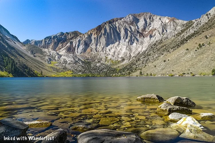
Also at the southern end is where you’ll find June Lake Beach (pictured above). To get there:
Turn left onto North Shore Drive
Turn left onto June Lake Beach Road and follow it to the parking lot
At this point, you’ve reached the official end of the June Lake Loop drive.
From here, you can complete the loop by heading away from the lake to June Lake Junction and rejoin highway 395 towards Lee Vining. Or………
Convict Lake Add-On
If you feel like calling it a day at June Lake (or Grant Lake if you went northbound) I wouldn’t blame you.
You’ve just driven one of California’s most beautiful roads and spent time at four, fantastic lakes.
If you’re feeling to it, though, we do have one more suggestion; Convict Lake.
Convict is just 24 miles from June Lake is one of the most picturesque in the area. It is definitely worth the extra effort.
Getting to Convict Lake from June Lake couldn’t be any easier:
From June Lake, head south back to the June Lake Junction (about 2 miles)
Turn right onto highway 395 for about 20 miles
Keep an eye out for Convict Lake Road and turn right. Keep going straight until you’ve reached the parking lot.
Much like the others, there’s a marina where you can rent boats or other water equipment. The nearby Convict Lake Resort features a highly rated restaurant if you’re hungry.
If you have time, we highly recommend hiking the Convict Lake loop. It’s a family friendly, two mile trail that encircles the lake. You can read about it here.
Best Time To Drive June Lake Loop
June Lake is a year round destination offering world-class skiing in the winter. Due to this, the road is open and drivable all year long.
However, this area gets pounded with snow on an annual basis. Sometimes necessitating closing famed highway 395. June Lake Loop is also subject to this.
During spring, you’re usually free of snow. The area flora comes to like, surrounding the lakes with color. Hiking trails can like hiking though creeks, though.
Summer is the tourist season. Lots of people with occasional afternoon storms. Hiking trails are clear and the resorts are in full operational mode.
Fall brings beautiful color to the region. Mono County is known for its fall colors and June Lake Loop is no exception. In my opinion, this is the best time.
Your Thoughts…
What are your thoughts on June Lake Loop? Does it sound like a drive you would love to take your family on?
Let us know in the comments below! We love hearing from our readers.
Please support our website by subscribing to our newsletter below.
Thank you for reading.
Check Out These Amazing Destinations In Oregon!
7 Things You Will Love About Bridgeport
The small mountain town of Bridgeport in eastern California is one of my favorite places in the country. There’s not only plenty to do within…
3 minute read | Contains affiliate links
The small mountain town of Bridgeport in Eastern California is one of our favorite places in the country. There’s so much much to do in town and so much within a close proximity, you could spend an eternity exploring the area.
The following list is by no means exhaustive, but it’s a combination of what the town is most known for and what we feel you would enjoy most about it. So let’s get into it!
1) Twin Lakes
Located just 10 miles from town down highly scenic Twin Lakes road (which is honestly an attraction all its own), Twin Lakes is both easy to get to, features top notch views, and offers great recreational opportunities.
Twin Lakes is made up of two separate lakes (lower & upper) and covers a combined 650 acres. Lined with evergreens and towered by the Sawtooth Mountain Range, many activities such as fishing, boating, and more can be enjoyed here.
2) Soak in the Hot Springs
There are two hot springs within close proximity of Bridgeport. Travertine Hot Springs (pictured above) is just up the road from the Bridgeport Ranger Station and the other, Buckeye, is located near Twin Lakes.
Both springs are clothing optional, however, we have been to Travertine numerous times and people have always been respectful whenever families were there. Just something to keep in mind if you decide to go.
READ ALSO: Soak and Relax At Travertine Hot Springs
3) Hiking & Camping
If you’re into hiking, camping, or both, Bridgeport is where you’ll want to be. At Twin Lakes there are at least half a dozen wonderful campgrounds to choose from including Mono Village, Doc & Al’s, Twin Lakes Resort, and Lower Honeymoon.
Pictured above is Barney Lake and can be accessed via a 4-mile hike on the Roberson Creek trail. Other popular trails include Green Lake, Benson Lake Loop, and Virginia Lakes.
READ ALSO: Take A Day Hike To Beautiful Barney Lake
4) Local Restaurants
After hiking all day, there’s nothing more we want to do than head to the nearest burger joint and chow down. Bridgeport has many local eateries serving up delicious food daily. These include Burger Barn, Nugent’s High Sierra Bakery, Jolly Kone, and more!
5) Fishing Galore!
Bridgeport is one of the premier fishing destinations in Mono County and is often touted for having the best trout fishing in the entire state. In fact, back in 1987, the current record holding brown trout was caught in Upper Twin Lake and weighed a whopping 26 pounds, 8 ounces.
Who knows? Perhaps you could be the one to catch the next record breaker.
6) Historic Buildings
There are numerous historic buildings in Bridgeport but perhaps the most known are the Mono County Courthouse and the (old) Mono County Jail. The courthouse was built in 1880 and is the 2nd oldest operating courthouse in California.
The old jail was built in 1863 and is located behind the courthouse. The new and far more modern jail was built directly adjacent to the old one. Due to Covid-19, the interior is closed off to all visitors for the remainder of 2020.
7) Bodie State Historic Park
If exploring abandoned places is your thing then you need to head to the Disneyland of ghost towns, Bodie State Historic Park. The turn off to Bodie is just 7 miles outside of Bridgeport and then another 13 miles to the park itself.
If you’ve never heard of Bodie, it’s an abandoned gold-mining town that’s being preserved in a state of arrested decay. Multiple original buildings remain (including the mill) and the interiors remain as they were back in the day.
We highly recommend spending a full day exploring Bodie and everything it has to offer.
Bonus! Proximity to Yosemite East
Bridgeport is a fairly short drive (about 45 minutes) from the east entrance of Yosemite National Park. This will take you through the charming town of Lee Vining and up Tioga Pass to the gate.
You won’t see the likes of Tunnel View or Yosemite Falls (those are an additional hour or so away) but you will find equally awesome sights on this seldom known area of the park.
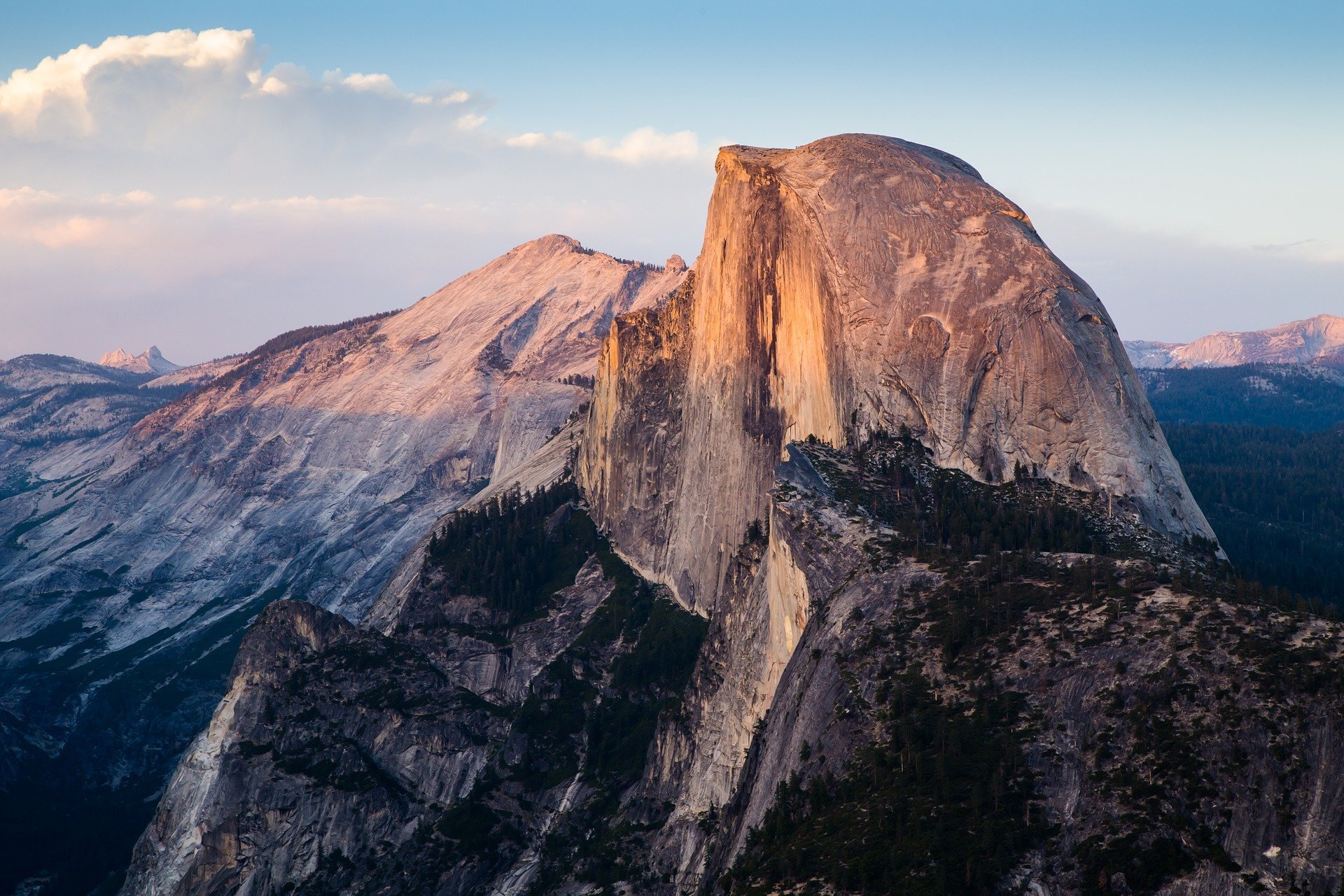
You can wander through Tuolumne Meadows, see the infamous Half Dome from Olmsted Point, hang out on the beach of Tenaya Lake, or take in a hike to the famous Cathedral Lakes. These are just a few mentions of the many things to do here.
Your Thoughts…
Does Bridgeport seem like a place you’d want to visit for yourself? Perhaps with your family? Are there any special places in or near Bridgeport we left out? Let us know in the comments below. We love hearing from our readers!
Please support our website by sharing it with your family and friends.
Thank you for reading.
Editor’s Note: This post was originally published in October 2020 and has been recently updated for comprehensiveness and accuracy.
Visit Devil's Postpile National Momument in California
Formed roughly 80,000 years ago, the up to 60 foot basalt columns of Devil’s Postpile National Monument are a sight to behold. The saying, “you won’t believe it until you see it”, holds
Formed roughly 80,000 years ago, the up to 60 foot basalt columns of Devil’s Postpile National Monument are a sight to behold. The saying, “you won’t believe it until you see it”, holds true in this case. Pictures do no justice to this natural masterpiece.
Read along to find out how you can see it for yourself and witness one of the best examples of how much of a role Volcanos played in shaping the Sierras as we know it today.
Mammoth Mountain
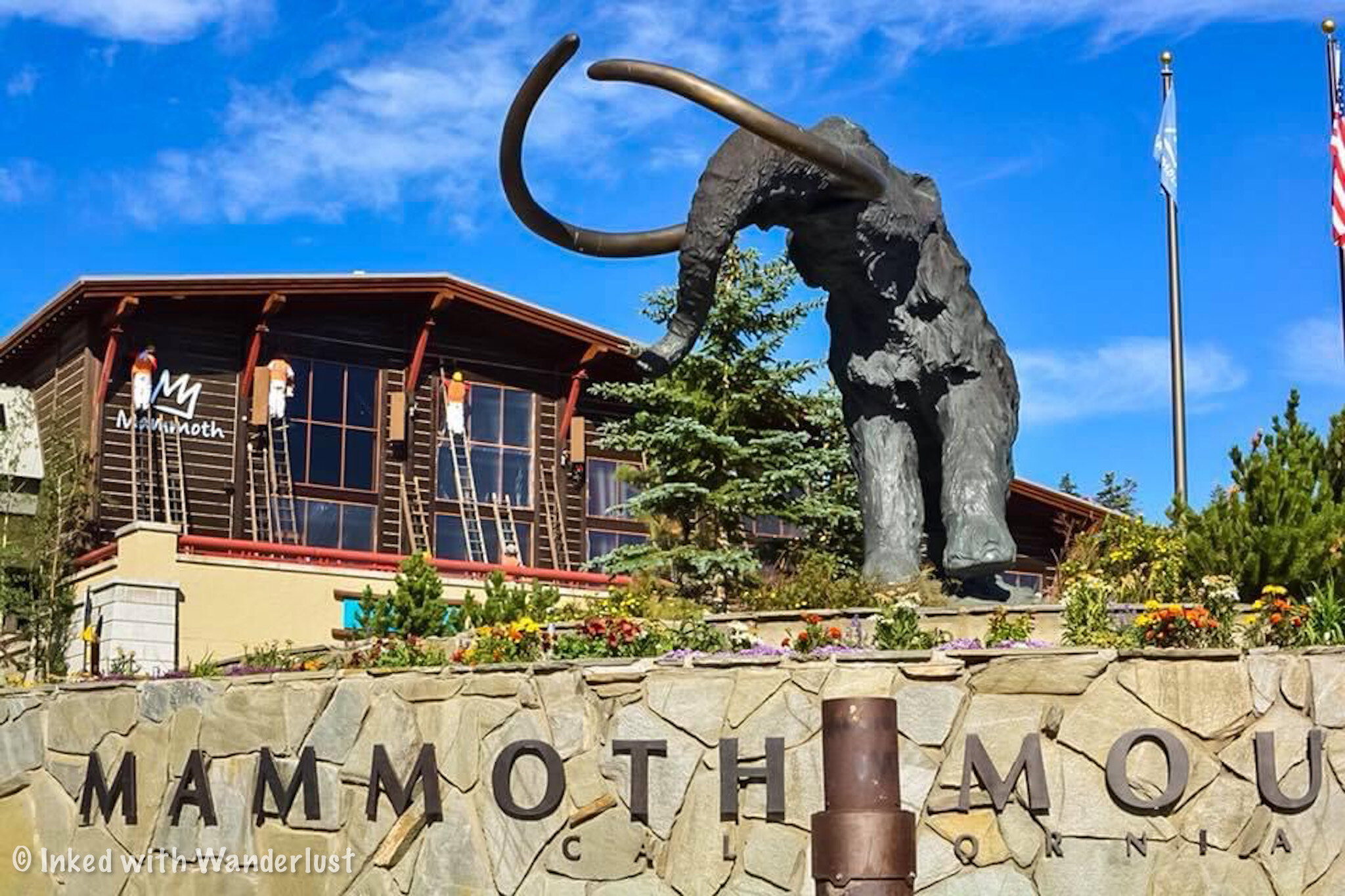
Your journey to Devil’s Postpile begins at the base of Mammoth Mountain in Mammoth Lakes, CA. With few exceptions, most visitors will be required to utilize the Monument’s shuttle that takes you down the access road to the valley.
The Shuttle
While the Monument itself is free, there is a fee to use this mandatory shuttle. Tickets can be purchased at the Adventure Center day of and as of 2019 it is $8.00 per person 15 and older, $4.00 per person between 3-15 years old, and free for those aged 2 and under (The shuttle rule was suspended in 2020 due to COVID-19).
As stated above, there are a few exceptions to this rule. They are:
Arrive before 7am or after 7pm
Have a handicap placard or plate
Are staying at either the valley campground or Red Meadow’s Resort.
You’re arriving after shuttle operating hours or season
You’re a hunter transporting game or weapons
You’re towing livestock and are using the livestock on valley trails
You have a cartop boat and are using it in valley lakes
READ ALSO: 7 Things You Will Love About Lee Vining
The shuttle runs on average every 45 minutes and usually takes 30 minutes or so to reach the valley. The line moves quickly due to plenty of seating on each shuttle along with some standing room (pro tip: If you’re standing, avoid locking your knees. Someone on the bus with me ate floor because of this).
Much like Yosemite’s east side, the Monument is seasonal and typically opens in mid June and closes in mid to late October. Be sure to keep this in mind when planning your trip.
Devil’s Postpile
The shuttle will make multiple stops along the access road. While you can reach the columns from Red’s Meadow, you’re going to want to get off at the Valley stop as this is the most direct and shortest route.
The valley is where you’ll find the campground, ranger station, bathrooms, and Soda Springs Meadow (which is where the trail to the columns begin). You can find the trailhead to the columns just beyond the Ranger Station.
It is just shy of .05 mile from the start of the trailhead to Devil’s Postpile. The trail is well maintained through Soda Springs Meadow but beyond this, you’ll start noticing thick tree roots and rocks getting in the way.
From here, it won’t be long before you get your first glimpse of Devil’s Postpile and when you do, you’ll be blown away. The columns formed around 80,000 years ago (give or take) after flowing lava cooled and cracked into what we see today.
Just as you come upon it keep an eye out for a side trail to your left. This trail will take you to the top of the columns and allow you to touch their smooth, hexagon shaped surface. The trail is a bit steep but freight not, it’s short.
Take all the time you want to admire and photograph this amazing sight. The sun rises above the columns so the morning light tends to be harsh. I found the light much better on my way back out when the sun had time to move on. So if you want to get some good pictures, keep this mind.
Rainbow Falls
You now have two choices. You can either stop here and head back to the shuttle once you’ve spent enough time admiring the Postpile or you can press on and head out to the other natural feature of the Monument; Rainbow Falls.
From here, it is another two miles to the falls. While that isn’t a lot and the trail is mostly flat with the occasional dip, there isn’t much in the way of shade. You’ll have a few opportunities here and there but for the most part, it’s exposed. So if you’re going to continue on, be sure that you brought plenty of water with you.
Between the postpile and the falls you’ll have amazing views of the San Joaquin River as you follow along side of it. Eventually, you’ll come out into a vast clearing (where a massive fire tore through) and be able to see the beautiful Minerats out in the distance to your right.
Soon enough, you’ll start to hear the roaring of the beautiful Rainbow Falls. Your first glimpse will come as you approach the main (and largest) concrete viewpoint.
If you’re looking for a better viewpoint with a more straight on angle of the falls, keep going down the path and you’ll eventually see it off to your right. When I was here, this one had far less people than the first one.
There are also stairs that lead down the base of this 101-foot beauty where you can get some amazing photos but unfortunately, these stairs were closed to the public for maintenance when I was there. More of a reason to go back, right?
Lower Falls
Located about a mile further down the trail from Rainbow Falls and outside the boundary of the Monument is Lower Falls. Lower Falls drops just 15 feet over smooth granite rocks and into the perfect swimming hole for overheated hikers.
My friend and I debated over whether or not to include this on our visit. Ultimately, we decided to do it and I was sure glad we did. Lower Falls is comparatively unknown to most visitors so we only had to share it with a few others (we were here in August). I highly recommend going for it.
Things to Know
Mileage will vary. If you only hike to the columns, you’re looking at just under a mile from the valley to the columns and back. If you go to Rainbow Falls, that’ll make it 5 miles round trip and if you include Lower Falls, it’s about 7 miles round trip.
The Monument is free, but the shuttle isn’t. If you manage to arrive outside the operating hours of the shuttle, you’re free to drive down to the valley. Otherwise, you must pay for and use the shuttle.
The Monument is seasonal. Due to heavy snowfall, the Monument is only accessible from mid June to around mid to late October. So plan your visit accordingly.
Crowds get heavy. Devil’s Postpile is one of the most popular attractions in the Sierras. As such, crowds tend to be heavy. Your best bet for light crowds is in the morning because later in the day, lines for the shuttle will rival those of Space Mountain.
Your annual parks pass won’t waive the shuttle fee. Keep this in mind if you’re a pass holder. Everyone pays for the shuttle.
The trail to Devil’s Postpile is (kind of) wheelchair and stroller friendly. I know of people who have pushed strollers along this trail and others who have used a wheelchair, but they did struggle. As you approach the columns, there’s a ramp to help circumvent the rocky stairwell but you will encounter thick tree roots and rocks along the trail. Beyond the columns to the falls, wheelchairs and strollers won’t be possible.
Bring plenty of water. Seriously. I underestimated this trail due to it being short but didn’t realize how exposed the trail to Rainbow Falls is and was nearing dehydration. Learn from my screw up.
Conclusion
Whether you decide to just see the columns or include Rainbow and Lower Falls in your visit, you’re sure to enjoy the time you spend at Devil’s Postpile National Monument.
We hope this article has inspired you to want to visit this beautiful place. If so, please support us by sharing it with your family and friends on your favorite social media site.
Thanks for reading and safe travels!
Glen Aulin: A Glorious Hiking Trail in Yosemite
I’m often asked by Yosemite first timers (friends and friends of friends) about which hiking trails in Yosemite should they hike during their visit…
Disclosure: This post contains affiliate links. If you make a purchase through these links, I may earn a small commission at no additional cost to you. I only recommend products or services that I believe will add value to my readers.
I’m often asked by Yosemite first timers (friends and friends of friends) about which hiking trails in Yosemite should they hike during their visit. There are many beautiful hikes in Yosemite, but one of the few I recommend most often is the Glen Aulin trail, located in the Tuolumne Meadows area of the park.
Its not the easiest hike in Yosemite, nor is it the shortest, but it’s far from difficult and I’d say that as long as you and your family have hiked, a minimum, a few times, then you shouldn’t have any issue with Glen Aulin. It’s a straight shot and mostly level throughout, making it an ideal hike for families.
Before we get into it, you need to know that this trail is located in the high elevation area of Yosemite’s east side. This area of the park receives tons of snow in the winter, making it inaccessible during that time. If you want to hike the Glen Aulin trail, you’ll need to plan a summer or fall visit as the east gate typically opens in late May or early June.
However, even at those times, there could still be heavy snow pack along the trail. If you want to avoid snow and/or muddy conditions, I recommend visiting in late summer or in the fall when the weather is pleasant.
Now that that’s out of the way, let’s get into it!
Glen Aulin Trailhead Parking
The official trailhead for Glen Aulin begins just to the right of Parson’s Lodge and Soda Springs in the back-end Tuolumne Meadows. However, you must begin on the opposition side of the meadow, which adds some milage to your hike, but not a lot.
Unless you’re starting from the Lembert Dome area, there is no official parking lot for this hike. Some attempt to park on the side of the road, but you’re risking being cited and towed. I would play it safe and park in the visitor center parking lot across the street.
Glen Aulin Hiking Trail
Once you’ve secured a spot, make sure there isn’t anything with a smell in your car or trunk, as this area sees a lot of bear activity. This includes food, drink, deodorant, etc. There are bear lockers everywhere in the area free to use.
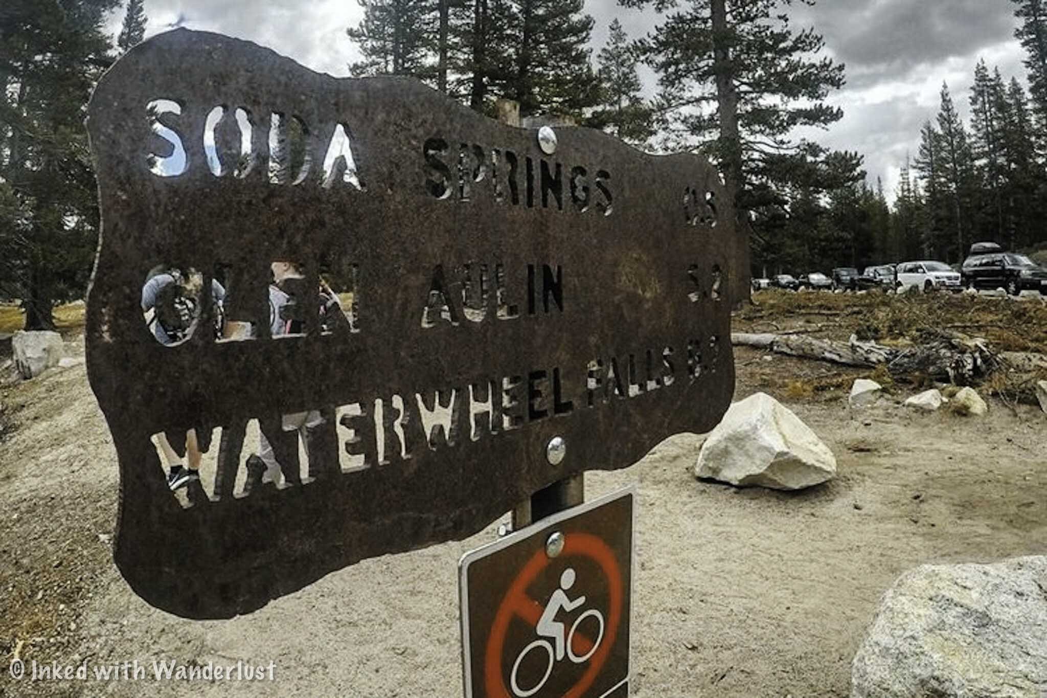
To start your hike, cross the street and look out for the trailhead sign that lists Soda Springs, Glen Aulin and Waterwheel Falls (pictured above). You’ll want to follow the dirt path to the opposite end of Tuolumne Meadows.
The first notable feature you’ll encounter is the picturesque bridge spanning over the Tuolumne River. If you arrive early, do yourself a favor and get your pictures in now because on your way out it’ll likely be littered with tourists.
After the bridge you’ll come across Parsons Lodge (slight left) and Soda Springs (slight right). Parson’s Lodge was built by the Sierra Club in 1915 as a memorial to Edward Taylor Parsons (club member and Yosemite advocate). Soda Springs is a mineral spring with a half cabin built around it.
Don’t spend too much time here, because you haven’t officially started the actual trail yet and still have a ways to go. Keep going past Soda Springs and the lodge and you’ll see signs pointing you toward Glen Aulin trail, proper.
Glen Aulin shares its trail with both the PCT and the JMT. So if you see signs for either or both, you’re going in the right direction.
The first half-ish is fairly flat and straightforward. It’s clearly marked and well-maintained so there’s no real risk of going off-track. At around the three mile mark, you’ll come out into a beautiful meadow and lake that rivals Tuolumne Meadows (in my opinion).
Shortly after this point is where the trial starts to get a bit rocky and less maintained. However, the views continue to get better and better. For the next couple miles, you’re zig-zagging along beautiful cascades and have jaw dropping views of the granite mountains out in the distance.
The closer you get to Glen Aulin, the more spectacular the cascades get. I hiked this late in the season and the river was going strong. I could only imagine how it looks earlier in the season.
Tuolumne Falls
Before reaching Glen Aulin, you’ll first find yourself at the beautiful Tuolumne Falls. This waterfall is simply breathtaking and worth spending some time at. Although no one was down there on my hike, I have heard of overheated hikers using the pool around the falls as a swimming hole. I would exercise caution if you decide to do so.
After soaking in the views and getting your pictures, continue down the trail. From here, you’re still another mile or so from your destination. This is where the drop in elevation will become more noticeable and trail becomes rockier than it was before. Watch your step and pace yourself, if needed.
White Cascades and Glen Aulin
This is one of those destinations that just sneak up on you. You’re wondering how much further you have to go and bam, you come off a slight descent and there it is, the beautiful Glen Aulin and White Cascade. The views in this area are simply stunning.
While there’s nothing wrong with enjoying the view from the initial side, you’ll want to keep going as the view is much better across the swimming hole. Head forward towards the bridge and cross it to get there.
Glen Aulin High Sierra Camp
As you’re coming off the bridge, take a right and head over to the Glen Aulin High Sierra Camp. Everyone and anyone is free to hang out around the camp and the swimming hole, but access to the tents and restrooms are only for registered guests.
The Glen Aulin High Sierra Camp is one of five camps scattered throughout some of Yosemite’s most popular locations. You can attain one by entering the annual lottery and crossing your fingers that you win one. Rates for the Glen Aulin Camp in 2024 are as follows:
$175 per night (Adults)
$90 per night (Children)
Rates include a stay in one of the tents, along with dinner and breakfast, with lunch available as an option for an additional charge. Bookings are available for stays from July 4 - September 7, 2024. You can get more information here. Keep in mind that each tent can fit four people and they will fill it. Depending on your party size, you may be sharing it with others.
The best part of the Glen Aulin High Sierra Camp is you’re camping directly next to the gorgeous White Cascades and swimming hole. Imagine waking up to that sight every morning and enjoying a prepared breakfast next to a fire. That beats any hotel I can think of.
Glen Aulin Hiking Tips
This trail gets crowded. For starters, the trailhead begins in Tuolumne Meadows, one of the most tourist-heavy areas of Yosemite. Additionally, it shares its trail with the PCT and JMT. The earlier you can get started, the better.
It’s a moderate level of difficulty. It’s not a difficult hike by any means, but it is on the longer side and rocky in the latter half. That said, it’s mostly level, straight forward, clearly marked and well-maintained. Just be prepared for the length of it and you’ll be fine.
This trail is seasonal. The Glen Aulin trail is located in Yosemite’s high elevation area and thus, receives a heavy amount of snow in the winter, making it inaccessible. The entire east side closes during this time. So plan a summer or fall visit if you want to hike Glen Aulin.
Bears do frequent this area. Bears are all over Yosemite. However, they tend to hang around Tuolumne Meadows and this trail quit a bit. I didn’t see any during my hike, but you might. If you do encounter a bear, make lots of noise to alert it of your presence, give the bear plenty of space and you’ll be fine.
Watch out for the pack horses! Supplies get down to Glen Aulin High Sierra Camp via pack horses. I encountered them 3 times on my hike. Keep an eye out for them and give them the right of way. You also may want to watch your footing after they pass, for obvious reasons.
Planning a trip to Yosemite? If it’s your first visit, be sure to read 10 Awesome Things to Do in Yosemite Valley on Your First Visit. Additionally, read Tunnel View: How to See the Most Iconic View in Yosemite for an epic view you won’t want to miss. Finally, if you’re thinking of hiking Half Dome, read How to Hike Half Dome: The Complete First Timers Guide.
IF YOU WANT TO SEE ALL OF YOSEMITE’S HIGHLIGHTS IN A DONE-FOR-YOU, HASSLE-FREE TOUR WITH KNOWLEDGEABLE GUIDES, GO HERE.
Travertine Hot Springs: A Relaxing Soak With Mountain Views
There’s nothing like taking a dip in a natural hot spring after a long, grueling day or two hiking in the wilderness. Luckily for us, there are many hot springs located within the Sierra Mountains but there’s one in particular we’re going to cover in this article; Travertine Hot Springs.
There’s nothing like taking a dip in a natural hot spring after a long, grueling day or two hiking in the wilderness. Luckily for us, there are many hot springs located within the Sierra Mountains but there’s one in particular we’re going to cover in this article; Travertine Hot Springs.
~ Getting There ~
Here’s the good news; Travertine is super easy to access. Here’s the bad news; Travertine is super easy to access. No, that wasn’t a typo. It can be both a good or bad thing depending on your preference.
The dirt road leading to the springs can be rough depending on which season it is but overall, most vehicles will be able to get through it. My Chevrolet Cruz made it just fine so having a high clearance vehicle isn’t necessary (unless a winter storm recently hit).
Due to this, Travertine sees its fair share of visitors and quickly fills up in the summer months (hence why it could be a bad thing). There are, however, a few things you could do to avoid the crowds which we’ll cover in the next section.
If you’re coming from Bridgeport: Get on Highway 395 south. Shortly after leaving town and just before the Ranger Station, turn left on Jack Sawyer road. Keep heading straight up over the hill and continue until you reach the terminus.
If you’re coming from Lee Vining: Get on Highway 395 north for about 25 miles. Shortly after passing the Bridgeport Ranger Station, turn right onto Jack Sawyer road and follow the same directions above.
As stated in the directions, you just keep following the dirt road until it ends at the parking lot. There’s a restroom available for use on the right. It’s of the vault variety and as far as cleanliness is concerned, it’s been hit or miss in my experience. Better than nothing, right?
~ The Pools ~
From the lot, it isn’t much of a hike to get to the pools. In fact, if the main pools are too crowded, there’s a small man-made pool right in the parking lot. This one could get especially hot, though. As in, you could boil in it. So dip your least favorite toe in first just to be safe.
You’ll find the four main pools after a short walk along the trail leaving the lot. By short, I mean around 2-3 minutes. The first pool you’ll see is the largest and hottest. From there, they get progressively smaller and cooler.
There’s an additional pool further down the trail that, if you’re lucky enough to get there first, you’ll enjoy relative seclusion. It is much smaller (can fit 3-4 and that’s assuming you’re comfortable with one another), but has an unobstructed epic view of the mountains before you.
~ When to Go ~
Honestly, any time is a good time but largely depends on your preferences. If your goal is to enjoy some relative peace and be alone, you’ll want to get here pre-sunrise (as in, still dark) or come during the winter time.
The summer months are the busiest. No matter what time of day you arrive, you’ll likely be sharing the pools with at least one or two others. Though I have had luck getting here during the week in August and managed to have it all to myself for a couple hours.
During winter you’ll have better luck avoiding crowds. However, it’s also possible that the road will either be closed or difficult to pass due to heavy snow or rain. High clearance vehicles may be necessary during this time.
If you arrive during the day in the summer, you WILL arrive to a full lot and pools full of bodies. As mentioned above, arrive pre-sunrise to increase your odds. This is what I always do and I almost always have it to myself for a while. You’ll be cold at first but that won’t matter once you’re in the spring.
~ Additional Info ~
The springs are located on California park land. While not a state park, it is state park land and is managed by local rangers. A bonus feature to this is there is free, dispersed camping along the road leading to the springs. It is primitive and there are no showers, restrooms, etc. Also, there is no fee to access the springs.
Travertine is clothing optional. While families and singles alike are welcome here, do keep in mind that you may see some nudity. The people that come here are usually respectful about it but if it’s something that you’d be uncomfortable with, you may want to visit a different hot spring.
These are natural springs, not man-made. Aside from the pool in the parking lot, the springs are nature made over thousands of years and the bottom of the pools are muddy, not made of concrete like established springs. So be sure to rub some of that mud on your body for some natural healing.
Be sure to watch for debris. While most who come here respect nature, unfortunately, there are some that couldn’t care less. It isn’t uncommon to find beer bottles and other trash in and around the pools. It would probably be wise to wear water shoes to avoid possible broken glass.
*Please, be sure to pack out whatever you brought in.
Safe travels & thanks for reading!
Please support this site by sharing this article with your friends & family on Pinterest, Facebook, or your favorite social media channel.
Furthermore, you can show your support by reading one or more of the related articles below.
Our 5 Favorite Waterfalls in California
California is littered with beautiful waterfalls and as such, I found it difficult to narrow them down to just five. I haven’t seen every waterfall in the state, but I have been fortunate enough to see many of…
California is littered with beautiful waterfalls and as such, we found it difficult to narrow them down to just five. We haven’t seen every waterfall in the state, but we’ve been fortunate enough to see many of them and below is our list of five of our favorites (so far).
They are in no particular order and if there’s a link listed in the description of a waterfall, click or tap it to find out more detailed information about how you can see it for yourself.
1) Yosemite Falls
Yosemite Falls has a commanding presence in the park and is not only the highest waterfall in Yosemite, but it’s one of the highest in the country!
Upper Yosemite Falls is the highest at 1,430 feet, followed the middle cascades at 675 feet, and finishing with Lower Yosemite Falls at 320 feet. This gives this beast a total of 2,425 feet.
Yosemite Falls is easily seen from multiple points throughout the park but the most popular viewpoint is the short trail to Lower Yosemite Falls. You can also hike to the top via a 3.5 mile (one-way), strenuous trail.
READ ALSO: 10 Awesome Things To Do In Yosemite Valley
2) Burney Falls
This 129-foot tall behemoth is a sight to behold. Nestled within the Cascade Range and Modoc Plateau, Burney Falls can be found just outside the small town of Burney, CA and can be accessed via a short, quarter mile trail down to the bottom.
It’s so spectacular that Theodore Roosevelt himself referred to it as the, “eighth wonder of the world” (allegedly). Burney is a MUST see attraction in California.
READ ALSO: The Complete Guide To Visiting Burney Falls
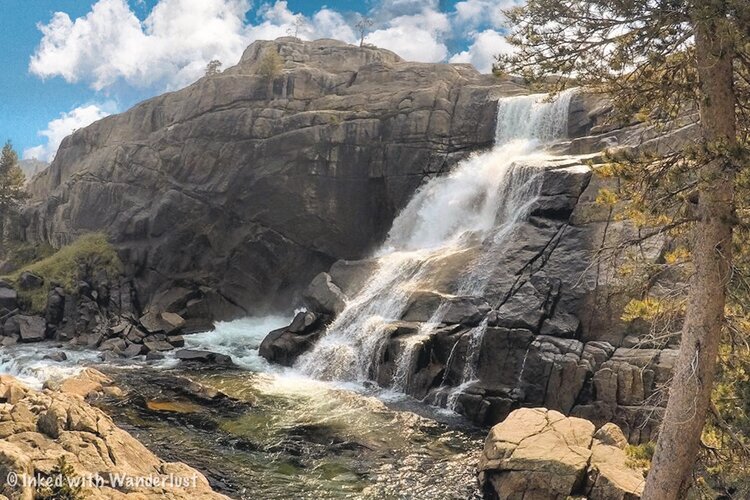
3) Tuolumne Falls
This is the first waterfall on the list that requires quite a bit of effort to see. It can be accessed via the Glen Aulin trail in Yosemite. The trail is located on the east side of the park (closed during the winter).
Tuolumne Falls stands at around 50-feet and is located within a mile from Glen Aulin proper and about 6 miles into the trail. You can read more about this trail below.
READ ALSO: Glen Aulin: A Glorious Hike Through Yosemite’s Backcountry
4) Rainbow Falls
Rainbow Falls is located within Devil’s Postpile National Monument and gets its name from the multiple rainbows that appear near the base when the sun hits it just right. While not the largest waterfall on the list, it still stands at a respectable 101 feet.
5) Vernal Fall
You want to see a beautiful waterfall? Look no further than Vernal Falls in Yosemite National Park. Vernal is the third Yosemite waterfall on this list and for good reason; It is stunning!
Vernal Falls is one of two waterfalls along Yosemite’s Mist Trail (the other is Nevada Fall). It features a 317-foot drop and provides the “mist” that makes up the trail’s namesake.
The trail leading to Vernal may be short, but it’s steep and because of the mist, has hundreds of slick stone steps giving you plenty of opportunity for injury. Remember, slow and steady wins the race here.
READ ALSO: The Mist Trail: Yosemite’s Most Beautiful Hike
Jump: Back to Top
Conclusion
That’s it. Those were our five favorite California waterfalls. Did we leave one off the list that you thought should be included? Want to suggest one to us? Drop us a comment below!
We hope you’ve enjoyed this article. If so, please support us by sharing it with your friends and family on Facebook or Pinterest. You can further show support by staying on and reading one or more of the related articles above.
Thanks for reading and safe travels!
Editor’s Note: This post was originally published in October 2020 and has recently been updated for comprehensiveness and accuracy.


