Hike Through the Historic Donner Summit Tunnels
Disclosure: This post contains affiliate links. If you make a purchase through these links, I may earn a small commission at no additional cost to you. I only recommend products or services that I believe will add value to my readers.
When searching for the most unique and best hikes in Northern California, many will point to areas like South Lake Tahoe, Yosemite National Park, and famed Mono County, and for good reason. Those areas have some of the most beautiful hiking trails in the state.
Just a bit outside of Lake Tahoe proper, near the historic gold mining town of Truckee, is one of the most unique hikes you’ll come across anywhere - the Donner Summit Tunnels.
The tunnels were built in 1867 to accommodate the first train passage through the Sierra Nevada Range. Built primarily by Chinese laborers, nothing but hand drilling methods and explosives were used to carve through the granite-based Mount Judah.
The tunnels saw the first train traffic shortly after completion in 1868, and were used as recently as 1993, when they were then decommissioned. Today, the property is still owned by Union Pacific, who have been kind enough to allow people to freely explore the tunnels.
So how do you get to the Donner Summit Tunnels? What’s the parking situation like? What can you expect on this hike? I answer all of these questions and more below. Let’s get into it.
Trail Stats
Location: Donner Summit in Norden, CA
Fee: None
Open: Mostly in Spring, Summer, and Fall. Difficult to impossible to access in Winter.
For: Everyone
Cell Service: Spotty
Restroom: None
Parking: Large dirt lot at the trailhead. There are also pull-outs on the side of the road, but you’ll be backtracking on the hike
EV Stations: None
Difficulty: Easy
Popularity: Moderate
Mileage: About 5-miles, out and back
Elevation Gain: Just shy of 400 feet. The trail is mostly flat
Condition: Not maintained, but completely doable
Features: Historic trail tunnels, China Wall, petroglyphs and vast views.
Pets: Allowed on leash
Drones: No signs prohibiting it, but I saw a few people flying theirs
Hazards: Uneven ground, loose gravel, low visibility, steep drop offs, and potential wildlife encounters.
My Visit(s): July 2024

Recommended Products for this Hike
Camera Tripod (you’ll need it for the low-light situations)
Citronella Spray (a Deet-free way to keep the bugs off of you)
DJI Drone (for even better photos/video of the area)
How to Get to Donner Tunnels
Most people access the Donner Tunnels from Interstate-80, as it’s easy and straight forward. If you’re coming from the direction of Reno or Truckee (westbound), take the Donner Lake Road exit. When you get to the bottom, turn right on Donner Pass Road to head up the pass.
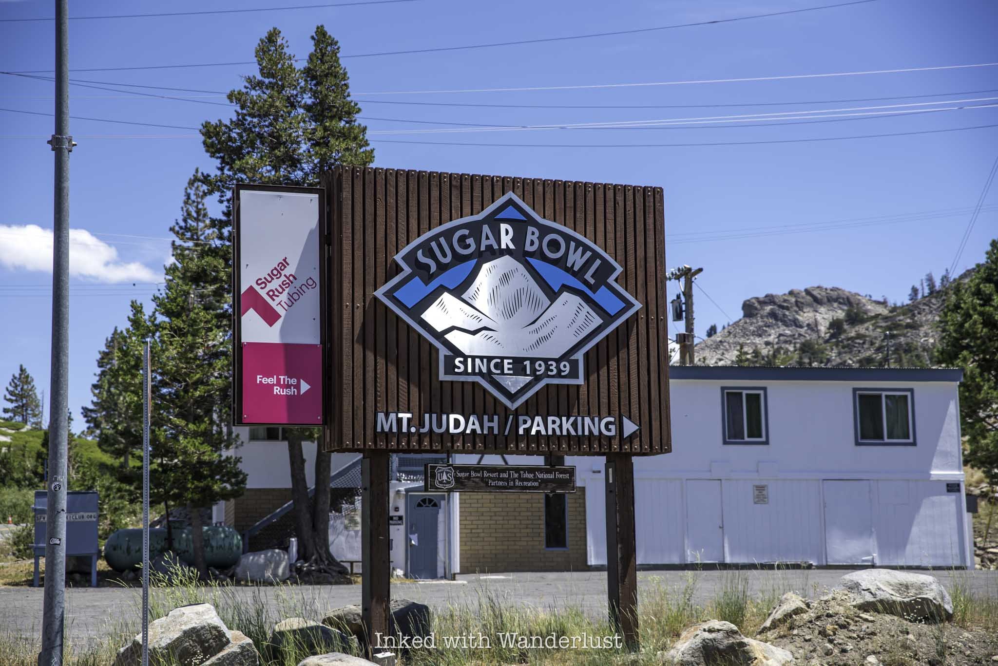
Less than a mile after crossing the Donner Summit Bridge, look for the sign in the photo above (Sugar Bowl Road). You’ll turn left here. Shortly thereafter, look for an unmarked dirt road on your right. This will take you to the parking lot.
Coming from Sacramento (eastbound), you’ll take the Donner Pass Road exit for about four miles before turning right onto Sugar Bowl Road to the parking lot. If you’re coming from Lake Tahoe, you have a couple options:
From North Lake/Sand Harbor area: Make your way to North Shore Boulevard (CA-217) and go north. Then, merge onto I-80 west for a short time before taking the Donner Pass road exit and head up the summit to the parking lot.
From South Lake/Emerald Bay area: Travel north on CA-89 and continue onto Highway 28, before turning left onto North Shore Boulevard (north). From there, follow the same directions as described above.
Donner Tunnels Parking Lot and Trailhead

The parking lot for Donner Tunnels is a circular dirt lot with no actual parking spaces laid out. It’s essentially park wherever you can find space. If you arrive early (like I did), you’ll have no trouble finding a spot. Later in the day is when it starts to fill, as shown in the photo above.

While any vehicle can access this lot, I do need to warn you about all of the tire-busting rocks. Union Pacific doesn’t maintain this lot at all and as such, there are rocks all over the place that have the potential for ruining your day. Take it slow and you should be fine. The good news is there’s no parking fee.
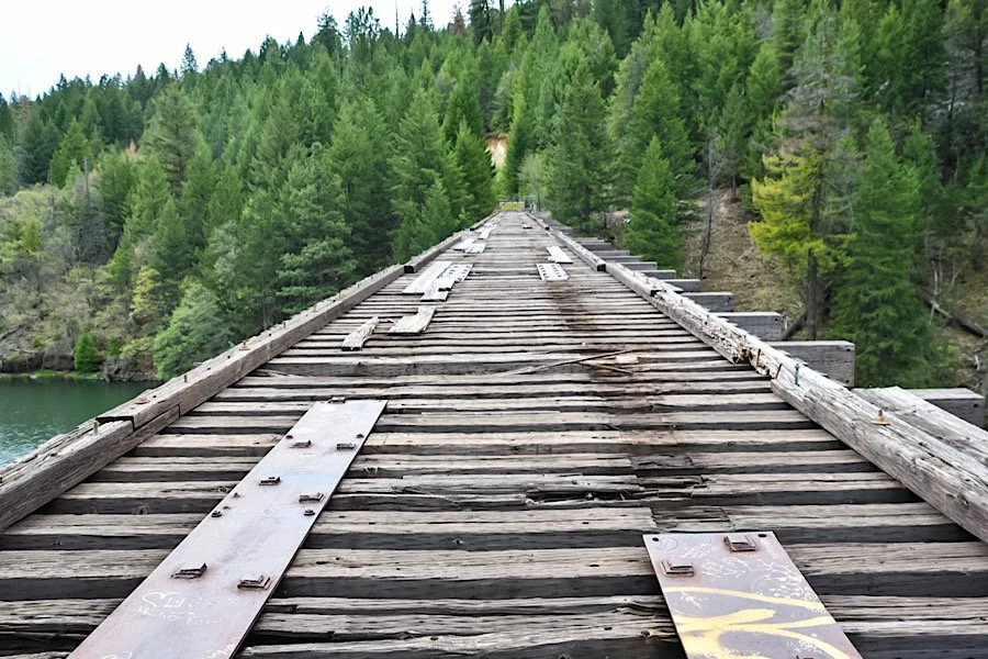
The unsigned trailhead is located just off the parking lot through a heavily graffitied red gate. You’ll find the first of several tunnels after you walk underneath the road you took to get here.
Donner Tunnels Hike

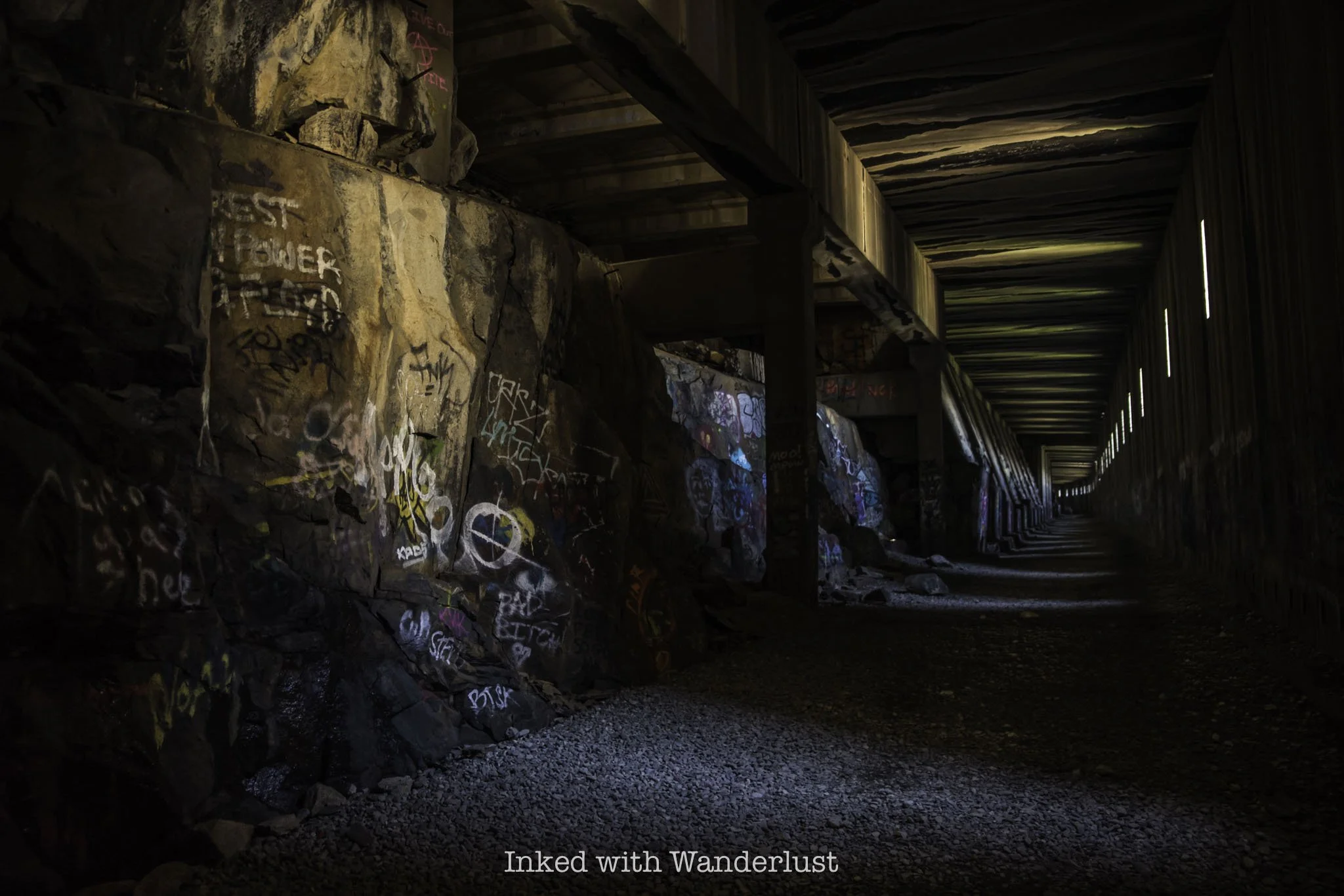
From here, you’ll work your way through a series of tunnels, each with a varying level of length (and graffiti). The first one from the parking lot is fairly long and dark, but you’ll always have the light at the end in sight.
Don’t be fooled by the amount of light in the photo above. That was me using my camera’s settings so I could show you the detail. It’s actually very dark in here and in my opinion, a cell phone flashlight doesn’t cut it. Which is why I recommend bringing a flashlight with high lumens.
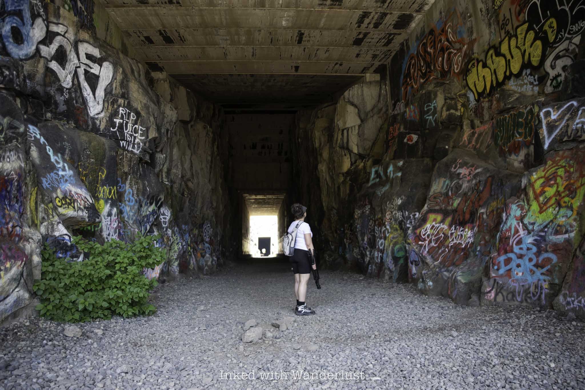
In these tunnels and the upcoming ones, you’ll likely hear, smell, and possibly even see bats in the tunnels. We never saw them, but we did hear and smell them. As is the case with most wildlife encounters, don’t go looking for trouble and you likely won’t find it. In other words, don’t bother them.
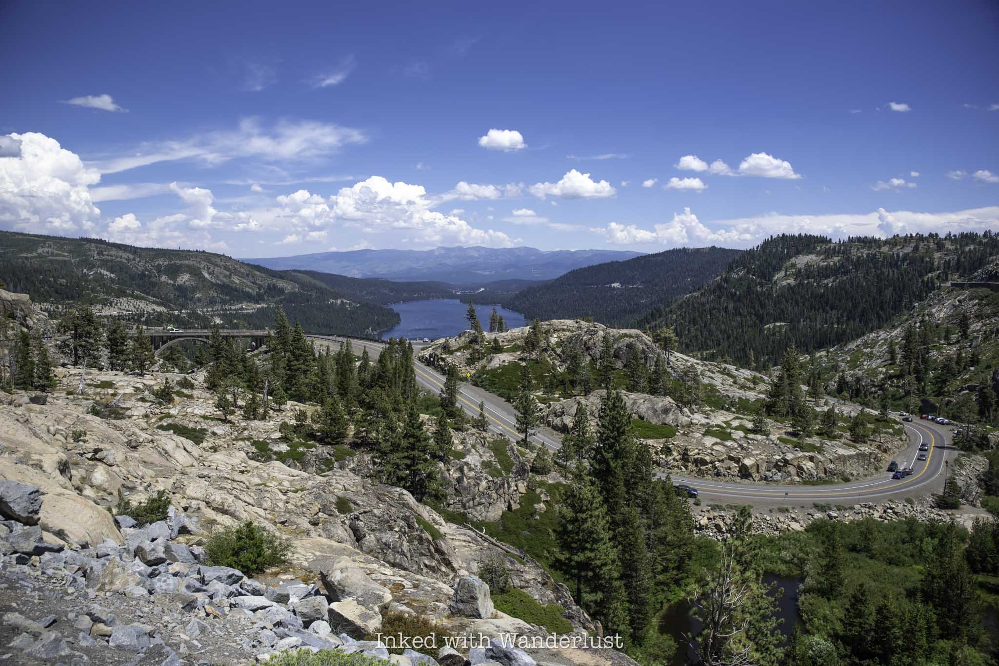
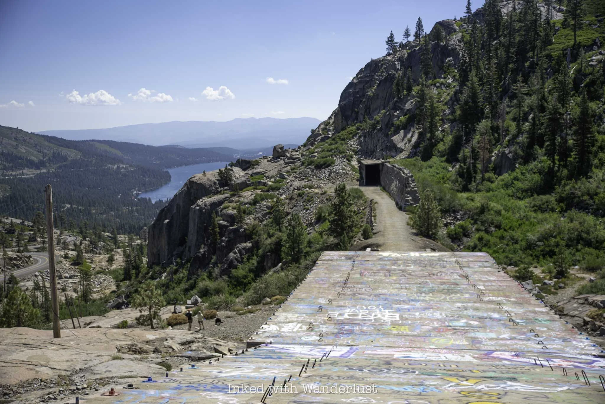
After the first tunnel, you’ll briefly enter a snow shed before walking back out into a clearing with sweeping views of Donner Lake and the surrounding mountains. On this stretch, you’ll pass by some petroglyphs on your left and walk over the historic China Wall (pictured below) before entering the next tunnel.

The China Wall is a 75-foot high hand-built retaining wall that helped keep the trains propped up as it passed between the two tunnels. Take a moment to check it out. It’s amazing what the laborers were able to accomplish without the help of modern equipment.
Also along this stretch is the ability to climb up onto the top of the tunnel you just left. You’ll get an awesome perspective for photos. Just be careful as there’s no established way up and the granite rocks are slippery. Going back down is a bit sketchy.
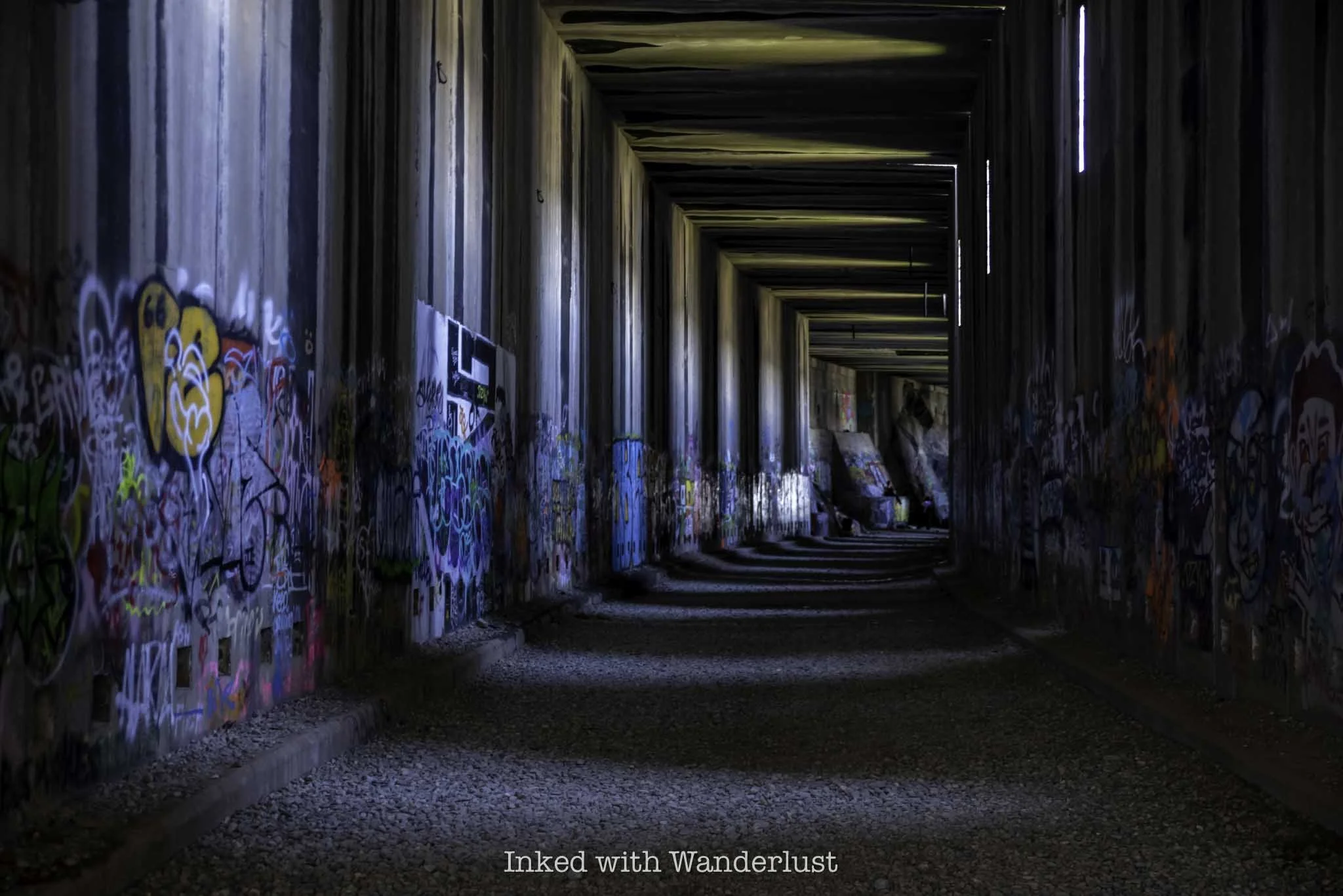
From here, you’ll enter the next tunnel and go through a series of several more. You’ll go through sections where enough light passes through the slits in the walls, enabling you to see without a flashlight. Then you’ll hike through sections of near-complete darkness as well.

On top of the darkness, the ground you’ll be walking on is on uneven, loose gravel with occasion larger rocks. Additionally, and particularly if you’re here while the snowpack is still melting, you’ll also have standing water and potential icy spots to traverse.

The walls of the tunnels are literally covered in graffiti. Some are actually artistically well done while other pieces are simply words/political statements or nondescript images. While I do think it’s a shame that a historical site like this has graffiti all over it, I have to admit that it does add a certain vibe to the overall experience.
If you’re bringing small children, be warned that some of the graffiti art is highly inappropriate for young eyes. Thankfully, most of it is difficult to make out, or even see in the darkness, so I wouldn’t let it stop you from bringing them. Just something to be conscience of.
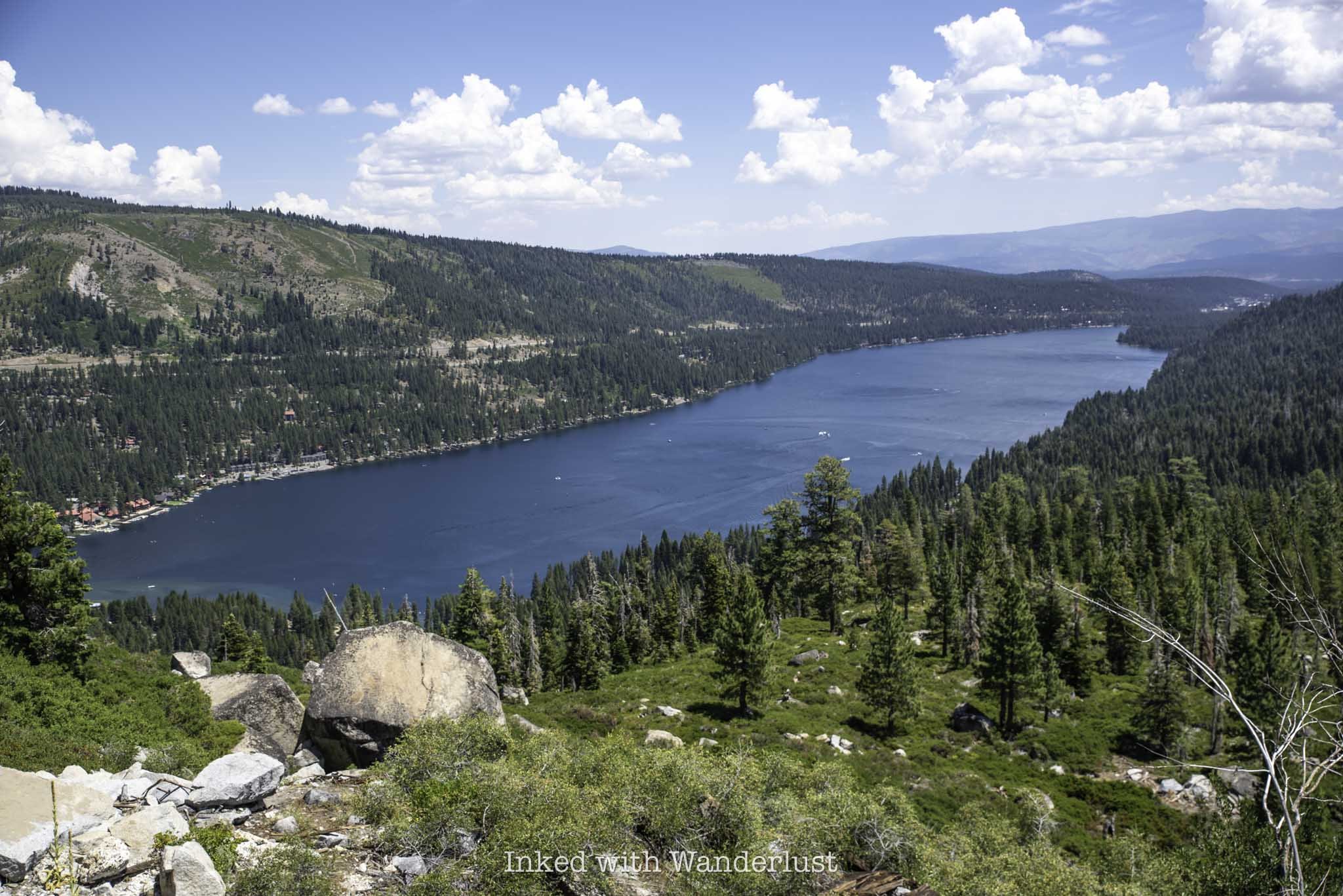
The hike can be as short or as long as you want it to be. During our hike, I noticed most people turn around after the second tunnel, but I recommend sticking it out and keep going to the end of the final tunnel. If you do, you’ll be rewarded with an epic, unobstructed view of Donner Lake (especially if you climb on top of the tunnel).
In conclusion, this hike is fantastic. Even if you don’t care about the historical aspect of it, it’s worth it for the views and photography opportunities alone. Additionally, because there’s so much to explore, you could hike the Donner Tunnels multiple times over and always see something new.
When you’re finished, consider heading over to nearby Donner Memorial State Park and see the site where part of the ill-fated Donner Party attempted to wait out winter and fight off starvation. Additionally, Emerald Bay State Park is about an hour away and more than worth the drive.
EXODUS 13:21