Visiting Glacier Point in Yosemite National Park
Disclosure: This post contains affiliate links. If you make a purchase through these links, I may earn a small commission at no additional cost to you. I only recommend products or services that I believe will add value to my readers.
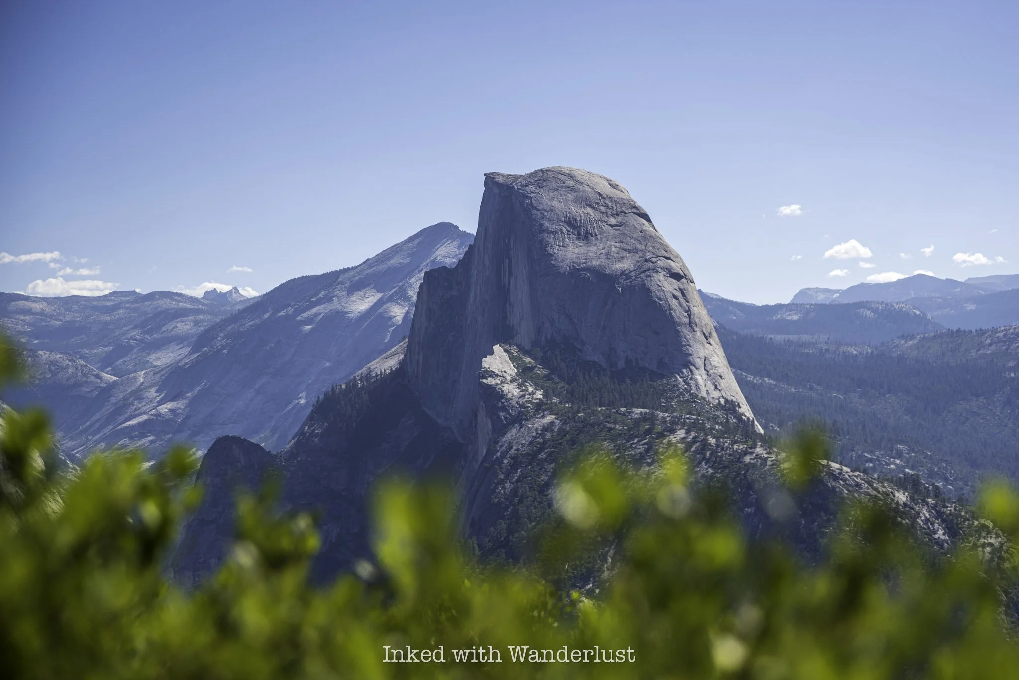
If you’ve ever seen a photo of Half Dome on social media, there’s a good chance it was taken from the subject location of this post, Glacier Point in Yosemite National Park. It’s one of the most iconic viewpoints in Yosemite and is visited by millions of people each year.
However, many don’t realize where in the park Glacier Point is located, and are often surprised to find out when they arrive to Yosemite Valley that it’s actually another hour’s drive away along a windy, mountainous road.
While it isn’t difficult to reach, there are a few things you should know ahead of time to avoid being surprised yourself. Aspects such as drive time, directions, transportation options, seasonality, and more are discussed in the post below. Let’s get into it.
Quick Stats
Location: Yosemite National Park
Fee: Yosemite requires an entry fee of $35
Open: All year, but only accessible via vehicle from April/May to November
Family Friendly: Yes
Cell Service: Yes
Restroom: Multiple
Parking: Large, paved lot
EV Stations: None
Milage: 0.5 mile, out and back
Elevation Gain/Loss: 50 feet
Difficulty: Easy
Popularity: Mega-high
Mileage: Less than a half-mile
Condition: Well maintained and easy to follow
Features: Views of Yosemite Valley and Half Dome
Best Viewed: Any time of year
Pets: Allowed on leash
Drones: Prohibited
Hazards: Usual wildlife hazards
My Visit(s): 2020 and 2024
When is Glacier Point Yosemite Open?
Glacier Point is open all year long, even during the park’s snow-dense winter season. However, most people will not be able to access it during winter because Glacier Point Road, the mountainous road which leads to and terminates at Glacier Point, is closed due to heavy snowpack.
Once it stops snowing, road crews begin plowing the road sometime in April and will typically open it to vehicle traffic in May. Much like Tioga Road on Yosemite’s east side, the road will close with the first heavy snowfall of the season, which usually occurs in November. You can see status updates on the NPS website here.
When the road is closed, you can still access Glacier Point, however, you’ll need to do so via cross-country skiing. If you’re skilled and experienced in this, there’s a good chance you’ll have Glacier Point all to yourself when you get there.
How to Get to Glacier Point Yosemite
The only entrance in Yosemite that’ll take you straight to Glacier Point is the southern entrance via Wawona Road. After driving through the entrance, you’ll continue along Wawona Road for about 17 miles before reaching Glacier Point Road, on which you’ll turn right. From there, it’s 15 miles to the road’s terminus at Glacier Point. Total drive time is about one hour.
From all other entrances, you’ll first need to drive into Yosemite Valley. If you’re driving in from the east entrance or El Portal, you’ll drive along Northside Drive before taking the turn off onto Southside Drive, before quickly turning right onto Wawona Road.
You’ll be passing one of the valley’s most famed waterfalls, Bridalveil Fall, on your left, as well as the most popular of Yosemite viewpoints, Tunnel View, on your right, before driving through the historic Wawona Tunnel.
You’ll drive on Wawona Road for about 18 miles before coming to Glacier Point Road. Turn left here and continue driving for about 15 miles until you’ve reached Glacier Point’s parking lot. Drive time depends on where in the valley you’re coming from but generally speaking, you can expect about one hour.
Shortly before reaching Glacier Point, you’ll pass another Yosemite viewpoint, Washburn Point, which offers a similar view. From Washburn, you’ll have an angled view of Half Dome and a closer view of two of Yosemite Valley’s most popular waterfalls, Vernal Fall and Nevada Fall, which are part of The Mist Trail.
Despite being signed appropriately, many mistake Washburn Point for Glacier Point. While deserving of a stop in its own right, and a great alternative if Glacier Point is too busy, you’ll need to continue another mile or so down the road to reach Glacier Point. Remember, the road terminates at Glacier Point’s parking lot, so there’s no mistaking it.
Parking at Glacier Point
Parking is plentiful at Glacier Point. The lot is paved, large, and contains hundreds of designated parking spaces. However, it is still known to fill quickly, particularly during the busy summer months and on days when there are no day-use reservation requirements.
Comparatively, sunrise and sunset both are mega-popular times at Glacier Point, particularly amongst photographers. I’ve been there in the morning shortly after sunrise and I’ve been there in the middle of the day. In my opinion, morning time is the way to go for guaranteed parking.
Another option is to arrive in the late afternoon, an hour or two prior to sunset. Whatever you do, avoid going in the middle of the day. That’s typically when Glacier Point is at its busiest and it’s also the hottest point in the day, and there’s little to no shade up there.
Does the Yosemite Valley Shuttle Go to Glacier Point?
While there are a varying degree of third party tour groups that’ll take you to Glacier Point, unfortunately, the free Yosemite Valley Shuttle service does not. If you don’t have your own vehicle with you or you’re just not comfortable driving yourself, you can utilize the paid shuttle to Glacier Point.
These shuttles pick up near Yosemite Valley Lodge (shuttle stop #7) and first take visitors on a tour of the valley highlights before continuing onto Glacier Point. The service has concluded for 2024 but in 2025, this tour will run from June 15 and conclude after October 13.
There are only two departure times daily, one at 8:30am and another at 1:30pm. Both roundtrip and one-way fares are available. The one-way fare is a great option for those who want to hike the iconic Four Mile Trail one-way into the valley and just a need a lift to the starting point.
Aside from this shuttle, your only other option is to either drive yourself or with someone else. Additionally, this shuttle does not make any other stops along Glacier Point Road. And no, ride sharing services are not options within the park due to limited cellular signals.
Glacier Point Hiking Trail
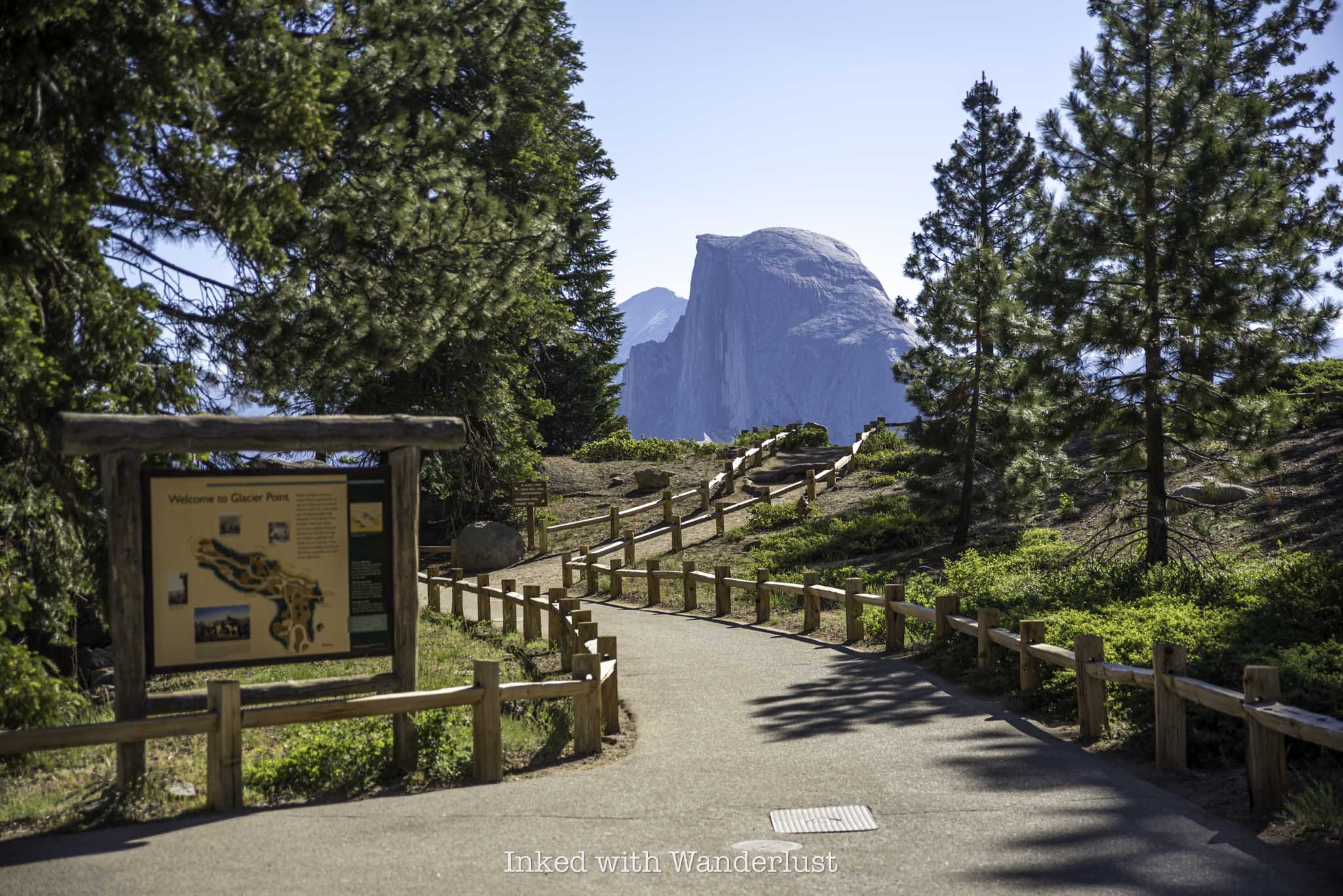
The Glacier Point trail is short and mostly paved. It begins nearly right off of the parking lot and concludes at an overlook offering magnificent views of Yosemite Valley and many of its main attractions. As you’re walking away from the parking lot and you get your first glimpse of Half Dome, keep left on the trail.
When you reach the clearing through the trees, you’ll see a structure on your left. Honestly, I’m not sure if this is supposed to be a visitor center or what, as it was closed on both of my visits. Moving on, to continue on the trail, stay to the left while keeping Half Dome on your right.
You’ll soon come across a sign indicating you’re on the right path. For Glacier Point, you’ll continue straight towards the upcoming geology hut. If you’re here to hike the Four Mile Trail, you’ll veer to the left at the junction.
The first feature of the trail you’ll walk up on is the geology hut, a stone-built structure constructed by the Yosemite Natural History Association in 1925. It was built as an observatory to help educate visitors about Yosemite’s geological past and how the valley was formed.
You can either go through or around it, but I do recommend checking it out. There isn’t much room on the inside, but there are numerous informational boards detailing the park’s glacial formation and history.
Beyond the geology hut, you’re just a short walk away from the viewing deck. When you arrive, you’ll notice there are two decks, one on the lower end that offers a superb view of Half Dome, Clouds Rest, Tenaya Canyon, Vernal Fall, Nevada Fall, North Dome, and more.
From the slightly elevated deck, you’ll be treated to straight-on views of the Royal Arches, Mount Hoffman, The Ahwahnee Hotel, Yosemite Village, Overhanging Rock, and if you’re here early enough in the season, Yosemite Falls.
From Glacier Point, you’re able to see about a quarter of the park from one spot. Since you’re 3,200 feet above Yosemite Valley from here, that means you’ll be looking down on many of the valley features that you'd normally look up at, including Yosemite Falls, which is 2,425 feet above the valley floor.
Throughout most of the viewing area, the guardrails are fairly high up, making an accidental fall highly unlikely. That said, at some points they are close to the ground, low enough for kids to climb on. If you’re bringing littles with you, watch them closely in these areas. During my visit, I saw one kid nearly climb completely over the rail before somebody spotted him.
From here, you can continue along the Four Mile Trail, which will offer much of the same views but from a different perspective. Keep in mind that this trail isn’t for the weak and goes all the way down to the valley floor. At the end, you’ll only be half done as you’ll have a physically demanding hike back up.
Other popular hiking trails that leave from Glacier Point include Panorama Trail, Pohono Trail, Illilouette Falls, Half Dome (provided you have a permit) and more. If not, simply head back the same way you came. From Glacier Point, you can check out Washburn Point, Taft Point, and more sights along Glacier Point Road.
PSALM 23:3-4


